
Meall a' Chaorainn
Good walks are even better shared.
Overview
Meall a' Chaorainn: A Highland Adventure
Nestled in the heart of the Scottish Highlands, Meall a' Chaorainn is not just a hill; it's a Munro that encourages both seasoned climbers and enthusiastic novices to lace up their boots and hit the trails. Standing at a respectable 965 meters above sea level, it boasts a prominence of 98 meters, ensuring that it catches the eye of many outdoor adventurers.
Geology
The captivating geology here speaks volumes of ancient volcanic activity and the impacts of Glacial periods. The rocky landscape tells a story that stretches back to the Devonian period, exhibiting rugged features and stunning views that slaughter any remaining excuse for why you haven't gotten outdoors today!
Routes
There are a couple of main routes up Meall a' Chaorainn. The East Ridge Route is your go-to for a moderate experience that winds gently towards the summit. At approximately 11.5 km long, it will take around 4.5 hours – more than enough time for a few breaks (and snacks, of course). The South-West Approach can be a bit more challenging, offering not just exercise, but also a chance to show off your scrambling skills, covering about 10 km in around 5 hours.
Summit Features
When you finally reach the summit, expect a charming sight: a sturdy stone cairn and a trig point that stand as testaments to the mountain's allure. Perfect spots for that Instagram-worthy snap!
Terrain Type
Be prepared for a delightful mix of rocky outcrops, rolling grassy areas, and that lovely Scottish bog you often hear about! Yes, muddy boots are practically par for the course here!
Views
Once at the top, take a moment to catch your breath and drink in the views: Ben Nevis on a clear day is absolutely a sight to behold, alongside the majestic Nevis Range. It’s true what they say – you can almost feel the mountain whispering sweet nothings about its beauty.
Hazards
While Meall a' Chaorainn may be a welcoming adventure, always be on your toes: weather can turn faster than you can say 'Scottish drizzle', and those boggy patches will test your footwork like a Highland jig!
Nearby Summits
Just a stone's throw away, you'll find Creag Meagaidh, another gem of a mountain waiting to be explored.
Access
Access is easy with parking well-positioned along the A86, just a short walk to the trailhead. If you're hopping on public transport, ensure you check the schedules – they can often surprise you by being less frequent than a unicorn sighting!
Facilities
Need a pit stop? Newtonmore has you covered, with cafés serving traditional Scottish nosh and essential amenities to kickstart your expedition.
History
Finally, some lore for the curious: the very name Meall a' Chaorainn means 'Hill of the Rowan Trees'. This beautiful setting has birthed tales as rich and vibrant as the surrounding landscapes.
In conclusion, Meall a' Chaorainn is a must-visit for any mountainous excursionist. Whether it’s the geological wonders, the stunning views, or the vibe of adventure that calls to you, this Munro has something for everyone. So, what are you waiting for? Get out there and make some memories!
Explore routes near Meall a' Chaorainn
Walks starting near this hill. Open a route to check its map, distance and full itinerary.
Loch Migdale from Torroy: Spinningdale pinewood and loch shore walk
View route
Ben Klibreck
View route
Beinn Eighe Lancaster Wreckage at Coire Mhic Fhearchair
View route
Glen Affric: Coire Loch Woodland Trail
View route
Route planning notes
These notes describe possible approaches. Check a route's map and access information when planning your walk.
East Ridge Route
A stunning route that ascends via the east ridge, offering views across the countryside and a gradual incline towards the summit.
South-West Approach
This approach begins from the village of Fersit and features a more challenging ascent with some rocky scrambles but rewards hikers with panoramic views.
Make a day of it, together
Find someone to share the walk with, or organise a day out along a route you like.
Hill facts and local notes
Classifications
Elevation
632m
2,073 ft
Prominence
157m
Coordinates
57.8040, -4.7614
NH360827
OS Map
20
Explorer: 437N
At the Summit
At the summit, you'll find a traditional stone cairn and a trig point, both of which make for great photo opportunities and slightly less lopsided selfies.
Terrain & Geology
The mountain is primarily composed of volcanic rock formed during the Devonian period, featuring some interesting glacial landforms and scree slopes. It is a classic example of the rugged Highland scenery with its mixed geology.
Views & Scenery
From the summit, you can see the majestic Nevis Range to the south and glorious views of the surrounding glens and peaks, including Ben Nevis on a clear day.
History & Heritage
Name Origin
The name Meall a' Chaorainn translates roughly to 'Hill of the Rowan Trees', reflecting the flora found in the area.
Historical Significance
The mountain is part of the ancient landscape shaped by volcanic activity and glaciation, and embodies the rugged beauty of the Scottish Highlands celebrated in local folklore.
Getting There & Facilities
Parking
There's layby parking available on the A86, about 3 km from the trailhead, which can accommodate a few cars. Early birds might catch the best spot!
Public Transport
Buses connect nearby villages; however, services are limited, so check local timetables in advance. Get ready for a bit of a trek if you are relying on buses!
Nearby Facilities
There's a lovely café in Newtonmore serving hearty Scottish fare and refreshments to fuel your adventures. Toilets are available in the town.
Safety Information
Known Hazards
- Potential for changing weather conditions, steep drops near the summit, and boggy areas making footing treacherous at times. Watch your step!
General Safety Tips
- Check weather conditions before setting out
- Carry appropriate clothing and equipment
- Let someone know your planned route
- Take a map, compass, and GPS device
- Carry emergency supplies: food, water, first aid kit, torch
Hills
Some common questions about the hills answered
Are there group walks up Meall a' Chaorainn?
Many walkers use Walkmates to join or organise walks with others. You can check for group walks around Meall a' Chaorainn through the maps
Are there other walkers around Meall a' Chaorainn?
Activity varies by location and time, but Walkmates lets you see whether others have shared walks or shown interest in this area. Find other people through the walking friends search walking friends for Meall a' Chaorainn search or of course create your own walk for Meall a' Chaorainn
Can I organise a walk to Meall a' Chaorainn?
Yes. If there aren’t any walks listed already, you can create a walk and make it available for others to join.
If you're signed up to Walkmates, you can create a walk to Meall a' Chaorainn.
How do I find a walk up this hill?
There are often multiple ways to walk this hill, depending on experience and route preference. Walkmates helps you explore walks and routes that others have shared.
Can I suggest a new route up Meall a' Chaorainn?
Yes. You can suggest or create routes to share with others. Walkmates focuses on the social side of walking, so routes are used to help people organise walks and explore areas together, rather than as detailed navigation tools or route libraries.
Other uses really appreciate knowledgeable walkers sharing their routes. Share your favourite route to Meall a' Chaorainn here
The is an error or something incorrect about this hill. How do I let you know?
We always strive to keep the information on Walkmates as accurate as possible. If you find an error, please let us know through the contact form and we'll aim to correct it as quickly as possible
Community Discussion
Comments
Location
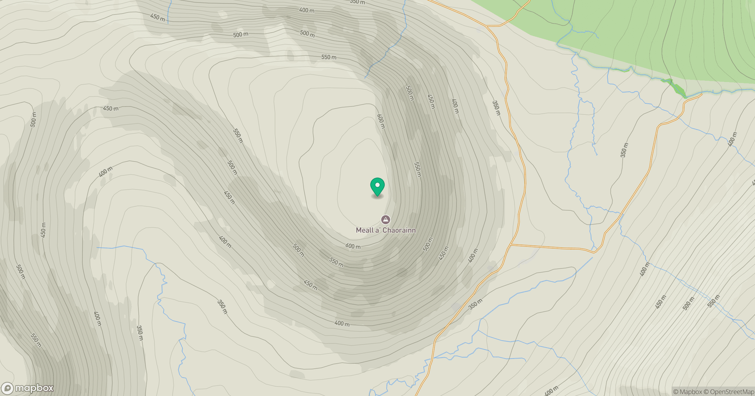
Grid reference: NH360827
View on OpenStreetMapOpens a map in a new tab, centred on the hill.
No comments yet. Be the first.