

Carn Ban
Good walks are even better shared.
NH3387 : Looking just north of west from Carn Ban
Dave Coustick Photo source
Overview
Hiking Carn Ban
Overview
Carn Ban stands as a proud Marilyn in the heart of the Scottish Highlands. With a peak elevation of 865 meters, this mountain isn’t just a height; it's a local favourite for those looking to immerse themselves in nature without getting lost in its intricacies.
Geology
This magnificent mountain is primarily made of granite, the product of ancient geological processes. You might feel like you’re walking on history itself with every step!
Routes
The From Achasmal route spans 7 km, taking around 3.5 hours to complete. Moderate in difficulty, it offers a delightful experience as you navigate lush heather and rocky outcrops, keeping any adventurer entertained. Dare I say, it's a walk in the park, if that park were full of rugged Highland terrain!
Summit Features
Upon reaching the summit, you are greeted with a well-constructed cairn, which is an absolute must-see. Why not feast your eyes on the surrounding beauty, whilst the cheeky wind tries to steal your hat?
Terrain Type
Be prepared for a mixture of rocky outcrops and grassy slopes! You'll find that while some parts are as inviting as a warm blanket, others can be boggy and challenging. That's nature's way of keeping you humble.
Views
The views from the top are nothing short of breathtaking. On a clear day, you could spot Ben Nevis off in the distance, along with vibrant valleys. Spring and early autumn offer the best visibility and colours, although winter has its charming appeal too!
Hazards
Watch out for slippery bogs and ever-changing weather. Always prepare for a surprise soaking, as the Highlands love to keep things interesting.
Nearby Summits
For those keen on extending their adventure, An Teallach and Creag Meagaidh are nearby summits worth exploring, so pack that picnic!
Access
Getting to Carn Ban is straightforward, with designated parking located at NH329870. Public transport options are available from Inverness, with the nearest town, Drumnadrochit, providing everything a hiker could need. Don’t forget to wave to Nessie!
Facilities
The nearby town includes all the necessary facilities, eateries, and toilets — ensure you refill on caffeine and snacks before your ascent.
History
The name Carn Ban means 'White Cairn' in Gaelic, a nod to its stunning exploration potential throughout all seasons, and it’s a site rich in local folklore. So keep your eyes peeled for myth and magic!
As you venture up this stunning Highland Marilyn, remember to respect the environment, enjoy the views, and maybe even whistle a wee tune.
Happy hiking! 😊
Explore routes near Carn Ban
Walks starting near this hill. Open a route to check its map, distance and full itinerary.
Loch Migdale from Torroy: Spinningdale pinewood and loch shore walk
View route
Ben Klibreck
View route
Beinn Eighe Lancaster Wreckage at Coire Mhic Fhearchair
View route
Fairy Lochs Liberator Wreckage Circuit
View route
Route planning notes
These notes describe possible approaches. Check a route's map and access information when planning your walk.
From Achasmal
This modest route leads you across lush heather and moderate slopes, with occasional rocky outcrops to keep things interesting.
Make a day of it, together
Find someone to share the walk with, or organise a day out along a route you like.
Photo Gallery
View all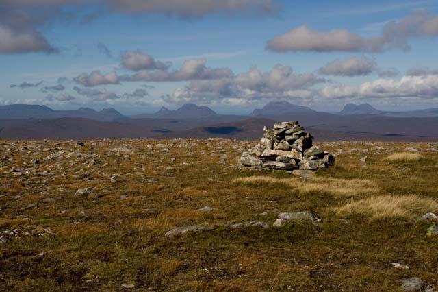 Photo could not load
NH3387 : Looking just north of west from Carn Ban
Dave Coustick
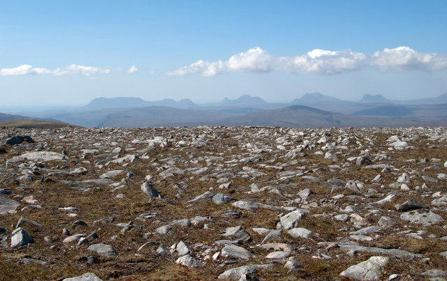 Photo could not load
NH3387 : Summit area of Carn Ban
Trevor Littlewood
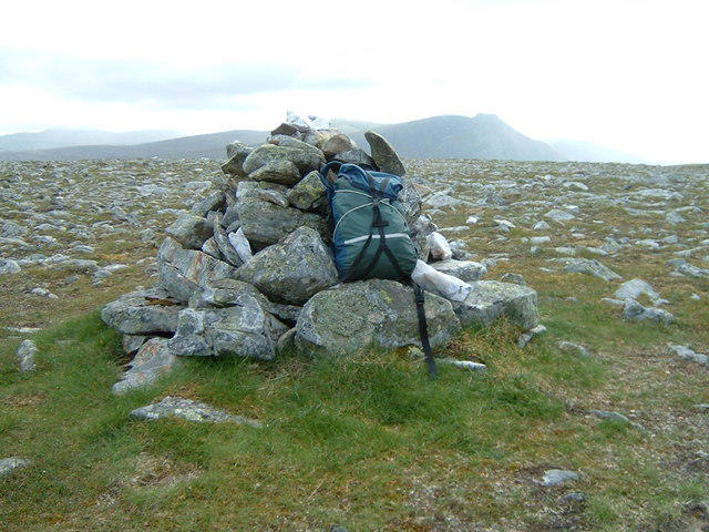 Photo could not load
NH3387 : Summit cairn, Carn Ban
Jim Barton
Hill facts and local notes
Classifications
Elevation
843m
2,767 ft
Prominence
205m
Coordinates
57.8468, -4.8010
NH338875
OS Map
20
Explorer: 437N
At the Summit
The summit boasts a prominent cairn, which is the perfect place for a victory selfie. Look out for the small scorched area from eager bonfire enthusiasts of yesteryear – I hear they enjoyed a good marshmallow roast!
Terrain & Geology
Carn Ban is primarily composed of granite, which formed during the Caledonian orogeny. This geological history makes it quite sturdy, perfect for a good old scramble!
Views & Scenery
Panoramic views of the surrounding peaks, including Ben Nevis in the distance, as well as sprawling valley landscapes where sheep outnumber people.
History & Heritage
Name Origin
Carn Ban translates to 'White Cairn' in Gaelic, possibly referring to the snow that dusts its peak during winter.
Historical Significance
The area is steeped in local folklore, often entwined with tales of a fresh-faced gnome or two lurking about, awaiting hikers with marshmallows.
Getting There & Facilities
Parking
A designated parking area is found at NH329870, making access simple for all walkers.
Public Transport
Public transport is available via the local bus service from Inverness, stopping at the nearby village of Foyers.
Nearby Facilities
Nearby you will find basic facilities in Drumnadrochit, including cafes, shops, and toilets, perfect for a cup of tea and a scone after your hike.
Safety Information
Known Hazards
- Wet and boggy patches can be slippery, and the weather can change quicker than you can say 'it's freezing' — always prepare for all possibilities.
General Safety Tips
- Check weather conditions before setting out
- Carry appropriate clothing and equipment
- Let someone know your planned route
- Take a map, compass, and GPS device
- Carry emergency supplies: food, water, first aid kit, torch
Hills
Some common questions about the hills answered
Are there group walks up Carn Ban?
Many walkers use Walkmates to join or organise walks with others. You can check for group walks around Carn Ban through the maps
Are there other walkers around Carn Ban?
Activity varies by location and time, but Walkmates lets you see whether others have shared walks or shown interest in this area. Find other people through the walking friends search walking friends for Carn Ban search or of course create your own walk for Carn Ban
Can I organise a walk to Carn Ban?
Yes. If there aren’t any walks listed already, you can create a walk and make it available for others to join.
If you're signed up to Walkmates, you can create a walk to Carn Ban.
How do I find a walk up this hill?
There are often multiple ways to walk this hill, depending on experience and route preference. Walkmates helps you explore walks and routes that others have shared.
Can I suggest a new route up Carn Ban?
Yes. You can suggest or create routes to share with others. Walkmates focuses on the social side of walking, so routes are used to help people organise walks and explore areas together, rather than as detailed navigation tools or route libraries.
Other uses really appreciate knowledgeable walkers sharing their routes. Share your favourite route to Carn Ban here
The is an error or something incorrect about this hill. How do I let you know?
We always strive to keep the information on Walkmates as accurate as possible. If you find an error, please let us know through the contact form and we'll aim to correct it as quickly as possible
Community Discussion
Comments
Location
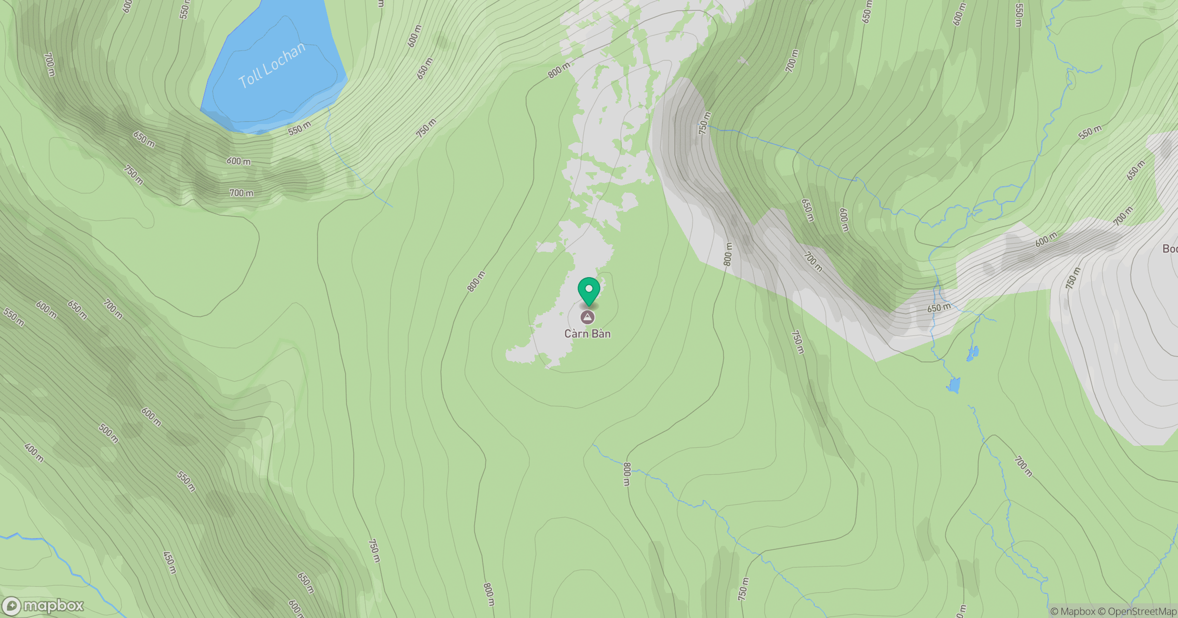
Grid reference: NH338875
View on OpenStreetMapOpens a map in a new tab, centred on the hill.
No comments yet. Be the first.