

Beinn a' Chaisteil
Good walks are even better shared.
NH3680 : Summit of Beinn a' Chaisteil
Calum McRoberts Photo source
Overview
Beinn a' Chaisteil: A Gem in the Scottish Highlands
Overview
Beinn a' Chaisteil is a stunning Munro located in the heart of the Scottish Highlands, boasting an elevation of 849 meters. With a prominence of 255 meters, this mountain is a popular choice amongst hikers looking to tick off another Munro from their list.
Geology
The rock formations on Beinn a' Chaisteil are predominantly composed of metamorphic schists and gneisses, which have been shaped by ancient geological forces over millions of years. This rugged terrain not only provides a challenging hike but also offers stunning geological features.
Routes
Culachy Route
Starting at Culachy, this route covers approximately 11.5 km and takes around 4.5 hours to complete at a moderate pace. It features a mix of forestry paths and open hillside, making it a favourite among many climbers.
Invergarry Approach
This challenging trail begins in Invergarry and stretches over 13 km. Hikers can expect to spend about 5 hours navigating through scenic woodlands leading to the summit.
Summit Features
Reaching the summit, climbers are greeted by a large stone cairn—the perfect spot for capturing that all-important summit selfie!
Terrain Type
Expect a delightful mix of rocky and grassy landscapes, interspersed with boggy patches after heavy rains. A sturdy pair of boots is essential to keep your feet dry and happy!
Views
While at the summit, the breathtaking views extend over Loch Lochy and the Great Glen. On a clear day, you might even spot Brooding Ben Nevis looming in the distance!
Best Seasons: Spring and autumn are recommended for the best views, with summer providing a bonus of less rain—just remember to bring sunscreen!
Hazards
Take care while navigating the rocky terrain, especially during wetter weather when the rocks can be slippery. The Highland mist can roll in suddenly, so always keep a map handy.
Nearby Summits
Make sure to check out nearby peaks like Beinn a' Mhuinidh (852 m) and Aonach Mor (1221 m), both offering unique experiences.
Access
Nearest Parking
Park your chariot at the designated area near Culachy, making sure you're in good company with other adventurous souls.
Public Transport
Local buses run from Fort William to Invergarry, but it’s advisable to check the current schedules to plan your trip effectively.
Nearest Town
The quaint village of Invergarry awaits with welcoming arms and a good supply of tea and biscuits!
Facilities
A lovely café in Invergarry serves up delicious meals and hot drinks, perfect for refuelling both before and after your hike. Toilets are also available in the village, so no need to worry!
History
Name Meaning
The name 'Beinn a' Chaisteil' translates to 'Hill of the Castle', alluding to the rich history laden in the surrounding area.
Significance
Over the years, this Munro has become an integral part of the local community's identity, cherished by climbers and nature lovers alike.
In conclusion, Beinn a' Chaisteil is not just another bump on the map; it is a journey through the highlands that combines stunning vistas, geological wonders, and a hint of history. Pack your bag, lace up your boots, and get ready to conquer one of Scotland's towering treasures!
Happy hiking!
Explore routes near Beinn a' Chaisteil
Walks starting near this hill. Open a route to check its map, distance and full itinerary.
Loch Migdale from Torroy: Spinningdale pinewood and loch shore walk
View route
Ben Klibreck
View route
Beinn Eighe Lancaster Wreckage at Coire Mhic Fhearchair
View route
Glen Affric: Coire Loch Woodland Trail
View route
Route planning notes
These notes describe possible approaches. Check a route's map and access information when planning your walk.
Culachy Route
A popular and rewarding trek starting from the hamlet of Culachy, offering a mix of forestry paths and open hillside.
Invergarry Approach
This route begins from Invergarry, leading hikers through scenic woodlands before ascending towards the peak.
Make a day of it, together
Find someone to share the walk with, or organise a day out along a route you like.
Photo Gallery
View all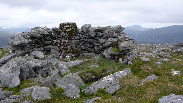 Photo could not load
NH3680 : Summit of Beinn a' Chaisteil
Calum McRoberts
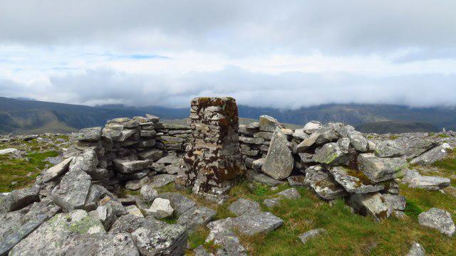 Photo could not load
NH3680 : Trig point on Beinn a' Chaisteil
Colin Park
Hill facts and local notes
Classifications
Elevation
787m
2,582 ft
Prominence
280m
Coordinates
57.7809, -4.7430
NH369801
OS Map
20
Explorer: 437N
At the Summit
The summit boasts a large stone cairn, ideal for a quick photo op and perfect for those Crème de Menthe celebrations on reaching the top!
Terrain & Geology
Beinn a' Chaisteil primarily consists of metamorphic rocks, particularly schists and gneisses, which tell tales of ancient geological processes and provide a rugged terrain filled with impressive outcrops.
Views & Scenery
Stunning panoramas overlooking Loch Lochy and the Great Glen, as well as glimpses of Ben Nevis in the distance.
History & Heritage
Name Origin
The name 'Beinn a' Chaisteil' translates to 'Hill of the Castle', hinting at a storied past perhaps filled with nefarious Highland chieftains.
Historical Significance
The mountain has been a site for climbers and outdoor enthusiasts for generations, becoming part of the local culture and identity.
Getting There & Facilities
Parking
Parking is available at the Culachy access point, with space for several vehicles. Arrive early in summer!
Public Transport
Accessible via local buses from Fort William to Invergarry during peak months; check local schedules.
Nearby Facilities
The nearest café is in Invergarry, offering hearty meals and, more importantly, hot cups of tea. Toilets are available in the village.
Safety Information
Known Hazards
- Rocky terrain may lead to slips, particularly in wet conditions. Visibility can drop quickly in fog—don’t take chances!
General Safety Tips
- Check weather conditions before setting out
- Carry appropriate clothing and equipment
- Let someone know your planned route
- Take a map, compass, and GPS device
- Carry emergency supplies: food, water, first aid kit, torch
Hills
Some common questions about the hills answered
Are there group walks up Beinn a' Chaisteil?
Many walkers use Walkmates to join or organise walks with others. You can check for group walks around Beinn a' Chaisteil through the maps
Are there other walkers around Beinn a' Chaisteil?
Activity varies by location and time, but Walkmates lets you see whether others have shared walks or shown interest in this area. Find other people through the walking friends search walking friends for Beinn a' Chaisteil search or of course create your own walk for Beinn a' Chaisteil
Can I organise a walk to Beinn a' Chaisteil?
Yes. If there aren’t any walks listed already, you can create a walk and make it available for others to join.
If you're signed up to Walkmates, you can create a walk to Beinn a' Chaisteil.
How do I find a walk up this hill?
There are often multiple ways to walk this hill, depending on experience and route preference. Walkmates helps you explore walks and routes that others have shared.
Can I suggest a new route up Beinn a' Chaisteil?
Yes. You can suggest or create routes to share with others. Walkmates focuses on the social side of walking, so routes are used to help people organise walks and explore areas together, rather than as detailed navigation tools or route libraries.
Other uses really appreciate knowledgeable walkers sharing their routes. Share your favourite route to Beinn a' Chaisteil here
The is an error or something incorrect about this hill. How do I let you know?
We always strive to keep the information on Walkmates as accurate as possible. If you find an error, please let us know through the contact form and we'll aim to correct it as quickly as possible
Community Discussion
Comments
Location
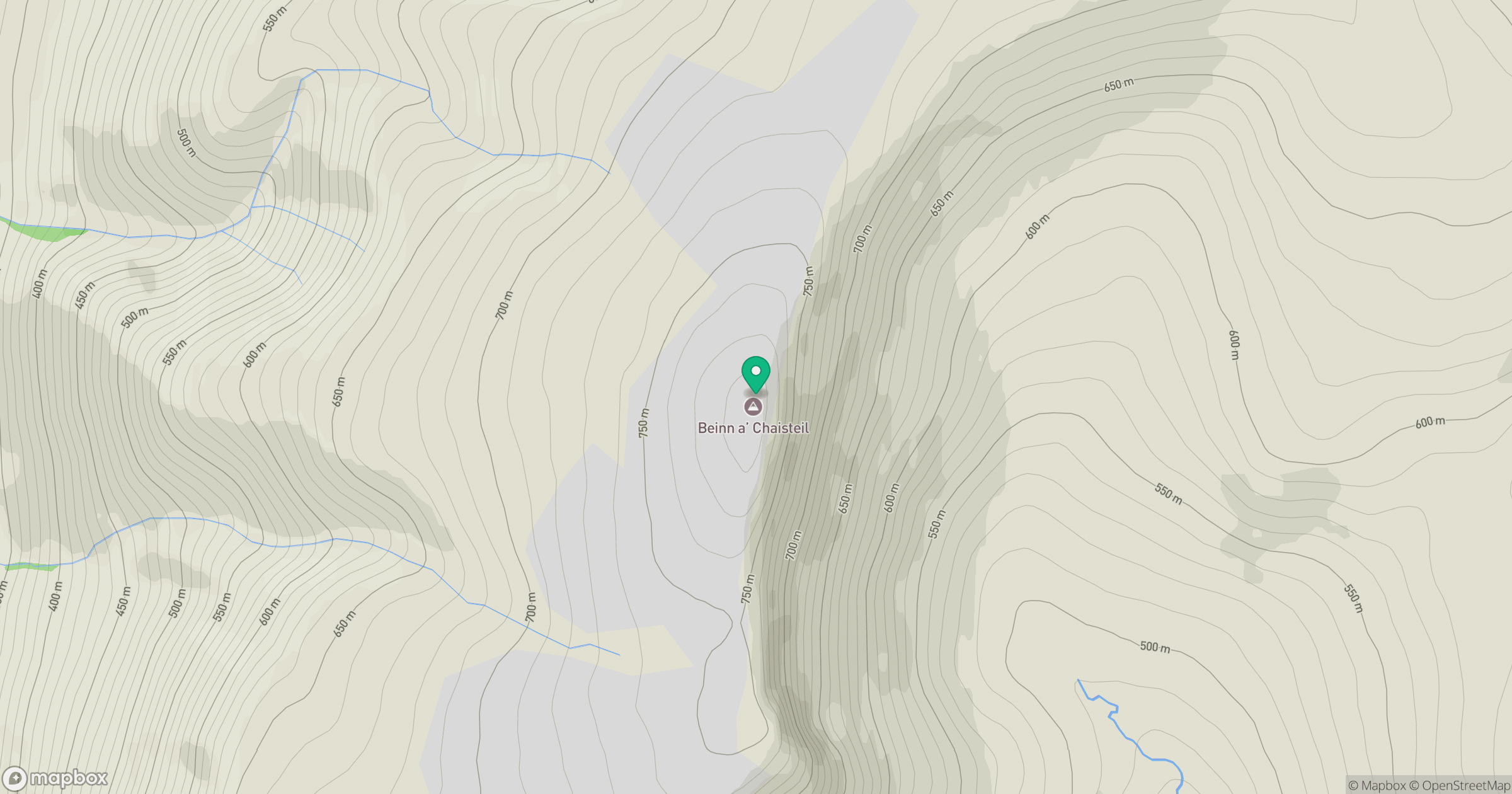
Grid reference: NH369801
View on OpenStreetMapOpens a map in a new tab, centred on the hill.
No comments yet. Be the first.