
An Socach
Good walks are even better shared.
Overview
An Socach
An Socach, ringing in at an impressive 942 metres, is a proud Munro located in the heart of the Scottish Highlands. This mountain is not just a number in the list of Munros; it’s a gateway to breathtaking views and stunning landscapes that define the region!
Geology
The mountain is primarily composed of gneiss and schist, showcasing the ancient geological history of the Highlands. If rocks could tell stories, let me tell you, An Socach could write a novel!
Routes
One of the most popular routes is the one starting from Inverey. This path offers a moderate challenge and a chance to immerse yourself in the stunning environment of the Highlands. Be sure to pack your lunch, because you won’t want to miss a picnic with a view once you reach the summit!
- Distance: 14.5 km
- Time: Approximately 5 hours
Summit Features
When you reach the summit, you'll be greeted by a proud little cairn marking your achievement. Just don't expect it to be a spacious plateau—it’s a bit snug up there!
Terrain Type
The mountain presents a delightful mix of grassy slopes and rocky outcrops. There are also a few boggy sections, so make sure your boots are up to the task! Let's face it, no one likes squishy socks on a hike!
Views
The views from the top are simply magnificent. On a clear day, you can see the expansive landscapes of the Cairngorms and the Glenshee ski area. Late spring and early autumn are the best times for these picturesque scenes.
Hazards
Always remember, in the Highlands, the weather is as changeable as a cat on a hot tin roof! Prepare for sudden changes and ensure you're equipped with the right gear. Also, be mindful of slippery rocks, especially after a rain.
Nearby Summits
If you’re feeling particularly adventurous, consider bagging nearby peaks like Braeriach (1296 m) or Benn Macdui (1309 m) to really make a day of it.
Access
Nearest Parking
There's a small car park at Inverey, so get there early to snag a spot.
Public Transport
Braemar is accessible by bus from Aviemore, but be aware that you may need to walk a fair distance to the trailhead after you hop off.
Nearest Town
Braemar is your closest haven for post-hike refreshments, with several cafes and public toilets.
Facilities
Braemar offers a handful of cafes where you can refuel after a long hike. Just don't forget to try a slice of cake—it's practically a tradition!
History
Name Meaning
An Socach translates to 'the highest peak', a fitting name for this remarkable mountain that has triumphed over the landscape for eons.
Significance
Conquering a Munro like An Socach is a rite of passage for many outdoor enthusiasts and is deeply embedded in Scottish culture.
In summary, An Socach is a must-visit for any hiker's list. Safe hiking, and may your socks be ever dry!
Explore routes near An Socach
Public walks starting within 80 km of this hill. Nearby does not mean a route reaches the summit; check its map and access before setting out.
Loch Migdale from Torroy: Spinningdale pinewood and loch shore walk
View route
Ben Klibreck
View route
Inverness: River Ness and Caledonian Canal circuit
View route
Beinn Eighe Lancaster Wreckage at Coire Mhic Fhearchair
View route
Route planning notes
These notes describe possible approaches, not verified navigable routes or permission to cross land. Check current paths, local access rules and conditions before setting out.
Inverey to An Socach
A scenic route starting from Inverey that provides a moderate challenge and beautiful landscapes.
Make a day of it, together
Find someone to share the walk with, or organise a day out along a route you like.
Hill facts and local notes
Classifications
Elevation
744m
2,440 ft
Prominence
137m
Coordinates
57.8413, -4.7339
NH378868
OS Map
20
Explorer: 437N
At the Summit
The summit is marked by a modest cairn and offers a slightly cramped space for outdoor enthusiasts hoping to snap a selfie at the top.
Terrain & Geology
Composed primarily of gneiss and schist, An Socach features stunning geological formations that reveal the ancient processes that shaped the Highlands over millions of years.
Views & Scenery
From the summit, you can feast your eyes on the stunning vista of the Glenshee ski area, the broad expanse of the Cairngorms, and the rugged charm of the surrounding hills.
History & Heritage
Name Origin
The name An Socach translates from Gaelic to 'the highest peak', aptly reflecting its stature in the area.
Historical Significance
An Socach, like many Munros, is a rite of passage for many Scottish walkers; conquering it feels less like a mountain hike and more like achieving a great Scottish aspiration.
Getting There & Facilities
Check current local access restrictions, parking rules and transport timetables before travelling. These notes do not confirm public access to the summit.
Parking
There is a small car park at Inverey. Arrive early, especially on weekends, as it can fill up quickly.
Public Transport
Buses run from Aviemore to Braemar, but check the timetable as services can be limited. A bit of a walk is required from the bus stop to the trailhead.
Nearby Facilities
Braemar offers various amenities including cafes and public toilets, ideal for a pre- or post-hike snack and comfort break.
Safety Information
Known Hazards
- Be wary of changing weather conditions; the Highlands are notorious for their unpredictable nature. Furthermore, rocky outcrops may pose slipping hazards, especially in wet weather.
General Safety Tips
- Check weather conditions before setting out
- Carry appropriate clothing and equipment
- Let someone know your planned route
- Take a map, compass, and GPS device
- Carry emergency supplies: food, water, first aid kit, torch
Hills
Some common questions about the hills answered
Are there group walks up An Socach?
Many walkers use Walkmates to join or organise walks with others. You can check for group walks around An Socach through the maps
Are there other walkers around An Socach?
Activity varies by location and time, but Walkmates lets you see whether others have shared walks or shown interest in this area. Find other people through the walking friends search walking friends for An Socach search or of course create your own walk for An Socach
Can I organise a walk to An Socach?
Yes. If there aren’t any walks listed already, you can create a walk and make it available for others to join.
If you're signed up to Walkmates, you can create a walk to An Socach.
How do I find a walk up this hill?
There are often multiple ways to walk this hill, depending on experience and route preference. Walkmates helps you explore walks and routes that others have shared.
Can I suggest a new route up An Socach?
Yes. You can suggest or create routes to share with others. Walkmates focuses on the social side of walking, so routes are used to help people organise walks and explore areas together, rather than as detailed navigation tools or route libraries.
Other uses really appreciate knowledgeable walkers sharing their routes. Share your favourite route to An Socach here
The is an error or something incorrect about this hill. How do I let you know?
We always strive to keep the information on Walkmates as accurate as possible. If you find an error, please let us know through the contact form and we'll aim to correct it as quickly as possible
Community Discussion
Comments
Location
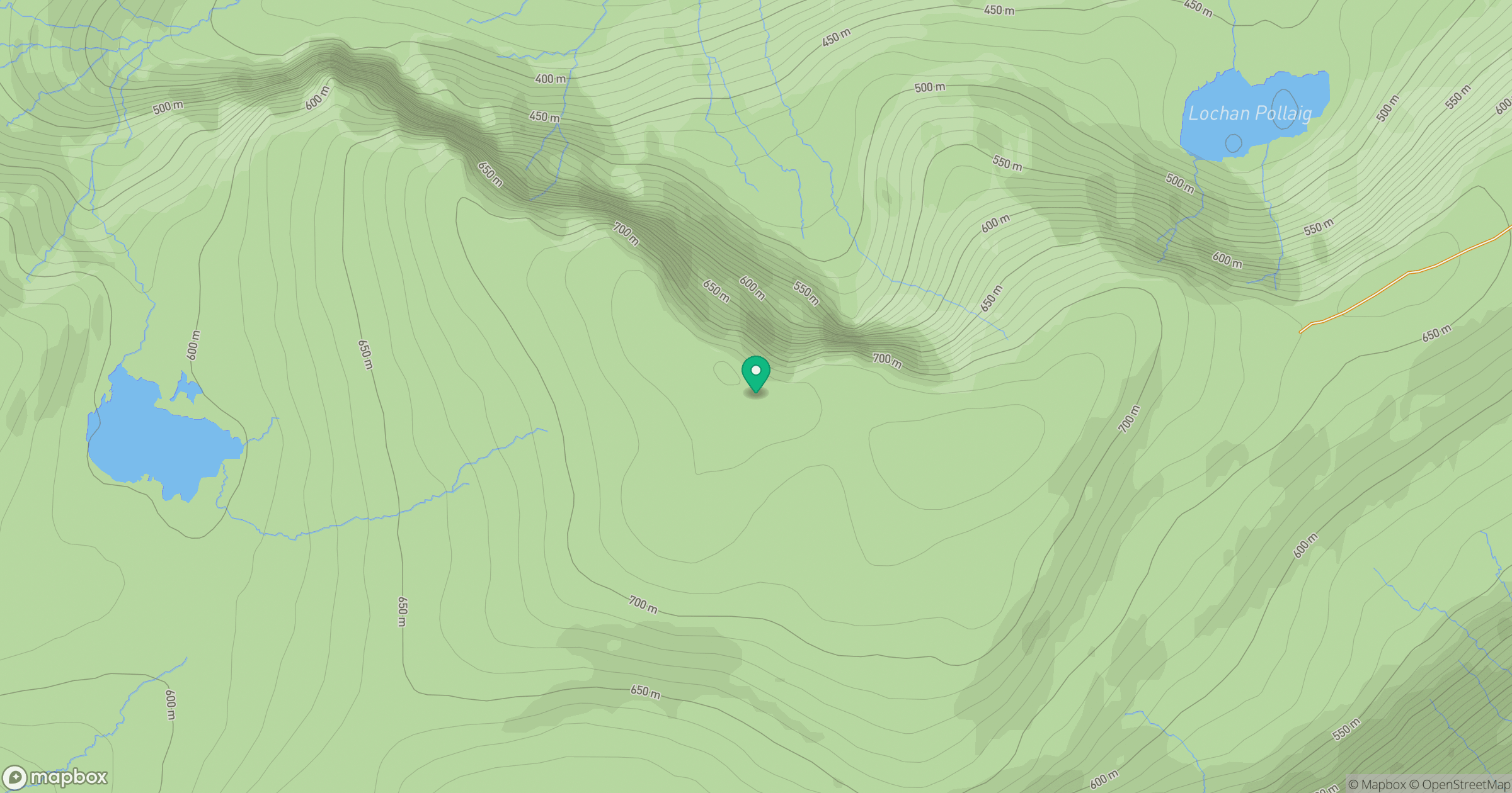
Grid reference: NH378868
View on OpenStreetMapOpens a map in a new tab, centred on the hill.
Hills within 30 km
Straight-line distance, not a walking route or confirmation of access.
Seana Bhraigh
926m
Bodach Beag
836m
Meall a' Chaorainn
632m
Carn Feur-lochain
692m
Carn a' Choin Deirg
701m
No comments yet. Be the first.