
Bodach Beag
Good walks are even better shared.
Overview
Bodach Beag: A Hidden Gem in the Scottish Highlands
Nestled within the enchanting Scottish Highlands, Bodach Beag offers a delightful escape for hikers seeking both adventure and tranquility. With an elevation of 858 meters, this Hewitt may not steal the limelight from its larger cousins, but its charm and views make it a rewarding destination for outdoor enthusiasts.
Geology
The geological composition of Bodach Beag contributes to its unique terrain. Schist and granite prevail, remnants of ancient volcanic activity that shaped these majestic hills. Glacial carvings are evident in the rock formations, providing a glimpse into the centuries of geological history that has formed the very ground beneath your feet.
The Hike
The most popular route to the summit starts at the southern end of Loch Awe. The Loch Awe Trail meanders alongside the glistening waters, offering captivating views of the loch and the surrounding uplands.
Route Details
- Distance: 10.5 km
- Time: Approximately 4 hours
- Difficulty: Moderate
Expect a mix of grassy stretches and rocky climbs, with the occasional boggy patch that might catch you off guard. If you're lucky (or skilled), you might avoid the “surprise swimming pools.”
Summit Features
Upon reaching the summit, you'll find a humble cairn, a perfect spot for a celebratory snack. Don't forget to have your camera ready for the array of picturesque views!
Terrain Type
The terrain is a delightful mix of grassy areas dotted with rocky outcrops. Just keep an eye out for the infamous bogs – they tend to be less than friendly!
Views
The views from Bodach Beag are nothing short of spectacular. From the summit, gaze upon Loch Awe, absorbing the beauty of the changing reflections in the water. If you're lucky, mountaineering giants like Ben Cruachan might come into view.
Best Seasons for Views
To fully appreciate the stunning scenery, consider hiking in spring or autumn. The skies are often clearer, and the vibrant colours make for an unforgettable experience.
Hazards
Though generally safe, certain hazards do exist. Be wary of slippery rocks during wet weather, and keep in mind that Highland weather can change on a dime – a sunny morning can quickly turn into a robust thunderstorm.
Nearby Summits
If you’re looking to extend your adventure, consider summiting Ben Cruachan or Beinn Eunaich, both accessible from the Bodach Beag route.
Access
Nearest Parking
Parking can be found at the southern end of Loch Awe near the village of Lochawe. Arrive early to secure a spot!
Public Transport
Dalmally serves as the nearest railway station, with bus services running to the village of Lochawe.
Nearest Town
Dalmore, a small town, provides basic amenities benefiting hikers.
Facilities
While there are no facilities at the trailhead, a small shop and café are available in Lochawe for refreshments before you hit the trail.
History
The name ‘Bodach Beag’ translates to ‘little old man’ in Gaelic, a playful nod to its stature in comparison to the larger surrounding peaks. Historically, it serves as a serene spot for reflection and connects visitors to Scotland's rich cultural heritage.
Embarking on an adventure to Bodach Beag promises memories that linger long after the boots are off. So lace them up and get ready to uncover this hidden gem!
Explore routes near Bodach Beag
Public walks starting within 80 km of this hill. Nearby does not mean a route reaches the summit; check its map and access before setting out.
Loch Migdale from Torroy: Spinningdale pinewood and loch shore walk
View route
Ben Klibreck
View route
Beinn Eighe Lancaster Wreckage at Coire Mhic Fhearchair
View route
Inverness: River Ness and Caledonian Canal circuit
View route
Route planning notes
These notes describe possible approaches, not verified navigable routes or permission to cross land. Check current paths, local access rules and conditions before setting out.
Bodach Beag via Loch Awe Trail
A picturesque route that meanders alongside Loch Awe with stunning views of the lake and surrounding hills, before ascending to the peak of Bodach Beag.
Make a day of it, together
Find someone to share the walk with, or organise a day out along a route you like.
Hill facts and local notes
Classifications
Elevation
836m
2,743 ft
Prominence
132m
Coordinates
57.8492, -4.7735
NH354877
OS Map
20
Explorer: 437N
At the Summit
The summit is adorned with a modest cairn, which is a useful landmark. On clear days, you may find fellow hikers basking in the glory of their ascent, or perhaps arguing over the best flavour of crisps to take on such adventures.
Terrain & Geology
The mountain is predominantly composed of schist and granite, giving way to rugged landscapes that have been shaped by ancient glaciers. The distinctive rock formations provide insight into the geological history of the Highlands and offer a striking contrast to the greener valleys below.
Views & Scenery
Panoramic views of Loch Awe, the surrounding hills, and on a clear day, one can even glimpse Ben Cruachan in the distance.
History & Heritage
Name Origin
The name 'Bodach Beag' translates to 'little old man' in Gaelic, a fitting description for its modest stature amid the towering giants of the Highlands.
Historical Significance
While not the highest peak in the region, Bodach Beag holds cultural significance, representing a quiet retreat into Scotland's natural beauty, a place to ponder life’s mysteries – like why your boots have suddenly decided to develop a leak.
Getting There & Facilities
Check current local access restrictions, parking rules and transport timetables before travelling. These notes do not confirm public access to the summit.
Parking
There is a parking area located at the southern end of Loch Awe, near the village of Lochawe. It's a small car park, so arriving early on weekends is advisable.
Public Transport
The nearest train station is located in Dalmally. You can take a bus to Lochawe Village and then walk to the parking area.
Nearby Facilities
There are no facilities directly at the start of the hike, but Lochawe has a small shop and a café where you can grab a quick bite or drink before setting off.
Safety Information
Known Hazards
- Potential for slippery rocks and mud, especially after rain. Weather can change rapidly—be prepared for all four seasons in one day!
General Safety Tips
- Check weather conditions before setting out
- Carry appropriate clothing and equipment
- Let someone know your planned route
- Take a map, compass, and GPS device
- Carry emergency supplies: food, water, first aid kit, torch
Hills
Some common questions about the hills answered
Are there group walks up Bodach Beag?
Many walkers use Walkmates to join or organise walks with others. You can check for group walks around Bodach Beag through the maps
Are there other walkers around Bodach Beag?
Activity varies by location and time, but Walkmates lets you see whether others have shared walks or shown interest in this area. Find other people through the walking friends search walking friends for Bodach Beag search or of course create your own walk for Bodach Beag
Can I organise a walk to Bodach Beag?
Yes. If there aren’t any walks listed already, you can create a walk and make it available for others to join.
If you're signed up to Walkmates, you can create a walk to Bodach Beag.
How do I find a walk up this hill?
There are often multiple ways to walk this hill, depending on experience and route preference. Walkmates helps you explore walks and routes that others have shared.
Can I suggest a new route up Bodach Beag?
Yes. You can suggest or create routes to share with others. Walkmates focuses on the social side of walking, so routes are used to help people organise walks and explore areas together, rather than as detailed navigation tools or route libraries.
Other uses really appreciate knowledgeable walkers sharing their routes. Share your favourite route to Bodach Beag here
The is an error or something incorrect about this hill. How do I let you know?
We always strive to keep the information on Walkmates as accurate as possible. If you find an error, please let us know through the contact form and we'll aim to correct it as quickly as possible
Community Discussion
Comments
Location
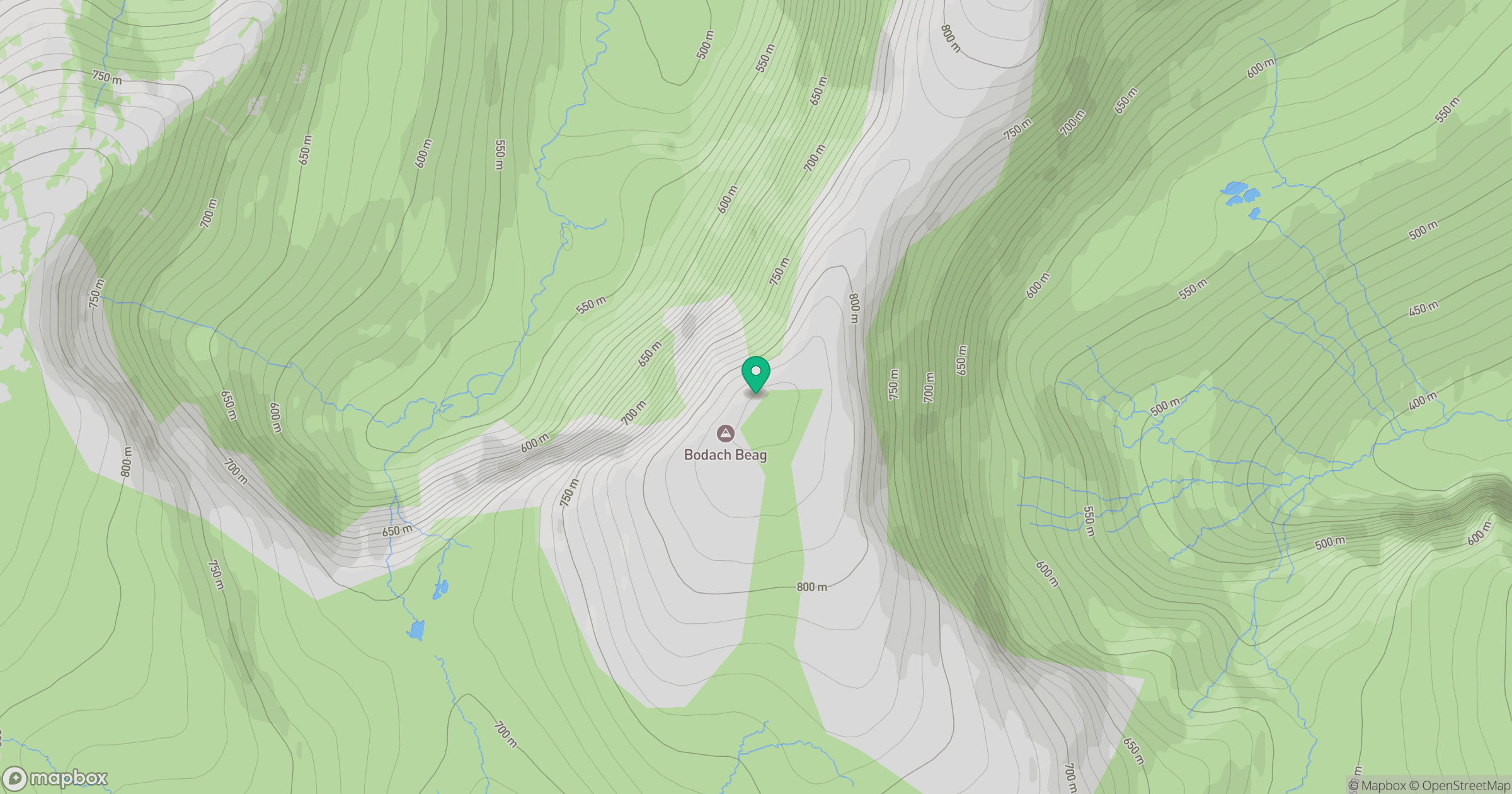
Grid reference: NH354877
View on OpenStreetMapOpens a map in a new tab, centred on the hill.
Hills within 30 km
Straight-line distance, not a walking route or confirmation of access.
Seana Bhraigh
926m
An Teallach - Bidein a' Ghlas Thuill
1,063m
An Teallach - Sgurr Fiona
1,059m
Carn Ban
843m
An Socach
744m
No comments yet. Be the first.