
Carn Dearg
Good walks are even better shared.
Overview
Carn Dearg
Overview
Nestled within the Scottish Highlands, Carn Dearg stands proudly at an elevation of 1044 meters. This Munro is beloved by climbers for its stunning views and diverse routes, making it a must-visit for any hiker in the area.
Geology
With granite formations standing resilient against the ravages of time, Carn Dearg offers an interesting palette of geology. As you ascend, keep an eye out for shimmering schist and alluring outcrops that could pique the interest of even the most casual geologists—or those who just like pretty rocks.
Routes
North Face Route
This route is for the adventurous spirit. It’s steep, rugged, and, let’s face it, will get your heart racing more than your last Tinder date.
- Distance: 8.5 km
- Time: Approximately 4 hours
- Difficulty: Challenging
A9 Approach
Ideal for those who prefer to warm up with a gentler stroll before tackling real heights.
- Distance: 10.5 km
- Time: About 3.5 hours
- Difficulty: Moderate
Summit Features
On reaching Carn Dearg’s summit, you’re greeted by a massive stone cairn that beckons for group photos. The panoramic views from the top are a reward worthy of the climb, with sprawling landscapes seemingly painted for a postcard.
Terrain Type
Prepare for a bit of everything! Expect rocky pathways, grassy stretches, and a few boggy bits just to keep you on your toes (literally!). Proper footwear is a must—this is not the time for flip-flops!
Views
From the top, gaze out at the expansive vistas that define this glorious region. Highlights include:
- The breathtaking Monadhliath Mountains
- The spectacle of the Cairngorms
- And if luck strikes, a view of Ben Nevis.
Best seasons for views? Late spring and early autumn are your friends here, when visibility is top-notch, and the weather plays nice.
Hazards
As always in the Highlands, respect the mountain. Pay heed to potential rockfalls, especially in damp conditions, and be wary of swiftly changing weather—bring a jacket and maybe an air horn to signal for help if the clouds start to roll in!
Access
Nearest Parking
There's good news for drivers! A small lay-by alongside the A9 provides ample parking, but be an early riser to snag a spot.
Public Transport
Public transport from Fort William or Inverness is an option, but those buses sometimes play hide and seek! Make sure to check your times.
Nearest Town
Fort William, your friendly neighbourhood outdoor hub, is just a stone’s throw away, offering cafes, restaurants, and those all-important toilet facilities.
Facilities
Fort William has it all! Pop into one of the locals during your visit for a post-hike chat and some much-deserved sustenance.
History
The name 'Carn Dearg,' translating to 'Red Hill,' adds a flourish of history and culture, linking you to the ancient landscapes that have been explored for generations.
In essence, Carn Dearg is not just a climb; it's an experience steeped in breathtaking nature and rich history, waiting to be explored. Now lace up those boots and go play!
Explore routes near Carn Dearg
Walks starting near this hill. Open a route to check its map, distance and full itinerary.
Fort Augustus to Kytra Lock: Caledonian Canal Towpath
View route
Aviemore: Loch an Eilein and the Croft Track from Rothiemurchus
View route
Rothiemurchus: Beaver Trail and Lochan Mor
View route
Glen Affric: Coire Loch Woodland Trail
View route
Route planning notes
These notes describe possible approaches. Check a route's map and access information when planning your walk.
North Face Route
A direct ascent via the north face, it offers both a challenge and a stunning view.
A9 Approach
Starting from the A9, this gentler ascent weaves through scenic woodland before climbing up to the summit.
Make a day of it, together
Find someone to share the walk with, or organise a day out along a route you like.
Hill facts and local notes
Classifications
Elevation
946m
3,103 ft
Prominence
591m
Coordinates
57.0923, -4.2533
NH635023
OS Map
35
Explorer: OL56 402
At the Summit
The summit features a sizeable stone cairn, perfect for a ‘before and after’ selfie, along with dramatic views of the surrounding peaks.
Terrain & Geology
Carn Dearg is primarily composed of granite and some schist, showcasing classic Highland geological formations. The bedrock provides a sturdy footing, though it can be slippery when wet, so best to watch your step—unless you fancy a surprise picnic on the way down.
Views & Scenery
From the summit, one can see the northern embrace of the Monadhliath Mountains and the chaotic peaks of the Cairngorms, including the majestic Ben Nevis on a clear day.
History & Heritage
Name Origin
The name 'Carn Dearg' translates to 'Red Hill', presumably inspired by the stunning sunsets that cast a warm glow on its upper slopes.
Historical Significance
A notable landmark for local climbers and mountain enthusiasts, Carn Dearg holds significance in Scottish culture as a landmark during Highland gatherings.
Getting There & Facilities
Parking
There’s a small lay-by near the A9, ample room for several cars. An early bird catches the best spot, so set your alarm!
Public Transport
Buses run from Fort William or Inverness to the A9 junction, but check schedules, as they can be quite erratic.
Nearby Facilities
Fort William sports a variety of cafes, restaurants, and some facilities for hydration and toilet breaks—always good to know before you embark!
Safety Information
Known Hazards
- Rockfall potential in steep areas, particularly during wet conditions; sudden weather changes are common, so pack that extra layer!
General Safety Tips
- Check weather conditions before setting out
- Carry appropriate clothing and equipment
- Let someone know your planned route
- Take a map, compass, and GPS device
- Carry emergency supplies: food, water, first aid kit, torch
Hills
Some common questions about the hills answered
Are there group walks up Carn Dearg?
Many walkers use Walkmates to join or organise walks with others. You can check for group walks around Carn Dearg through the maps
Are there other walkers around Carn Dearg?
Activity varies by location and time, but Walkmates lets you see whether others have shared walks or shown interest in this area. Find other people through the walking friends search walking friends for Carn Dearg search or of course create your own walk for Carn Dearg
Can I organise a walk to Carn Dearg?
Yes. If there aren’t any walks listed already, you can create a walk and make it available for others to join.
If you're signed up to Walkmates, you can create a walk to Carn Dearg.
How do I find a walk up this hill?
There are often multiple ways to walk this hill, depending on experience and route preference. Walkmates helps you explore walks and routes that others have shared.
Can I suggest a new route up Carn Dearg?
Yes. You can suggest or create routes to share with others. Walkmates focuses on the social side of walking, so routes are used to help people organise walks and explore areas together, rather than as detailed navigation tools or route libraries.
Other uses really appreciate knowledgeable walkers sharing their routes. Share your favourite route to Carn Dearg here
The is an error or something incorrect about this hill. How do I let you know?
We always strive to keep the information on Walkmates as accurate as possible. If you find an error, please let us know through the contact form and we'll aim to correct it as quickly as possible
Community Discussion
Comments
Location
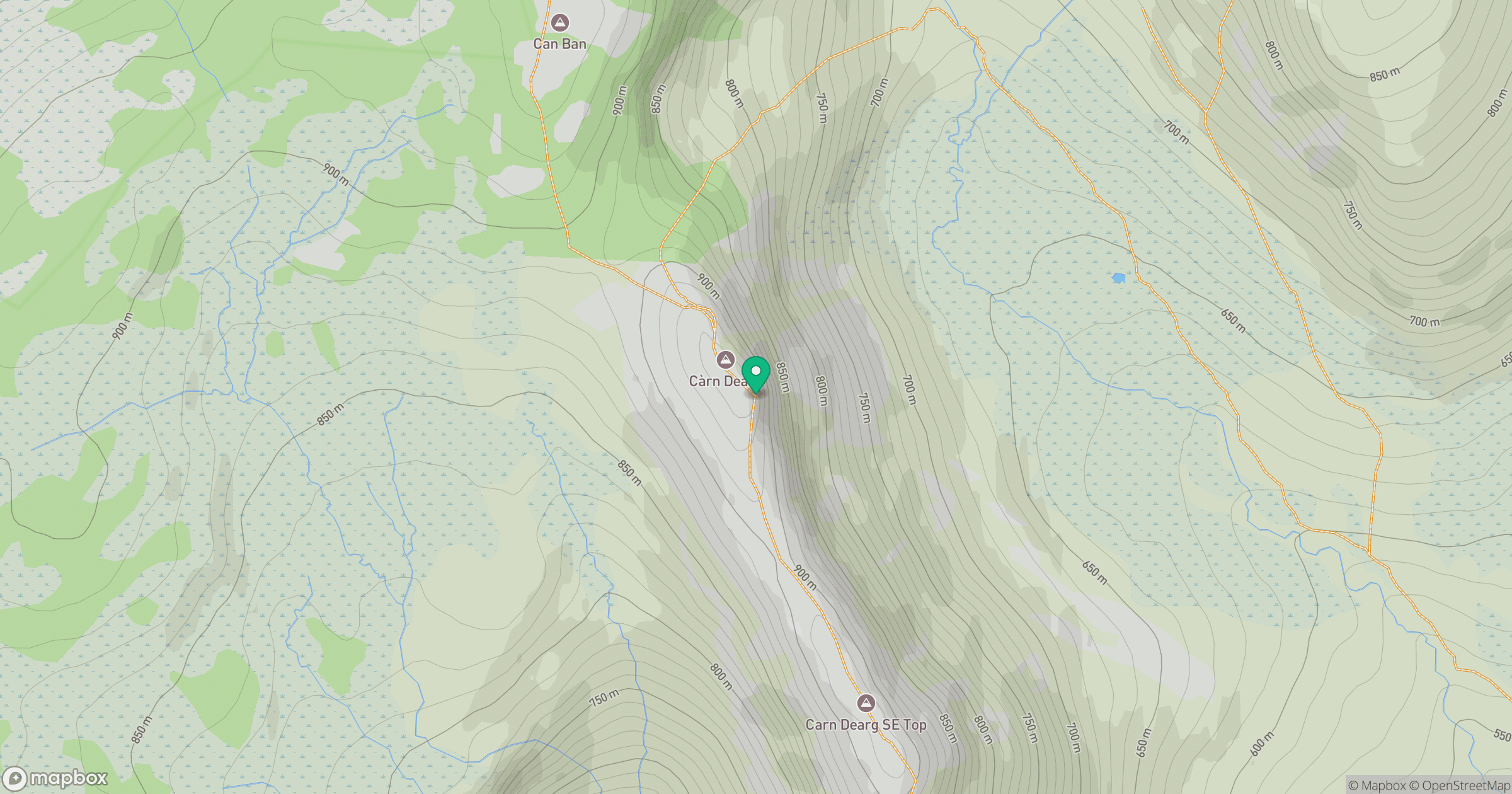
Grid reference: NH635023
View on OpenStreetMapOpens a map in a new tab, centred on the hill.
No comments yet. Be the first.