
Lamyatt Beacon
Good walks are even better shared.
Overview
Lamyatt Beacon: A Hidden Gem in the Mendip Hills
Nestled within the beautiful Mendip Hills, Lamyatt Beacon stands at a respectable 287 meters above sea level. Though it may not be the tallest peak in the area, it certainly packs a punch when it comes to enchanting views and delightful walking routes.
Geology
The predominant limestone of Lamyatt Beacon has a story to tell, crafted by the forces of nature over countless years. The rugged terrain displays fascinating karst features, perfect for geologists and nature lovers alike, ensuring every step offers a new discovery. Just keep your eyes peeled for those cheeky little rock formations — they can be quite the jokesters!
Routes
Lamyatt Beacon Circular Walk
Starting from the charming village of Lamyatt, this moderate 5km circular route will have you embracing the joys of the great outdoors. With an estimated time of 2 hours, this hike is perfect for a leisurely afternoon stroll, or perhaps a race against a particularly motivated sheep!
Summit Features
As you reach the top, you'll be greeted by a humble stone cairn, standing as a testament to the many adventurers who have visited this beacon before you. The panoramic views from the summit are nothing short of breathtaking, allowing you to take in the rolling landscape and distant landmarks that pepper the horizon.
Terrain
Prepare for a mix of grassy patches and rocky outcrops as you navigate your way to the summit. The varied terrain makes for an engaging walk, so wear sturdy shoes and bring your best hiking spirit!
Views
The vistas from Lamyatt Beacon are truly spectacular. You can gaze upon the scenic Chew Valley, perhaps imagining the tales of yore that echo through this area. For the best views, consider visiting in spring or autumn; the changing colours can make the scenery feel like a work of art.
Hazards
While the hike is accessible, it’s worth noting that after rainfall, rocks can be particularly slippery. And if you come across livestock, give them a friendly wave, but be sure to maintain your distance — those cows can be quite territorial!
Access
Parking is available in a small layby on the A371, but space is limited, so do park with care. If you're relying on public transport, local buses service the village and make for an easy day out! The nearest sizeable town is Shepton Mallet, which offers more amenities and charm.
Facilities
Lamyatt may be small, but it boasts a welcoming pub for a quick refreshment. Facilities like restrooms can be found in nearby Shepton Mallet, so plan accordingly!
History
The name 'Beacon' hints at its historical significance, serving as a lookout point for navigating the countryside. Locals often share stories about its role in ancient communications, linking communities miles apart.
In summary, Lamyatt Beacon is not just another hill, but a treasure trove of experiences waiting to be explored. Grab your hiking boots, pack some snacks, and don't forget your camera — you won't want to miss capturing those stunning views!
Conclusion
So, if you're in the area and looking for a perfect outdoor adventure, look no further than Lamyatt Beacon. It’s a little slice of heaven in the Mendips, where the beauty of nature meets a sprinkle of history — what more could a hiker want?
Explore routes near Lamyatt Beacon
Walks starting near this hill. Open a route to check its map, distance and full itinerary.
Heal Somerset wetland ranger walk
View route
Heal Somerset wetland ranger walk
View route
Mindful photowalk at Heal Somerset
View route
Beaver Moon dusk walk at Heal Somerset
View route
Route planning notes
These notes describe possible approaches. Check a route's map and access information when planning your walk.
Lamyatt Beacon Circular Walk
A scenic circular route starting from the village of Lamyatt, taking you through charming countryside and up to the beacon.
Make a day of it, together
Find someone to share the walk with, or organise a day out along a route you like.
Hill facts and local notes
Classifications
Elevation
220m
722 ft
Prominence
70m
Coordinates
51.1239, -2.4736
ST669361
OS Map
183
Explorer: 142
At the Summit
The summit is marked by a small stone cairn and provides a panoramic view of the surrounding Mendip Hills.
Terrain & Geology
Lamyatt Beacon primarily consists of limestone, typical of the Mendip Hills, shaped by millennia of sedimentation and erosion. The area showcases dramatic rock formations and intriguing karst features.
Views & Scenery
From the top, enjoy views towards the Chew Valley and Ashelford in the distance. On a clear day, the Bristol Channel is visible.
History & Heritage
Name Origin
The name 'Beacon' suggests a historical use for signalling, likely from earlier centuries when such towers were crucial for communication.
Historical Significance
Lamyatt Beacon holds significance in local folklore and serves as a historical marker for navigators in the region.
Getting There & Facilities
Parking
There is a small layby on the A371 near Lamyatt, suitable for a few cars. Please park considerately.
Public Transport
The nearest bus stop is in the village of Lamyatt, serviced by local routes from Shepton Mallet.
Nearby Facilities
The village of Lamyatt has a small pub for refreshments, though facilities may be limited. Toilets are best found in Shepton Mallet.
Safety Information
Known Hazards
- Watch out for slippery rocks after rainfall, and be cautious of livestock when crossing fields.
General Safety Tips
- Check weather conditions before setting out
- Carry appropriate clothing and equipment
- Let someone know your planned route
- Take a map, compass, and GPS device
- Carry emergency supplies: food, water, first aid kit, torch
Hills
Some common questions about the hills answered
Are there group walks up Lamyatt Beacon?
Many walkers use Walkmates to join or organise walks with others. You can check for group walks around Lamyatt Beacon through the maps
Are there other walkers around Lamyatt Beacon?
Activity varies by location and time, but Walkmates lets you see whether others have shared walks or shown interest in this area. Find other people through the walking friends search walking friends for Lamyatt Beacon search or of course create your own walk for Lamyatt Beacon
Can I organise a walk to Lamyatt Beacon?
Yes. If there aren’t any walks listed already, you can create a walk and make it available for others to join.
If you're signed up to Walkmates, you can create a walk to Lamyatt Beacon.
How do I find a walk up this hill?
There are often multiple ways to walk this hill, depending on experience and route preference. Walkmates helps you explore walks and routes that others have shared.
Can I suggest a new route up Lamyatt Beacon?
Yes. You can suggest or create routes to share with others. Walkmates focuses on the social side of walking, so routes are used to help people organise walks and explore areas together, rather than as detailed navigation tools or route libraries.
Other uses really appreciate knowledgeable walkers sharing their routes. Share your favourite route to Lamyatt Beacon here
The is an error or something incorrect about this hill. How do I let you know?
We always strive to keep the information on Walkmates as accurate as possible. If you find an error, please let us know through the contact form and we'll aim to correct it as quickly as possible
Community Discussion
Comments
Location
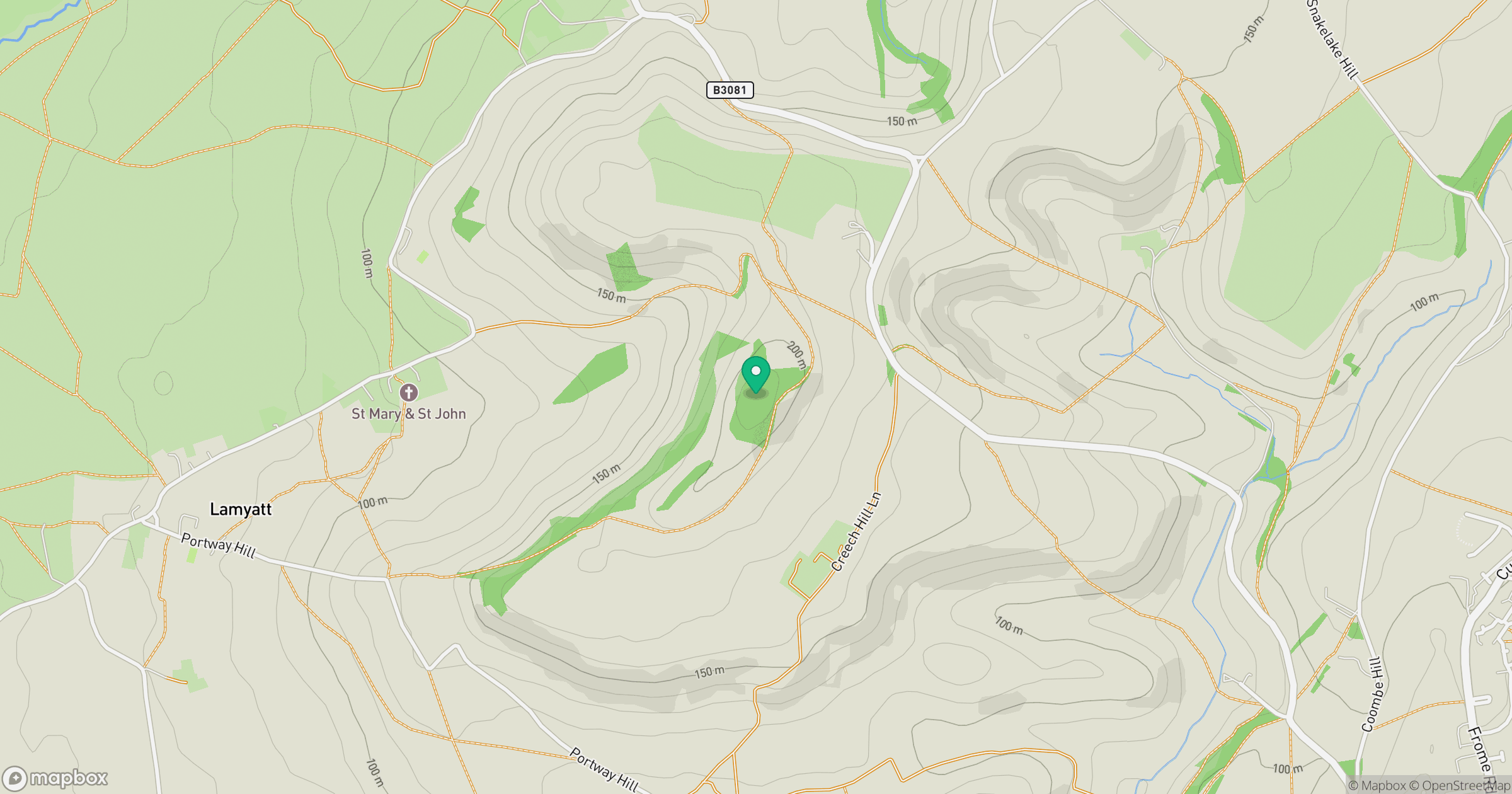
Grid reference: ST669361
View on OpenStreetMapOpens a map in a new tab, centred on the hill.


No comments yet. Be the first.