

Knocklayd
Good walks are even better shared.
D1136 : Bog cotton, Knocklayd
Rossographer Photo source
Overview
Knocklayd: A Gem of the Antrim Mountains
Knocklayd, standing at a proud 603 meters, is a marvellous mountain located in the Antrim Mountains of Northern Ireland. It is classified as a Marilyn, meaning it rises prominently above its surroundings, making it a worthy destination for hikers and outdoor enthusiasts alike.
Geology
The geological foundation of Knocklayd is primarily basalt, a remnant of volcanic activity. Its distinctive cliffs and rolling landscapes provide not only stunning scenic views but also a glimpse into the ancient history of the earth's formation in this region. Wanderers here will be walking on a rocky stage set by nature!
Routes
The most popular route to the summit is the Knocklayd via the forest trail, which offers a moderate challenge. Stretching about 5.5 km, this trail immerses you in the beauty of the forest before leading you to the spectacular summit. Expect to spend around 2.5 hours enjoying the ascent, perfect for a lovely day outing!
Summit Features
Reaching the summit, you'll find a considerable stone cairn, where all who make the climb are inducted into the 'I Made It!' club. And let’s be honest—there’s nothing quite like the feeling of gazing over sweeping views and pretending to be king of the mountain.
Terrain Type
The terrain at Knocklayd is a delightful mix of grassy slopes and rocky outcrops. Be prepared for some steep sections, and watch your footing on loose rocks, particularly when you venture off the beaten track.
Views
From the summit, vistas unfold dramatically, showcasing the mesmerizing Mourne Mountains, the rugged Causeway Coast, and on clear days, even the hills of Scotland. For the most striking views, aim for a visit in spring or autumn when nature flaunts its colours.
Hazards
As with many hikes, there are a few hazards to keep in mind. Uneven ground, steep drops, and occasionally muddy paths can surprise the unwary. Always check weather forecasts before setting off to avoid an uninvited downpour!
Nearby Summits
If you're feeling adventurous, consider tagging along to nearby summits such as Slemish Mountain or Trostan. They offer unique views and a taste of the diverse geology of the region.
Access
The nearest parking area is located at the forest trailhead on the B56 road, with easy access to the hiking trails. For those relying on public transport, bus services run regularly from Ballymoney and Ballymena, reaching the village of Armoy, about 4 km away.
Facilities
While the immediate area is tucked away in nature, the charming village of Armoy offers basic amenities, including a café for that well-deserved cuppa post-hike. Don't forget to look for toilets in the nearest towns before heading to the hills!
History
The name 'Knocklayd' has intriguing roots, as it comes from the Irish name 'Cnoc Léata', meaning 'hill of the otters’. Local folklore adds charm, speaking of faeries and ancient ritualistic practices among the hills.
In conclusion, Knocklayd is a beacon for hikers seeking a mix of natural beauty, geological wonder, and a hint of cultural richness. So, pack your bags, lace up those boots, and get ready for a grand day's adventure!
Explore routes near Knocklayd
Walks starting near this hill. Open a route to check its map, distance and full itinerary.
Portballintrae to Giant's Causeway: railway path and Blue Trail return
View route
Belfast street-art walk
View route
Belfast street-art walk
View route
Lagan Towpath: Shaw's Bridge to Drumbeg Footbridge
View route
Route planning notes
These notes describe possible approaches. Check a route's map and access information when planning your walk.
Knocklayd via the forest trail
A picturesque route that meanders through lush forests before ascending to the summit, offering both beauty and challenge.
Make a day of it, together
Find someone to share the walk with, or organise a day out along a route you like.
Photo Gallery
View all Photo could not load
D1136 : Bog cotton, Knocklayd
Rossographer
 Photo could not load
D1136 : Knocklayd and Ballycastle
Rossographer
 Photo could not load
D1136 : Trig point & Carn an Truagh, Knocklayd Summit
Colin Park
 Photo could not load
D1136 : Knocklayd Triangulation Pillar
Rossographer
 Photo could not load
D1136 : Flush Bracket, Knocklayd Triangulation Pillar
Rossographer
 Photo could not load
D1136 : Spider, Knocklayd Triangulation Pillar
Rossographer
 Photo could not load
D1136 : The summit of Knocklayd, 514m in Co. Antrim
Michael Earnshaw
Hill facts and local notes
Classifications
Elevation
514m
1,686 ft
Prominence
392m
Coordinates
55.1621, -6.2510
D115363
OS Map
05
At the Summit
The summit features a prominent stone cairn and panoramic views that stretch across the glens and mountains of County Antrim.
Terrain & Geology
Knocklayd is primarily composed of basalt and dolerite, with rugged cliffs and rolling grasslands that speak to its volcanic origins. The terrain offers a fascinating mix of ancient geological history and stunning landscapes.
Views & Scenery
From the summit, you can enjoy spectacular views of the Mourne Mountains, the stunning Causeway Coast, and even the distant hills of Scotland on a clear day.
History & Heritage
Name Origin
The name 'Knocklayd' is believed to derive from the Irish 'Cnoc Léata', which translates to 'hill of the otters'.
Historical Significance
This area is steeped in mythology, with local legends speaking of faeries and ancient rituals among the hills.
Getting There & Facilities
Parking
There is parking available at the forest trailhead on the B56 road, which offers easy access to the trail.
Public Transport
Regular bus services operate from Ballymoney and Ballymena to the nearby village of Armoy, which is around 4km from the trailhead.
Nearby Facilities
Though the immediate area is quite rural, Armoy offers basic amenities, including a shop and a café. Toilets are often found in the nearest towns, so plan accordingly.
Safety Information
Known Hazards
- Steep gradients, loose rocks, and occasionally muddy paths can pose risks. Be wary of sudden weather changes, as conditions can shift quickly.
General Safety Tips
- Check weather conditions before setting out
- Carry appropriate clothing and equipment
- Let someone know your planned route
- Take a map, compass, and GPS device
- Carry emergency supplies: food, water, first aid kit, torch
Hills
Some common questions about the hills answered
Are there group walks up Knocklayd?
Many walkers use Walkmates to join or organise walks with others. You can check for group walks around Knocklayd through the maps
Are there other walkers around Knocklayd?
Activity varies by location and time, but Walkmates lets you see whether others have shared walks or shown interest in this area. Find other people through the walking friends search walking friends for Knocklayd search or of course create your own walk for Knocklayd
Can I organise a walk to Knocklayd?
Yes. If there aren’t any walks listed already, you can create a walk and make it available for others to join.
If you're signed up to Walkmates, you can create a walk to Knocklayd.
How do I find a walk up this hill?
There are often multiple ways to walk this hill, depending on experience and route preference. Walkmates helps you explore walks and routes that others have shared.
Can I suggest a new route up Knocklayd?
Yes. You can suggest or create routes to share with others. Walkmates focuses on the social side of walking, so routes are used to help people organise walks and explore areas together, rather than as detailed navigation tools or route libraries.
Other uses really appreciate knowledgeable walkers sharing their routes. Share your favourite route to Knocklayd here
The is an error or something incorrect about this hill. How do I let you know?
We always strive to keep the information on Walkmates as accurate as possible. If you find an error, please let us know through the contact form and we'll aim to correct it as quickly as possible
Community Discussion
Comments
Location
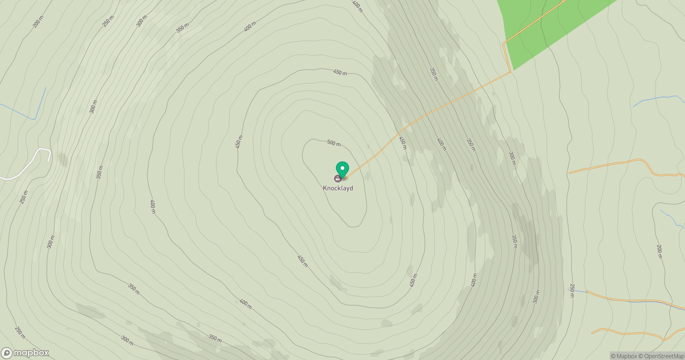
Grid reference: D115363
View on OpenStreetMapOpens a map in a new tab, centred on the hill.
No comments yet. Be the first.