Start at the public Shaw's Bridge car park on the west side of the Lagan, reached from the Malone Road side. Take the short marked connection beside the old bridge onto the Lagan Towpath and follow it upstream towards Lisburn. This out-and-back stays on the towpath throughout, passing the wooded edge of Barnett Demesne, the Gilchrist Bridge junction and the canal reaches near Edenderry. Continue beside the canal past Locks 4 and 5 to the towpath footbridge near Drumbeg, then retrace the same route to Shaw's Bridge.
The route is mainly flat on a shared surfaced path. There are canal and river edges, narrow bridge approaches and cyclists, so keep children close, keep dogs under control and give other users room. Stay on the towpath rather than using the side bridges or neighbouring estate drives. Cross the towpath footbridge over the Lagan near Drumbeg and turn around immediately beyond it. Retrace the crossing and towpath without joining the road or park paths. Allow about 3 hours 15 minutes for the walk and short stops; you can shorten it by turning back earlier.
Park only in the signed public car park and check its entrance signs for any restrictions or closing time. The Lock Keeper's Cottage is downstream of this walk and its opening hours vary, so do not rely on it for facilities on this route. Follow notices on the day and turn back if a section is closed or flooded.
Route and access information checked against Lagan Valley Regional Park's Towpath Leaflet and Department for Infrastructure towpath notices, 4 October 2026. The listed July-August maintenance closure is on the Lock 3 to Shaw's Bridge stretch, downstream of this route. Sources: https://www.laganvalley.co.uk/sites/default/files/PDFs/Finaltowpathwhite.pdf and https://www.infrastructure-ni.gov.uk/articles/lagan-towpath .
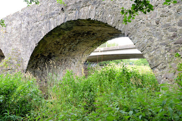
Cover photograph: Shaw's Bridge, Belfast (2013), copyright Albert Bridge, taken 19 August 2013. Source: https://www.geograph.org.uk/photo/3608963 . Reused without alteration under Creative Commons Attribution-ShareAlike 2.0: https://creativecommons.org/licenses/by-sa/2.0/ . The dated photograph illustrates the bridge, not current water or path conditions.