
Croaghan
Good walks are even better shared.
Overview
Croaghan: A Gem in the Ox Mountains
Croaghan is not just another bump on the map, but a splendid peak situated in the embrace of the Ox Mountains. Rising to an elevation of 664 meters, it may not be the highest, but it certainly packs a mighty punch with its stunning vistas and diverse terrain.
Geology
The mountain’s geology consists largely of Old Red Sandstone, which has led to interesting formations and a distinctive reddish tint. Erosion has played its part too, carving out the mountain's steeper inclines, making it a captivating study for both geologists and casual hikers alike.
Routes
For those keen on exploring Croaghan, the Ballysadare Quick Route is a popular choice. At about 7.5 kilometers, the trek takes approximately 3.5 hours. The ascent is moderate and rewards hikers with panoramic views that make every step worth it. Just remember, when you reach the top, you’re not just conquering a mountain; you’re embracing adventure!
Summit Features
As you arrive at the summit, you’ll notice a humble but sturdy cairn, a testament to the many adventurers that have come before you. The views from here are absolutely breathtaking, revealing the lay of the land in all its glory.
Terrain
Expect a mixed bag of rocky outcrops, grassy glens, and the occasional bog that can catch you off guard. A good pair of hiking boots will serve you well on this journey, as some patches can get rather squelchy.
Views
The summit of Croaghan presents expansive views across the Ox Mountains, Lough Arrow, and all the way to the vast Atlantic Ocean when the weather plays nice. Late spring and early autumn are deemed the best times to experience the magic—especially if you fancy photos that make you look like a total legend.
Hazards
Always keep an eye on the weather! Conditions can shift in a heartbeat in these highlands, and rain can turn trails into slippery slopes quicker than you can say 'mountain goat'.
Nearby Summits
For the peak-baggers out there, Croaghan is flanked by the majestic Benbulben to the north and the historically rich Knocknarea to the south. Why not do a double-header?
Access
Reaching Croaghan is a doddle! The nearest parking is conveniently located at the Ballysadare village hall. Public transport options are available for those without a set of wheels, as buses frequently ply the route from Sligo Town.
Facilities
The charming village of Ballysadare has a handful of cafés where you can enjoy a hearty meal, sip a cuppa, and even find those all-important restroom facilities.
History
The name 'Croaghan' tells us that this peak’s local heritage runs deep, with stories imbuing the area with tales of mythical beings and cultural legends. Essentially, it’s not just a walk: it’s a walk through history.
So lace up your boots and set off on an unforgettable journey to Croaghan, where every step tells a story, and the memories await just around the bend!
Enjoy your adventures, and don’t forget to breathe in that fresh mountain air!
Explore routes near Croaghan
Public walks starting within 80 km of this hill. Nearby does not mean a route reaches the summit; check its map and access before setting out.
Portballintrae to Giant's Causeway: railway path and Blue Trail return
View route
Banagher Glen and Forest: complete higher-return circuit
View route
Belfast street-art walk
View route
Comber Greenway: Dee Street to Belfast Road
View route
Route planning notes
These notes describe possible approaches, not verified navigable routes or permission to cross land. Check current paths, local access rules and conditions before setting out.
Ballysadare Quick Route
This route starts from the scenic village of Ballysadare and takes you upward through lush woodlands before emerging into open moorland. A real feast for the senses!
Make a day of it, together
Find someone to share the walk with, or organise a day out along a route you like.
Hill facts and local notes
Classifications
Elevation
417m
1,368 ft
Prominence
115m
Coordinates
55.1119, -6.2488
D118308
OS Map
05
At the Summit
At the summit, you'll find a small cairn and a stunning view across the Sligo countryside. Sometimes, you might even feel like you're on top of the world (or at least County Sligo).
Terrain & Geology
The mountain is primarily composed of Old Red Sandstone, giving it a stunning reddish hue against the lush green surroundings. Erosion has shaped its steep faces and led to the creation of interesting rock formations.
Views & Scenery
From the top, you can see the expansive lands of the Ox Mountains, Lough Arrow, and even down towards the Atlantic Ocean on a clear day.
History & Heritage
Name Origin
The name 'Croaghan' is derived from the Irish word 'Cnoc', meaning 'hill'.
Historical Significance
Croaghan has been a site of local legend and folklore, often intertwined with the stories of the mythical creatures that are said to inhabit the nearby lands.
Getting There & Facilities
Check current local access restrictions, parking rules and transport timetables before travelling. These notes do not confirm public access to the summit.
Parking
Parking is available at the Ballysadare village hall, where you can also enjoy a cup of tea before or after your hike.
Public Transport
Buses run regularly from Sligo Town to Ballysadare, making it accessible for those relying on public transport.
Nearby Facilities
Ballysadare offers a few quaint cafés and shops, where hikers can fuel up with some local delicacies and use toilet facilities.
Safety Information
Known Hazards
- Rain can make the paths slippery; always wear appropriate footwear. Be mindful of sudden changes in weather common in mountainous areas.
General Safety Tips
- Check weather conditions before setting out
- Carry appropriate clothing and equipment
- Let someone know your planned route
- Take a map, compass, and GPS device
- Carry emergency supplies: food, water, first aid kit, torch
Hills
Some common questions about the hills answered
Are there group walks up Croaghan?
Many walkers use Walkmates to join or organise walks with others. You can check for group walks around Croaghan through the maps
Are there other walkers around Croaghan?
Activity varies by location and time, but Walkmates lets you see whether others have shared walks or shown interest in this area. Find other people through the walking friends search walking friends for Croaghan search or of course create your own walk for Croaghan
Can I organise a walk to Croaghan?
Yes. If there aren’t any walks listed already, you can create a walk and make it available for others to join.
If you're signed up to Walkmates, you can create a walk to Croaghan.
How do I find a walk up this hill?
There are often multiple ways to walk this hill, depending on experience and route preference. Walkmates helps you explore walks and routes that others have shared.
Can I suggest a new route up Croaghan?
Yes. You can suggest or create routes to share with others. Walkmates focuses on the social side of walking, so routes are used to help people organise walks and explore areas together, rather than as detailed navigation tools or route libraries.
Other uses really appreciate knowledgeable walkers sharing their routes. Share your favourite route to Croaghan here
The is an error or something incorrect about this hill. How do I let you know?
We always strive to keep the information on Walkmates as accurate as possible. If you find an error, please let us know through the contact form and we'll aim to correct it as quickly as possible
Community Discussion
Comments
Location
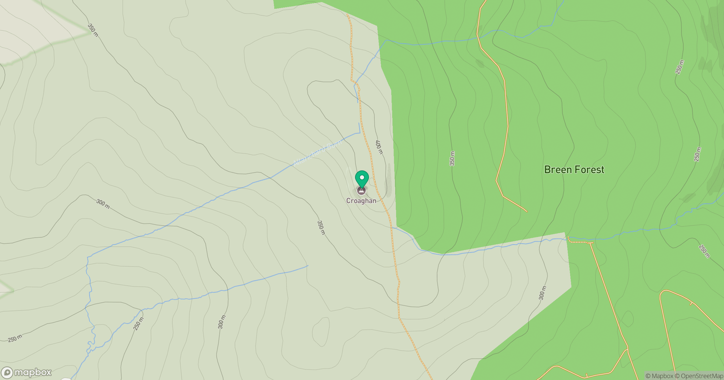
Grid reference: D118308
View on OpenStreetMapOpens a map in a new tab, centred on the hill.
Hills within 30 km
Straight-line distance, not a walking route or confirmation of access.
No comments yet. Be the first.