
Slievenanee
Good walks are even better shared.
Overview
Overview
Slievenanee, standing at 682 meters, is a gem in the Fermanagh and Omagh region of Northern Ireland. Known for its impressive views and approachable trails, it attracts both novice hikers and seasoned walkers alike.
Geology
Composed mainly of Carboniferous limestone, Slievenanee showcases fascinating geological features that tell the tale of its ancient marine origins. The interplay of limestone and shale offers a unique hiking experience, with plenty of interesting rock formations to gaze upon.
Hiking Routes
The most popular hiking route is the Stoneyford Trail. This route spans approximately 5.2 km and is classified as a moderate hike that typically takes around 2.5 hours to complete. The trail is well-defined, offering stunning views as you ascend.
Summit Features
At the summit, adventurers will find a trig point diligently watching over the landscape, alongside a charming stone cairn. These features not only serve as navigation points but also as perfect spots for capturing the moment with some photos.
Terrain and Hazards
Expect a mix of grassy paths and rocky outcrops along with the occasional bogginess after rain. Wet trails can be slippery, so tread carefully to avoid unintentional mud baths!
Views
The vistas from Slievenanee are nothing short of spectacular. Hikers can enjoy views of Lough Erne and the rolling landscapes of the Sperrin Mountains, particularly vibrant during Spring and Autumn—nature's very own festival of colour.
Access and Facilities
The nearest car park, Stoneyford Car Park, is conveniently located just 1 km from the trailhead and offers enough space for several vehicles. Public transport to the area is limited; a car is recommended for ease of access. Amenities can be found in nearby towns such as Enniskillen, where you can grab snacks and refreshments.
History
The mountain’s name, Slievenanee, translates as 'mountain of the birds,' which is fitting given the abundant avian life that thrives in the area. Immerse yourself in the local history, with remnants of ancient structures adding to the allure of this hike.
Conclusion
A trek to the summit of Slievenanee promises not only an invigorating experience but also a chance to connect with the rich natural and cultural tapestry of Northern Ireland. Don’t forget your camera and a snack (or two)!
Explore routes near Slievenanee
Public walks starting within 80 km of this hill. Nearby does not mean a route reaches the summit; check its map and access before setting out.
Portballintrae to Giant's Causeway: railway path and Blue Trail return
View route
Belfast street-art walk
View route
Comber Greenway: Dee Street to Belfast Road
View route
Banagher Glen and Forest: complete higher-return circuit
View route
Route planning notes
These notes describe possible approaches, not verified navigable routes or permission to cross land. Check current paths, local access rules and conditions before setting out.
Stoneyford Trail
A scenic trail starting from the Stoneyford car park, leading through lush pastures and up to the summit of Slievenanee.
Make a day of it, together
Find someone to share the walk with, or organise a day out along a route you like.
Hill facts and local notes
Classifications
Elevation
543m
1,781 ft
Prominence
100m
Coordinates
55.0263, -6.1753
D167214
OS Map
09
At the Summit
The summit boasts a distinct trig point marking the highest point. A wonderful stone cairn adds character and serves as an excellent backdrop for those all-important summit selfies.
Terrain & Geology
Slievenanee is primarily composed of Carboniferous limestone with some pockets of shale and sandstone, contributing to its rugged terrain and unique features. The geological formations provide insights into the region's ancient marine environment.
Views & Scenery
On a clear day, hikers are treated to panoramic views including Lough Erne and the distant Sperrin Mountains. A breathtaking vista worth the effort!
History & Heritage
Name Origin
The name Slievenanee derives from the Irish 'Sliabh na nÉan,' meaning 'mountain of the birds.'
Historical Significance
The area is steeped in local history, with ancient stone structures and evidence of early settlements dotted around the region.
Getting There & Facilities
Check current local access restrictions, parking rules and transport timetables before travelling. These notes do not confirm public access to the summit.
Parking
Stoneyford Car Park, approximately 1 km from the trailhead. Space for several vehicles, but arrive early in peak season.
Public Transport
Limited options; best accessed by car. However, bus services run from Enniskillen, with a short taxi ride needed thereafter.
Nearby Facilities
The nearby towns of Enniskillen and Irvinestown offer various amenities including cafés, public toilets, and shops. Essential after a long hike!
Safety Information
Known Hazards
- Wet and slippery paths, especially in wet weather. Some rocky sections can be treacherous; take care not to test the limits of gravity!
General Safety Tips
- Check weather conditions before setting out
- Carry appropriate clothing and equipment
- Let someone know your planned route
- Take a map, compass, and GPS device
- Carry emergency supplies: food, water, first aid kit, torch
Hills
Some common questions about the hills answered
Are there group walks up Slievenanee?
Many walkers use Walkmates to join or organise walks with others. You can check for group walks around Slievenanee through the maps
Are there other walkers around Slievenanee?
Activity varies by location and time, but Walkmates lets you see whether others have shared walks or shown interest in this area. Find other people through the walking friends search walking friends for Slievenanee search or of course create your own walk for Slievenanee
Can I organise a walk to Slievenanee?
Yes. If there aren’t any walks listed already, you can create a walk and make it available for others to join.
If you're signed up to Walkmates, you can create a walk to Slievenanee.
How do I find a walk up this hill?
There are often multiple ways to walk this hill, depending on experience and route preference. Walkmates helps you explore walks and routes that others have shared.
Can I suggest a new route up Slievenanee?
Yes. You can suggest or create routes to share with others. Walkmates focuses on the social side of walking, so routes are used to help people organise walks and explore areas together, rather than as detailed navigation tools or route libraries.
Other uses really appreciate knowledgeable walkers sharing their routes. Share your favourite route to Slievenanee here
The is an error or something incorrect about this hill. How do I let you know?
We always strive to keep the information on Walkmates as accurate as possible. If you find an error, please let us know through the contact form and we'll aim to correct it as quickly as possible
Community Discussion
Comments
Location
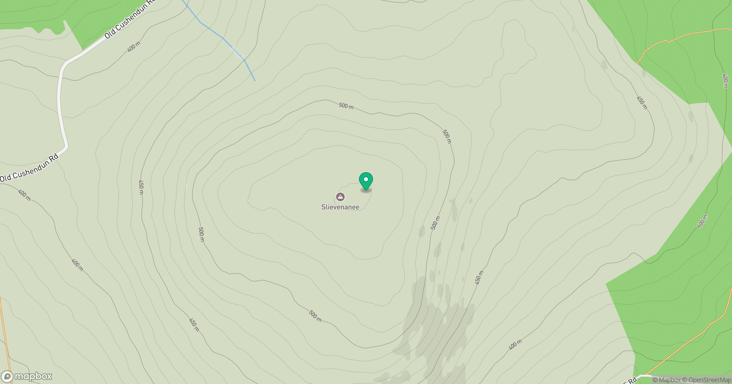
Grid reference: D167214
View on OpenStreetMapOpens a map in a new tab, centred on the hill.
Hills within 30 km
Straight-line distance, not a walking route or confirmation of access.
No comments yet. Be the first.