

Knock Mary
Good walks are even better shared.
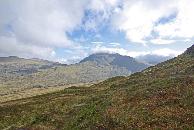
NN8420 : Path up Knock Mary
Richard Webb Photo source
Overview
Knock Mary
Knock Mary, standing at a proud 514 meters, is one of those hidden gems in the Scottish Highlands that make hikers grin from ear to ear. With its unassuming stature, it's often overshadowed by its taller neighbours but packs plenty of charm and breathtaking views.
Geology
This hill is a lovely specimen of metamorphic rocks, mainly schists, sculpted by ancient glaciers. The ruggedness is not just impressive to look at; it tells stories of eons of natural history. Just imagine the sheer force of ice carving out this beautiful landscape!
Routes
The South Approach from Acharn is a favourite route. Beginning in the quaint village of Acharn, you’ll find yourself winding through verdant forests before popping out onto open land leading up to the summit. The trek is about 6.5 km round trip and will take around 2.5 hours, depending on how many pictures you stop to take.
Summit Features
Upon reaching the top, the first thing you’ll spot is the modest cairn, a perfect way to mark your accomplishment. If you’re lucky enough to have the sun on your side, prepare for some jaw-dropping views of Loch Tay and the mighty Tarmachan Ridge in the distance. Make sure to grab a photo; your friends will want proof that you climbed something that didn’t come with a lift!
Terrain
The ground is primarily grassy with a few rocky patches, especially near the summit. Be mindful, as it can get a bit slippery in damp conditions, which could turn your ascent into an unplanned ballet recital.
Views
The vistas from the top are particularly magical in late spring and early autumn, providing clear visibility over the lush glens and shimmering waters. After all, who doesn’t enjoy a good view while pretending they’re a mountain goat?
Hazards
While Knock Mary may not be towering like some of its Scottish counterparts, don’t underestimate the terrain! Uneven footing may test your skills especially in wetter weather. A good set of boots is worth its weight in gold.
Access
For those keen on a jaunt up Knock Mary, parking can be found at Acharn with limited spaces. Should you find yourself relying on public transport, the buses to Killin aren’t very frequent, so plan accordingly.
Facilities
Before you embark, pop into Killin for supplies and perhaps a cheeky cuppa. It’s bad manners to venture into the hills on an empty stomach!
History
Aside from being a peaceful retreat for hikers, Knock Mary has an endearing name with historical roots. It translates to 'Mary’s Hill' in Gaelic, likely pointing to some old local stories unknown to all but a few old Highlanders.
Overall, Knock Mary may not be the highest hill you've conquered, but it surely adds a touch of grace to your collection of climbs. Happy hiking!
Explore routes near Knock Mary
Walks starting near this hill. Open a route to check its map, distance and full itinerary.
Crieff: Lady Mary's Walk and the River Earn
View route
Bridge of Allan Strollers and Stragglers
View route
Strathallan Court Strollers and Stragglers
View route
Club outing: Crianlarich and West Highland Way (coach departure)
View route
Route planning notes
These notes describe possible approaches. Check a route's map and access information when planning your walk.
South Approach from Acharn
This is a straightforward route beginning from the small village of Acharn, leading through lush forests before emerging onto hill grazings and the final grassy ascent.
Make a day of it, together
Find someone to share the walk with, or organise a day out along a route you like.
Photo Gallery
View all Photo could not load
NN8420 : Path up Knock Mary
Richard Webb
 Photo could not load
NN8419 : Larches, Knock Mary
Richard Webb
 Photo could not load
NN8419 : Woodland Knock Mary
Eleanor Miller
 Photo could not load
NN8420 : Near the summit of Knock Mary
Richard Webb
 Photo could not load
NN8420 : Mobile phone mast
Eleanor Miller
 Photo could not load
NN8419 : Knock Mary
Eleanor Miller
Hill facts and local notes
Classifications
Elevation
180m
592 ft
Prominence
32m
Coordinates
56.3581, -3.8746
NN842199
OS Map
58
Explorer: OL47E 368E
At the Summit
At the summit, you'll find a small cairn adorned with stones left by fellow hikers, offering a great photo opportunity. On clear days, there’s also a lovely viewpoint marker which can induce some 'oohs' and 'aahs'.
Terrain & Geology
The landscape of Knock Mary is primarily composed of metamorphic rocks, primarily schists, which have been shaped over millennia by glacial activity. It's a classic example of the rugged terrain found in the Scottish Highlands.
Views & Scenery
Panoramic views of the surrounding glens, particularly the stunning Loch Tay and the distant peaks of the Tarmachan Ridge.
History & Heritage
Name Origin
The name 'Knock Mary' is derived from the Gaelic 'Cnoc Mairi', translating to 'Mary’s Hill', likely reflecting local tales or connections to historic figures.
Historical Significance
This mountain is beloved by local walkers and holds a special place within Highland culture, offering not just a hike but a link to the area's past.
Getting There & Facilities
Parking
There is limited road-side parking available at Acharn where the route begins. It's advisable to arrive early during peak season.
Public Transport
The nearest bus stop is in Killin, approximately 5 miles away, with limited services. A taxi might be your best bet from there.
Nearby Facilities
A few local shops and cafes in Killin provide refreshments, as well as public toilets. Do stock up on snacks before heading up!
Safety Information
Known Hazards
- Uneven footing, especially in wet conditions, which may lead to slipping. Please be cautious on the grassy slopes.
General Safety Tips
- Check weather conditions before setting out
- Carry appropriate clothing and equipment
- Let someone know your planned route
- Take a map, compass, and GPS device
- Carry emergency supplies: food, water, first aid kit, torch
Hills
Some common questions about the hills answered
Are there group walks up Knock Mary?
Many walkers use Walkmates to join or organise walks with others. You can check for group walks around Knock Mary through the maps
Are there other walkers around Knock Mary?
Activity varies by location and time, but Walkmates lets you see whether others have shared walks or shown interest in this area. Find other people through the walking friends search walking friends for Knock Mary search or of course create your own walk for Knock Mary
Can I organise a walk to Knock Mary?
Yes. If there aren’t any walks listed already, you can create a walk and make it available for others to join.
If you're signed up to Walkmates, you can create a walk to Knock Mary.
How do I find a walk up this hill?
There are often multiple ways to walk this hill, depending on experience and route preference. Walkmates helps you explore walks and routes that others have shared.
Can I suggest a new route up Knock Mary?
Yes. You can suggest or create routes to share with others. Walkmates focuses on the social side of walking, so routes are used to help people organise walks and explore areas together, rather than as detailed navigation tools or route libraries.
Other uses really appreciate knowledgeable walkers sharing their routes. Share your favourite route to Knock Mary here
The is an error or something incorrect about this hill. How do I let you know?
We always strive to keep the information on Walkmates as accurate as possible. If you find an error, please let us know through the contact form and we'll aim to correct it as quickly as possible
Community Discussion
Comments
Location
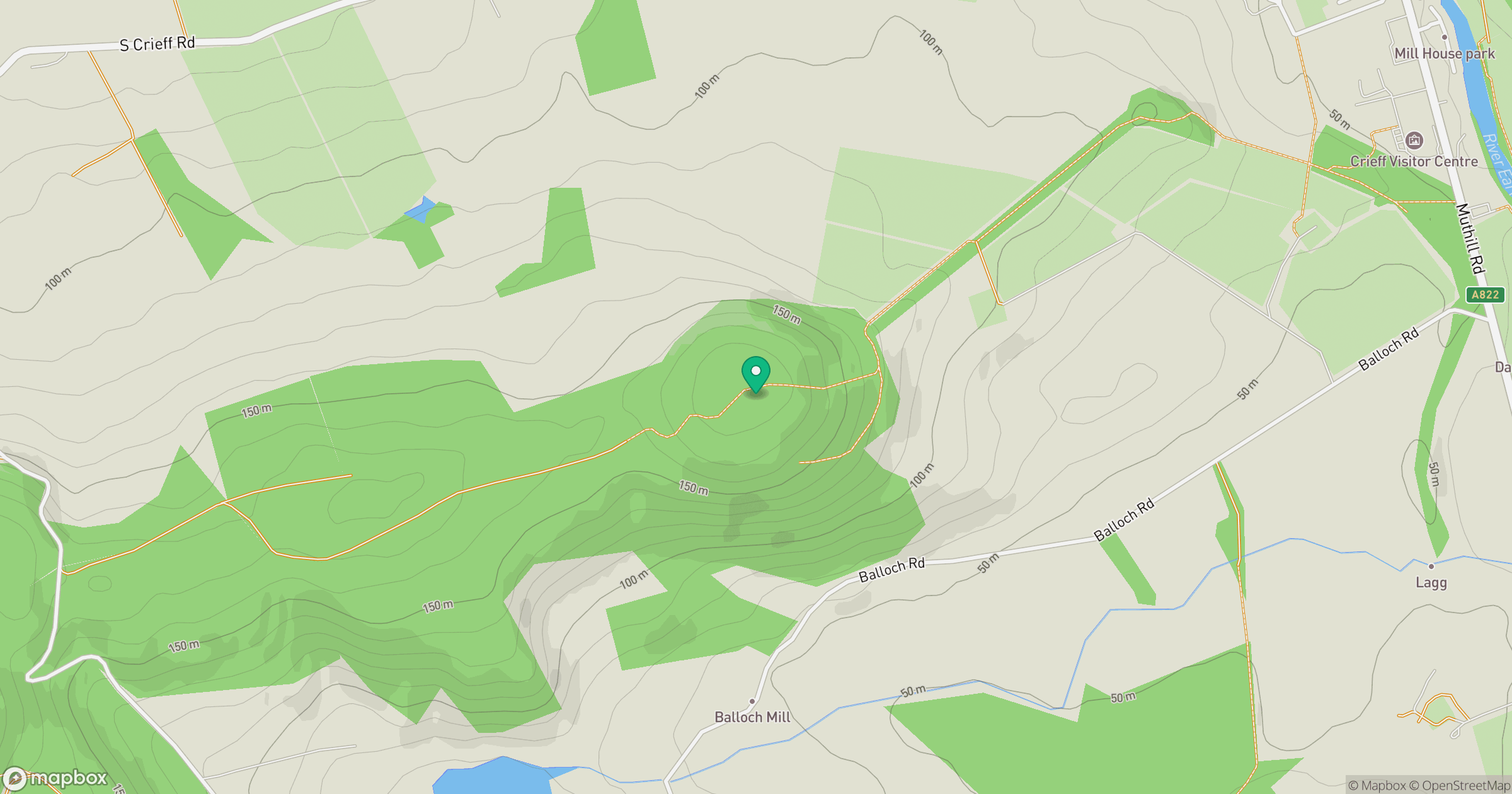
Grid reference: NN842199
View on OpenStreetMapOpens a map in a new tab, centred on the hill.
No comments yet. Be the first.