
Dun Mor
Good walks are even better shared.
Overview
Dun Mor
Dun Mor stands proudly at 751 meters, embodying the rugged beauty of the Scottish Highlands. It is a Corbett, which means it has an elevation between 2500 and 3000 feet, and is widely appreciated among hikers and nature lovers alike.
Geology
Composed primarily of granite, Dun Mor is embedded in a landscape that narrates a geological history stretching back over 400 million years. The sturdy granite rock faces tell tales of ancient volcanic activity and erosion, providing a stunning backdrop for your hike.
Routes
The most popular route is the Dun Mor Trail from Glen Gyle. This scenic ascent is approximately 9 km long and typically takes around 3.5 hours to complete. As you ascend, the views become significantly more impressive, making every step worth it!
For those seeking a bit more challenge, the Northern Approach offers a 7.5 km trek that takes about 4 hours. This route is less travelled, allowing you to enjoy the serenity of nature, but be sure to watch your footing among the rocky outcrops.
Summit Features
Upon reaching the summit, you will be welcomed by a substantial cairn – a fine resting place that beckons for a few celebratory snaps. The views from up here are absolutely marvellous, with Loch Katrine sprawling below, and towering presence of Ben Venue dominating the horizon.
Terrain Type
Expect a mix of grassy slopes and rocky outcrops that may flirt with the idea of bogginess. Yes, you’ll want to keep your boots in check to avoid an unexpected dip!
Views
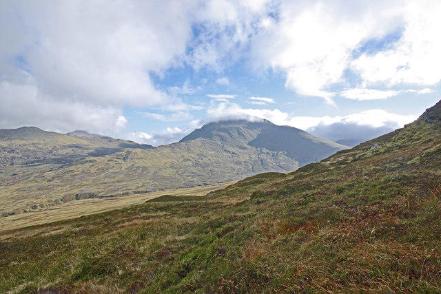
The scenery from Dun Mor's summit is nothing short of breathtaking. Notable landmarks include the shimmering waters of Loch Katrine and the imposing silhouettes of Ben Venue and Ben A'an. For the best views, aim for a visit in late spring or early autumn when the landscape bursts into colour.
Hazards
Be prepared for the unpredictable Scottish weather, which can switch from sunny to worryingly wet in the blink of an eye. The ground can also be boggy, so good boots are essential to keep your feet dry and spirits high!
Access
Parking is available at a small layby at the end of the public road leading into Glen Gyle, just a short walk from the trailhead.
If you're relying on public transport, the nearest bus stop is in Stronachlachar, though do check schedules beforehand!
The quaint town of Callander, about 15 miles to the south, is your best bet for any refreshments or facilities you may need.
Facilities
While there are no facilities directly on the mountain, the nearby town of Callander boasts a number of cafes and public toilets, perfect for a post-hike breather.
History
The name 'Dun Mor', translating to 'Big Fort', hints at its historical significance and formidable nature. Embraced by local folklore, it has a cherished place within the cultural tapestry of the Highlands.
A hike up Dun Mor is more than just a trek; it’s an opportunity to immerse yourself in the rich geology, culture, and nature that defines this splendid part of Scotland. Lace up your boots, pack your sense of adventure, and enjoy!
Explore routes near Dun Mor
Public walks starting within 80 km of this hill. Nearby does not mean a route reaches the summit; check its map and access before setting out.
Crieff: Lady Mary's Walk and the River Earn
View route
Aberfeldy: Glassie Woodland and River Tay Circular
View route
Kenmore: Drummond Hill Black Rock Trail above Loch Tay
View route
Club outing: Glen Ogle and Killin (coach departure)
View route
Route planning notes
These notes describe possible approaches, not verified navigable routes or permission to cross land. Check current paths, local access rules and conditions before setting out.
Dun Mor Trail from Glen Gyle
A scenic ascent starting from Glen Gyle, offering a mix of rugged terrain and clear paths with stunning views.
Northern Approach
A less trodden path that takes you over rocky outcrops but rewards you with solitude and picturesque panoramas.
Make a day of it, together
Find someone to share the walk with, or organise a day out along a route you like.
Hill facts and local notes
Classifications
Elevation
522m
1,713 ft
Prominence
116m
Coordinates
56.4601, -3.7837
NN901311
OS Map
52
Explorer: 379W
At the Summit
The summit of Dun Mor features a prominent cairn, surrounded by breathtaking views of the surrounding valleys and peaks, making it a perfect spot for a well-deserved break and a photo op.
Terrain & Geology
Dun Mor is primarily composed of granite, characteristic of the Highland landscape. The mountain is part of a wider geological formation that includes schists and gneisses, telling a geological story that dates back over 400 million years.
Views & Scenery
From the summit, hikers are treated to sweeping views of Loch Katrine, the towering Ben Venue and the rugged landscape of the Trossachs.
History & Heritage
Name Origin
The name 'Dun Mor' translates to 'Big Fort' in Gaelic, hinting at the historical significance of the site and its formidable presence in the landscape.
Historical Significance
Dun Mor has been a notable feature in local lore and signifies the rich cultural tapestry of the Scottish Highlands.
Getting There & Facilities
Check current local access restrictions, parking rules and transport timetables before travelling. These notes do not confirm public access to the summit.
Parking
There is a small car park at the end of the public road leading to Glen Gyle, offering ample space for a few vehicles but be prepared for a bit of a walk to the trailhead.
Public Transport
The nearest bus stop is in the village of Stronachlachar, but do check local schedules as services may be infrequent.
Nearby Facilities
Although facilities at the mountain itself are sparse, Callander offers cafes, restaurants, and public toilets.
Safety Information
Known Hazards
- Beware of the changeable weather conditions, which may turn on a dime when you least expect it. Wet and boggy ground is common, so sturdy footing is crucial.
General Safety Tips
- Check weather conditions before setting out
- Carry appropriate clothing and equipment
- Let someone know your planned route
- Take a map, compass, and GPS device
- Carry emergency supplies: food, water, first aid kit, torch
Hills
Some common questions about the hills answered
Are there group walks up Dun Mor?
Many walkers use Walkmates to join or organise walks with others. You can check for group walks around Dun Mor through the maps
Are there other walkers around Dun Mor?
Activity varies by location and time, but Walkmates lets you see whether others have shared walks or shown interest in this area. Find other people through the walking friends search walking friends for Dun Mor search or of course create your own walk for Dun Mor
Can I organise a walk to Dun Mor?
Yes. If there aren’t any walks listed already, you can create a walk and make it available for others to join.
If you're signed up to Walkmates, you can create a walk to Dun Mor.
How do I find a walk up this hill?
There are often multiple ways to walk this hill, depending on experience and route preference. Walkmates helps you explore walks and routes that others have shared.
Can I suggest a new route up Dun Mor?
Yes. You can suggest or create routes to share with others. Walkmates focuses on the social side of walking, so routes are used to help people organise walks and explore areas together, rather than as detailed navigation tools or route libraries.
Other uses really appreciate knowledgeable walkers sharing their routes. Share your favourite route to Dun Mor here
The is an error or something incorrect about this hill. How do I let you know?
We always strive to keep the information on Walkmates as accurate as possible. If you find an error, please let us know through the contact form and we'll aim to correct it as quickly as possible
Community Discussion
Comments
Location
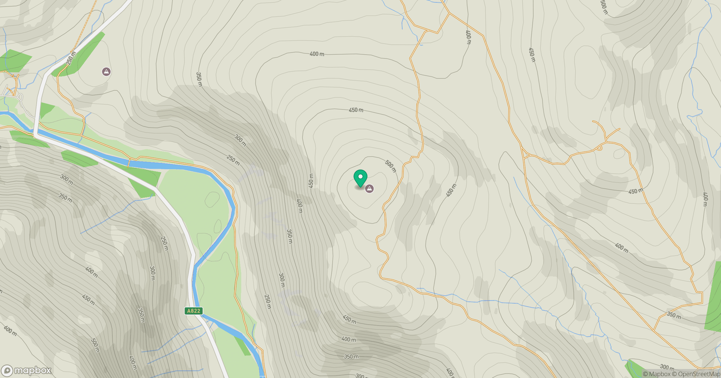
Grid reference: NN901311
View on OpenStreetMapOpens a map in a new tab, centred on the hill.
Hills within 30 km
Straight-line distance, not a walking route or confirmation of access.
No comments yet. Be the first.