

Horsea Island
Good walks are even better shared.
SU6404 : Landfill site on Horsea Island
Peter Facey Photo source
Overview
Horsea Island: A Hidden Gem in Portsmouth
Overview
Nestled in the Solent, Horsea Island is a flat island at sea level, making it a unique spot for outdoor enthusiasts and nature lovers alike. With no daunting peaks to conquer, this is a place where you can kick back and enjoy the great outdoors without the usual uphill struggles.
Geology
The island's sandy beach and marsh areas result from a mix of artificial land reclamation and natural coastal formations. It's a prime example of how human intervention can create new ecosystems, and it's home to various birds and coastal flora.
Routes
The main route on Horsea is the Coastal Walkway, a gentle 2.5 km stretch around the island. Perfect for families and those looking to enjoy a lovely day out without a sweat! You might even burn a few calories, but don’t count on it—unless you indulge in a few too many ice creams from the nearby ice cream truck!
Access
Getting to Horsea Island is quite a doddle! You can park at Tipner Lane car park, and from there it's a short stroll over to the island. Buses run frequently from Portsmouth, so public transport is also an option if you fancy a pint in the city before your jaunt.
Facilities
Facilities on the island itself are limited—think of it as a chance to 'rough it'! However, you're never too far from Portsmouth, where you'll find cafes, toilets, and everything you might need. Just don't expect a five-star dining experience amidst the sand!
Wildlife and Views
While on the island, keep your eyes peeled for local wildlife. Birds flutter about and if you're lucky, you might spot the odd rabbit hopping along. The views across the Solent to the mainland and the Spinnaker Tower are simply marvellous. Best enjoyed in spring or summer when the weather is decent and the scenery is at its brightest.
Conclusion
Horsea Island may lack the rugged peaks of other British landscapes, but it's a perfect spot for a day out with nature. So pack a picnic, grab your best mate, and enjoy this small slice of paradise on the south coast. Remember: the only heights you’ll reach are from the refreshing seaside breezes! Happy exploring!
Explore routes near Horsea Island
Walks starting near this hill. Open a route to check its map, distance and full itinerary.
Port Solent Walk with Men Walking & Talking
View route
Havant Walk with Men Walking & Talking
View route
Hinton Ampner: Dutton Estate Woodland and Downland Circuit
View route
Ventnor Downs Dakota Crash Memorial Circuit
View route
Route planning notes
These notes describe possible approaches. Check a route's map and access information when planning your walk.
Coastal Walkway
A leisurely walk around the island's perimeter, allowing for views of both the water and the island's wildlife.
Make a day of it, together
Find someone to share the walk with, or organise a day out along a route you like.
Photo Gallery
View all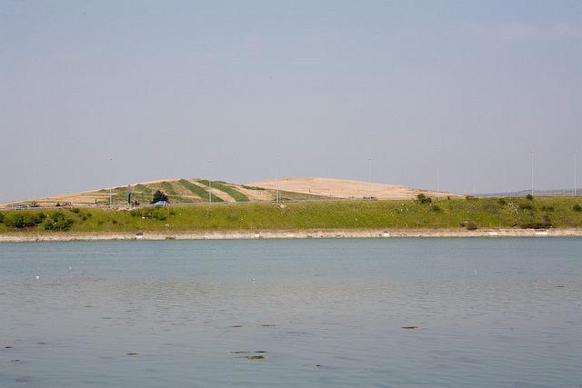 Photo could not load
SU6404 : Landfill site on Horsea Island
Peter Facey
Hill facts and local notes
Classifications
Elevation
41m
135 ft
Prominence
36m
Coordinates
50.8368, -1.0899
SU641045
OS Map
196
Explorer: OL3 OL29E 119
At the Summit
Being an island with no elevation gain, Horsea Island does not have traditional summit features, but it boasts serene beach areas and a variety of wildlife.
Terrain & Geology
Primarily made up of sandy deposits and sediments, Horsea Island showcases a diverse range of marine ecosystems. The geology reflects its artificial origins combined with natural coastal processes.
Views & Scenery
Stunning views of the Solent, nearby coastal regions, and the iconic Spinnaker Tower.
History & Heritage
Name Origin
The name 'Horsea' is derived from Old English, meaning 'Horse Island', likely related to its past use.
Historical Significance
Historically, Horsea Island has been used for military purposes and is now popular for recreation and as a nature reserve.
Getting There & Facilities
Parking
Parking is available at the nearby Tipner Lane car park, a short walk from the access point to the island.
Public Transport
Accessible via local buses that service Portsmouth; the nearest stop is a short walk from the car park.
Nearby Facilities
Limited facilities available on the island; visitors may find cafes and toilets in Portsmouth before heading out.
Safety Information
Known Hazards
- Coastal erosion, strong tides, and occasional wildlife such as rabbits and birds. Watch where you step!
General Safety Tips
- Check weather conditions before setting out
- Carry appropriate clothing and equipment
- Let someone know your planned route
- Take a map, compass, and GPS device
- Carry emergency supplies: food, water, first aid kit, torch
Hills
Some common questions about the hills answered
Are there group walks up Horsea Island?
Many walkers use Walkmates to join or organise walks with others. You can check for group walks around Horsea Island through the maps
Are there other walkers around Horsea Island?
Activity varies by location and time, but Walkmates lets you see whether others have shared walks or shown interest in this area. Find other people through the walking friends search walking friends for Horsea Island search or of course create your own walk for Horsea Island
Can I organise a walk to Horsea Island?
Yes. If there aren’t any walks listed already, you can create a walk and make it available for others to join.
If you're signed up to Walkmates, you can create a walk to Horsea Island.
How do I find a walk up this hill?
There are often multiple ways to walk this hill, depending on experience and route preference. Walkmates helps you explore walks and routes that others have shared.
Can I suggest a new route up Horsea Island?
Yes. You can suggest or create routes to share with others. Walkmates focuses on the social side of walking, so routes are used to help people organise walks and explore areas together, rather than as detailed navigation tools or route libraries.
Other uses really appreciate knowledgeable walkers sharing their routes. Share your favourite route to Horsea Island here
The is an error or something incorrect about this hill. How do I let you know?
We always strive to keep the information on Walkmates as accurate as possible. If you find an error, please let us know through the contact form and we'll aim to correct it as quickly as possible
Community Discussion
Comments
Location
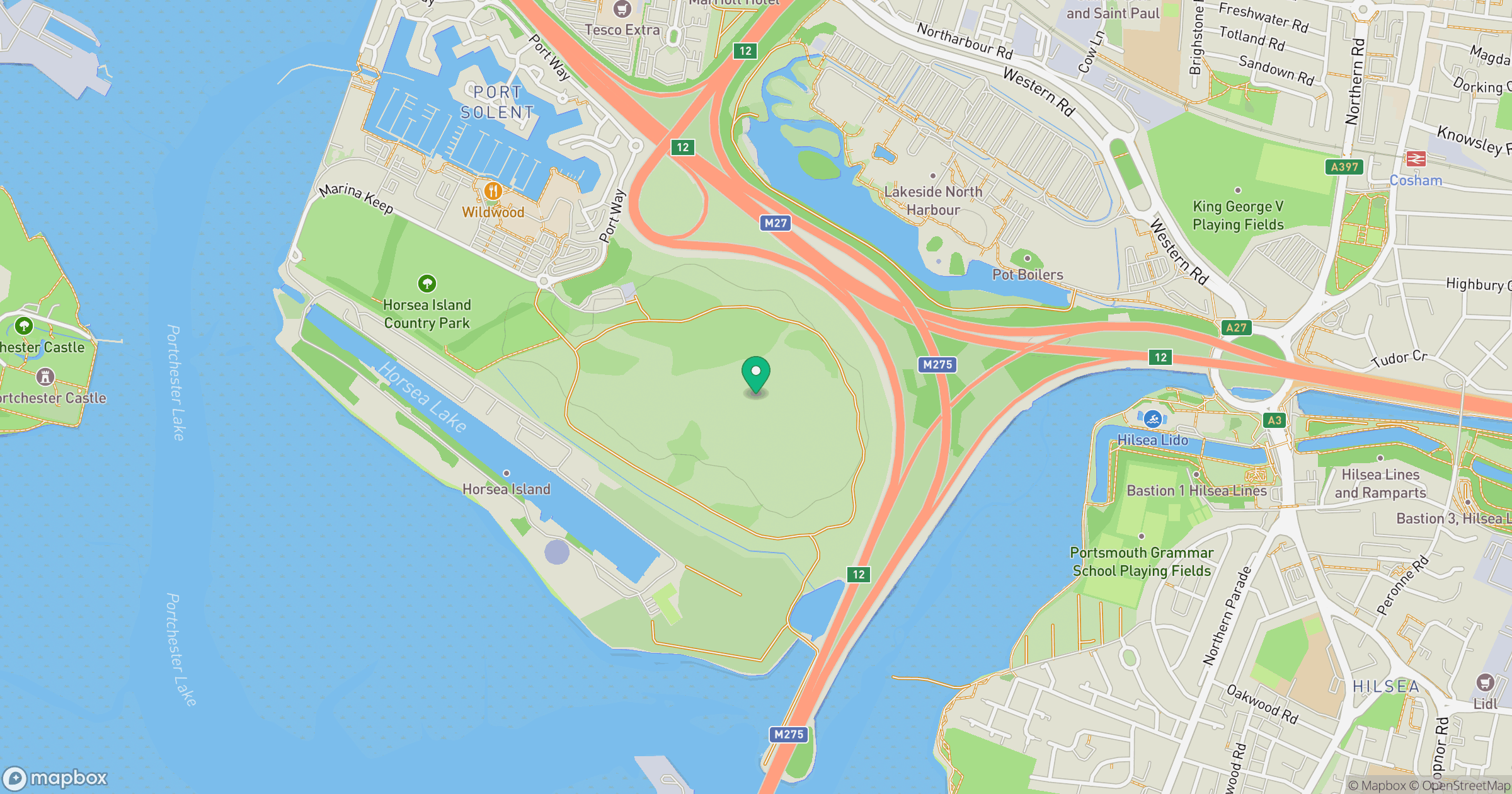
Grid reference: SU641045
View on OpenStreetMapOpens a map in a new tab, centred on the hill.
Nearby Hills
Leith Hill
294m
Ditchling Beacon
248m
Glastonbury Tor
158m
Worcestershire Beacon
425m
Titterstone Clee Hill
533m
No comments yet. Be the first.