

Tullo Hill
Good walks are even better shared.
Overview
Tullo Hill
Tullo Hill, standing proudly at 328 meters, is a delightful Marilyn located in the Central Lowlands of Scotland. This hill may not be the tallest in the land, but it certainly has its own charm. Its sandstone base tells tales of ancient landscapes shaped by rivers and time, adding a touch of geological intrigue to your hike.
Routes
The most popular route is the Tullo Hill Circular Route, starting from the picturesque village of Muiravonside. Spanning approximately 8.5 km, it combines woodland paths and open fields, making it a perfect outing for families and seasoned hikers alike. Allow around 3.5 hours to enjoy the sights, although if you stop for selfies (and who wouldn’t?), you might want to allow for a bit extra!
Summit Features
Reaching the summit, you'll find a modest stone cairn atop a grassy mound — a classic summit feature that begs for a triumphant photo. It’s not quite Everest, but it'll do your Instagram feed proud!
Terrain
The terrain is a mix of grassy slopes dotted with rocky outcrops and the odd boggy patch, so sturdy walking boots are advised. While it may tempt you with green pastures, the mud can catch you off guard — take heed!
Views
The views from the top are worth the trek. Expect sweeping panoramas of the surrounding valleys, with the River Forth winding like a silver ribbon below. Spring and early summer are the best times to visit, as the heathland bursts into vibrant colours — a feast for the eyes.
Hazards
Hikers should keep an eye out for the elusive boggy patches, which delight in swallowing shoes when least expected! Also, remember that the Scottish weather can be as unpredictable as a cat on the tiles; being prepared for sudden changes is crucial.
Nearby Summits
If you've got time to carry on, consider the nearby Muiravonside Hill at 305 meters. It’s just a short journey away and offers even more lovely views and hiking opportunities.
Access
Parking can be found at Muiravonside Country Park, about 5 km from the start of the path up Tullo Hill. Public transport options are available from Linlithgow, where you can hop on a bus that takes you close to the action — check local schedules to make sure you don’t miss the last ride! The nearest town, Linlithgow, is charming, with plenty of eateries to refuel after your adventure.
Facilities
Muiravonside Country Park is well-equipped for visitors, offering picnic areas, restrooms, and a charming café where you can grab a cuppa and a bun post-hike.
History
The name Tullo originates from the Gaelic word 'Tulaigh', which simply means hill. This area has been part of human activity for centuries, with historical agricultural practices leaving their mark on the landscape.
So grab your boots, pack a snack, and make your way to Tullo Hill! It may not be the highest peak, but it’s bursting with character and stunning views that make every step worthwhile.
Explore routes near Tullo Hill
Public walks starting within 80 km of this hill. Nearby does not mean a route reaches the summit; check its map and access before setting out.
Forfar to Lunanhead: East Road and the Ditches Walk
View route
Club outing: Auchnafree Hill (shared-car departure)
View route
Club outing: Lomond Hills (shared-car departure)
View route
Club outing: Carn a’ Gheoidh (shared-car departure)
View route
Route planning notes
These notes describe possible approaches, not verified navigable routes or permission to cross land. Check current paths, local access rules and conditions before setting out.
Tullo Hill Circular Route
A scenic circular route starting from the village of Muiravonside, offering a mix of woodland paths and open fields.
Make a day of it, together
Find someone to share the walk with, or organise a day out along a route you like.
Photo Gallery
View all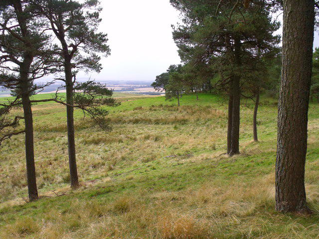 Photo could not load
NO4964 : Little woodland bay on Tullo Hill near Brechin
ian shiell
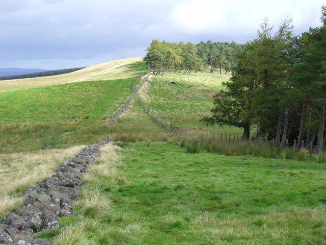 Photo could not load
NO4964 : Tullo Hill from Shandford Hill near Brechin
ian shiell
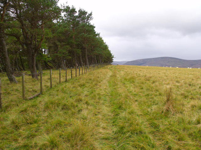 Photo could not load
NO4964 : Summit of Tullo Hill near Brechin
ian shiell
Hill facts and local notes
Classifications
Elevation
316m
1,037 ft
Prominence
119m
Coordinates
56.7697, -2.8214
NO498645
OS Map
44
Explorer: 389
At the Summit
At the summit, expect a simple yet charming grassy mound with a modest stone cairn. It’s the perfect backdrop for that 'I made it' selfie!
Terrain & Geology
Tullo Hill is primarily composed of sandstone, characteristic of the Central Lowlands. The underlying geology tells a tale of ancient river systems and deposits formed in a green, rolling landscape.
Views & Scenery
From the summit, gaze at the distant foothills and rolling fields stretching towards the horizon, with the River Forth shimmering in the valleys below.
History & Heritage
Name Origin
The name 'Tullo' derives from the Gaelic 'Tulaigh', meaning 'hill' or 'mound'.
Historical Significance
Historically, the area around Tullo Hill was used for farming and grazing, with remnants of ancient agricultural practices still visible.
Getting There & Facilities
Check current local access restrictions, parking rules and transport timetables before travelling. These notes do not confirm public access to the summit.
Parking
There is parking available at Muiravonside Country Park, approximately 5 km from the footpath to Tullo Hill.
Public Transport
Bus services from Linlithgow offer access to Muiravonside, but check local schedules for the latest routes.
Nearby Facilities
Muiravonside Country Park features picnic areas, restrooms, and a café, perfect for refreshments post-hike.
Safety Information
Known Hazards
- Occasional boggy areas can surprise unwary hikers; a decent map or GPS is essential to avoid detours into the muck!
- Weather can change swiftly; it's best to be prepared for all seasons.
General Safety Tips
- Check weather conditions before setting out
- Carry appropriate clothing and equipment
- Let someone know your planned route
- Take a map, compass, and GPS device
- Carry emergency supplies: food, water, first aid kit, torch
Hills
Some common questions about the hills answered
Are there group walks up Tullo Hill?
Many walkers use Walkmates to join or organise walks with others. You can check for group walks around Tullo Hill through the maps
Are there other walkers around Tullo Hill?
Activity varies by location and time, but Walkmates lets you see whether others have shared walks or shown interest in this area. Find other people through the walking friends search walking friends for Tullo Hill search or of course create your own walk for Tullo Hill
Can I organise a walk to Tullo Hill?
Yes. If there aren’t any walks listed already, you can create a walk and make it available for others to join.
If you're signed up to Walkmates, you can create a walk to Tullo Hill.
How do I find a walk up this hill?
There are often multiple ways to walk this hill, depending on experience and route preference. Walkmates helps you explore walks and routes that others have shared.
Can I suggest a new route up Tullo Hill?
Yes. You can suggest or create routes to share with others. Walkmates focuses on the social side of walking, so routes are used to help people organise walks and explore areas together, rather than as detailed navigation tools or route libraries.
Other uses really appreciate knowledgeable walkers sharing their routes. Share your favourite route to Tullo Hill here
The is an error or something incorrect about this hill. How do I let you know?
We always strive to keep the information on Walkmates as accurate as possible. If you find an error, please let us know through the contact form and we'll aim to correct it as quickly as possible
Community Discussion
Comments
Location
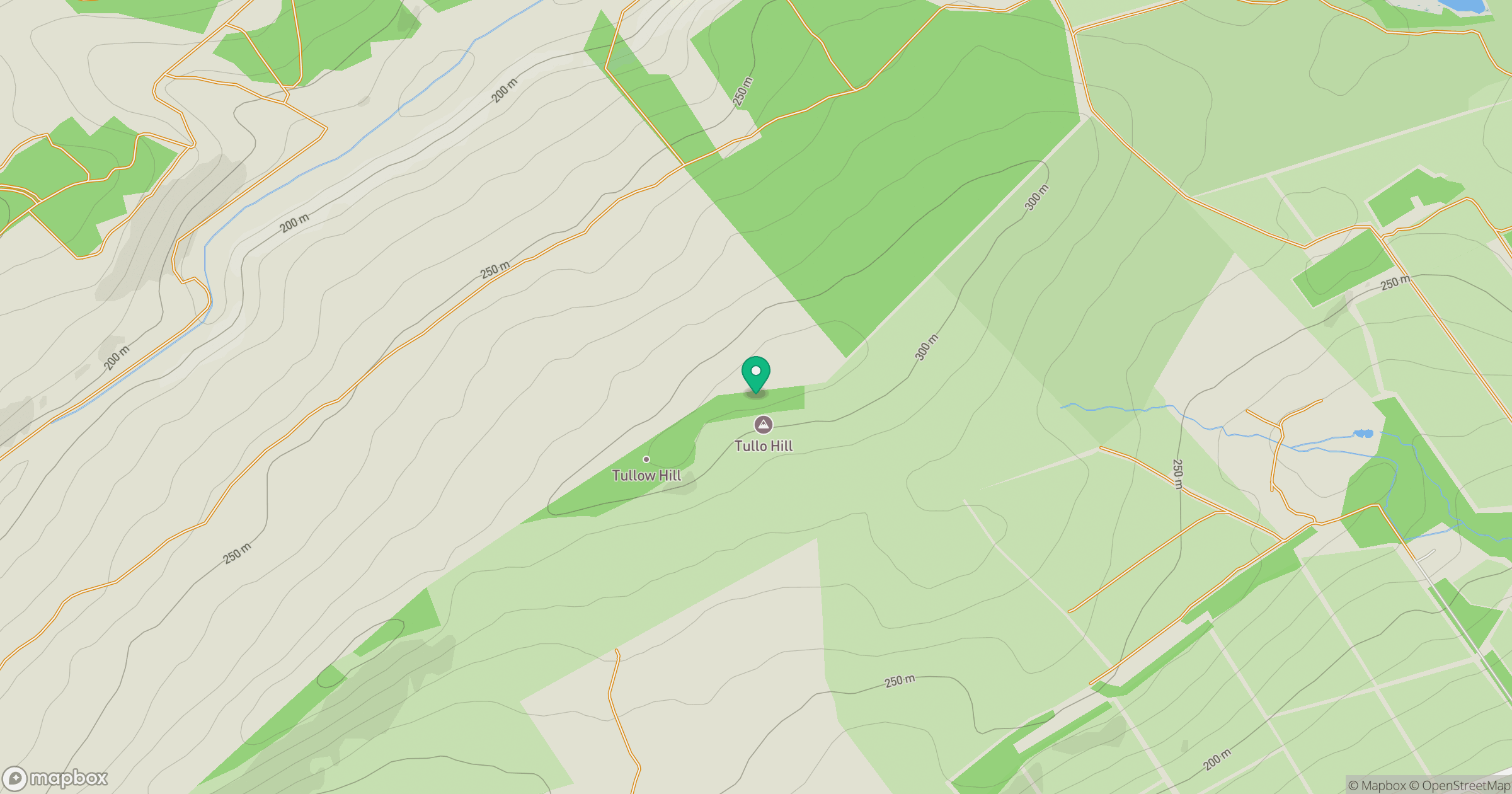
Grid reference: NO498645
View on OpenStreetMapOpens a map in a new tab, centred on the hill.
Hills within 30 km
Straight-line distance, not a walking route or confirmation of access.
No comments yet. Be the first.