
Black Hill
Good walks are even better shared.
Overview
Black Hill is a 581.1 m moorland summit in the northern Peak District, between the Longdendale and Holme valleys. The Pennine Way crosses its peat-covered plateau near the Holme Moss transmitter. Flagstone paths help on the main trail, but other approaches cross rough, wet and sometimes pathless ground. The surveyed high point is unmarked, 85 m north of the trig point.
Black Hill, Peak District
Black Hill is a 581.1 m moorland summit between the Longdendale and Holme valleys in the northern Peak District. The Pennine Way crosses the plateau near the Holme Moss transmitter. Its prominence is 165.2 m and it is a Marilyn, Dodd, Dewey and Ethel.
Finding the summit
The recorded high point is unmarked ground at SE 07822 04773, 85 m north of the trig point at SE 07816 04687. Ground 90 m south-south-west of the trig, at SE 07763 04611, is of similar height and is the historic Cheshire county top. The familiar trig point and the surveyed high point are separate locations. The two route guides below visit the trig point; their distances do not include an extra excursion to the surveyed high point.
Terrain and geology
This is blanket-peat moorland in the Dark Peak's Carboniferous Millstone Grit landscape. Stone flagging improves the Pennine Way, while alternative approaches encounter peat hags, gullies, wet ground and stretches without a clear path. The dark exposed surface was peat. Moors for the Future records a suggested link between that peaty soil and the hill's name.
Industrial pollution and fires damaged the vegetation. Conservation started in 2003, with later MoorLIFE work restoring peat-forming sphagnum. Stay on established paths where possible to protect the recovering moor.
Route options
Crowden via Little Brook and Tooleyshaw Moor
Walking Britain's walk 3022 is a 14.6 km circuit, with a published time of 5 hours 40 minutes and a moderate grade. From Crowden car park (SK 072 992), it follows Crowden Little Brook, climbs through Whitelow Slack towards White Low and continues over Tooleyshaw Moor to the trig point. The return follows the Pennine Way south-west via Laddow Rocks to Crowden. Parts are pathless, and streams may be unsafe after heavy rain. The cliffs require particular care.
Standedge via Wessenden and Saddleworth Moor
National Trails' Walk 45 is a challenging 20.25 km circuit from Standedge parking area (SE 019 095). It follows the Pennine Way past Black Moss and Wessenden reservoirs, crosses the A635 and reaches Black Hill. The return takes the old Pennine Way north-west across Wessenden Head Moor, crosses the A635 and continues over Featherbed and Saddleworth moors to Black Moss Reservoir, then retraces the outward path to Standedge. The remote return has very difficult, partly pathless ground and needs fair weather and confident compass navigation.
Access and facilities
Match the starting point to your chosen route: Crowden is just north of the A628, and Standedge is beside the A62. Holme Moss car park beside the A6024 provides an eastern approach. Crowden has a picnic area and toilets with seasonal opening hours; the accessible toilet requires a RADAR key. Bring food and water onto the moor.
Metro service 314 links Huddersfield, Holmfirth and Holme. Holme requires a separately planned walk-in and is not either circuit's starting point. Check the timetable and last return before travelling.
Views and nearby hills
The summit is broad and open, with the Holme Moss transmitter nearby. More pronounced valley views are available on the approaches, including Laddow Rocks above the Crowden valley. Nearby summits include Black Chew Head (542 m) and West Nab (501 m).
Safety and conservation
Check the Peak District mountain forecast and carry navigation equipment, waterproofs and warm layers. Low cloud, wind, winter ice and snow can make this exposed ground much more serious. After heavy rain, turn back from unsafe stream crossings. Keep away from cliff edges and take particular care beside and across the A635.
Check current access notices before leaving public rights of way. Open-access land can be restricted for conservation, land management or exceptional fire risk; those restrictions do not themselves close public rights of way. Do not light fires or barbecues. On open-access land, dogs need a fixed lead no longer than 2 m from 1 March to 31 July and at all times near livestock; follow any additional local dog restrictions.
Explore routes near Black Hill
Walks starting near this hill. Open a route to check its map, distance and full itinerary.
Marsden to Slaithwaite Canal Walk
View route
Old Glossop and Bleaklow Head Circular with B-29 Crash Site
View route
Scammonden Reservoir Circuit
View route
Langsett Northern Shore and Woodland
View route
Route planning notes
These notes describe possible approaches. Check a route's map and access information when planning your walk.
Crowden via Little Brook and Tooleyshaw Moor (circular)
Start and finish at Crowden car park (SK 072 992). Follow Crowden Little Brook to the sheepfolds, then cross Whitelow Slack to White Low and follow Tooleyshaw Moor to Black Hill trig point. Return south-west on the Pennine Way via Laddow Rocks to Crowden. The 14.6 km circuit includes pathless sections, stream crossings and cliff-edge terrain; map-and-compass skills are essential. Walking Britain: 5 h 40 min; figures exclude the extra high-point excursion.
Standedge via Wessenden and Saddleworth Moor (circular)
From Standedge parking (SE 019 095), follow the Pennine Way past Black Moss and Wessenden reservoirs, cross the A635 and climb to Black Hill trig point. Return north-west on the old Pennine Way over Wessenden Head Moor to the A635, then across Featherbed and Saddleworth moors to Black Moss Reservoir; retrace the outward path to Standedge. This 20.25 km circuit has a very difficult, partly pathless return requiring fair weather and strong navigation skills.
Make a day of it, together
Find someone to share the walk with, or organise a day out along a route you like.
Hill facts and local notes
Classifications
Elevation
581m
1,906 ft
Prominence
165m
Coordinates
53.5395, -1.8835
SE078047
OS Map
110
Explorer: OL1W
At the Summit
The recorded high point is unmarked ground at SE 07822 04773, 85 m north of the trig point at SE 07816 04687. The trig point is the familiar landmark on the broad, peat-covered plateau. Ground 90 m south-south-west of the trig at SE 07763 04611 is of similar height and is the historic Cheshire county top.
Terrain & Geology
Black Hill is a peat-covered moor in the Dark Peak Millstone Grit landscape. The region is underlain by Carboniferous sedimentary sandstones, siltstones and shales. The dark material exposed across the damaged summit moor was peat. Restoration has helped vegetation recover and reintroduced peat-building sphagnum moss.
Views & Scenery
The broad summit gives an open moorland outlook, with the Holme Moss transmitter a prominent nearby landmark. The approaches offer clearer valley views: towards Holmfirth on the northern climb and into the Crowden valley from Laddow Rocks.
History & Heritage
Name Origin
Moors for the Future records a suggested connection between the name Black Hill and the black peaty soil covering the hill.
Historical Significance
The summit area spans historic county-top locations: the recorded summit lay in the West Riding of Yorkshire, while nearby ground south-south-west of the trig is the historic Cheshire top. Industrial pollution and fires severely damaged the moorland vegetation. Conservation work began in 2003, followed by further peatland restoration through the MoorLIFE project.
Getting There & Facilities
Parking
Holme Moss car park beside the A6024 serves an eastern approach. The routes described here start at Crowden car park, just north of the A628 (SK 072 992), and the Standedge parking area beside the A62 (SE 019 095). Choose parking to match the route and use designated spaces.
Public Transport
Metro lists service 314 between Huddersfield, Holmfirth and Holme. Holme is a separate walk-in starting point, so an onward walking route is needed; it is not the Crowden or Standedge start described here. Check the current timetable and last return before travelling.
Nearby Facilities
Crowden has a picnic area and public toilets near the car park. Toilet opening hours vary by season; a RADAR key is required for the accessible toilet. Carry food and water for the moorland sections.
Safety Information
Known Hazards
- Deep wet peat, bogs and gullies occur away from the flagstone paths. Some approaches are pathless and require confident map-and-compass navigation.
- Streams on the Crowden and Wessenden approaches can become difficult or unsafe to ford after heavy rain. Turn back rather than attempt a dangerous crossing.
- Laddow Rocks has steep cliff edges. Keep well back, especially in strong winds, poor visibility or icy conditions.
- The Standedge circuit returns across remote Wessenden Head Moor and Saddleworth Moor on very difficult ground; it also crosses and follows short sections beside the busy A635.
- The exposed plateau is vulnerable to cold, wind and low cloud. Carry waterproofs, warm layers, food, water, a map and compass, and check the Peak District mountain forecast.
Seasonal Hazards
Winter snow and ice can hide paths and make navigation and footing harder. Heavy rain increases bog and stream-crossing hazards. In dry weather, peat and vegetation can burn rapidly: do not light fires or barbecues, and obey access-closure notices. On open-access land, keep dogs on a fixed lead no longer than 2 m from 1 March to 31 July and whenever near livestock; local dog restrictions may also apply.
General Safety Tips
- Check weather conditions before setting out
- Carry appropriate clothing and equipment
- Let someone know your planned route
- Take a map, compass, and GPS device
- Carry emergency supplies: food, water, first aid kit, torch
Hills
Some common questions about the hills answered
Are there group walks up Black Hill?
Many walkers use Walkmates to join or organise walks with others. You can check for group walks around Black Hill through the maps
Are there other walkers around Black Hill?
Activity varies by location and time, but Walkmates lets you see whether others have shared walks or shown interest in this area. Find other people through the walking friends search walking friends for Black Hill search or of course create your own walk for Black Hill
Can I organise a walk to Black Hill?
Yes. If there aren’t any walks listed already, you can create a walk and make it available for others to join.
If you're signed up to Walkmates, you can create a walk to Black Hill.
How do I find a walk up this hill?
There are often multiple ways to walk this hill, depending on experience and route preference. Walkmates helps you explore walks and routes that others have shared.
Can I suggest a new route up Black Hill?
Yes. You can suggest or create routes to share with others. Walkmates focuses on the social side of walking, so routes are used to help people organise walks and explore areas together, rather than as detailed navigation tools or route libraries.
Other uses really appreciate knowledgeable walkers sharing their routes. Share your favourite route to Black Hill here
The is an error or something incorrect about this hill. How do I let you know?
We always strive to keep the information on Walkmates as accurate as possible. If you find an error, please let us know through the contact form and we'll aim to correct it as quickly as possible
Community Discussion
Comments
Location
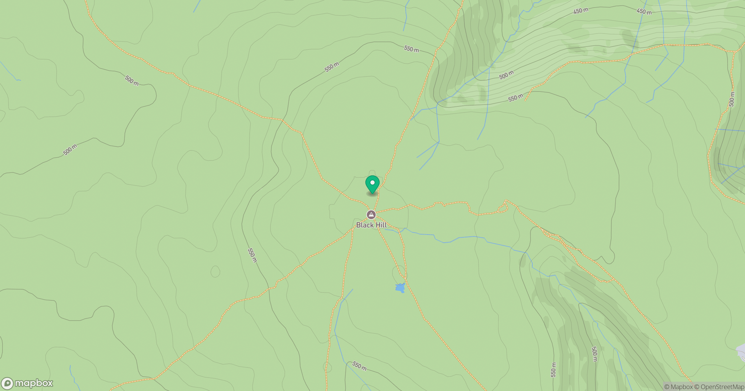
Grid reference: SE078047
View on OpenStreetMapOpens a map in a new tab, centred on the hill.
Nearby Hills

Kinder Scout
636m
Rombalds Moor [Ilkley Moor]
402m
The Roaches
505m

Pendle Hill
557m
Winter Hill
456m
No comments yet. Be the first.