

Hensol Park
Good walks are even better shared.
ST0379 : Country Road between Cefn Llys & Keepers Lodge Farms
Kev Griffin Photo source
Overview
Hensol Park: A Hidden Gem in South Wales
Nestled in the verdant heart of South Wales, Hensol Park is not just a place to stretch your legs; it’s a glimpse into the region's rich historical tapestry and natural beauty.
Geology
Hensol Park's land is predominantly made up of sedimentary rock formations, particularly limestone and sandstone. This geologic backdrop provides fertile ground for a diverse range of flora, making it a haven for nature enthusiasts.
Routes
If you're looking for a leisurely stroll, the Hensol Park Circular Walk is the ticket. This 3.5 km route takes about 1.5 hours to complete and is graded as easy—perfect for families or those just wanting to enjoy some fresh air without breaking a sweat. You might even get a chance to stop and smell the roses, quite literally!
Summit Features
Instead of towering peaks, Hensol Park offers charming features such as a historical mansion, scenic ornamental lakes, and panoramic viewpoints that make it a delightful destination.
Terrain
The park is predominantly grassy and wooded, with well-maintained paths ensuring a comfortable walking experience. Bring along a picnic to fully appreciate the tranquil environment!
Views
From the gentle rises within the park, take in stunning views of lush woodlands and serene lakes. The best time to appreciate these vistas is during the spring, when the flowers bloom, or in autumn, when the leaves showcase a delightful palette of colours.
Hazards
While Hensol Park is generally an easy hike, be cautious of muddy paths, especially after a good Welsh downpour. Nothing like a bit of mud to keep things interesting, right?
Access
Getting to Hensol Park is fairly straightforward. There’s a small car park available at the main entrance for your convenience, and public transport is accessible from nearby towns, including Pontyclun. If you fancy a good walk, grab the bus and enjoy the scenery! The closest town is Pontyclun, which has a lovely selection of cafés.
Facilities
For those who might need a pit stop, public toilets are available at the park entrance, and for a bite to eat, local cafés are just a stone's throw away in Pontyclun.
History
As for the name, 'Hensol' meaning 'old sun' suggests that this has been a beloved spot for centuries. The park has historical significance and has been a site of interest since the 18th century, showcasing a blend of beautiful architecture and meticulously landscaped grounds.
In conclusion, Hensol Park might not be the highest point on any map, but it certainly provides a quaint escape into nature without straying far from modern comforts. Whether you're a seasoned hiker or just someone looking for a nice walk, Hensol Park welcomes you with open arms.
Go on, give it a go! It’s a proper gem in the Welsh countryside!
Explore routes near Hensol Park
Walks starting near this hill. Open a route to check its map, distance and full itinerary.
Cardiff: Hailey Park to Blackweir Bridge on the Taff Trail
View route
Aberdare Walk with Men Walking & Talking
View route
Newport Fourteen Locks to Risca: Monmouthshire Canal Return
View route
Merthyr Tydfil with Men Walking & Talking
View route
Route planning notes
These notes describe possible approaches. Check a route's map and access information when planning your walk.
Hensol Park Circular Walk
A pleasant circular route winding through the park, showcasing its natural beauty and historical features.
Make a day of it, together
Find someone to share the walk with, or organise a day out along a route you like.
Photo Gallery
View all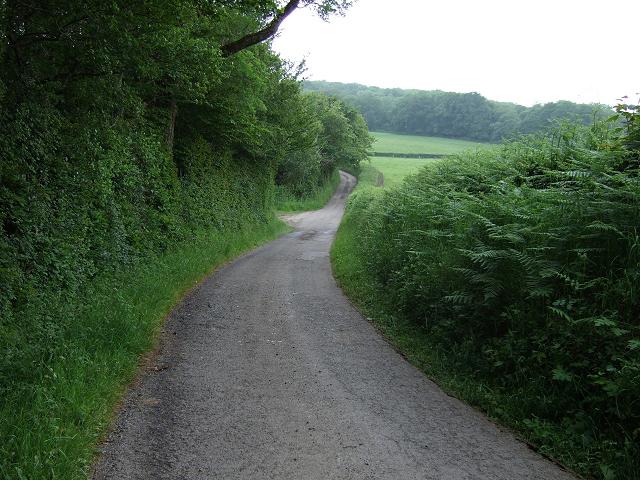 Photo could not load
ST0379 : Country Road between Cefn Llys & Keepers Lodge Farms
Kev Griffin
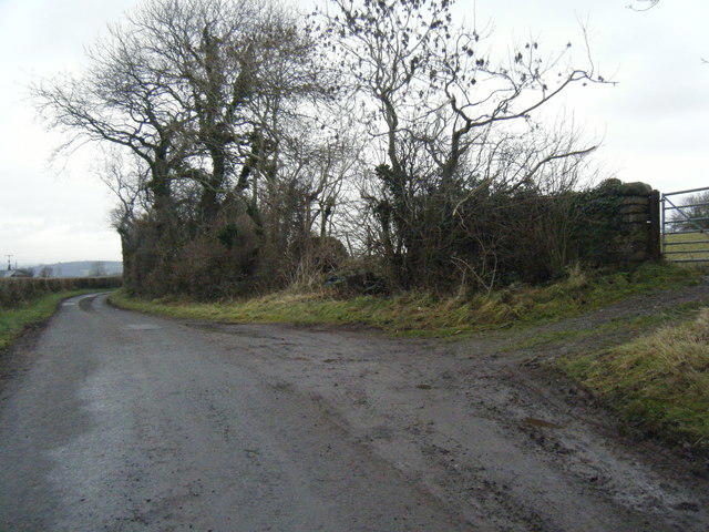 Photo could not load
ST0379 : Lane between Keepers Lodge and Cefn Llys farms
Colin Pyle
Hill facts and local notes
Classifications
Elevation
109m
358 ft
Prominence
51m
Coordinates
51.5027, -3.3842
ST040791
OS Map
170
Explorer: 151E
At the Summit
The park features a historic mansion, ornamental lakes, and scenic viewpoints rather than a traditional summit.
Terrain & Geology
Hensol Park is primarily characterised by sedimentary geology, comprising limestone and sandstone. The area's geological history adds to its lush landscape, featuring a mix of manicured gardens and natural woodlands.
Views & Scenery
Views of the surrounding woodland and the ornamental lakes within the park create a serene atmosphere.
History & Heritage
Name Origin
The name 'Hensol' is derived from the Welsh words 'hen' meaning 'old' and 'sol' possibly related to the sun or warmth, suggesting an ancient warm spot.
Historical Significance
Hensol Park has historical significance dating back to the 18th century, featuring beautiful architecture and landscaping, adding to its allure.
Getting There & Facilities
Parking
Hensol Park has a small car park available at the main entrance, suitable for visitors. Parking is usually free.
Public Transport
Regular bus services operate from nearby towns such as Pontyclun and Talbot Green. Check local schedules for updates.
Nearby Facilities
There are amenities such as toilets available at the park entrance, and various cafés are located a short drive away in Pontyclun.
Safety Information
Known Hazards
- Occasional muddy paths after rainfall, but nothing that would spoil your day out. Just bring your wellies!
General Safety Tips
- Check weather conditions before setting out
- Carry appropriate clothing and equipment
- Let someone know your planned route
- Take a map, compass, and GPS device
- Carry emergency supplies: food, water, first aid kit, torch
Hills
Some common questions about the hills answered
Are there group walks up Hensol Park?
Many walkers use Walkmates to join or organise walks with others. You can check for group walks around Hensol Park through the maps
Are there other walkers around Hensol Park?
Activity varies by location and time, but Walkmates lets you see whether others have shared walks or shown interest in this area. Find other people through the walking friends search walking friends for Hensol Park search or of course create your own walk for Hensol Park
Can I organise a walk to Hensol Park?
Yes. If there aren’t any walks listed already, you can create a walk and make it available for others to join.
If you're signed up to Walkmates, you can create a walk to Hensol Park.
How do I find a walk up this hill?
There are often multiple ways to walk this hill, depending on experience and route preference. Walkmates helps you explore walks and routes that others have shared.
Can I suggest a new route up Hensol Park?
Yes. You can suggest or create routes to share with others. Walkmates focuses on the social side of walking, so routes are used to help people organise walks and explore areas together, rather than as detailed navigation tools or route libraries.
Other uses really appreciate knowledgeable walkers sharing their routes. Share your favourite route to Hensol Park here
The is an error or something incorrect about this hill. How do I let you know?
We always strive to keep the information on Walkmates as accurate as possible. If you find an error, please let us know through the contact form and we'll aim to correct it as quickly as possible
Community Discussion
Comments
Location
View the hill's mapped position and surrounding paths.
Grid reference: ST040791
View on OpenStreetMapOpens a map in a new tab, centred on the hill.



No comments yet. Be the first.