

Healabhal Bheag
Good walks are even better shared.
NG2242 : Summit of Healabhal Bheag
Richard Dorrell Photo source
Overview
Healabhal Bheag
Located in the breathtaking Hebrides of Scotland, Healabhal Bheag stands proudly at 255 meters. This Marilyn invites hikers to experience its renowned views and unique geological features. The mountain's name translates to 'Little Healabhal', a fitting moniker when contrasted with its larger counterpart, Healabhal Mor.
Geology
Healabhal Bheag is primarily composed of Lewisian gneiss, which gives the mountain a majestic, ancient character. As one of the oldest rock types in the UK, it serves as a geological time capsule, perfect for anyone with a curiosity about the Earth's history.
Routes
The predominant route to the summit begins from the east, starting from a small parking lot near Calanais. It’s a moderate hike of approximately 3.2 km, which takes around 1.5 hours. The path is well-defined but does feature some boggy bits, so choose your footwear wisely!
Summit Features
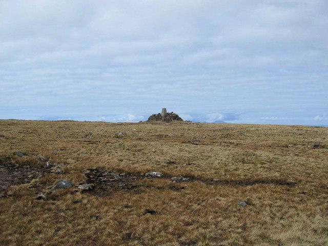
Upon reaching the peak, expect to find a modest cairn. It's the ideal spot to rest your legs, catch your breath, and take in the views. This little pile of stones is a beacon for tired hikers and a perfect backdrop for photos.
Terrain and Hazards
The terrain consists of a mix of grassy slopes and rocky outcrops, with stretches of bog that can leave your feet wetter than intended. It’s wise to watch your step to avoid unintended splashes.
Views
From the summit, the views are nothing short of spectacular. On a clear day, you can feast your eyes on the Outer Hebrides and, if luck is on your side, the distant peaks of the Isle of Skye. The best seasons for optimal views are late spring and early summer when the heather blooms and the skies are typically clearer.
Access
The closest parking area is in Calanais, just a stone's throw from the trailhead. If using public transport, there are buses from Stornoway to Calanais, followed by a short 1.5 km walk.
Nearby Facilities
While facilities are limited on the mountain itself, the nearest town, Stornoway, provides a range of cafes, restaurants, and public toilets to help refuel and refresh after your outdoor adventure.
Conclusion
Whether you're a seasoned hiker or just looking for a gentle stroll with stunning views, Healabhal Bheag is a must-visit. Just remember, a little mud never hurt anyone – just consider it your badge of honour!
Happy hiking!
Explore routes near Healabhal Bheag
Walks starting near this hill. Open a route to check its map, distance and full itinerary.
Berneray Community Hall to the beautiful beach
View route
Dun Mhulan Broch Quick Walk
View route
Fairy Lochs Liberator Wreckage Circuit
View route
Beautiful private beach walk Isle of Harris
View route
Route planning notes
These notes describe possible approaches. Check a route's map and access information when planning your walk.
Path from the East
This well-trodden route begins at a small parking area and climbs steadily through heather-covered slopes to the summit.
Make a day of it, together
Find someone to share the walk with, or organise a day out along a route you like.
Photo Gallery
View all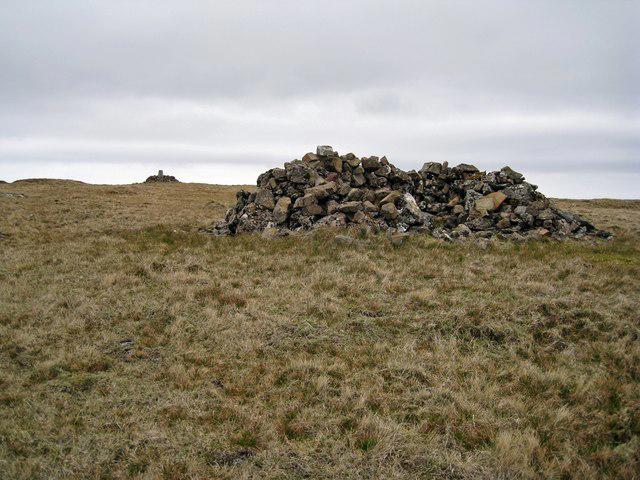 Photo could not load
NG2242 : Summit of Healabhal Bheag
Richard Dorrell
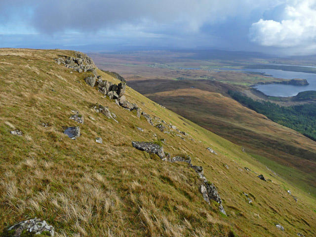 Photo could not load
NG2242 : From Healabhal Bheag
John Allan
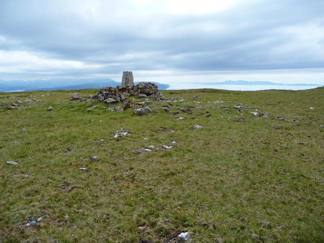 Photo could not load
NG2242 : Healabhal Bheag summit
John Allan
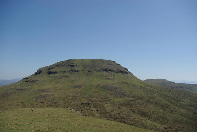 Photo could not load
NG2242 : Healabhal Bheag & Beinn Bhac-ghlais
Leslie Barrie
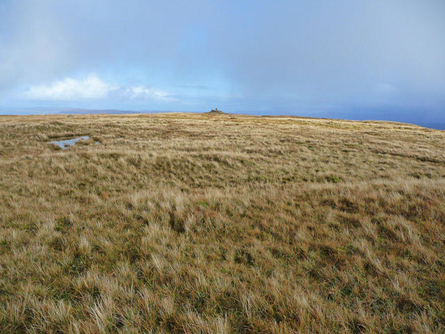 Photo could not load
NG2242 : The flat summit of Healabhal Bheag
John Allan
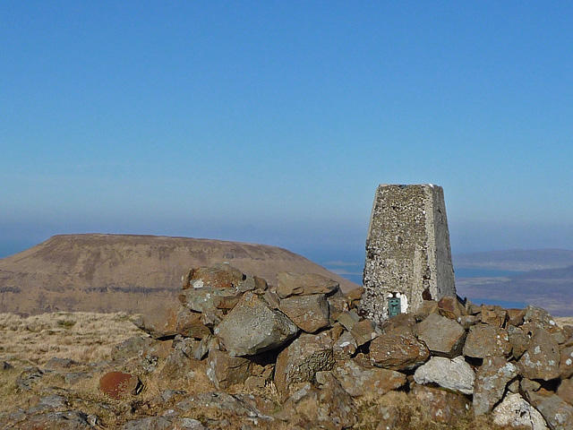 Photo could not load
NG2242 : Trigpoint on Healabhal Bheag
John Allan
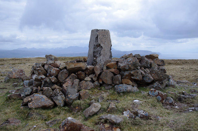 Photo could not load
NG2242 : Trig point on Healabhal Bheag
Ian Taylor
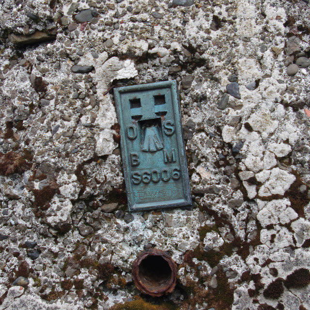 Photo could not load
NG2242 : Flush bracket S6006
Ian Taylor
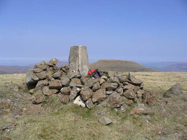 Photo could not load
NG2242 : The trig point on Healabhal Bheag
Walter Baxter
NG2242 : Healabhal Bheag Summit
John Allan
Hill facts and local notes
Classifications
Elevation
489m
1,604 ft
Prominence
462m
Coordinates
57.3843, -6.6204
NG224420
OS Map
23
Explorer: 407
At the Summit
A modest cairn marks the summit, providing a perfect spot for a well-deserved breather and a photo op.
Terrain & Geology
The mountain primarily features Lewisian gneiss, one of the oldest rock types in the UK, which adds a touch of ancient intrigue to this rugged landscape.
Views & Scenery
On a clear day, you'll be treated to views of the Outer Hebrides and the rugged landscape of the Isle of Skye in the distance.
History & Heritage
Name Origin
The name 'Healabhal Bheag' translates to 'Little Healabhal', indicating its stature compared to its larger sibling, Healabhal Mor.
Historical Significance
The area is culturally significant, with ancient stone circles and historical sites nearby, including the famous Calanais Standing Stones.
Getting There & Facilities
Parking
There's a small parking area located near the village of Calanais, just a short drive from the trailhead.
Public Transport
Buses are available from Stornoway to Callanish, followed by a 1.5 km walk to the trailhead.
Nearby Facilities
There are no facilities directly on the mountain, but Stornoway offers cafes, restaurants, and toilet facilities.
Safety Information
Known Hazards
- Be mindful of the wet conditions which can lead to slippery trails, especially in the boggy areas.
General Safety Tips
- Check weather conditions before setting out
- Carry appropriate clothing and equipment
- Let someone know your planned route
- Take a map, compass, and GPS device
- Carry emergency supplies: food, water, first aid kit, torch
Hills
Some common questions about the hills answered
Are there group walks up Healabhal Bheag?
Many walkers use Walkmates to join or organise walks with others. You can check for group walks around Healabhal Bheag through the maps
Are there other walkers around Healabhal Bheag?
Activity varies by location and time, but Walkmates lets you see whether others have shared walks or shown interest in this area. Find other people through the walking friends search walking friends for Healabhal Bheag search or of course create your own walk for Healabhal Bheag
Can I organise a walk to Healabhal Bheag?
Yes. If there aren’t any walks listed already, you can create a walk and make it available for others to join.
If you're signed up to Walkmates, you can create a walk to Healabhal Bheag.
How do I find a walk up this hill?
There are often multiple ways to walk this hill, depending on experience and route preference. Walkmates helps you explore walks and routes that others have shared.
Can I suggest a new route up Healabhal Bheag?
Yes. You can suggest or create routes to share with others. Walkmates focuses on the social side of walking, so routes are used to help people organise walks and explore areas together, rather than as detailed navigation tools or route libraries.
Other uses really appreciate knowledgeable walkers sharing their routes. Share your favourite route to Healabhal Bheag here
The is an error or something incorrect about this hill. How do I let you know?
We always strive to keep the information on Walkmates as accurate as possible. If you find an error, please let us know through the contact form and we'll aim to correct it as quickly as possible
Community Discussion
Comments
Location
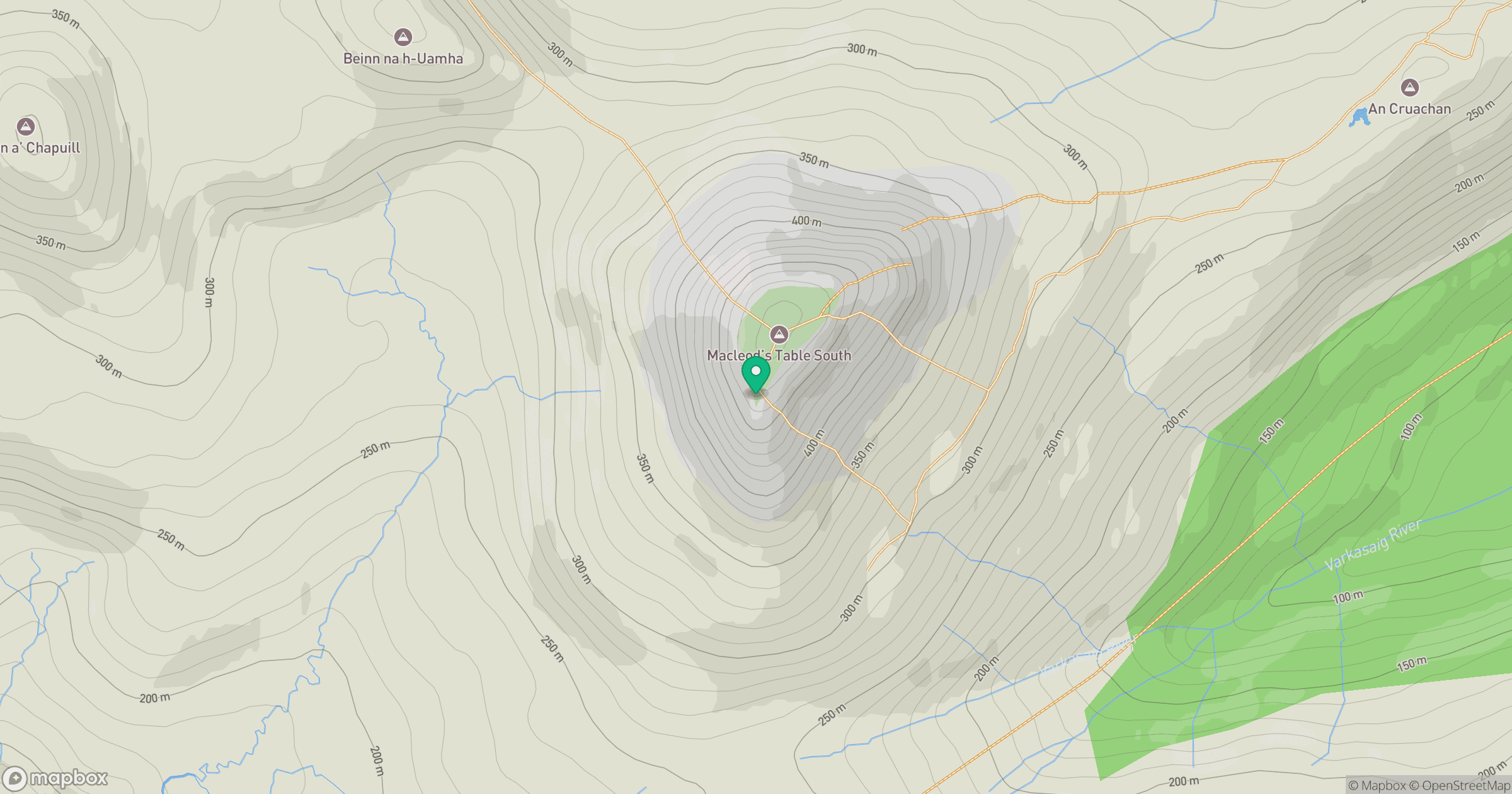
Grid reference: NG224420
View on OpenStreetMapOpens a map in a new tab, centred on the hill.
No comments yet. Be the first.