

Ben Corkeval
Good walks are even better shared.
Overview
Ben Corkeval: A Hidden Gem of the Scottish Highlands
Ben Corkeval, standing proud at 849 meters, is a Marilyn mountain shimmering quietly in the Scottish Highlands. Often overshadowed by its more famous neighbours, this delightful peak offers adventures aplenty without the hustle and bustle of larger summits.
Geology
The granite that forms Ben Corkeval is not just there for show; it's a testament to the earth's movements over millennia. The striations on its rocky surfaces tell a tale of time, revealing the whims of nature itself. Hikers interested in geology will find plenty to ponder while they catch their breath!
Routes
Ben Corkeval caters to both eager novices and seasoned hikers. The Westward Route is a gentle affair, winding through beautiful forests with ample opportunities for wildlife spotting. Meanwhile, the East Ridge Route offers a more exhilarating scramble, perfect for those wanting a challenge. Just be sure to bring a sense of humour for the more demanding sections!
Summit Features
Upon reaching the summit, the triad of relief and accomplishment awaits you. Behold the cairn constructed by fellow adventurers, perfectly posing for your photos. It’s the best Instagram backdrop you could hope for!
Terrain Type
Navigating the mountain presents hikers with a diverse terrain of rocky paths, grassy knolls, and the occasional bog for a soggy surprise. Dress your feet wisely, as Mother Nature can be cheeky!
Views
The panorama from Ben Corkeval's summit is simply breathtaking. From here, sights include the shimmering waters of Loch Awe and the imposing Ben Cruachan on the horizon. Each season paints a different masterpiece. Pack your camera in spring for vibrant blooms and again in autumn for fiery foliage—who knew a hike could double as a photoshoot?
Hazards
Always keep an eye on the weather. Like any good Scotsman, it can change faster than you can say 'did I pack my waterproofs?' Be prepared, and you’ll be just fine!
Nearby Summits
Take your pick from spectacular neighbours, like Ben Cruachan, reaching heights of 1126 meters, or the smaller but no less charming Ben Leach at 645 meters.
Access
Getting there is half the adventure! With parking for roughly 10 vehicles at the trailhead, an early start is best. Consider the bus from Oban to Dalavich if you're relying on public transport.
Facilities
While there are no lavatories atop the mountain, Dalavich offers a quirky shop for supplies, and Oban is a bustling hub of cafes and toilet facilities—important after a few hours of hiking!
History
The name ‘Corkeval’ holds a delightful piece of heritage, meaning 'the head of the coracle.' Plus, this mountain has cemented its place in the hearts of locals and hikers alike.
Delve into Ben Corkeval, and you might just uncover a gem of the great outdoors!
Happy hiking, and remember—always leave no trace!
Explore routes near Ben Corkeval
Public walks starting within 80 km of this hill. Nearby does not mean a route reaches the summit; check its map and access before setting out.
Berneray Community Hall to the beautiful beach
View route
Dun Mhulan Broch Quick Walk
View route
Fairy Lochs Liberator Wreckage Circuit
View route
Beautiful private beach walk Isle of Harris
View route
Route planning notes
These notes describe possible approaches, not verified navigable routes or permission to cross land. Check current paths, local access rules and conditions before setting out.
Westward Route
A straightforward path starting from the nearby forestry, providing gentle slopes and beautiful views.
East Ridge Route
A slightly more challenging ascent with rocky terrain and the occasional scramble, perfect for those looking to test their mettle.
Make a day of it, together
Find someone to share the walk with, or organise a day out along a route you like.
Photo Gallery
View all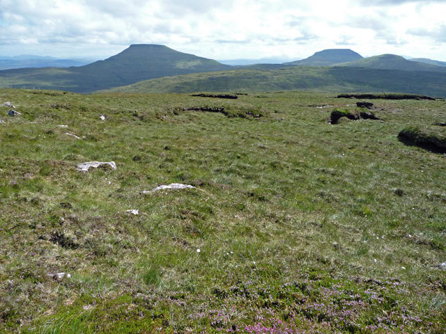 Photo could not load
NG1844 : Summit of Ben Corkeval
John Allan
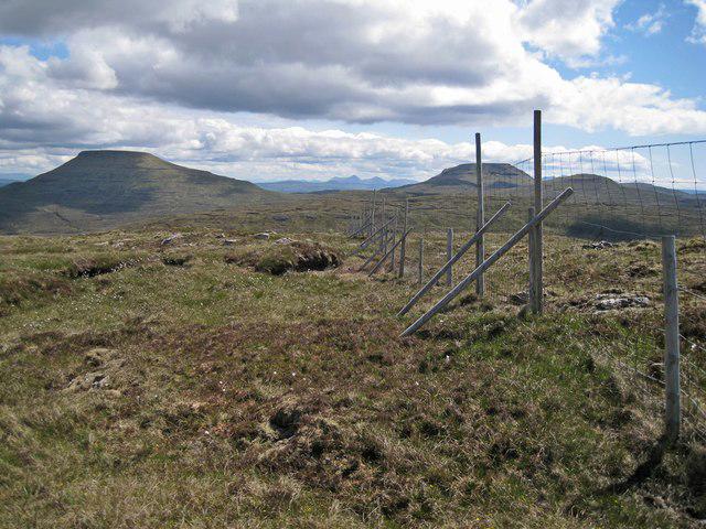 Photo could not load
NG1844 : Deer fence on the summit
Richard Dorrell
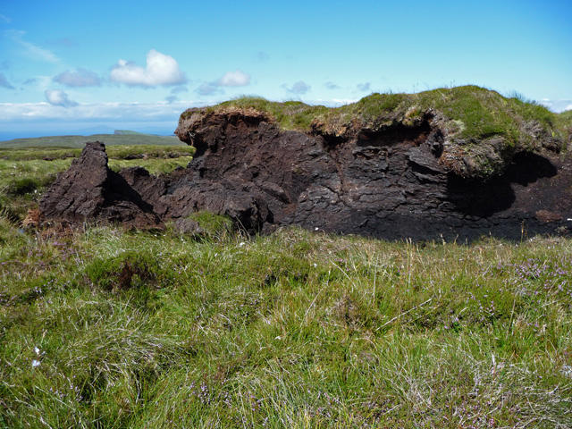 Photo could not load
NG1844 : Peat hag on Ben Corkeval
John Allan
Hill facts and local notes
Classifications
Elevation
351m
1,152 ft
Prominence
103m
Coordinates
57.4065, -6.6890
NG184448
OS Map
23
Explorer: 407
At the Summit
The summit features a prominent cairn, lovingly crafted by previous hikers, and offers an irresistible photo opportunity!
Terrain & Geology
Ben Corkeval is primarily composed of granite, which offers a sturdy foundation for this majestic mountain. The weathered surfaces reveal interesting striations and mineral deposits that add character, making it a geologist's delight.
Views & Scenery
From the summit, you can catch stunning glimpses of Loch Awe and the rugged peaks of the surrounding region, as well as the distant silhouette of Ben Cruachan.
History & Heritage
Name Origin
The name 'Corkeval' derives from the Gaelic 'Ceann Corca', meaning 'the head of the coracle', a nod to the shape of the mountain reminiscent of the traditional boats used by the locals.
Historical Significance
The mountain has been a cherished landmark for generations, marking the landscape and the cultural identity of the area.
Getting There & Facilities
Check current local access restrictions, parking rules and transport timetables before travelling. These notes do not confirm public access to the summit.
Parking
Parking is available at the Ben Corkeval trailhead, which accommodates approximately 10 vehicles—arrive early to secure a spot!
Public Transport
There are limited bus services from Oban to the nearby village of Dalavich, with onward connections by taxi to the trailhead.
Nearby Facilities
While there are no facilities directly on the mountain, Dalavich has a small shop, and Oban boasts plenty of cafes and proper toilets—a luxury after a long hike!
Safety Information
Known Hazards
- Watch out for sudden weather changes, as they can occur without warning. Engaging in a conversation about the weather won't help; pack accordingly!
General Safety Tips
- Check weather conditions before setting out
- Carry appropriate clothing and equipment
- Let someone know your planned route
- Take a map, compass, and GPS device
- Carry emergency supplies: food, water, first aid kit, torch
Hills
Some common questions about the hills answered
Are there group walks up Ben Corkeval?
Many walkers use Walkmates to join or organise walks with others. You can check for group walks around Ben Corkeval through the maps
Are there other walkers around Ben Corkeval?
Activity varies by location and time, but Walkmates lets you see whether others have shared walks or shown interest in this area. Find other people through the walking friends search walking friends for Ben Corkeval search or of course create your own walk for Ben Corkeval
Can I organise a walk to Ben Corkeval?
Yes. If there aren’t any walks listed already, you can create a walk and make it available for others to join.
If you're signed up to Walkmates, you can create a walk to Ben Corkeval.
How do I find a walk up this hill?
There are often multiple ways to walk this hill, depending on experience and route preference. Walkmates helps you explore walks and routes that others have shared.
Can I suggest a new route up Ben Corkeval?
Yes. You can suggest or create routes to share with others. Walkmates focuses on the social side of walking, so routes are used to help people organise walks and explore areas together, rather than as detailed navigation tools or route libraries.
Other uses really appreciate knowledgeable walkers sharing their routes. Share your favourite route to Ben Corkeval here
The is an error or something incorrect about this hill. How do I let you know?
We always strive to keep the information on Walkmates as accurate as possible. If you find an error, please let us know through the contact form and we'll aim to correct it as quickly as possible
Community Discussion
Comments
Location
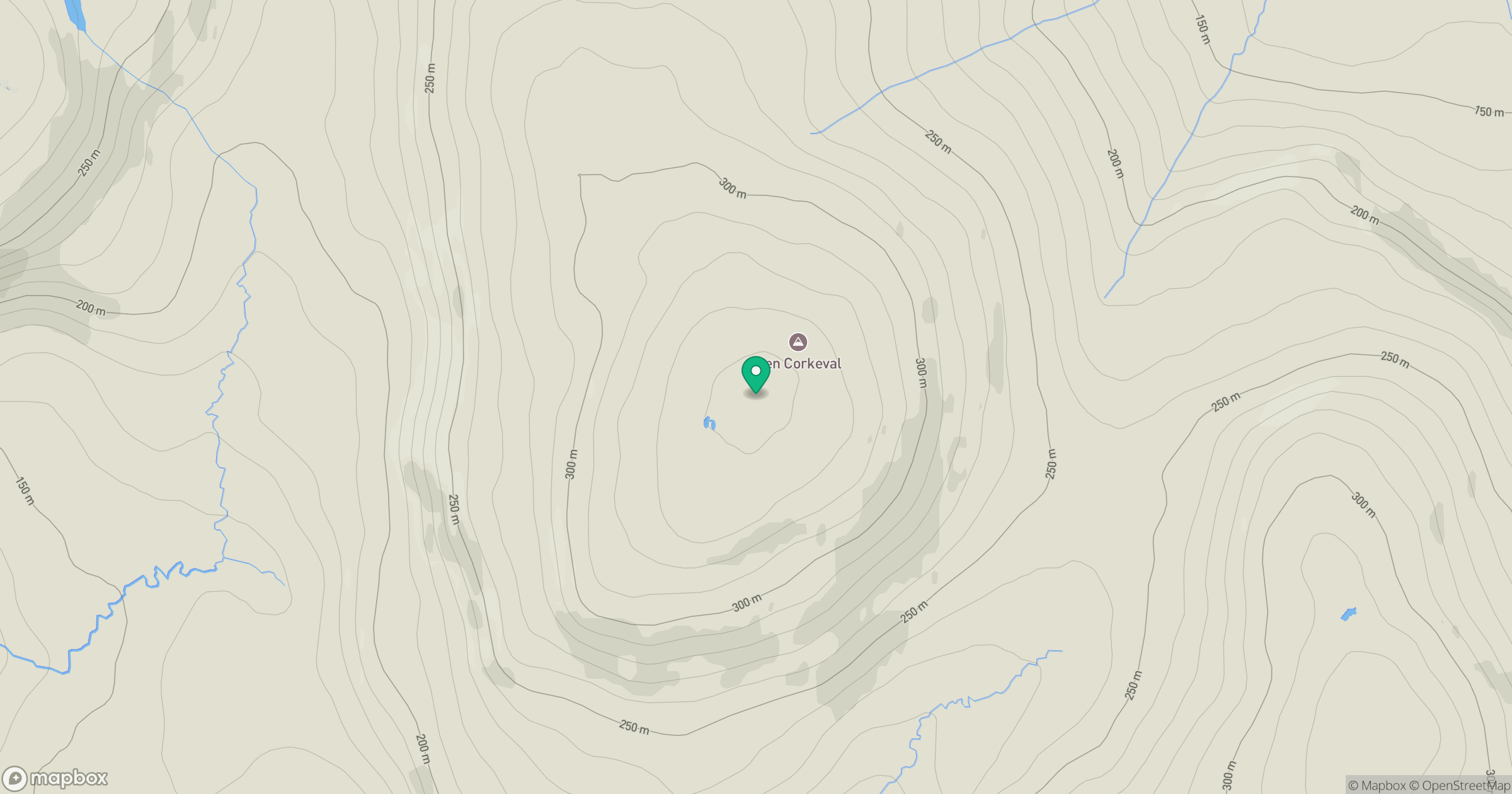
Grid reference: NG184448
View on OpenStreetMapOpens a map in a new tab, centred on the hill.
Hills within 30 km
Straight-line distance, not a walking route or confirmation of access.
No comments yet. Be the first.