
Head Down
Good walks are even better shared.
Overview
Head Down
Introduction
Nestled within the stunning scenery of the Brecon Beacons, Head Down (elevation 300 meters) is a charming hill that offers an excellent outing for those looking to escape into nature without clambering up the highest peaks. Perfect for a gentle hike or a more vigorous walk, this Marilyn is often overlooked but is filled with delightful surprises.
Geology
The landscape here is predominantly composed of Old Red Sandstone, a superb geological feature that tells a tale of ancient riverbeds and landforms shaped by time. As you wander, you may even spot fossilised remnants of sea creatures from when this area was once submerged under water—talk about a blast from the past!
Routes
The primary route from Cwm Ddu delivers a splendid ascent that's challenging enough to please the seasoned hiker but accessible enough for families. You'll navigate both rocky paths and grassy fields while taking in the mesmerizing views of rolling hills.
Summit Features
Reaching the summit rewards you with a substantial cairn, standing proudly against the skyline, providing an ideal backdrop for a midday snack—or a well-deserved picnic of pastries, anyone? The panoramic vistas extend into the valleys below and further toward the majestic Pen y Fan.
Terrain Type
Expect a varied terrain that leads you through rocky outcrops and grassy slopes. Keep your eyes peeled for those sneaky bogs that might just test your footing!
Views
From the summit, enjoy breathtaking views that are particularly stunning in spring and autumn when the light dances across the landscape. On clear days, expect to spot Pen y Fan in all its glory to the northwest, just beckoning for more explorers.
Hazards
Mind your step! The paths can be slippery in the wet, and while the bogs may seem innocuous, they’ve caught more than a few hikers off guard. Staying on marked paths will keep you in safer territory.
Nearby Summits
A short stroll can bring you to the heights of Pen y Fan and Corn Du—all part of a great day hike.
Access
Make your way to the small car park at Cwm Ddu early in the day to secure a parking space, especially on weekends. Public transport from Brecon is a convenient option if you're without a car—no need to fret about driving!
Facilities
Once you return from your adventure, Brecon offers a wealth of cafés and restaurants, alongside public toilets to freshen up.
History
The name 'Head Down' reflects the local dialect, a nod to the mountain’s gentle slopes towards the valley. Historically, this region thrived on trade, facilitating connection between various settlements, echoing the stories of those who walked these paths before us.
Conclusion
Head Down may not claim the highest peak title, but it certainly offers the kind of experience that forever draws you back. So whether you are after serenity, a good workout, or simply a jolly good view, pack your boots and head on down to Head Down. There's a lovely adventure waiting!
Explore routes near Head Down
Walks starting near this hill. Open a route to check its map, distance and full itinerary.
Havant Walk with Men Walking & Talking
View route
Hinton Ampner: Dutton Estate Woodland and Downland Circuit
View route
Port Solent Walk with Men Walking & Talking
View route
Hindhead Sailor's Stroll to Gibbet Hill
View route
Route planning notes
These notes describe possible approaches. Check a route's map and access information when planning your walk.
Cwm Ddu to Head Down
A delightful ascent through lush valleys and rocky outcrops, this route offers both charm and challenge, perfect for a brisk Sunday jaunt.
Make a day of it, together
Find someone to share the walk with, or organise a day out along a route you like.
Hill facts and local notes
Classifications
Elevation
205m
673 ft
Prominence
68m
Coordinates
50.9673, -0.9541
SU735191
OS Map
197
Explorer: OL8 120
At the Summit
The summit boasts a sizeable cairn, perfect for a cheeky sit down and a selfie. Great views all around too!
Terrain & Geology
Primarily composed of Old Red Sandstone, the craggy outcrops here hold remnants of ancient riverbeds and deltaic deposits, giving insight into the region's vivid past.
Views & Scenery
Fantastic views of the surrounding valleys, with Pen y Fan peeking through the clouds to the northwest.
History & Heritage
Name Origin
The name 'Head Down' is thought to originate from the local dialect, referring to the downward slope towards the neighbouring valley.
Historical Significance
Historically, this area was a vital route for traders and farmers, connecting various villages in the Breconshire region.
Getting There & Facilities
Parking
There is a small car park at the base of Cwm Ddu which provides easy access. Arrive early to secure a spot!
Public Transport
Buses operate from Brecon to Cwm Ddu, with services running regularly on weekends.
Nearby Facilities
Cafés can be found in Brecon, and public toilets are available in the town centre.
Safety Information
Known Hazards
- Slippery paths in wet conditions, and a few boggy patches can surprise the unwary. Watch your step!
General Safety Tips
- Check weather conditions before setting out
- Carry appropriate clothing and equipment
- Let someone know your planned route
- Take a map, compass, and GPS device
- Carry emergency supplies: food, water, first aid kit, torch
Hills
Some common questions about the hills answered
Are there group walks up Head Down?
Many walkers use Walkmates to join or organise walks with others. You can check for group walks around Head Down through the maps
Are there other walkers around Head Down?
Activity varies by location and time, but Walkmates lets you see whether others have shared walks or shown interest in this area. Find other people through the walking friends search walking friends for Head Down search or of course create your own walk for Head Down
Can I organise a walk to Head Down?
Yes. If there aren’t any walks listed already, you can create a walk and make it available for others to join.
If you're signed up to Walkmates, you can create a walk to Head Down.
How do I find a walk up this hill?
There are often multiple ways to walk this hill, depending on experience and route preference. Walkmates helps you explore walks and routes that others have shared.
Can I suggest a new route up Head Down?
Yes. You can suggest or create routes to share with others. Walkmates focuses on the social side of walking, so routes are used to help people organise walks and explore areas together, rather than as detailed navigation tools or route libraries.
Other uses really appreciate knowledgeable walkers sharing their routes. Share your favourite route to Head Down here
The is an error or something incorrect about this hill. How do I let you know?
We always strive to keep the information on Walkmates as accurate as possible. If you find an error, please let us know through the contact form and we'll aim to correct it as quickly as possible
Community Discussion
Comments
Location
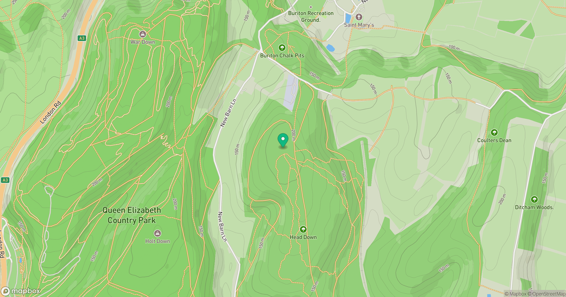
Grid reference: SU735191
View on OpenStreetMapOpens a map in a new tab, centred on the hill.
Nearby Hills
Leith Hill
294m
Ditchling Beacon
248m
Glastonbury Tor
158m
Worcestershire Beacon
425m
Titterstone Clee Hill
533m
No comments yet. Be the first.