

Craigmaid
Good walks are even better shared.
Overview
Craigmaid
Craigmaid, standing at a humble 580 meters above sea level, is often overshadowed by its taller neighbours but offers a treasure trove of sights and experiences for hikers of all skills.
Geology
Craigmaid is primarily comprised of Old Red Sandstone, full of fascinating geological history. This rock type brings unique formations and a vibrant landscape that speaks to millions of years of natural progression. Prepare to marvel at the views and perhaps contemplate the ages of time while you stand atop (if you can catch your breath).
Routes
A favourite among locals is the Craigmaid Circular Route, a journey of about 10.5 km that offers a delightful blend of varied terrain, picturesque views, and just the right amount of challenge to keep you entertained. It takes roughly 3.5 hours to complete, though keep an eye on your watch—hiking too long might ensue some intense round-the-bush conversations!
Summit Features
At the summit, hikers are greeted with a charming stone cairn, a warm invitation for those who've made it up. The panoramic views are worth every uphill step, showcasing some of the best the Scottish Highlands have to offer.
Terrain
Venture up Craigmid and you'll encounter rocky outcrops, lush grassy slopes, and the occasional treacherous bog. A sturdy pair of boots will serve you well here—nothing dampens a hike like a soggy sock!
Views
When you reach the top, be sure to take a moment to soak in the sights. You can spot the regal peaks of Ben Nevis to the west and get an eyeful of the Great Glen. Spring and Autumn grace the landscape with vivid colours, making these times nearly magical for outdoor enthusiasts.
Hazards
As enchanting as it is, Craigmaid isn't without its pitfalls. Keep your wits about you on those steep and rocky sections, especially when conditions are wet—gravitational forces have a way of making themselves known!
Nearby Summits
If you're eager for more, nearby summits like Ben Chonzie and Creag Bhreac await with open arms and even more breathtaking views.
Access
Craigmaid is accessible with a small parking area located conveniently off the A822 road. For those relying on public transport, local buses run to nearby Comrie, putting you a short trek away from this highland gem.
Facilities
After your adventure, head to Comrie for some well-deserved refreshments. With several cafes and shops, you can grab a bite or simply boast about your hiking triumphs.
History
The name 'Craigmaid' hints at its rocky character, combining elements from the Scots Gaelic language. Historically, it has been a beloved spot for both casual walkers and experienced climbers, drawing attention for its stunning landscapes and inviting hiking routes.
In summary, whether you are looking for a day hike or a new addition to your mountain-bagging adventure, Craigmaid stands ready to impress. Just remember—every ascent begins with a single step, preferably in the right direction!
Happy hiking!
Explore routes near Craigmaid
Public walks starting within 80 km of this hill. Nearby does not mean a route reaches the summit; check its map and access before setting out.
Moffat Gallow Hill Woodland and Viewpoint Circuit
View route
Cademuir Forest Pilots Trail
View route
Peebles to Neidpath Castle: Tweed Riverside Walk
View route
Forest of Ae Water of Ae Riverside Trail
View route
Route planning notes
These notes describe possible approaches, not verified navigable routes or permission to cross land. Check current paths, local access rules and conditions before setting out.
Craigmaid Circular Route
This popular circular route takes you around the base of Craigmaid, offering beautiful views and a gentle incline before tackling the summit itself.
Make a day of it, together
Find someone to share the walk with, or organise a day out along a route you like.
Photo Gallery
View all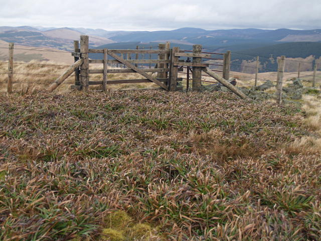 Photo could not load
NT0717 : Fence intersection, Craigmaid
Chris Eilbeck
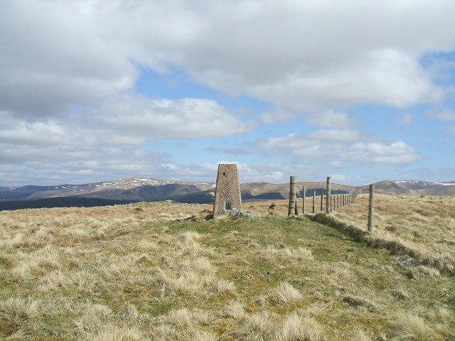 Photo could not load
NT0717 : Craigmaid
Iain Russell
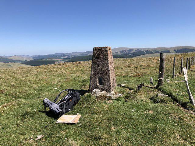 Photo could not load
NT0717 : The summit of Craigmaid, 553m
Alan Castle
Hill facts and local notes
Classifications
Elevation
553m
1,814 ft
Prominence
101m
Coordinates
55.4451, -3.4639
NT074177
OS Map
78
Explorer: 330
At the Summit
The summit is marked by a stone cairn and offers stunning panoramic views of the surrounding glens and peaks.
Terrain & Geology
Craigmaid is primarily composed of Old Red Sandstone, giving rise to its characteristic rugged crags and steep slopes. The geology provides a spectacular view of the surrounding hills, revealing layers of sediment that date back to the Devonian period.
Views & Scenery
From the summit, you can see the nearby Munros such as Ben Nevis to the west and the expansive Great Glen.
History & Heritage
Name Origin
The name 'Craigmaid' derives from Scots Gaelic 'craig' meaning 'rock' and 'maid' possibly indicating 'little', perhaps referring to its modest stature compared to surrounding peaks.
Historical Significance
Craigmaid has been a popular spot for both casual walkers and serious climbers, often included in local hiking routes and celebrated for its scenic beauty.
Getting There & Facilities
Check current local access restrictions, parking rules and transport timetables before travelling. These notes do not confirm public access to the summit.
Parking
There is a small parking area at the base of the Craigmaid trail, off the A822 road.
Public Transport
Local bus services run to the nearby village of Comrie, which is around 5 km away.
Nearby Facilities
Nearby Comrie offers several cafes, public toilets, and shops to refuel before or after your hike.
Safety Information
Known Hazards
- Steep slopes and rocky terrain can lead to slips, particularly in wet conditions. Always be mindful of changing weather.
General Safety Tips
- Check weather conditions before setting out
- Carry appropriate clothing and equipment
- Let someone know your planned route
- Take a map, compass, and GPS device
- Carry emergency supplies: food, water, first aid kit, torch
Hills
Some common questions about the hills answered
Are there group walks up Craigmaid?
Many walkers use Walkmates to join or organise walks with others. You can check for group walks around Craigmaid through the maps
Are there other walkers around Craigmaid?
Activity varies by location and time, but Walkmates lets you see whether others have shared walks or shown interest in this area. Find other people through the walking friends search walking friends for Craigmaid search or of course create your own walk for Craigmaid
Can I organise a walk to Craigmaid?
Yes. If there aren’t any walks listed already, you can create a walk and make it available for others to join.
If you're signed up to Walkmates, you can create a walk to Craigmaid.
How do I find a walk up this hill?
There are often multiple ways to walk this hill, depending on experience and route preference. Walkmates helps you explore walks and routes that others have shared.
Can I suggest a new route up Craigmaid?
Yes. You can suggest or create routes to share with others. Walkmates focuses on the social side of walking, so routes are used to help people organise walks and explore areas together, rather than as detailed navigation tools or route libraries.
Other uses really appreciate knowledgeable walkers sharing their routes. Share your favourite route to Craigmaid here
The is an error or something incorrect about this hill. How do I let you know?
We always strive to keep the information on Walkmates as accurate as possible. If you find an error, please let us know through the contact form and we'll aim to correct it as quickly as possible
Community Discussion
Comments
Location
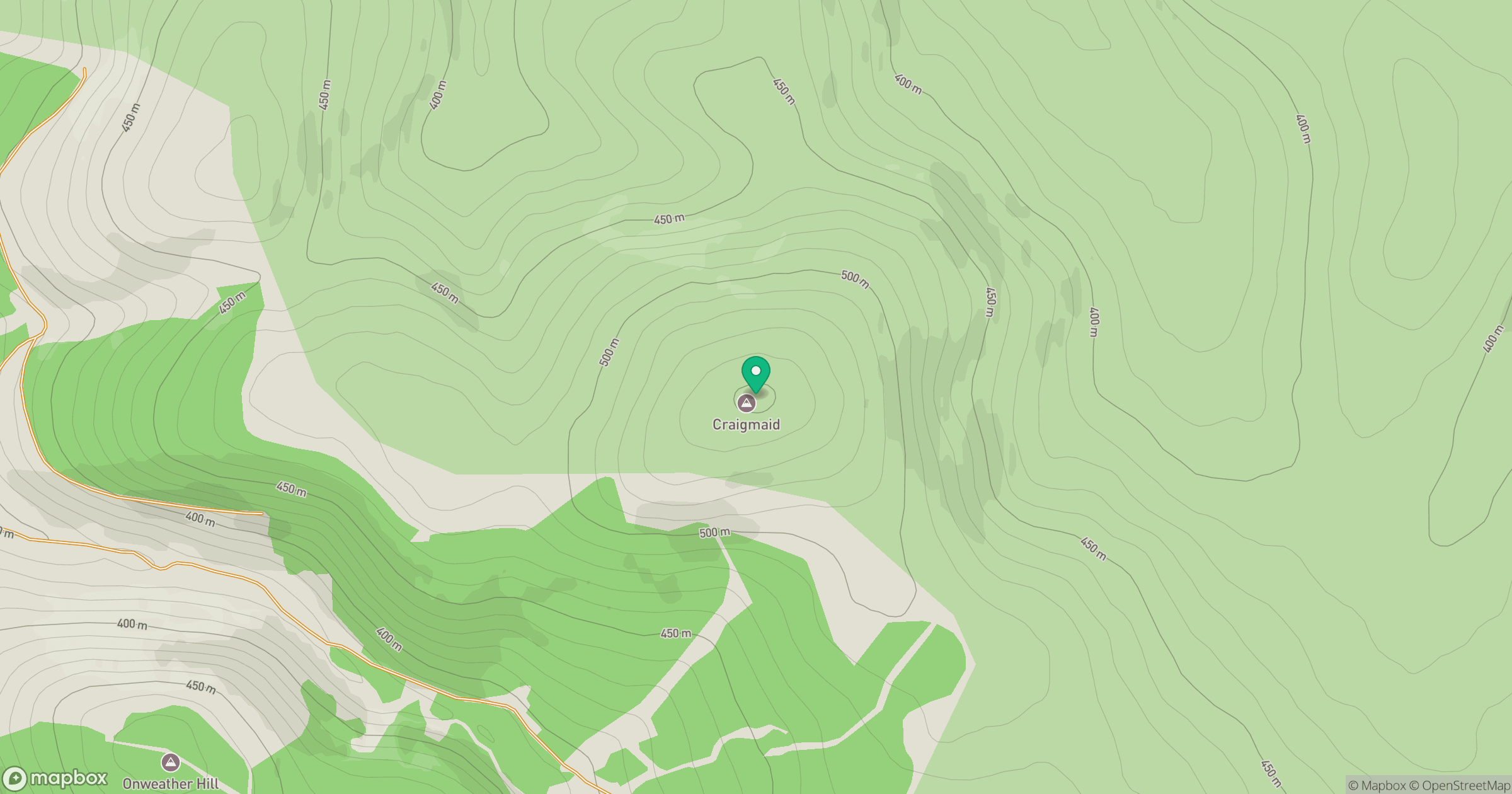
Grid reference: NT074177
View on OpenStreetMapOpens a map in a new tab, centred on the hill.
Hills within 30 km
Straight-line distance, not a walking route or confirmation of access.

No comments yet. Be the first.