
Hart Fell
Good walks are even better shared.
Overview
Hart Fell
Overview
Hart Fell, standing tall at 616 meters, is a splendid Marilyn situated in the Southern Uplands of Scotland. Known for its welcoming grassy slopes and rocky outcrops, it's a popular choice for hikers. With a prominence of 77 meters, it may not boast the heights of some Munros, but it offers stunning views and a satisfying walk.
Geology
The mountain is primarily made up of sedimentary rocks from the Carboniferous period, comprising both sandstone and shale. This geological history provides not only fascinating formations but unique habitats for local flora and fauna.
Routes
One of the preferred routes to the summit begins from the B724 road. This route is generally considered moderate, stretching around 6 km, and typically takes about 2.5 hours to complete. The ascent is straightforward, with beautiful views greeting you right from the start.
Summit Features
The summit features a modest cairn and rocky outcrop providing ample opportunities for those all-important summit selfies. Remember to contribute to the cairn with a stone!
Terrain and Views
Expect a mix of grassy slopes with occasional rocky sections, alongside some boggy areas—perfectly characterising the terrain in the Southern Uplands. The views from Hart Fell are nothing short of spectacular. On a clear day, you can see the Moffat Hills and enjoy picturesque views stretching to Dumfries and Galloway. For the best experience, plan your visit in spring or autumn.
Hazards
While the terrain is inviting, it can also be deceitful. Watch out for boggy patches, especially after rain—no one likes muddy boots on a Sunday stroll!
Nearby Summits
After conquering Hart Fell, consider visiting nearby summits like Moffat Hill (700 m) or White Coomb (822 m) for further adventure.
Access
Parking is available along the B724, but be sure to park responsibly. If you're relying on public transport, the bus stop in Moffat is your best bet, adding a bit of adventure to your day. Moffat is the nearest town and offers plenty of facilities, from cafés to restrooms.
Facilities
Treat yourself to a slice of cake in Moffat after your hike; you've earned it!
History
The name 'Hart Fell' speaks to the mountain's historical significance as a hunting ground, with 'Hart' referring to deer. This lends the area a rich cultural heritage.
Whether you're a seasoned hiker or a casual walker, Hart Fell's charm and breathtaking views make it a worthy destination. Now grab your boots, pack your sense of adventure, and set off to explore this stunning gem in the Southern Uplands!
Explore routes near Hart Fell
Public walks starting within 80 km of this hill. Nearby does not mean a route reaches the summit; check its map and access before setting out.
Hoddom Castle and River Annan Woodland Circuit
View route
Moffat Gallow Hill Woodland and Viewpoint Circuit
View route
Forest of Ae Water of Ae Riverside Trail
View route
Newcastleton Forest Priest Hill Viewpoint Trail
View route
Route planning notes
These notes describe possible approaches, not verified navigable routes or permission to cross land. Check current paths, local access rules and conditions before setting out.
From the B724 Road
A straightforward ascent from the B724 road offering beautiful views from the onset.
Make a day of it, together
Find someone to share the walk with, or organise a day out along a route you like.
Hill facts and local notes
Classifications
Elevation
331m
1,086 ft
Prominence
103m
Coordinates
55.1888, -3.2108
NY230889
OS Map
79
Explorer: 323N
At the Summit
The summit boasts a rocky outcrop and a small cairn, perfect for those Instagram snaps. Don't forget to add your stone to the pile, it's a tradition!
Terrain & Geology
Hart Fell is primarily composed of sedimentary rocks, including sandstone and shale, which date back to the Carboniferous period. The erosion of these materials has created various interesting formations in the area.
Views & Scenery
From the summit, you can enjoy spectacular views of the Moffat Hills and further afield, including the rolling landscapes of Dumfries and Galloway.
History & Heritage
Name Origin
The name 'Hart Fell' is thought to derive from 'Hart', an Old English word for deer, indicating that the area was once a hunting ground.
Historical Significance
The mountain has been a beloved spot for walking and wildlife observation, showcasing the natural beauty and rich biodiversity of the Southern Uplands.
Getting There & Facilities
Check current local access restrictions, parking rules and transport timetables before travelling. These notes do not confirm public access to the summit.
Parking
There is limited roadside parking available along the B724; however, ensure to park off-road to avoid obstructing traffic.
Public Transport
The nearest bus stop is in Moffat, which is about 5 miles away, so a bit of a trek is necessary unless you fancy a good old-fashioned hitch-hike.
Nearby Facilities
Moffat has a variety of facilities, including cafes, pubs, and public restrooms, so don't hesitate to reward yourself with cake after your adventure!
Safety Information
Known Hazards
- Boggy terrain can be treacherous, especially after heavy rain. Be prepared to possibly get your boots muddy!
General Safety Tips
- Check weather conditions before setting out
- Carry appropriate clothing and equipment
- Let someone know your planned route
- Take a map, compass, and GPS device
- Carry emergency supplies: food, water, first aid kit, torch
Hills
Some common questions about the hills answered
Are there group walks up Hart Fell?
Many walkers use Walkmates to join or organise walks with others. You can check for group walks around Hart Fell through the maps
Are there other walkers around Hart Fell?
Activity varies by location and time, but Walkmates lets you see whether others have shared walks or shown interest in this area. Find other people through the walking friends search walking friends for Hart Fell search or of course create your own walk for Hart Fell
Can I organise a walk to Hart Fell?
Yes. If there aren’t any walks listed already, you can create a walk and make it available for others to join.
If you're signed up to Walkmates, you can create a walk to Hart Fell.
How do I find a walk up this hill?
There are often multiple ways to walk this hill, depending on experience and route preference. Walkmates helps you explore walks and routes that others have shared.
Can I suggest a new route up Hart Fell?
Yes. You can suggest or create routes to share with others. Walkmates focuses on the social side of walking, so routes are used to help people organise walks and explore areas together, rather than as detailed navigation tools or route libraries.
Other uses really appreciate knowledgeable walkers sharing their routes. Share your favourite route to Hart Fell here
The is an error or something incorrect about this hill. How do I let you know?
We always strive to keep the information on Walkmates as accurate as possible. If you find an error, please let us know through the contact form and we'll aim to correct it as quickly as possible
Community Discussion
Comments
Location
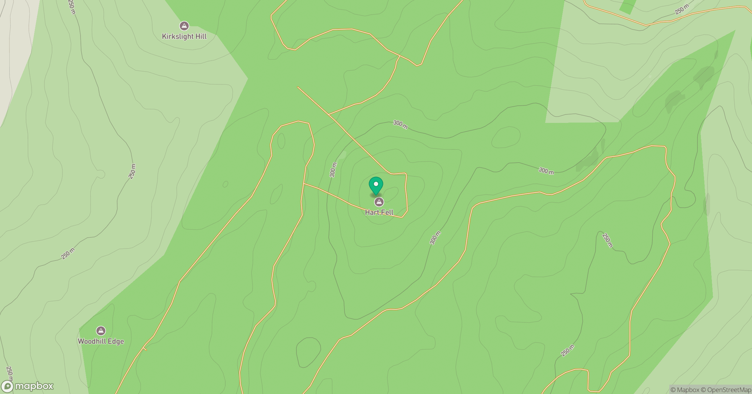
Grid reference: NY230889
View on OpenStreetMapOpens a map in a new tab, centred on the hill.
Hills within 30 km
Straight-line distance, not a walking route or confirmation of access.
No comments yet. Be the first.