

Halnaker Hill
Good walks are even better shared.
SU9209 : Approaching Halnaker Mill
Chris Thomas-Atkin Photo source
Overview
Halnaker Hill
Discreetly nestled within the vibrant landscapes of the South Downs National Park, Halnaker Hill graces the countryside at 108 meters above sea level. A Marilyn in classification, this hill invites walkers and nature-lovers alike to explore its chalky terrain.
Geology
The hill is primarily composed of chalk, a geological signature of the South Downs, decorated with flint nodules that speak to the region's ancient origins. This particular geology supports a variety of unique flora and fauna, turning a simple walk into a nature spotting adventure. Don’t forget your magnifying glass; you’ll never know what you might find!
Routes
Halnaker Hill Trail
Ideal for families and casual walkers, this 3.5 km trail provides a straightforward, yet enchanting ascent starting from the village of Halnaker. Expect stunning vistas and perhaps a curious sheep or two asking for company!
South Downs Way Approach
For those seeking a bit more of a challenge, the 8 km route along the South Downs Way will quench your thirst for adventure. It’s a moderate trek featuring picturesque views and historical remnants, making each step a journey through time.
Summit Features
At the apex of Halnaker Hill rests a well-loved trig point, standing proud and offering a panoramic view that might make even the most seasoned photographers swoon. Bring your camera; you’ll want to capture the rolling hills and sparkling coastline.
Terrain
The hill’s terrain is predominantly grassy, interspersed with chalk outcrops that are easy to navigate. However, keep an eye out for the occasional muddy patch; we all know how unpredictable the British weather can be!
Views
From the summit, you’ll be greeted by breathtaking views. Look towards Chichester and the coastline of the Solent, and gaze upon rolling hills that seem to go on forever. The best views are often found in spring and early summer, when wildflowers bloom and the greenery is at its richest.
Hazards
As always, tread carefully. There can be muddy patches after rainfall, and the steeper edges deserve a respectful distance. Safety first, adventurers!
Nearby Summits
Just a short trek away is Kingley Vale, another gem in this picturesque region. With an elevation of 90 meters, it’s perfect for extending your hiking exploits.
Access
Parking in Halnaker is limited, so respectful street parking is a must. Public transport is pretty good, with regular buses from Chichester. The nearest town, Chichester, is brimming with amenities for both pre-hike fuel and post-hike relaxation.
Facilities
While facilities are sparse on the hill itself, nearby Chichester offers everything from public toilets to delightful cafes where you can treat yourself to a slice of cake—you’ve earned it!
History
The name ‘Halnaker’ has roots in Old English, meaning ‘nook or corner of the hal.’ The area is steeped in history, with archaeological findings that date back to prehistoric times, adding a layer of intrigue to your outdoor adventure.
In summary, Halnaker Hill is not just a walk in the park—it’s a chance to connect with nature, history, and perhaps even a few cheeky sheep. Happy hiking!
Explore routes near Halnaker Hill
Walks starting near this hill. Open a route to check its map, distance and full itinerary.
Bognor Regis Walk & Talk
View route
Bognor Regis Walk & Talk
View route
Bognor Regis Walk & Talk
View route
Petworth Walk with Men Walking & Talking
View route
Route planning notes
These notes describe possible approaches. Check a route's map and access information when planning your walk.
Halnaker Hill Trail
Starting at the village of Halnaker, this route offers a gentle ascent with stunning views, perfect for families or those looking for a leisurely stroll.
South Downs Way Approach
A longer trek joining the well-known South Downs Way, this route delivers scenic walks through rolling hills and historical sites.
Make a day of it, together
Find someone to share the walk with, or organise a day out along a route you like.
Photo Gallery
View all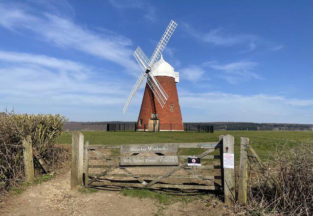 Photo could not load
SU9209 : Approaching Halnaker Mill
Chris Thomas-Atkin
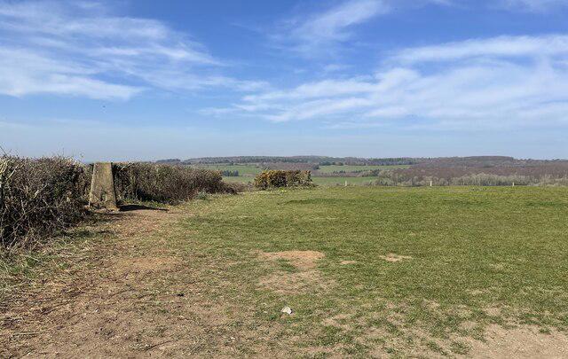 Photo could not load
SU9209 : Halnaker Hill looking west
Chris Thomas-Atkin
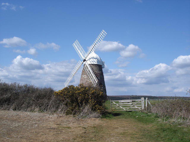 Photo could not load
SU9209 : Halnaker Windmill
Ian Hawfinch
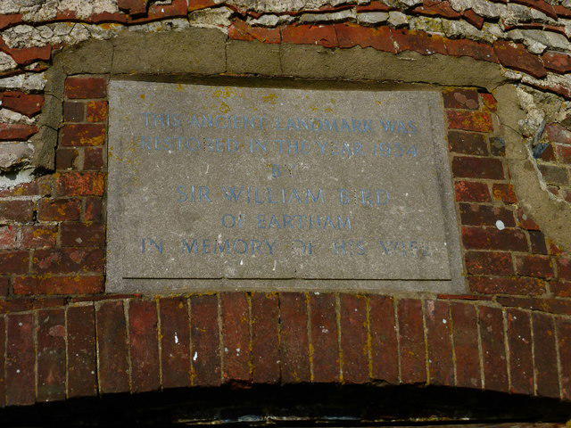 Photo could not load
SU9209 : Plaque above door of Halnaker Windmill
Shazz
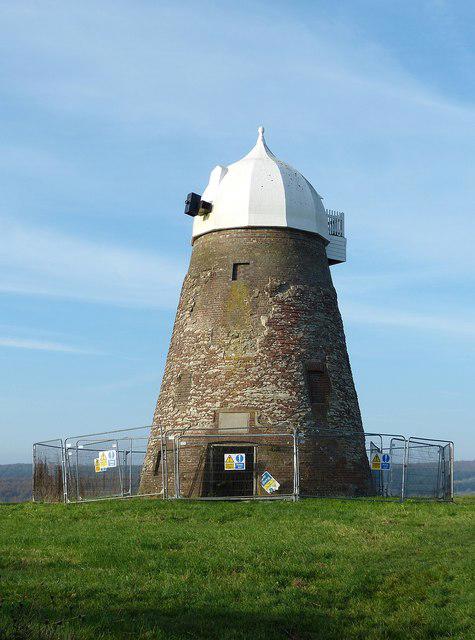 Photo could not load
SU9209 : Halnaker Windmill
Rob Farrow
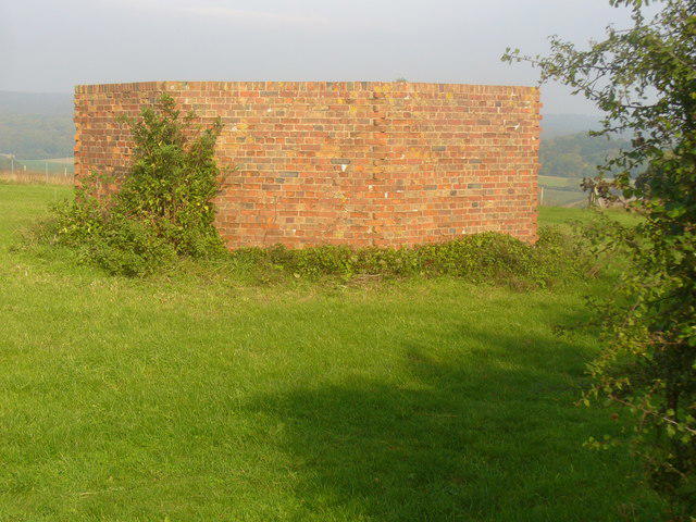 Photo could not load
SU9209 : Pillbox on Halnaker Hill
Colin Smith
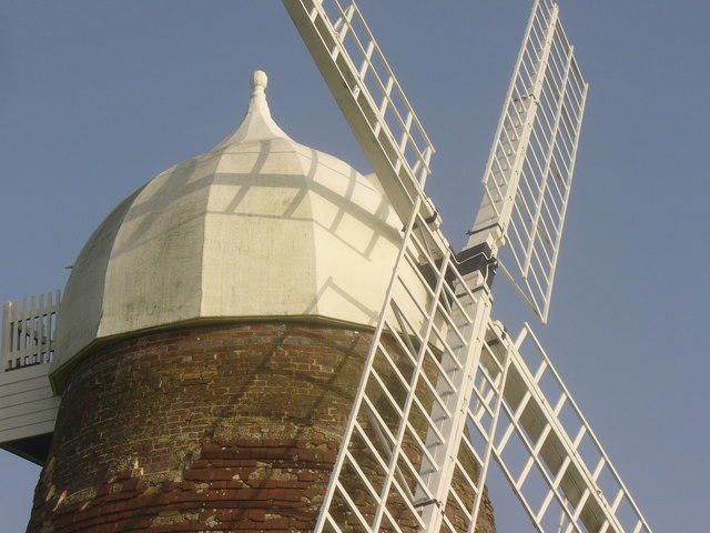 Photo could not load
SU9209 : Cap on Halnaker Windmill
Colin Smith
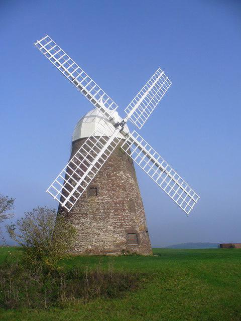 Photo could not load
SU9209 : Halnaker Windmill on Halnaker Hill
Colin Smith
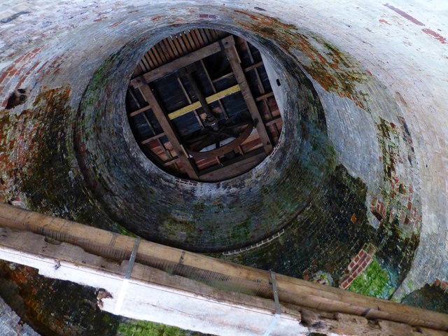 Photo could not load
SU9209 : Looking up inside Halnaker Windmill
Shazz
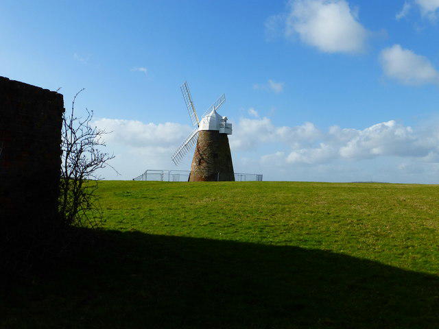
SU9209 : Halnaker Windmill (3)
Shazz
Hill facts and local notes
Classifications
Elevation
128m
420 ft
Prominence
34m
Coordinates
50.8791, -0.6932
SU920096
OS Map
197
Explorer: OL10 121
At the Summit
The summit features a distinctive trig point, providing an excellent vantage point for panoramic views of the surrounding countryside.
Terrain & Geology
Halnaker Hill is composed primarily of chalk, characteristic of the South Downs, with layers of flint nodules. This geology supports diverse flora and fauna endemic to chalk grasslands.
Views & Scenery
From the summit, hikers can enjoy views towards Chichester and the coastal outline of the Solent, as well as the rolling hills of the South Downs.
History & Heritage
Name Origin
The name ‘Halnaker’ is derived from Old English, meaning ‘nook or corner of the hal.'
Historical Significance
The area around Halnaker Hill has been settled since prehistoric times, with various archaeological finds contributing to its historical intrigue.
Getting There & Facilities
Parking
Limited street parking available in Halnaker village; respectful parking is advised to avoid blocking residents.
Public Transport
Regular bus services operate from Chichester, approximately 3 miles away.
Nearby Facilities
Public toilets are available in Chichester; local cafes and shops are perfect for a pre-hike coffee or post-hike snack.
Safety Information
Known Hazards
- Occasional muddy patches, especially after rain; stay clear of steep edges.
General Safety Tips
- Check weather conditions before setting out
- Carry appropriate clothing and equipment
- Let someone know your planned route
- Take a map, compass, and GPS device
- Carry emergency supplies: food, water, first aid kit, torch
Hills
Some common questions about the hills answered
Are there group walks up Halnaker Hill?
Many walkers use Walkmates to join or organise walks with others. You can check for group walks around Halnaker Hill through the maps
Are there other walkers around Halnaker Hill?
Activity varies by location and time, but Walkmates lets you see whether others have shared walks or shown interest in this area. Find other people through the walking friends search walking friends for Halnaker Hill search or of course create your own walk for Halnaker Hill
Can I organise a walk to Halnaker Hill?
Yes. If there aren’t any walks listed already, you can create a walk and make it available for others to join.
If you're signed up to Walkmates, you can create a walk to Halnaker Hill.
How do I find a walk up this hill?
There are often multiple ways to walk this hill, depending on experience and route preference. Walkmates helps you explore walks and routes that others have shared.
Can I suggest a new route up Halnaker Hill?
Yes. You can suggest or create routes to share with others. Walkmates focuses on the social side of walking, so routes are used to help people organise walks and explore areas together, rather than as detailed navigation tools or route libraries.
Other uses really appreciate knowledgeable walkers sharing their routes. Share your favourite route to Halnaker Hill here
The is an error or something incorrect about this hill. How do I let you know?
We always strive to keep the information on Walkmates as accurate as possible. If you find an error, please let us know through the contact form and we'll aim to correct it as quickly as possible
Community Discussion
Comments
Location
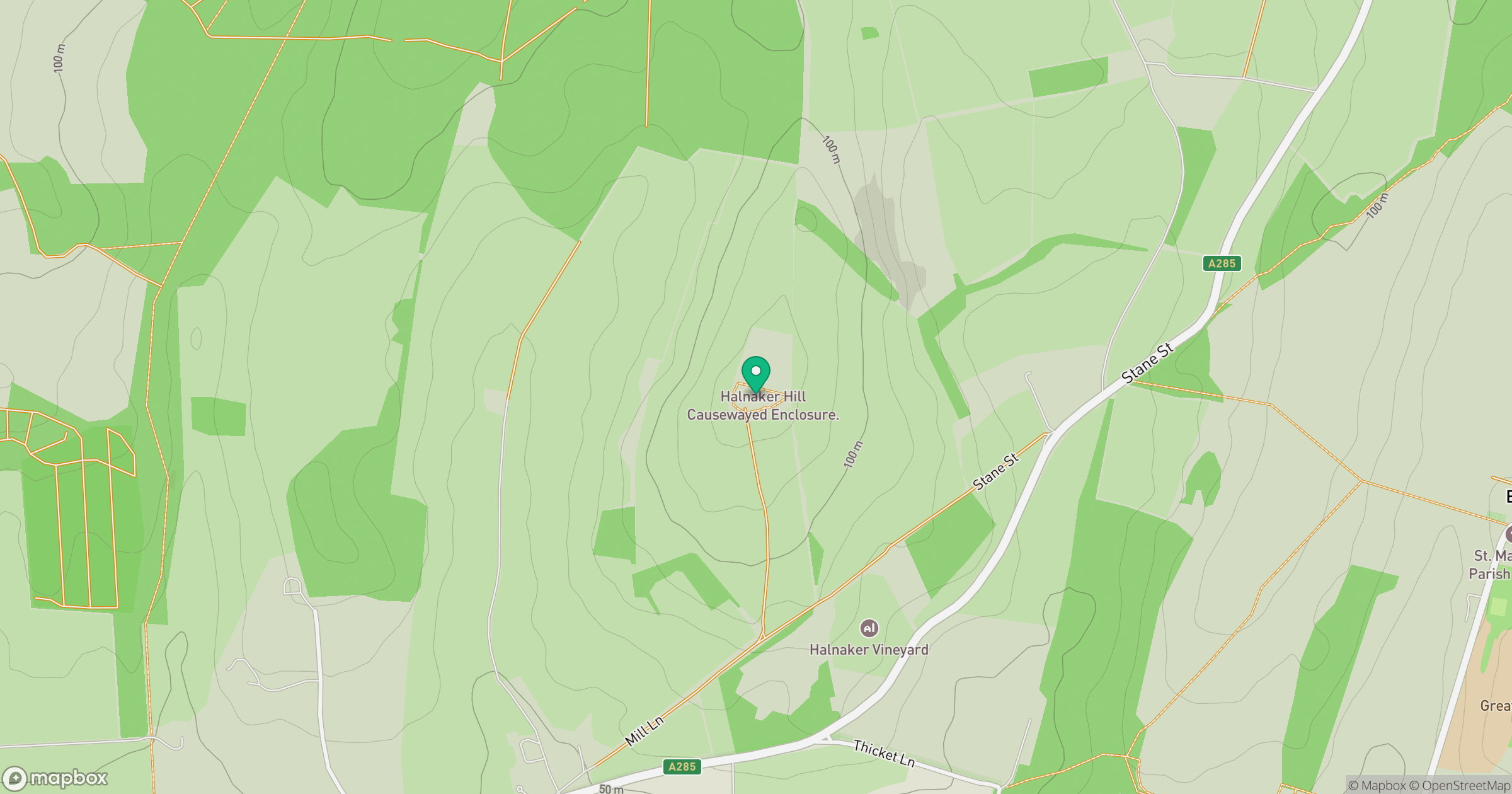
Grid reference: SU920096
View on OpenStreetMapOpens a map in a new tab, centred on the hill.
Nearby Hills
Leith Hill
294m
Ditchling Beacon
248m
Glastonbury Tor
158m
Worcestershire Beacon
425m
Titterstone Clee Hill
533m
No comments yet. Be the first.