

Chanctonbury Ring
Good walks are even better shared.
TQ1312 : Chanctonbury Ring
Sally Photo source
Overview
Chanctonbury Ring is a 242 m Marilyn on the South Downs in West Sussex, marked by a beech clump around a prehistoric hillfort. Walks from Washington and Findon combine chalk tracks, steep slopes and woodland, with views across the Weald and towards the Channel coast.
Chanctonbury Ring: An Iconic Gem of the South Downs
Chanctonbury Ring is a 242 m hill on the South Downs in West Sussex, between the walking bases of Washington and Steyning. The beech clump and prehistoric earthworks make it a distinctive landmark. The Database of British and Irish Hills lists it as a Marilyn with 217.7 m of prominence.
Geology
The hill stands on the South Downs chalk ridge. This limestone formed from microscopic marine remains in the Cretaceous period and contains flint. Open downland and wooded slopes form the setting for the walks.
Routes
Chanctonbury Ring Circular Walk
Discover Sussex's 4.6 km circuit begins at Washington South Downs Way car park, south of the village. It climbs to the ring using chalk tracks and field paths, then returns through woodland to the same car park. The descent is steep and can be slippery after rain. Follow the complete circular itinerary in the route description.
Findon Valley, Cissbury and Chanctonbury circuit
The longer route is the National Park's complete Findon Valley circuit via Cissbury's ramparts and Chanctonbury Ring, using only a section of the South Downs Way. Its January 2026 Findon leaflet specifies 12.9 km and 3.5–4 hours. It returns through the valley and past Cissbury to the May Tree Avenue start. There are numerous inclines and uneven surfaces.
Summit Features
The highest ground is near the centre of the ring, at grid reference TQ 13922 12072, and has no summit marker. The trig point is farther west at TQ 13431 12057. DoBIH records the ring summit as 3.5 m higher than ground 7 m southwest of that trig; reaching the trig is not the same as reaching the ring summit.
Views
Views from the hill take in the Weald to the north, the South Downs ridge and the Channel coast to the south, subject to visibility and the surrounding trees.
Hazards
Expect steep climbs and descents, wet-weather slipperiness, gates and cattle grids. Paths are shared with other users. Keep dogs under control and on leads around livestock, and follow local notices. Bring suitable footwear, weather protection and water.
Access and Facilities
Washington South Downs Way car park is at TQ120119. Discover Sussex reports that it is locked at dusk, so check the posted closing time when arriving. Wiston Estate also describes walks from the separate Chanctonbury Ring car park.
Metrobus route 23 links Washington and Findon with Worthing, Horsham and Crawley. Check the current timetable and the walking connection from your chosen stop. The longer circuit starts at May Tree Avenue in Findon Valley.
Chalk restaurant and coffee facilities are at Wiston Estate's North Farm, away from the summit. Check opening hours before relying on refreshments.
History
Historic England records an Early Iron Age hillfort, later reused as a Roman sacred precinct containing at least two temples. These survive as earthworks and buried archaeological remains. The monument is scheduled. Charles Goring planted the original beech trees in 1760; many were lost in the 1987 storm and subsequently replaced. Stories about supernatural visitors belong to the site's folklore.
The name's -bury element comes from Old English for an earthwork or fortification. Place-name scholar Richard Coates records the earlier form Chankbury and suggests that it preserves an older name for the fort; the first element remains uncertain.
Explore routes near Chanctonbury Ring
Walks starting near this hill. Open a route to check its map, distance and full itinerary.
Littlehampton Walk & Talk
View route
Littlehampton Walk & Talk
View route
Littlehampton Walk & Talk
View route
Petworth Walk with Men Walking & Talking
View route
Route planning notes
These notes describe possible approaches. Check a route's map and access information when planning your walk.
Chanctonbury Ring Circular Walk
Complete circular walk from Washington South Downs Way car park, south of the village. Climb the South Downs Way towards the River Adur, then take the slightly left-hand path at the fingerpost. Go through the gates into the open field, continue past the dew pond and rejoin the South Downs Way. Turn left over the cattle grid to reach Chanctonbury Ring. After visiting the ring, return to its approach side and take the gated, steep descent into the woods. As the slope eases, follow the path curving left, cross the field and pass through the metal gate onto the South Downs Way. Turn right downhill to the same car park. Discover Sussex publishes 4.6 km for this circuit; its woodland descent can be slippery in wet weather.
Findon Valley, Cissbury and Chanctonbury circuit
The park's January 2026 Findon leaflet gives 12.9 km and 3.5–4 hours for this complete circuit. Start at the May Tree Avenue bus stop on the A24. Climb through the field and woodland to Cissbury's ramparts, follow them left, then descend to the small ridge car park. Take the fenced track north to the South Downs Way and turn left to Chanctonbury Ring. Continue along the restricted byway, descend into the valley and follow the leaflet's return across the road and fields to Cissbury's ridge car park. Turn down through the gates and field, then take the wooded bridleway back to May Tree Avenue. If treefall blocks that final bridleway, the leaflet describes using the adjacent field and rejoining at the next bridle gate; follow current local notices.
Make a day of it, together
Find someone to share the walk with, or organise a day out along a route you like.
Photo Gallery
View all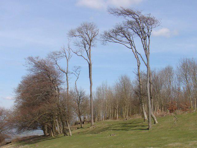 Photo could not load
TQ1312 : Chanctonbury Ring
Sally
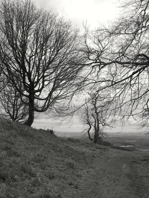 Photo could not load
TQ1312 : Chanctonbury Ring: trees on the northern flank
Stefan Czapski
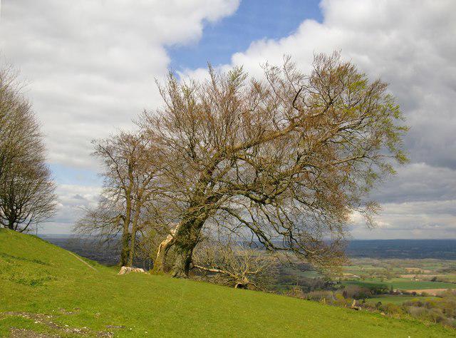 Photo could not load
TQ1312 : Chanctonbury Ring: trees on the northern flanks
Stefan Czapski
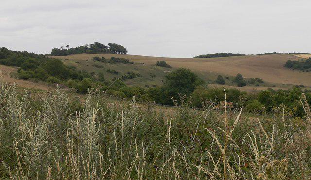 Photo could not load
TQ1312 : View across valley to Chanctonbury Ring
Shazz
 Photo could not load
TQ1312 : Approaching Chanctonbury Ring from the south-east
Stefan Czapski
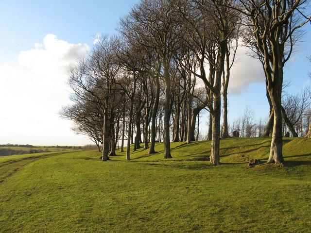 Photo could not load
TQ1312 : Outer ring of trees at Chanctonbury Ring
Dave Spicer
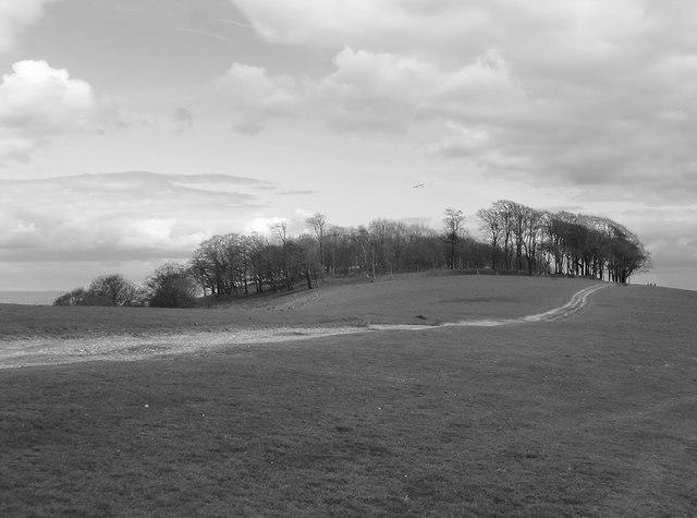 Photo could not load
TQ1312 : Chanctonbury Ring from the south-west
Stefan Czapski
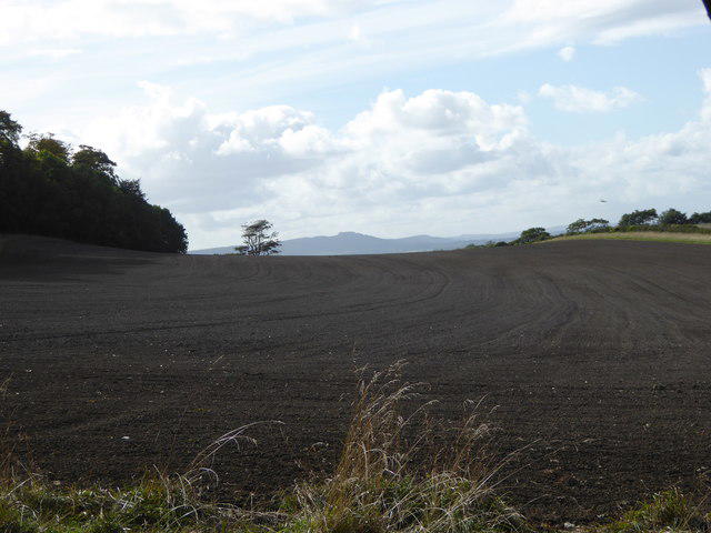 Photo could not load
TQ1412 : Eight and a half miles to Chanctonbury Ring
Shazz
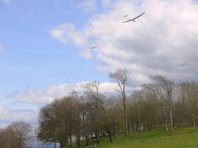 Photo could not load
TQ1312 : Gliders over Chanctonbury Ring
Stefan Czapski
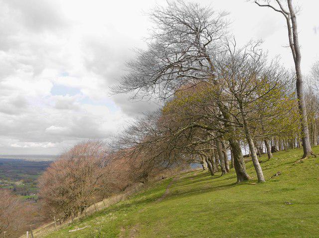
TQ1312 : Chanctonbury Ring: the northern flank
Stefan Czapski
Hill facts and local notes
Classifications
Elevation
242m
794 ft
Prominence
218m
Coordinates
50.8968, -0.3814
TQ139120
OS Map
198
Explorer: OL10 121
At the Summit
The 242 m summit is unmarked ground near the centre of the ring, within the beech clump and hillfort. The trig point is farther west at TQ1343112057. DoBIH records the ring summit as 3.5 m higher than ground 7 m southwest of that trig.
Terrain & Geology
The hill stands on the chalk ridge of the South Downs. Chalk is a limestone formed from microscopic marine remains during the Cretaceous period and contains flint. The landscape combines a steep northern escarpment with gentler south-facing downland slopes.
Views & Scenery
Views across the Weald to the north, along the South Downs and towards the Channel coast to the south, subject to visibility and the surrounding trees.
History & Heritage
Name Origin
The -bury element is Old English for an earthwork or fortification. Place-name scholar Richard Coates records the earlier form Chankbury and suggests that it preserves an older name for the fort; the first element remains uncertain.
Historical Significance
A scheduled Early Iron Age hillfort, later reused as a Roman sacred precinct with at least two temples, survives as earthworks and buried remains. Charles Goring planted the original beech trees in 1760; many were lost in the 1987 storm and subsequently replaced. Supernatural stories associated with the ring are folklore.
Getting There & Facilities
Parking
Washington South Downs Way car park (TQ120119), south of Washington village, is the start of the short circular route. Discover Sussex reports locking at dusk; check the posted closing time on arrival. Wiston Estate also lists the separate Chanctonbury Ring car park for walks from the north.
Public Transport
Metrobus route 23 links Washington and Findon with Worthing, Horsham and Crawley. Check the operator's current timetable and the walking connection from your chosen stop. The longer circular walk starts at the May Tree Avenue bus stop in Findon Valley.
Nearby Facilities
Chalk restaurant and coffee facilities are at Wiston Estate's North Farm, away from the summit and separate from Washington South Downs Way car park. Check opening hours and carry water for the walk.
Safety Information
Known Hazards
- Steep climbs and descents, including the woodland descent on the Washington circuit.
- Uneven chalk, flint and woodland paths; take care at gates and cattle grids.
- Shared paths and livestock: keep dogs under control and on leads around grazing animals.
Seasonal Hazards
Wet weather can make the steep chalk and woodland paths slippery.
General Safety Tips
- Check weather conditions before setting out
- Carry appropriate clothing and equipment
- Let someone know your planned route
- Take a map, compass, and GPS device
- Carry emergency supplies: food, water, first aid kit, torch
Hills
Some common questions about the hills answered
Are there group walks up Chanctonbury Ring?
Many walkers use Walkmates to join or organise walks with others. You can check for group walks around Chanctonbury Ring through the maps
Are there other walkers around Chanctonbury Ring?
Activity varies by location and time, but Walkmates lets you see whether others have shared walks or shown interest in this area. Find other people through the walking friends search walking friends for Chanctonbury Ring search or of course create your own walk for Chanctonbury Ring
Can I organise a walk to Chanctonbury Ring?
Yes. If there aren’t any walks listed already, you can create a walk and make it available for others to join.
If you're signed up to Walkmates, you can create a walk to Chanctonbury Ring.
How do I find a walk up this hill?
There are often multiple ways to walk this hill, depending on experience and route preference. Walkmates helps you explore walks and routes that others have shared.
Can I suggest a new route up Chanctonbury Ring?
Yes. You can suggest or create routes to share with others. Walkmates focuses on the social side of walking, so routes are used to help people organise walks and explore areas together, rather than as detailed navigation tools or route libraries.
Other uses really appreciate knowledgeable walkers sharing their routes. Share your favourite route to Chanctonbury Ring here
The is an error or something incorrect about this hill. How do I let you know?
We always strive to keep the information on Walkmates as accurate as possible. If you find an error, please let us know through the contact form and we'll aim to correct it as quickly as possible
Community Discussion
Comments
Location
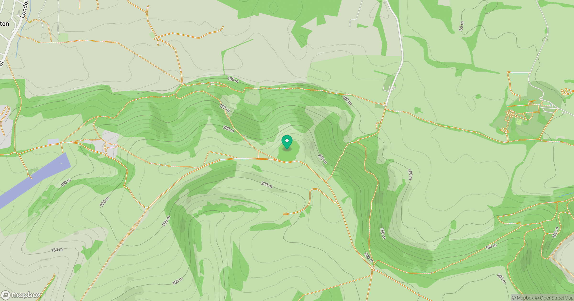
Grid reference: TQ139120
View on OpenStreetMapOpens a map in a new tab, centred on the hill.
Nearby Hills
Ditchling Beacon
248m
Leith Hill
294m
Worcestershire Beacon
425m
Glastonbury Tor
158m
Titterstone Clee Hill
533m
No comments yet. Be the first.