

Gummer's How
Good walks are even better shared.
Overview
Gummer's How is a 321.1 m Marilyn and Outlying Wainwright above southern Windermere. Its trig-point summit is reached from the Fell Foot Brow car park by short but rocky uphill paths. Two published short return routes are described separately because their geometry and ascent figures differ.
Gummer's How
Gummer's How is a 321.1 m Marilyn and Outlying Wainwright above southern Windermere. Its trig-point summit is reached from the Fell Foot Brow car park by short but rocky uphill paths. Two published short return routes are described separately because their geometry and ascent figures differ.
Summit
DoBIH identifies the trig point at SD 39044 88486 as the summit feature, at 321.1 m (1053 ft). It stands on rocky ground above Windermere.
Routes
Gummer's How from Astley's Plantation (WalkLakes return)
Start and finish at the picnic-area car park, SD389876. Follow the woodland path beside the road, cross carefully through the gates, then climb the stone-pitched path and rocky step to the summit trig. Continue north and use a right-turning minor path, then turn right beneath the summit to rejoin the ascent path and return across the road to the car park. WalkLakes gives 2.3 km and 118 m ascent for its outing. Its 39 minutes is explicitly a minimum, not a recommended duration. The optional northern knoll and direct retrace are not separately measured. Minor paths and the rocky descent need care.
Gummer's How with western summit return (Lakes Walks circuit)
Start and finish at the Forestry car park, SD389876. Walk briefly uphill on Fell Foot Brow, enter the kissing gate and climb past the woodland, stream, steps and fence. Continue over rocky ground to the trig point. Leave northwest toward Windermere, then take the left fork south around the summit's west side to regain the ascent path. Descend the steps, exit the gate and follow the road downhill to the same car park. Lakes Walks reports 2.4 km, 180 m ascent and an estimated 45 minutes for its complete route. The ascent differs from WalkLakes' 118 m and has not been reconciled; neither figure is transferred to the other route.
Terrain and safety
Woodland approaches and constructed steps lead to rocky upper ground with some indistinct paths. The direct rocky step can be awkward on descent. Mud, cattle and the road approach require care; this is not a step-free walk.
Rocky steps, loose stones and wet or muddy paths require careful footing; the direct step may be harder descending. Take care on Fell Foot Brow: routes involve a road crossing or short road section without a protected footway. Cattle have been reported on the hill. Keep dogs under control and follow current signs; no current animal positions or access clearance are established here.
Access and facilities
The short routes start and finish at Gummer's How car park on Fell Foot Brow, SD389876, uphill from the A592 near Newby Bridge. Forestry England identifies parking and picnic areas here; the summit is outside its land. Check current parking terms, notices and availability.
Forestry England lists the car park and picnic areas. Current parking charges and toilet availability are unverified. Fell Foot's café and toilets are separate facilities and must not be assumed to be at this trailhead.
Geology and history
BGS 1:50,000 mapping places the summit in the Silurian Bannisdale Formation: interbedded siltstone and mudstone of the Kendal Group, within the Windermere Supergroup. This is generalized mapped bedrock, not a new outcrop survey. A predominantly limestone summit is not supported.
Gummer's How is an Outlying Wainwright, included in Wainwright's Outlying Fells walking literature. It is separate from the core 214 Wainwright fells.
Views
The summit overlooks southern Windermere, with wider Lakeland and coastal views in clear conditions. No season guarantees good visibility.
Explore routes near Gummer's How
Public walks starting within 80 km of this hill. Nearby does not mean a route reaches the summit; check its map and access before setting out.
Windermere west shore: Ash Landing to Wray and back
View route
Grizedale: Silurian Way walking trail
View route
Sizergh: Park End Moss and Brigsteer Park Wood Circuit
View route
Coniston to Tarn Hows: Monk Coniston Gardens and Woodland Circuit
View route
Route planning notes
These notes describe possible approaches, not verified navigable routes or permission to cross land. Check current paths, local access rules and conditions before setting out.
Gummer's How from Astley's Plantation (WalkLakes return)
Start and finish at the picnic-area car park, SD389876. Follow the woodland path beside the road, cross carefully through the gates, then climb the stone-pitched path and rocky step to the summit trig. Continue north and use a right-turning minor path, then turn right beneath the summit to rejoin the ascent path and return across the road to the car park. WalkLakes gives 2.3 km and 118 m ascent for its outing. Its 39 minutes is explicitly a minimum, not a recommended duration. The optional northern knoll and direct retrace are not separately measured. Minor paths and the rocky descent need care.
Gummer's How with western summit return (Lakes Walks circuit)
Start and finish at the Forestry car park, SD389876. Walk briefly uphill on Fell Foot Brow, enter the kissing gate and climb past the woodland, stream, steps and fence. Continue over rocky ground to the trig point. Leave northwest toward Windermere, then take the left fork south around the summit's west side to regain the ascent path. Descend the steps, exit the gate and follow the road downhill to the same car park. Lakes Walks reports 2.4 km, 180 m ascent and an estimated 45 minutes for its complete route. The ascent differs from WalkLakes' 118 m and has not been reconciled; neither figure is transferred to the other route.
Make a day of it, together
Find someone to share the walk with, or organise a day out along a route you like.
Photo Gallery
View all Photo could not load
SD3988 : Luing cattle sheltering below Gummer’s How
Anthony Foster
 Photo could not load
SD3988 : On Gummer's How
Derek Harper
 Photo could not load
SD3988 : Viewpoint, Gummer's How
Derek Harper
 Photo could not load
SD3988 : Towards Birch Fell Plantation
DS Pugh
 Photo could not load
SD3988 : Gummer's How trig point
DS Pugh
 Photo could not load
SD3988 : Trig Pillar, Gummer's How
Michael Graham
 Photo could not load
SD3988 : Trig at night
mauldy
 Photo could not load
SD3988 : The summit of Gummers How.
steven ruffles
 Photo could not load
SD3988 : Gummer's How Trig Point
Robert Matin

SD3988 : Summit of Gummer's How, with Luing cattle
Antony Dixon
Hill facts and local notes
Classifications
Elevation
321m
1,053 ft
Prominence
217m
Coordinates
54.2884, -2.9379
SD390884
OS Map
96 97
Explorer: OL7S
At the Summit
DoBIH identifies the trig point at SD 39044 88486 as the summit feature, at 321.1 m (1053 ft). It stands on rocky ground above Windermere.
Terrain & Geology
BGS 1:50,000 mapping places the summit in the Silurian Bannisdale Formation: interbedded siltstone and mudstone of the Kendal Group, within the Windermere Supergroup. This is generalized mapped bedrock, not a new outcrop survey. A predominantly limestone summit is not supported.
Views & Scenery
The summit overlooks southern Windermere, with wider Lakeland and coastal views in clear conditions. No season guarantees good visibility.
History & Heritage
Historical Significance
Gummer's How is an Outlying Wainwright, included in Wainwright's Outlying Fells walking literature. It is separate from the core 214 Wainwright fells.
Getting There & Facilities
Check current local access restrictions, parking rules and transport timetables before travelling. These notes do not confirm public access to the summit.
Parking
The short routes start and finish at Gummer's How car park on Fell Foot Brow, SD389876, uphill from the A592 near Newby Bridge. Forestry England identifies parking and picnic areas here; the summit is outside its land. Check current parking terms, notices and availability.
Nearby Facilities
Forestry England lists the car park and picnic areas. Current parking charges and toilet availability are unverified. Fell Foot's café and toilets are separate facilities and must not be assumed to be at this trailhead.
Safety Information
Known Hazards
- Rocky steps, loose stones and wet or muddy paths require careful footing; the direct step may be harder descending.
- Take care on Fell Foot Brow: routes involve a road crossing or short road section without a protected footway.
- Cattle have been reported on the hill. Keep dogs under control and follow current signs; no current animal positions or access clearance are established here.
General Safety Tips
- Check weather conditions before setting out
- Carry appropriate clothing and equipment
- Let someone know your planned route
- Take a map, compass, and GPS device
- Carry emergency supplies: food, water, first aid kit, torch
Hills
Some common questions about the hills answered
Are there group walks up Gummer's How?
Many walkers use Walkmates to join or organise walks with others. You can check for group walks around Gummer's How through the maps
Are there other walkers around Gummer's How?
Activity varies by location and time, but Walkmates lets you see whether others have shared walks or shown interest in this area. Find other people through the walking friends search walking friends for Gummer's How search or of course create your own walk for Gummer's How
Can I organise a walk to Gummer's How?
Yes. If there aren’t any walks listed already, you can create a walk and make it available for others to join.
If you're signed up to Walkmates, you can create a walk to Gummer's How.
How do I find a walk up this hill?
There are often multiple ways to walk this hill, depending on experience and route preference. Walkmates helps you explore walks and routes that others have shared.
Can I suggest a new route up Gummer's How?
Yes. You can suggest or create routes to share with others. Walkmates focuses on the social side of walking, so routes are used to help people organise walks and explore areas together, rather than as detailed navigation tools or route libraries.
Other uses really appreciate knowledgeable walkers sharing their routes. Share your favourite route to Gummer's How here
The is an error or something incorrect about this hill. How do I let you know?
We always strive to keep the information on Walkmates as accurate as possible. If you find an error, please let us know through the contact form and we'll aim to correct it as quickly as possible
Community Discussion
Comments
Location
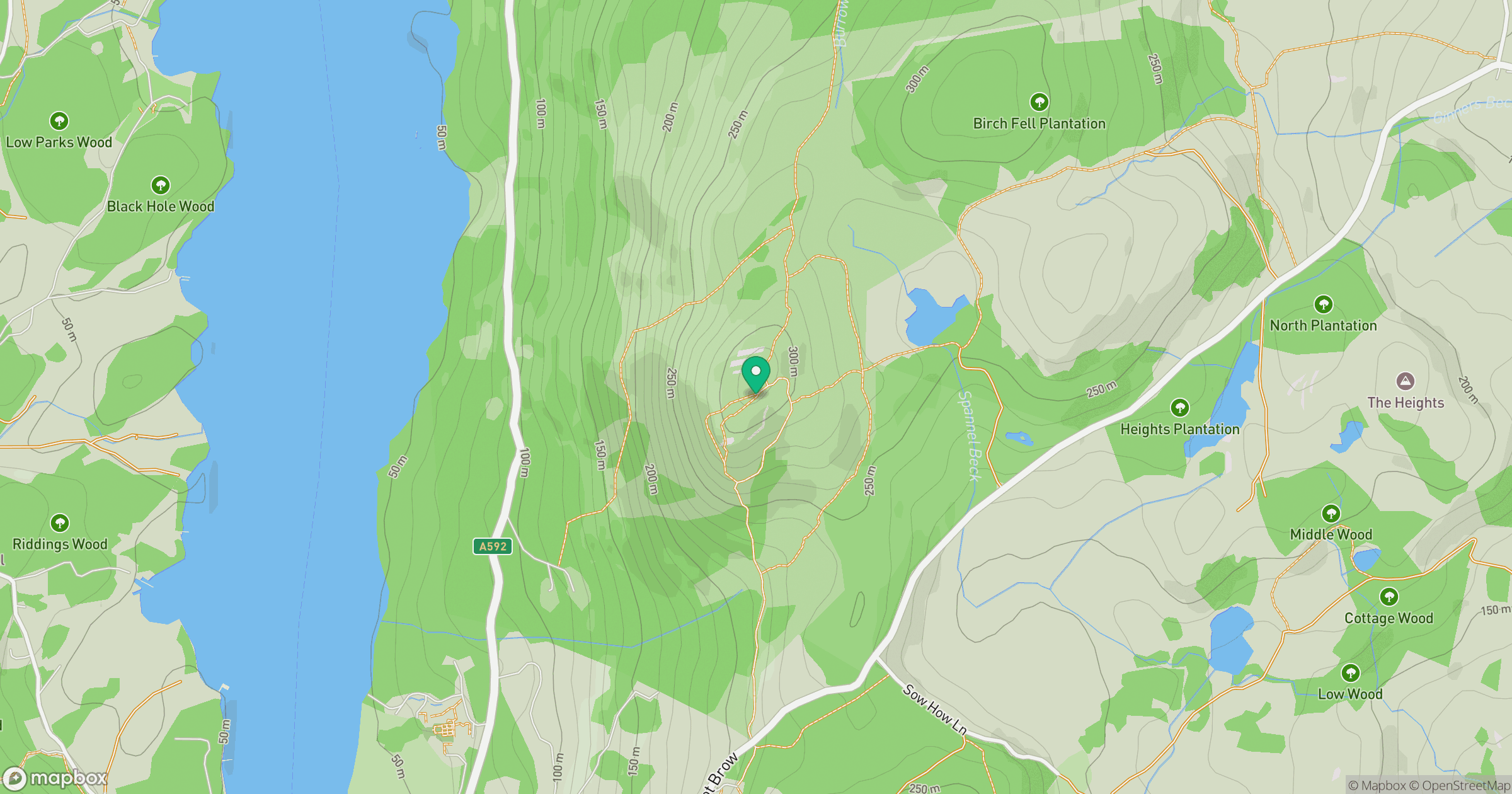
Grid reference: SD390884
View on OpenStreetMapOpens a map in a new tab, centred on the hill.
Hills within 30 km
Straight-line distance, not a walking route or confirmation of access.
Loughrigg Fell
335m
Red Screes
779m
Wetherlam
763m

The Old Man of Coniston [Coniston Old Man]
802m
Dow Crag
778m
No comments yet. Be the first.