

Dow Crag
Good walks are even better shared.
SD2697 : Dow Crag and Goats Water
Graham Robson Photo source
Overview
Dow Crag
Introduction
Nestled in the stunning Lake District, Dow Crag is a prominent peak that attracts hikers and climbers from all walks of life. Standing at 802 meters, it offers both challenge and reward, with breathtaking views from its rocky summit.
Geology
Dow Crag is a marvel of volcanic geology, formed primarily from dramatic andesitic lavas. This geological history contributes to its rugged charm, making it a hotspot for both nature lovers and geological enthusiasts.
Routes
Coniston via Goat's Water
This moderate route starts from Coniston and meanders past the picturesque Goat's Water. It’s a favourite for those wishing to enjoy the natural beauty of the area with a good stretch of the legs.
Dow Crag from Walna Scar Road
More adventurous hikers may prefer this challenging ascend from Walna Scar Road. While it may put your fitness to the test, the sense of achievement at the summit will make it all worthwhile.
Summit Features
Upon reaching the summit, hikers are greeted by a rocky outcrop and a small cairn—a perfect backdrop for that obligatory “I made it!” picture.
Terrain
Expect a mix of rocky paths and scree, especially on steeper inclines. Proper footwear is essential, as things can become slippery when wet.
Views
From the top, you can feast your eyes on the shimmering Coniston Water, other majestic peaks in the region, and possibly even the Isle of Man on clear days. The views are simply stunning, showcasing the best of the Lake District!
Best Seasons
The clear skies of early summer and autumn provide the best opportunities for stunning panoramas, so plan your trip accordingly.
Hazards
While the views are breathtaking, be cautious of loose rocks and changing weather conditions. Always check the forecast before heading out!
Nearby Summits
Don’t forget to extend your adventure by considering a visit to nearby peaks like the Old Man of Coniston or Brim Fell. They’re equally beautiful and add variety to your hiking experience.
Access
Parking at Walna Scar Road makes access relatively convenient, with Coniston just a hop and skip away for food and refreshments.
Facilities
After tackling Dow Crag, unwind in one of Coniston's cafes or pubs—because, let’s face it, nothing beats a hearty meal after a long hike!
Conclusion
So grab your hiking boots, pack your sense of adventure, and set out to conquer Dow Crag. Whether you’re scaling its heights for the solitude or the views, this mountain surely won’t disappoint!
Explore routes near Dow Crag
Walks starting near this hill. Open a route to check its map, distance and full itinerary.
Great Carrs Halifax Wreckage from Wrynose Pass
View route
Coniston to Tarn Hows: Monk Coniston Gardens and Woodland Circuit
View route
Tarn Hows Fast Route
View route
Bow Fell from Langdale
View route
Route planning notes
These notes describe possible approaches. Check a route's map and access information when planning your walk.
Coniston Circular via Dow Crag and Old Man of Coniston
This classic circular route starts from Walna Scar Road car park (grid ref SD288970). Follow the Walna Scar Road westward before ascending to Brown Pike. From here, continue along the ridge to Buck Pike and finally reach Dow Crag. Descend briefly to Goat's Hawse before climbing to the summit of the Old Man of Coniston. Return via the well-trodden path leading back to Walna Scar Road.
Dow Crag via Goat's Water
Begin at Walna Scar Road car park (grid ref SD288970) and follow the path south-westward to reach Goat's Water. From the tarn, ascend the steep path leading directly to the summit of Dow Crag. Retrace your steps back or extend the walk to include Buck Pike and Brown Pike before returning via the same route.
Dow Crag from Torver
Starting in the village of Torver (grid ref SD289947), follow the track leading to Walna Scar Road. Head west to Goat's Water and ascend to Dow Crag. Optionally, extend the route to include the Old Man of Coniston. Return via the same path or take a lower route skirting Torver Beck.
Dow Crag and Seathwaite Tarn Circular
Park at the Walna Scar Road car park (grid ref SD288970) and follow the path leading south-west to the ridge of Dow Crag. After summiting, descend southwards to Seathwaite Tarn. Follow the track around the tarn and return via Walna Scar Road.
Dow Crag Scramble via South Rake
For the adventurous walker, start at Walna Scar Road car park (grid ref SD288970) and head to Goat's Water. From here, tackle the South Rake scramble route leading to the summit of Dow Crag. This route requires good scrambling skills and a head for heights. Descend northwards to Goat's Hawse and return via Walna Scar Road.
Make a day of it, together
Find someone to share the walk with, or organise a day out along a route you like.
Photo Gallery
View all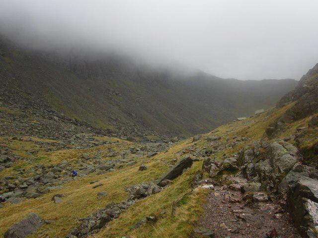 Photo could not load
SD2697 : Dow Crag and Goats Water
Graham Robson
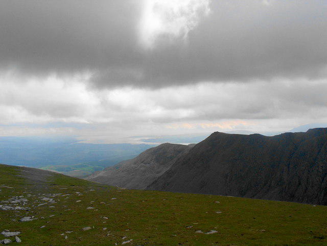 Photo could not load
SD2697 : Dow Crag from Brim Fell
Bill Boaden
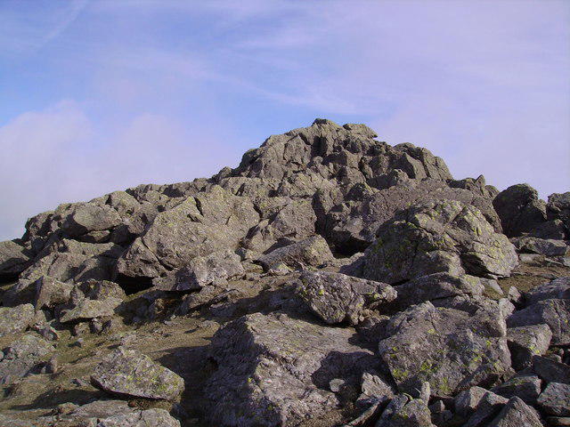 Photo could not load
SD2697 : Dow Crag Summit
Michael Graham
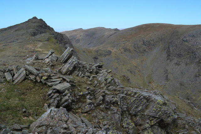 Photo could not load
SD2697 : Dow Crag from Buck Pike
David Martin
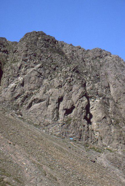 Photo could not load
SD2697 : Dow Crag
Richard Webb
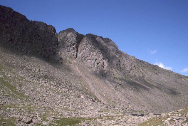 Photo could not load
SD2697 : Dow Crag
Richard Webb
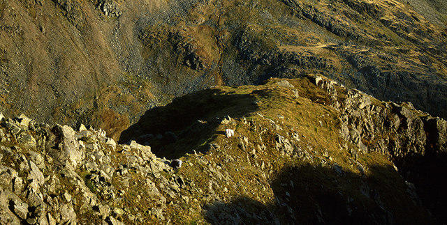 Photo could not load
SD2697 : Spur east face Dow Crag
Tom Richardson
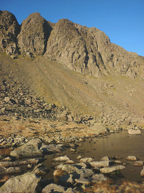 Photo could not load
SD2697 : Dow Crag and Goat's Water
Karl and Ali
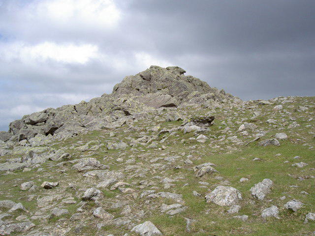 Photo could not load
SD2697 : The summit of Dow Crag
Ian Greig
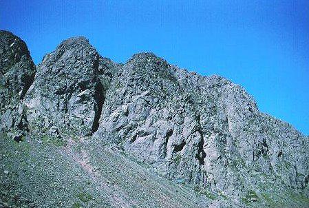
SD2697 : Dow Crag
Richard Webb
Hill facts and local notes
Classifications
Elevation
778m
2,552 ft
Prominence
129m
Coordinates
54.3703, -3.1367
SD262977
OS Map
96 97
Explorer: OL6N
At the Summit
The summit of Dow Crag features a prominent rocky outcrop and a small cairn, providing the perfect spot to catch your breath and enjoy the views. Don't forget to take a selfie at the top—no summit is complete without one!
Terrain & Geology
Dow Crag is primarily composed of volcanic rock, specifically formed from andesitic lavas. These rocks give Dow Crag its rugged appearance and provide a rich habitat for various plant species, showcasing the geological history of the Lake District.
Views & Scenery
From the summit, you can see the stunning vistas of Coniston Water, the surrounding peaks of the Lake District including the Old Man of Coniston, and on a clear day, even as far as the Isle of Man!
History & Heritage
Name Origin
The name 'Dow' is derived from the Old Norse term for 'hill', while 'Crag' refers to rocky outcrops, aptly describing this striking feature.
Historical Significance
Dow Crag holds a place in the heart of local climbing and hiking culture, often featured in guides and beloved by both novice and experienced walkers alike.
Getting There & Facilities
Parking
Parking is available at the end of Walna Scar Road, approximately 2 km from the village of Coniston.
Public Transport
Regular buses run from Ambleside to Coniston. Check the local timetable for the most up-to-date information.
Nearby Facilities
The village of Coniston offers several cafes, pubs, and shops where you can stock up on supplies or enjoy a well-deserved meal post-hike. Toilets are also available at the visitor centre.
Safety Information
Known Hazards
- Loose rocks and scree on the ascent can be a tripping hazard; always watch your step!
- Weather can change rapidly in the Lake District, so be prepared for rain or wind, even on sunny days.
General Safety Tips
- Check weather conditions before setting out
- Carry appropriate clothing and equipment
- Let someone know your planned route
- Take a map, compass, and GPS device
- Carry emergency supplies: food, water, first aid kit, torch
Hills
Some common questions about the hills answered
Are there group walks up Dow Crag?
Many walkers use Walkmates to join or organise walks with others. You can check for group walks around Dow Crag through the maps
Are there other walkers around Dow Crag?
Activity varies by location and time, but Walkmates lets you see whether others have shared walks or shown interest in this area. Find other people through the walking friends search walking friends for Dow Crag search or of course create your own walk for Dow Crag
Can I organise a walk to Dow Crag?
Yes. If there aren’t any walks listed already, you can create a walk and make it available for others to join.
If you're signed up to Walkmates, you can create a walk to Dow Crag.
How do I find a walk up this hill?
There are often multiple ways to walk this hill, depending on experience and route preference. Walkmates helps you explore walks and routes that others have shared.
Can I suggest a new route up Dow Crag?
Yes. You can suggest or create routes to share with others. Walkmates focuses on the social side of walking, so routes are used to help people organise walks and explore areas together, rather than as detailed navigation tools or route libraries.
Other uses really appreciate knowledgeable walkers sharing their routes. Share your favourite route to Dow Crag here
The is an error or something incorrect about this hill. How do I let you know?
We always strive to keep the information on Walkmates as accurate as possible. If you find an error, please let us know through the contact form and we'll aim to correct it as quickly as possible
Community Discussion
Comments
Location
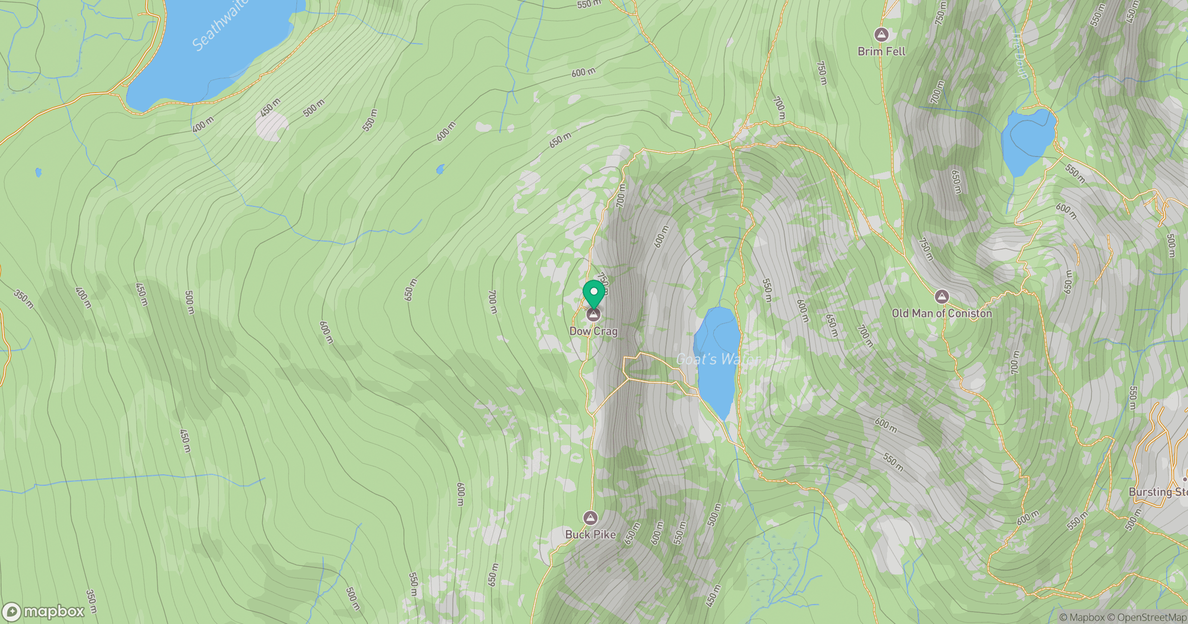
Grid reference: SD262977
View on OpenStreetMapOpens a map in a new tab, centred on the hill.
Nearby Hills
![The Old Man of Coniston [Coniston Old Man]](https://cdn.walkmates.com/gallery-images/0c140e91269b49abbee339fc41828d25.jpg)
The Old Man of Coniston [Coniston Old Man]
802m
Wetherlam
763m
Pike of Blisco
703m
Hard Knott
550m
Crinkle Crags - Long Top [Second Crinkle]
859m
No comments yet. Be the first.