

Glendhu Hill
Good walks are even better shared.
Overview
Glendhu Hill: A Hiker's Delight
Nestled in the breathtaking Lake District, Glendhu Hill stands as a testament to the rugged beauty of the region. With an elevation of 446 meters, it's classified as a Marilyn, making it a worthy challenge for outdoor enthusiasts looking to bag another peak.
Geology
Glendhu Hill’s formation is primarily volcanic, boasting basalt rock formed during ancient volcanic activity. This geology offers a rich tapestry of textures and colours, making every step an adventure.
Routes
The Glendhu Hill Circular Walk is the most popular route to the summit. Spanning 8.5 km, it usually takes about 3.5 hours to complete, offering a moderate challenge that’s perfect for families and seasoned hikers alike. The route winds through lush pastures before tackling the rocky ascent to the summit.
Summit Features
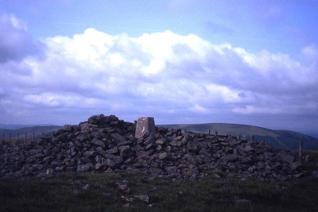
Upon reaching the top, you're greeted by a humble stone cairn, a perfect backdrop for selfies and an opportunity to reflect on the journey you've just undertaken. Who doesn’t love a good summit snack? Don’t forget to bring a picnic!
Terrain
The terrain can be quite varied, as one would expect in the Lake District. Expect grassy slopes, rocky outcrops, and the occasional bog. Consider yourself warned: if it rains, those boggy patches can become more like mini-swamps!
Views
From the summit, you'll be rewarded with stunning panoramic views. Coniston Water glimmers below, framed by the majestic backdrop of surrounding hills, and on a clear day, the peaks of the Langdale Pikes stand proud in the distance. Spring and early summer are ideal for vistas that will leave your camera working overtime.
Hazards
While glorious, nature can be unpredictable. Sudden weather changes can occur, so keep an eye on the forecast and don’t forget your kit! The trail can be slick and muddy, especially after a downpour, so hiking boots are a must.
Nearby Summits
If you fancy a little more adventure, you can easily extend your hike to nearby peaks like Caw (651 m) and The Old Man of Coniston (803 m). Just don’t forget to take the map – those hills can be cheeky!
Access
The nearest parking is a limited layby situated by High Nibthwaite village. Public transport is available with bus services from Coniston. After your hike, the vibrant town of Coniston awaits, filled with cafes, pubs, and the infamous slice of homemade cake.
Facilities
Coniston not only serves as the base for adventurers but also boasts facilities for comfort, including cafes and public toilets. It’s the perfect spot to relax and recover post-hike!
History
The name Glendhu, deriving from Gaelic, means 'Glen of the Dark Water', an apt tribute to the nearby glen. The hill holds historical significance as a beloved local hill, often walked by enthusiasts who seek out the beauty this region always has in store.
So lace up those boots, grab your pack, and make your way to Glendhu Hill. Adventure awaits, and who knows what tales you'll have for the campfire later!
Explore routes near Glendhu Hill
Public walks starting within 80 km of this hill. Nearby does not mean a route reaches the summit; check its map and access before setting out.
Newcastleton Forest Priest Hill Viewpoint Trail
View route
Kielder Forest - 50 Rocks of Northumberland inspired
View route
Lewisburn Inlet from Matthew’s Linn
View route
Kielder Skyspace and Observatory Forest Walk
View route
Route planning notes
These notes describe possible approaches, not verified navigable routes or permission to cross land. Check current paths, local access rules and conditions before setting out.
Glendhu Hill Circular Walk
A scenic circular walk starting from the nearby village of High Nibthwaite, taking you through lush green pastures and rocky inclines up to the summit.
Make a day of it, together
Find someone to share the walk with, or organise a day out along a route you like.
Photo Gallery
View all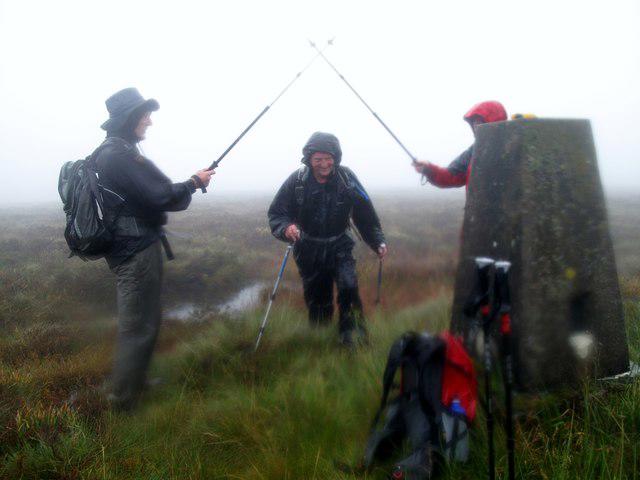 Photo could not load
NY5686 : Glendhu Hill Trig
Rude Health
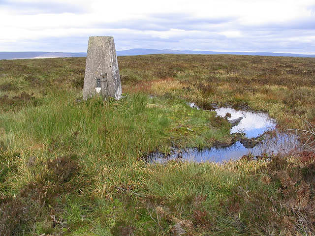 Photo could not load
NY5686 : The trig point on Glendhu Hill
Walter Baxter
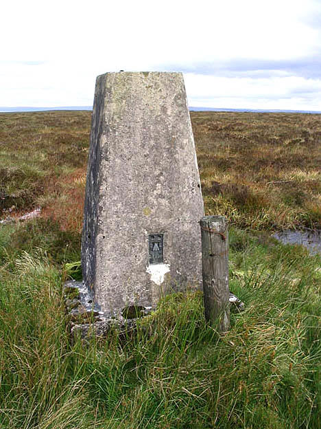 Photo could not load
NY5686 : Glendhu Hill trig point
Walter Baxter
Hill facts and local notes
Classifications
Elevation
514m
1,686 ft
Prominence
116m
Coordinates
55.1698, -2.6791
NY568863
OS Map
80
Explorer: OL42W 324
At the Summit
The summit of Glendhu Hill features a simple stone cairn, offering a great spot for a photo op. On a clear day, you may even spot your next adventure from up there!
Terrain & Geology
Glendhu Hill is primarily composed of volcanic rock, specifically basalt, which contributes to its rugged terrain. The hill's geological history dates back to the volcanic activity that formed the Lake District millions of years ago.
Views & Scenery
From the summit, enjoy panoramic views of Coniston Water, the surrounding hills, and, if you're lucky, a glimpse of the distant peaks of the Langdale Pikes.
History & Heritage
Name Origin
The name Glendhu derives from Gaelic origins, meaning 'Glen of the Dark Water', which refers to the nearby glen filled with dark water from the fells.
Historical Significance
Locally, Glendhu Hill is cherished for its stunning views and is often frequented by walkers, contributing to the area's rich outdoor heritage.
Getting There & Facilities
Check current local access restrictions, parking rules and transport timetables before travelling. These notes do not confirm public access to the summit.
Parking
There is a small layby near High Nibthwaite village where hikers can park. However, spaces are limited, so arrive early during peak seasons!
Public Transport
Buses run from Coniston to the nearby villages, with the nearest stop at High Nibthwaite.
Nearby Facilities
Coniston offers several cafes, pubs, and public toilets. Don’t forget to treat yourself to a slice of cake post-hike!
Safety Information
Known Hazards
- Be mindful of sudden weather changes typical in the Lake District. Wet and muddy paths can be slippery, especially on the descent.
General Safety Tips
- Check weather conditions before setting out
- Carry appropriate clothing and equipment
- Let someone know your planned route
- Take a map, compass, and GPS device
- Carry emergency supplies: food, water, first aid kit, torch
Hills
Some common questions about the hills answered
Are there group walks up Glendhu Hill?
Many walkers use Walkmates to join or organise walks with others. You can check for group walks around Glendhu Hill through the maps
Are there other walkers around Glendhu Hill?
Activity varies by location and time, but Walkmates lets you see whether others have shared walks or shown interest in this area. Find other people through the walking friends search walking friends for Glendhu Hill search or of course create your own walk for Glendhu Hill
Can I organise a walk to Glendhu Hill?
Yes. If there aren’t any walks listed already, you can create a walk and make it available for others to join.
If you're signed up to Walkmates, you can create a walk to Glendhu Hill.
How do I find a walk up this hill?
There are often multiple ways to walk this hill, depending on experience and route preference. Walkmates helps you explore walks and routes that others have shared.
Can I suggest a new route up Glendhu Hill?
Yes. You can suggest or create routes to share with others. Walkmates focuses on the social side of walking, so routes are used to help people organise walks and explore areas together, rather than as detailed navigation tools or route libraries.
Other uses really appreciate knowledgeable walkers sharing their routes. Share your favourite route to Glendhu Hill here
The is an error or something incorrect about this hill. How do I let you know?
We always strive to keep the information on Walkmates as accurate as possible. If you find an error, please let us know through the contact form and we'll aim to correct it as quickly as possible
Community Discussion
Comments
Location
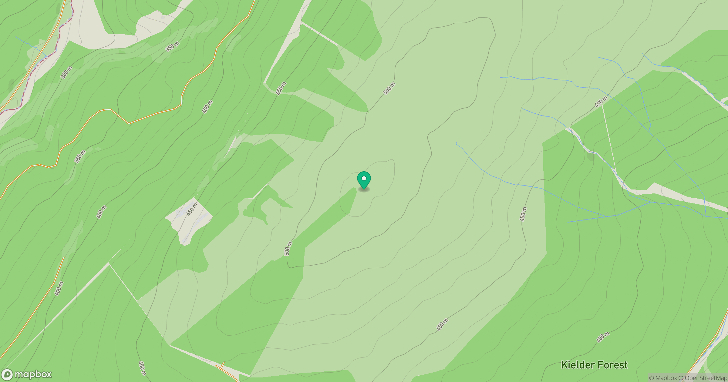
Grid reference: NY568863
View on OpenStreetMapOpens a map in a new tab, centred on the hill.
Hills within 30 km
Straight-line distance, not a walking route or confirmation of access.

No comments yet. Be the first.