

Foel Dinas
Good walks are even better shared.
Overview
Foel Dinas: An Overview
Foel Dinas is one of those hidden gems nestled within the magnificent Snowdonia National Park. Standing proudly at 370 meters, it offers not only a solid leg workout but also some of the most rewarding views without the crowds that flock to its taller cousins.
Geology
Composed primarily of volcanic rock, the mountain showcases its ancient origins that date back to the Ordovician period. The geology of Foel Dinas reveals the tumultuous history of volcanic activity and helps inform visitors about the planet's geological processes. Perfect for those with an interest in the natural sciences! And who said geology can’t be cool?
Routes
There are multiple routes to reach the summit, suiting different skill levels.
- Foel Dinas from Cwm Penamnen is an easy climb for families and those wanting a more leisurely hike.
- The North Ridge offers a moderate route, perfect for those wanting a bit of a workout without turning it into a marathon.
Terrain and Summit Features
The terrain ranges from lush grassy patches to the rocky outcrops that demand a bit of agility. The summit features a rather charming cairn which is ideal for a quick photo. Add to that the trig point, and you'll have a variety of options for striking poses with your hiking companions.
Views
From the summit, prepare your camera for some fantastic views! Snowdonia's peaks rise majestically, and on particularly clear days, you can even catch a glimpse of the shimmering sea far off in the distance. Spring and autumn are perfect for enjoying these panoramas, especially during sunrise or sunset when nature shows off its artistic flair.
Hazards
While Foel Dinas is accessible for many, don’t let your guard down—be mindful of loose rocks and keep an eye on the ever-changing weather. Conditions can turn from sunny to stormy quicker than you can say 'raincoat.'
Access and Facilities
Access is straightforward with a small car park at the trailhead in Cwm Penamnen, though it's best to arrive early on busy weekends to secure a spot. If you're relying on public transport, Betws-y-Coed is the nearest station, serving as your launch pad to explore. Treat yourself to a pint at the nearby pub in Rhyd Ddu after your hike; you’ve earned it!
History
Historically, Foel Dinas served as a lookout point and fortification during the Iron Age. The name itself, translating to 'Hill of the Fort,' speaks volumes about its significance.
In conclusion, whether you’re a dedicated hiker or just dipping your toe into the outdoors, Foel Dinas will leave you with a smile and a sense of accomplishment.
Enjoy the journey and take in the sights, but don't forget to bring a friend—or at least a good sandwich!
Explore routes near Foel Dinas
Public walks starting within 80 km of this hill. Nearby does not mean a route reaches the summit; check its map and access before setting out.
Waun-oer, Maesglase and Cribin Fawr guided mountain walk
View route
Mawddach Trail: Dolgellau to Barmouth
View route
Cadair Idris - Pony Path
View route
Mawddach Trail: Penmaenpool to Arthog Estuary Return
View route
Route planning notes
These notes describe possible approaches, not verified navigable routes or permission to cross land. Check current paths, local access rules and conditions before setting out.
Foel Dinas from Cwm Penamnen
A gentle ascent from the scenic Cwm Penamnen, this route offers a pleasant walk through picturesque woodlands before approaching the summit. It’s ideal for families and beginners.
The North Ridge
For those seeking a bit more adventure, the North Ridge route provides a moderate challenge with stunning views as you ascend the rocky terrain.
Make a day of it, together
Find someone to share the walk with, or organise a day out along a route you like.
Photo Gallery
View all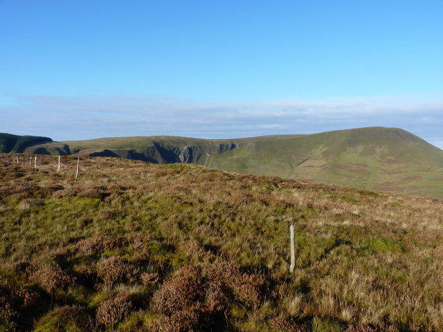 Photo could not load
SH8414 : Old fenceposts on the summit of Foel Dinas
Richard Law
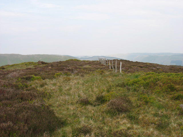 Photo could not load
SH8414 : The summit of Foel Dinas
David Purchase
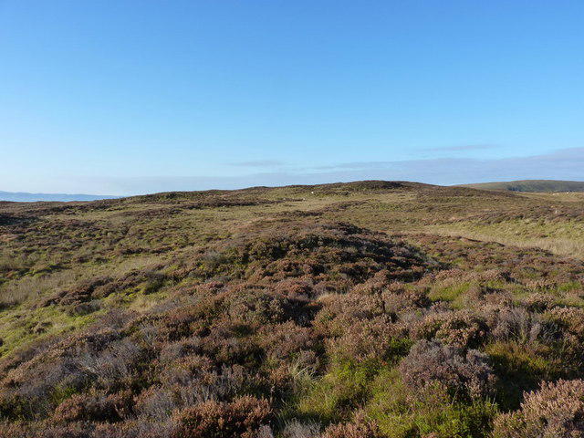 Photo could not load
SH8414 : The summit 'ridge' of Foel Dinas
Richard Law
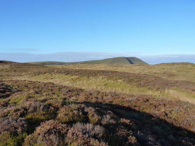 Photo could not load
SH8414 : View WNW from Foel Dinas
Richard Law
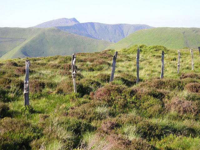 Photo could not load
SH8414 : Old fence line, Foel Dinas
Chris Andrews
Hill facts and local notes
Classifications
Elevation
478m
1,568 ft
Prominence
135m
Coordinates
52.7141, -3.7149
SH842143
OS Map
124 125
Explorer: OL23E
At the Summit
The summit features a distinctive cairn, offering a perfect spot for a well-deserved breather and a photo op. On a clear day, the trig point can serve as a rather impressive backdrop.
Terrain & Geology
Foel Dinas is primarily composed of volcanic rock, with its origins dating back to the Ordovician period. The mountain showcases rugged cliffs and ancient formations that tell a tale of geological upheaval and volcanic activity.
Views & Scenery
From the summit, hikers can revel in views of the Snowdonia peaks, the serene Llyn Cwellyn, and even a glimpse of the rugged coastline on the horizon.
History & Heritage
Name Origin
The name Foel Dinas translates to 'Hill of the Fort,' indicative of its historical significance as a defensive site.
Historical Significance
Foel Dinas has been a viewpoint for centuries, with archaeological remains hinting at its use during Iron Age. Its historical fortifications suggest a rich tapestry of human activity across the ages.
Getting There & Facilities
Check current local access restrictions, parking rules and transport timetables before travelling. These notes do not confirm public access to the summit.
Parking
There is a small parking area at the Cwm Penamnen trailhead. Parking is free but can fill up quickly during weekends and holidays.
Public Transport
The nearest train station is in Betws-y-Coed, from where local buses connect to Cwm Penamnen.
Nearby Facilities
Nearby, you can find a traditional pub in Rhyd Ddu offering meals and local ales, as well as public toilets at the base of some trails.
Safety Information
Known Hazards
- Watch out for loose rocks and sudden changes in weather conditions which can occur quickly in the mountains.
General Safety Tips
- Check weather conditions before setting out
- Carry appropriate clothing and equipment
- Let someone know your planned route
- Take a map, compass, and GPS device
- Carry emergency supplies: food, water, first aid kit, torch
Hills
Some common questions about the hills answered
Are there group walks up Foel Dinas?
Many walkers use Walkmates to join or organise walks with others. You can check for group walks around Foel Dinas through the maps
Are there other walkers around Foel Dinas?
Activity varies by location and time, but Walkmates lets you see whether others have shared walks or shown interest in this area. Find other people through the walking friends search walking friends for Foel Dinas search or of course create your own walk for Foel Dinas
Can I organise a walk to Foel Dinas?
Yes. If there aren’t any walks listed already, you can create a walk and make it available for others to join.
If you're signed up to Walkmates, you can create a walk to Foel Dinas.
How do I find a walk up this hill?
There are often multiple ways to walk this hill, depending on experience and route preference. Walkmates helps you explore walks and routes that others have shared.
Can I suggest a new route up Foel Dinas?
Yes. You can suggest or create routes to share with others. Walkmates focuses on the social side of walking, so routes are used to help people organise walks and explore areas together, rather than as detailed navigation tools or route libraries.
Other uses really appreciate knowledgeable walkers sharing their routes. Share your favourite route to Foel Dinas here
The is an error or something incorrect about this hill. How do I let you know?
We always strive to keep the information on Walkmates as accurate as possible. If you find an error, please let us know through the contact form and we'll aim to correct it as quickly as possible
Community Discussion
Comments
Location
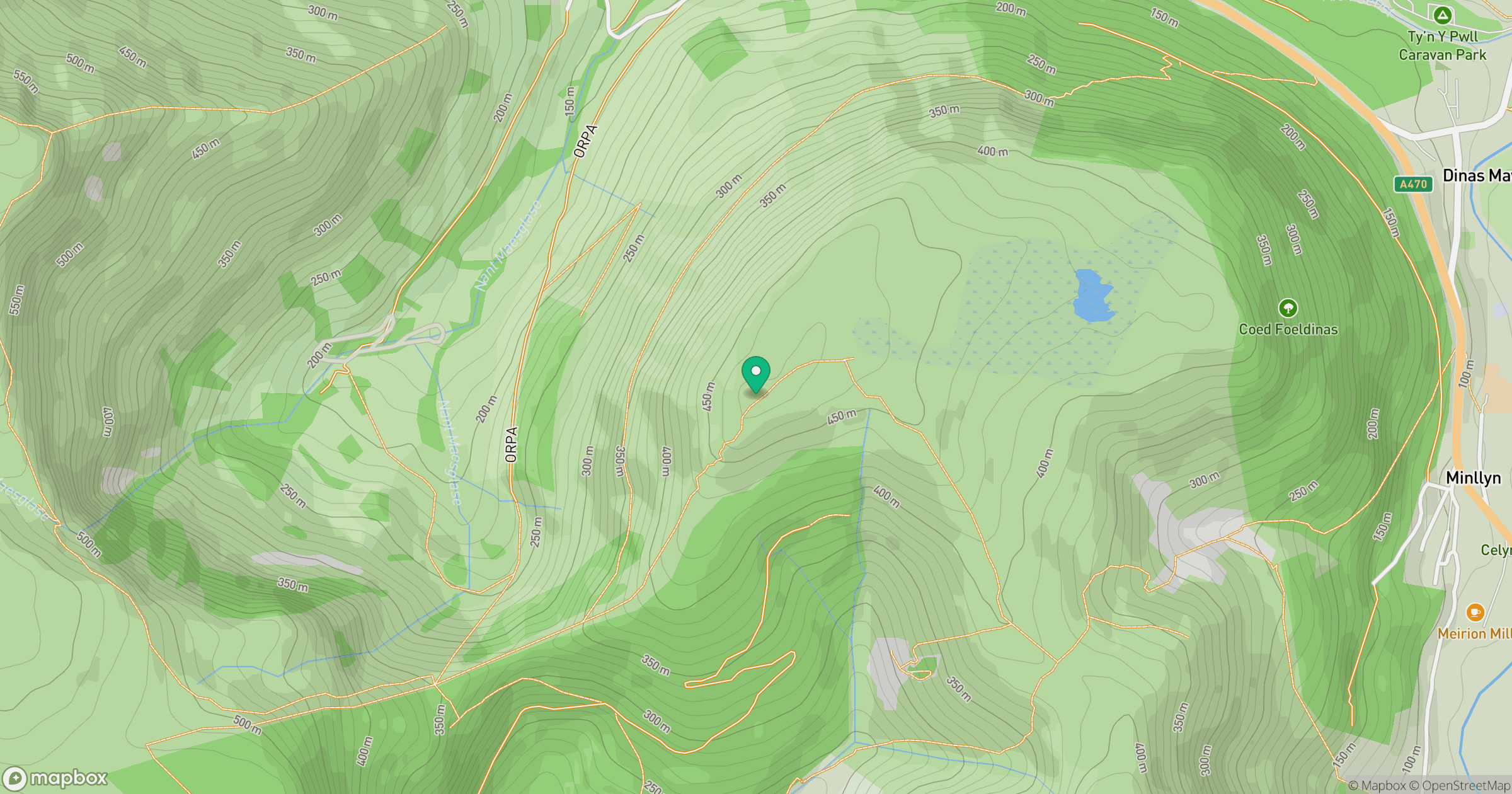
Grid reference: SH842143
View on OpenStreetMapOpens a map in a new tab, centred on the hill.
Hills within 30 km
Straight-line distance, not a walking route or confirmation of access.
Aran Fawddwy
906m
Cadair Idris - Penygadair
893m
Arenig Fawr
854m
Y Garn
629m
Pumlumon Fawr [Plynlimon]
753m
No comments yet. Be the first.