

Foel y Geifr
Good walks are even better shared.
Overview
Foel y Geifr
Rising gracefully to an elevation of 542 meters, Foel y Geifr is a splendid Marilyn nestled in the heart of Snowdonia National Park. Known for its beautiful landscapes and captivating views, it is a beloved destination for both novice and seasoned hikers alike.
Geology
Foel y Geifr primarily features layers of mudstone and sandstone, creating a tapestry of rugged hills and valleys. The geological formations speak volumes about the region's ancient marine past, and here's a fun fact: if you're ever lost, just follow the rocks—you're bound to find your way back with some patience!
Routes
The most popular route is a round trip from Dolwyddelan, which winds through picturesque scenery, taking about 3 hours to complete. Spanning approximately 8.5 km, this moderate trek offers both challenge and reward as you make your way to the summit.
Summit Features
At the top, you'll find a traditional stone cairn, a perfect spot for that well-deserved selfie with the panoramic backdrop of mountains. The 360-degree vistas are worth every step, as they grant views of the iconic peaks of Snowdon and Moel Siabod.
Terrain
Expect primarily grassy paths with sporadic rocky patches, so it’s a good idea to skip the heels! Keep an eye out for those sneaky bogs that seem to be prime real estate for every adventurous hiker’s boot.
Views
Highlighting the beauty of this area, the views integrate valley and peak, making it a photographer’s delight. The splendid valleys, lush greens, and striking mountains create a dramatic landscape that’s breathtaking year-round. Spring provides blossoming flora, while autumn blankets the hills in fiery hues.
Hazards
As is often the case in Snowdonia, the weather can be unpredictable. Pack appropriately and keep an eye out for slippery paths, especially following a good rain. And remember, the only wildlife you want to encounter is the cute kind, not the creepy crawly type!
Nearby Summits
For those keen to tackle more heights, nearby summits include Moel Siabod and Cnicht, both offering their unique challenges and spectacular views.
Access
The nearest parking can be found in Dolwyddelan village. After parking, it’s just a short walk to the trailhead. If you prefer public transport, the village is well-connected by the railway, making it an easy getaway for city dwellers.
Facilities
Post-hike, there are local cafes to refuel with a hearty meal or just grab a quick tea to relive your adventure.
History
The meaning of its name adds to its charm—hill of the goats—a nod to the wildlife that frolics in its greenery. It’s more than just a mountain; it’s a cornerstone of local folklore and a treasure trove of natural wonder.
In conclusion, a hike up Foel y Geifr is not merely a trek; it’s an experience wrapped in natural beauty, geological history, and the warm embrace of the Welsh landscape. So grab your boots, get out there, and enjoy the view!
Happy Hiking!
Explore routes near Foel y Geifr
Public walks starting within 80 km of this hill. Nearby does not mean a route reaches the summit; check its map and access before setting out.
Aran Benllyn and Aran Fawddwy from LLanuwchllyn
View route
Arenig Fach guided mountain walk
View route
Waun-oer, Maesglase and Cribin Fawr guided mountain walk
View route
Coed y Brenin: Pont Ty'n-y-groes and Mawddach Forest Trail
View route
Route planning notes
These notes describe possible approaches, not verified navigable routes or permission to cross land. Check current paths, local access rules and conditions before setting out.
Round Trip from Dolwyddelan
A scenic loop starting from the village of Dolwyddelan, following paths that wind through lush valleys and past charming stone walls.
Make a day of it, together
Find someone to share the walk with, or organise a day out along a route you like.
Photo Gallery
View all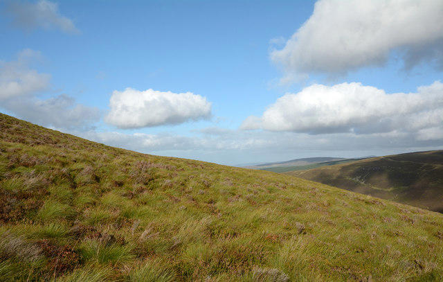 Photo could not load
SH9327 : Upper eastern slope of Foel y Geifr
Trevor Littlewood
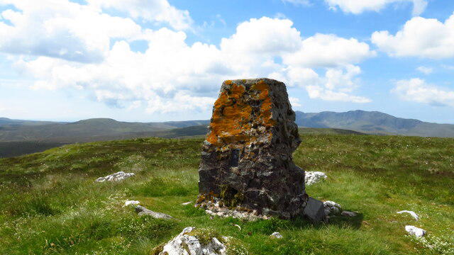 Photo could not load
SH9327 : Trig Point on Foel y Geifr
Colin Park
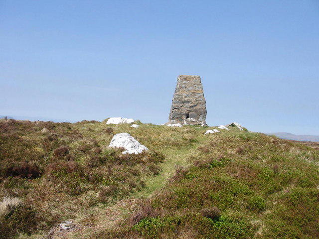 Photo could not load
SH9327 : Foel y Geifr summit
Dewi
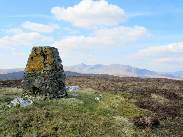 Photo could not load
SH9327 : Trig point on Foel y Geifr 2054' / 626m
John H Darch
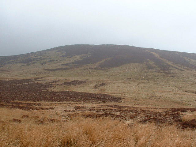 Photo could not load
SH9327 : Foel y Geifr
Bill Rowley
Hill facts and local notes
Classifications
Elevation
626m
2,054 ft
Prominence
111m
Coordinates
52.8347, -3.5793
SH937275
OS Map
125
Explorer: OL23E
At the Summit
The summit boasts a modest stone cairn and offers stunning 360-degree views over the surrounding mountains and valleys, making it a favourite amongst local walkers.
Terrain & Geology
Foel y Geifr is primarily composed of layers of mudstone and sandstone, forming the rugged and dramatic landscape typical of the Snowdonia region. The geological features around the summit reveal a rich history of ancient marine deposits.
Views & Scenery
From the summit, hikers can enjoy views of the peaks of Snowdon, Moel Siabod, and the dramatic landscape of the Lledr Valley. On a clear day, the shimmering waters of Llyn Elsi can be seen glistening below.
History & Heritage
Name Origin
The name translates from Welsh as 'hill of the goats', possibly a nod to the local wildlife or the profusion of wildlife in the area.
Historical Significance
Foel y Geifr holds significance in local folklore and has been a point of interest for hikers and nature lovers for generations.
Getting There & Facilities
Check current local access restrictions, parking rules and transport timetables before travelling. These notes do not confirm public access to the summit.
Parking
There is a small car park in Dolwyddelan village (SH 715 450), which can accommodate a few vehicles. Arrive early to secure your spot!
Public Transport
Dolwyddelan is accessible via the Conwy Valley railway line, with the nearest station at Dolwyddelan, approximately 1.5 km from the car park.
Nearby Facilities
The village has a local shop for supplies, and there are also a couple of quaint cafes where you can grab a bite to eat post-hike.
Safety Information
Known Hazards
- Be mindful of sudden weather changes common in the region. The terrain can be rugged, with potential slippery sections, particularly after rain. Always be aware of wildlife.
General Safety Tips
- Check weather conditions before setting out
- Carry appropriate clothing and equipment
- Let someone know your planned route
- Take a map, compass, and GPS device
- Carry emergency supplies: food, water, first aid kit, torch
Hills
Some common questions about the hills answered
Are there group walks up Foel y Geifr?
Many walkers use Walkmates to join or organise walks with others. You can check for group walks around Foel y Geifr through the maps
Are there other walkers around Foel y Geifr?
Activity varies by location and time, but Walkmates lets you see whether others have shared walks or shown interest in this area. Find other people through the walking friends search walking friends for Foel y Geifr search or of course create your own walk for Foel y Geifr
Can I organise a walk to Foel y Geifr?
Yes. If there aren’t any walks listed already, you can create a walk and make it available for others to join.
If you're signed up to Walkmates, you can create a walk to Foel y Geifr.
How do I find a walk up this hill?
There are often multiple ways to walk this hill, depending on experience and route preference. Walkmates helps you explore walks and routes that others have shared.
Can I suggest a new route up Foel y Geifr?
Yes. You can suggest or create routes to share with others. Walkmates focuses on the social side of walking, so routes are used to help people organise walks and explore areas together, rather than as detailed navigation tools or route libraries.
Other uses really appreciate knowledgeable walkers sharing their routes. Share your favourite route to Foel y Geifr here
The is an error or something incorrect about this hill. How do I let you know?
We always strive to keep the information on Walkmates as accurate as possible. If you find an error, please let us know through the contact form and we'll aim to correct it as quickly as possible
Community Discussion
Comments
Location
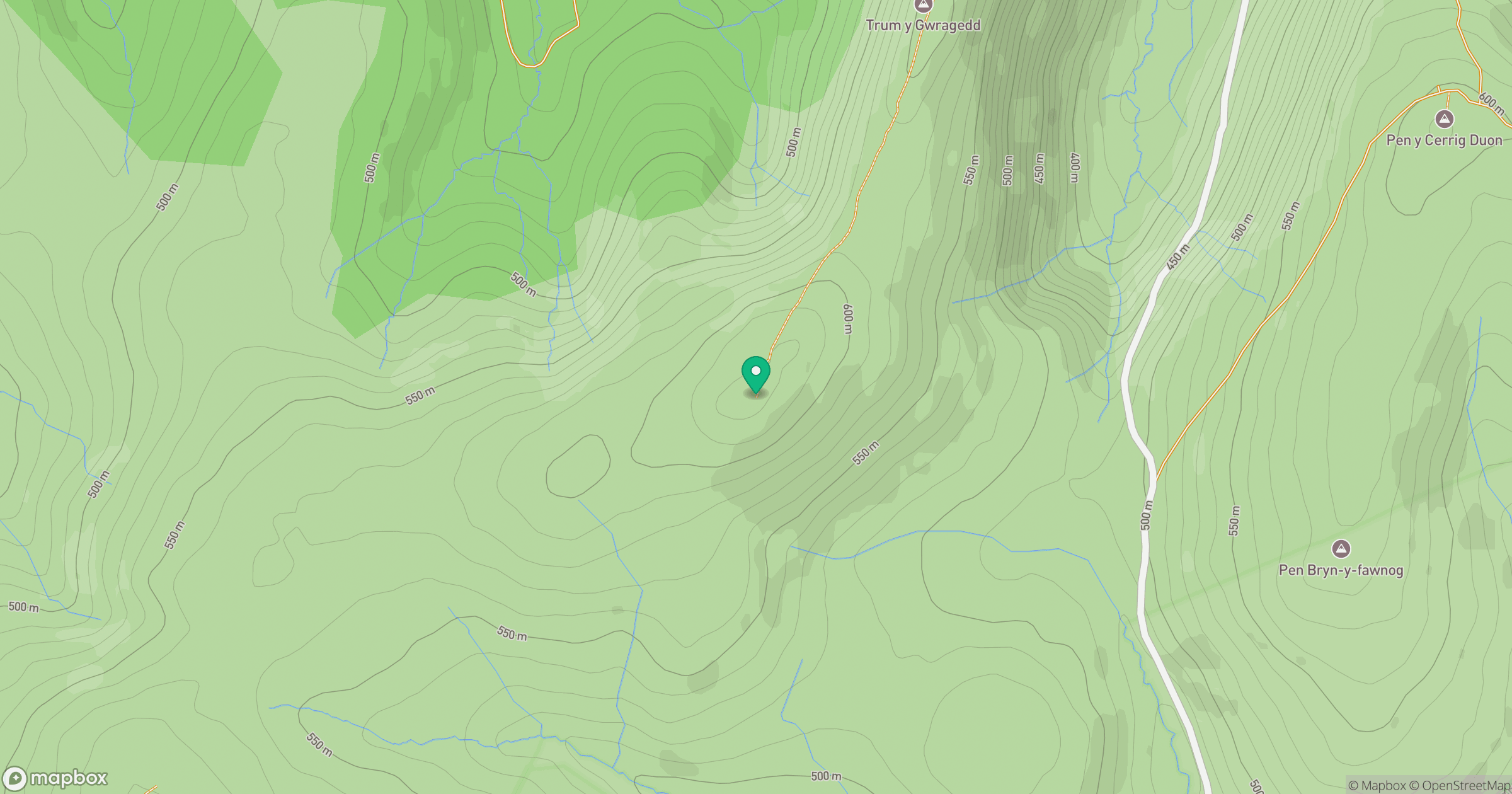
Grid reference: SH937275
View on OpenStreetMapOpens a map in a new tab, centred on the hill.
Hills within 30 km
Straight-line distance, not a walking route or confirmation of access.
No comments yet. Be the first.