

Foel Figenau
Good walks are even better shared.
SH9128 : Foel Figenau
Anton Ciritis Photo source
Overview
Foel Figenau: The Friendly Hill
Nestled in the heart of Snowdonia National Park, Foel Figenau is a pleasant Marilyn standing at 469 meters above sea level. While it might not be the tallest of peaks, it compensates with stunning views and relatively easy access, making it a gem for hikers of all abilities.
Geography and Geology
Foel Figenau is primarily made up of volcanic and sedimentary rocks, telling tales of ancient geological upheavals. The rocky outcrops provide clues into the area’s volcanic past, so keep your eyes peeled for interesting formations that would make a geologist nod in approval.
Routes of Adventure
The most popular route starts directly from the A5, near Capel Curig. The well-trodden path offers a gentle ascent, taking about 1.5 hours to reach the summit. At approximately 3.5 km round trip, it’s a breeze for most walkers. Remember, the key to enjoying your hike is pacing yourself and taking in the splendid surroundings – after all, it's not a race!
Summit Features
Upon reaching the summit, you’ll be greeted by a quaint stone cairn and a trig point. These features are perfect for photo opportunities. Trust us, nothing says 'I've conquered a peak' quite like a selfie with a cairn!
Terrain and Views
Expect a mix of grassy slopes and rocky patches, with the occasional boggy bit that may test your balance. Be sure to look around; on clear days, the sight of Snowdon and the surrounding mountains is simply breathtaking. The best seasons to experience this are late spring to early autumn.
Hazards to Keep in Mind
As picturesque as it is, be cautious. The terrain can become slick when wet, and fog can roll in without warning, obscuring your path. Always bring a map and compass, just in case your sense of direction goes on a holiday!
Nearby Summits
If you’re in the mood for more adventure, Foel Figenau’s neighbours include the majestic Moel Siabod and Foel Goch, both of which provide additional walking opportunities.
Getting There
Parking is available on the roadside along the A5. It's wise to arrive early to snag a spot, especially on weekends when fellow adventurers are also seeking thrills. Public transport options are available, with the closest bus stop located in Capel Curig.
Facilities
Before or after your trek, Capel Curig has several facilities, including a cozy café and toilets to refresh yourself.
Historical Significance
The name 'Foel Figenau' reflects the area's rich history and culture, while the landscape serves as a reminder of the people who have traversed these hills for centuries.
So, whether you're a seasoned hiker or just looking for a gentle stroll with stunning views, Foel Figenau welcomes you with open arms and the promise of adventure. Happy hiking!
Explore routes near Foel Figenau
Walks starting near this hill. Open a route to check its map, distance and full itinerary.
Aran Benllyn and Aran Fawddwy from LLanuwchllyn
View route
Arenig Fach guided mountain walk
View route
Waun-oer, Maesglase and Cribin Fawr guided mountain walk
View route
Coed y Brenin: Pont Ty'n-y-groes and Mawddach Forest Trail
View route
Route planning notes
These notes describe possible approaches. Check a route's map and access information when planning your walk.
From the A5 near Capel Curig
A straightforward ascent starting from the A5 road, with well-defined paths leading up to the summit.
Make a day of it, together
Find someone to share the walk with, or organise a day out along a route you like.
Photo Gallery
View all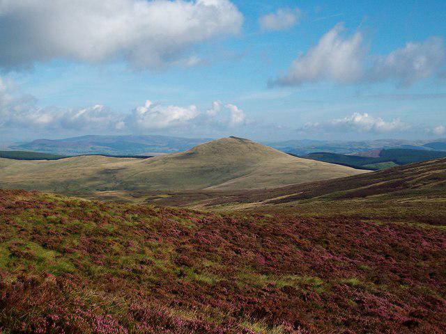 Photo could not load
SH9128 : Foel Figenau
Anton Ciritis
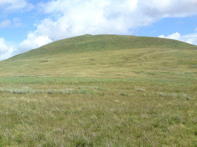 Photo could not load
SH9128 : Foel Figenau from western slopes
Martin Evans
Hill facts and local notes
Classifications
Elevation
590m
1,936 ft
Prominence
109m
Coordinates
52.8424, -3.6103
SH916284
OS Map
125
Explorer: OL23E
At the Summit
A small stone cairn marks the summit, providing a perfect spot for a celebratory selfie. A trig point is nearby for those who like their peaks accurately measured.
Terrain & Geology
Mainly composed of a mix of volcanic and sedimentary rock, providing a fascinating glimpse into the geological past of North Wales. Look for signs of ancient lava flows and sediment deposits amidst the outcrops.
Views & Scenery
On a clear day, expect stunning views of the surrounding peaks of Snowdonia, including the iconic Snowdon itself.
History & Heritage
Name Origin
The name 'Foel Figenau' translates roughly as 'hill of the Figenau', with 'foel' meaning hill in Welsh, though the origins of 'Figenau' are less clear.
Historical Significance
The area has a rich heritage, with historic paths used by drovers and a culture shaped by the rugged landscape.
Getting There & Facilities
Parking
There is limited roadside parking along the A5 near Capel Curig. Arrive early to secure a spot, especially on weekends.
Public Transport
The nearest bus stop is in Capel Curig, with services connecting to Betws-y-Coed and Llanrwst.
Nearby Facilities
There are facilities in Capel Curig, including a café and public toilets available for hikers.
Safety Information
Known Hazards
- The terrain can become slippery when wet, and foggy conditions may reduce visibility. Always carry a map and compass.
General Safety Tips
- Check weather conditions before setting out
- Carry appropriate clothing and equipment
- Let someone know your planned route
- Take a map, compass, and GPS device
- Carry emergency supplies: food, water, first aid kit, torch
Hills
Some common questions about the hills answered
Are there group walks up Foel Figenau?
Many walkers use Walkmates to join or organise walks with others. You can check for group walks around Foel Figenau through the maps
Are there other walkers around Foel Figenau?
Activity varies by location and time, but Walkmates lets you see whether others have shared walks or shown interest in this area. Find other people through the walking friends search walking friends for Foel Figenau search or of course create your own walk for Foel Figenau
Can I organise a walk to Foel Figenau?
Yes. If there aren’t any walks listed already, you can create a walk and make it available for others to join.
If you're signed up to Walkmates, you can create a walk to Foel Figenau.
How do I find a walk up this hill?
There are often multiple ways to walk this hill, depending on experience and route preference. Walkmates helps you explore walks and routes that others have shared.
Can I suggest a new route up Foel Figenau?
Yes. You can suggest or create routes to share with others. Walkmates focuses on the social side of walking, so routes are used to help people organise walks and explore areas together, rather than as detailed navigation tools or route libraries.
Other uses really appreciate knowledgeable walkers sharing their routes. Share your favourite route to Foel Figenau here
The is an error or something incorrect about this hill. How do I let you know?
We always strive to keep the information on Walkmates as accurate as possible. If you find an error, please let us know through the contact form and we'll aim to correct it as quickly as possible
Community Discussion
Comments
Location
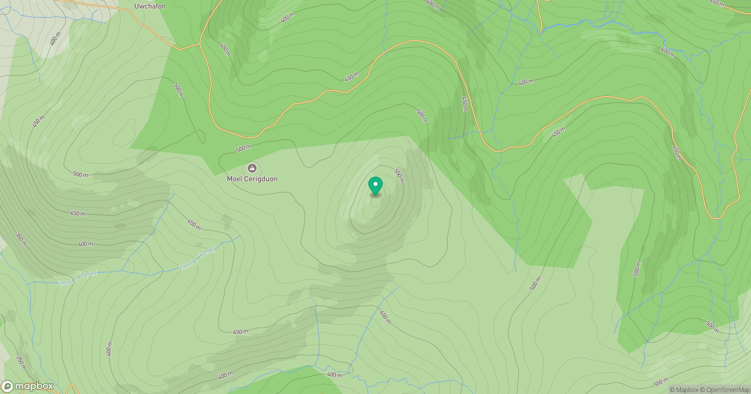
Grid reference: SH916284
View on OpenStreetMapOpens a map in a new tab, centred on the hill.
No comments yet. Be the first.