

Fidra
Good walks are even better shared.
NT5186 : Fidra from Yellow Craig beach
Mike Pennington Photo source
Overview
Fidra: A Hidden Gem of East Lothian
Nestled off the picturesque coast of East Lothian, Fidra is a small island that packs quite a punch with its natural beauty and historical significance. Rising only 43 meters above sea level, it may not be the mightiest of peaks, but don’t let its stature fool you. This charming spot is rich in geological wonders and coastal charm.
Geology
Fidra’s geology primarily consists of basalt, a volcanic rock formed during the Tertiary period. As you wander its rugged coastline, you might just feel like you're walking on the very scars of history. The area is a geologist's delight, revealing secrets of volcanic activity that shaped Scotland’s stunning landscapes. Plus, there's nothing like a bit of rock hunting for a proper weekend adventure!
Hiking Routes
One of the most popular ways to explore Fidra is via the Fidra Island Loop. This easy-going trek of about 2.5 km can be comfortably done in 1.5 hours, making it perfect for families and those looking to soak in some sea air without too much fuss. As you circumambulate the island, keep your eyes peeled for diverse birdlife and marine creatures.
Summit Features
At the summit, you'll be greeted by the iconic Fidra Lighthouse, a historic structure that has stood since 1851. This lighthouse is not just a beacon for ships; it's also a picturesque spot perfect for photos - just don't photobomb any passing puffins!
Terrain and Views
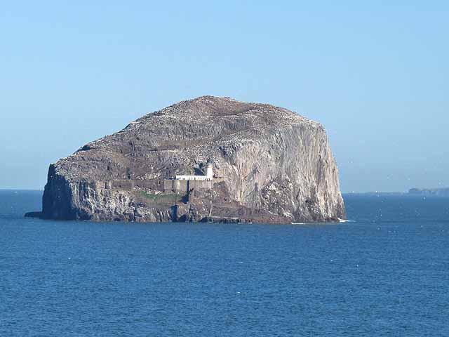
The terrain consists of rocky and grassy stretches, interspersed with sandy patches. The views from the top are nothing short of breathtaking. Look out towards the Firth of Forth and don’t miss Bass Rock, famous for its seabird colonies. For photo enthusiasts, spring and autumn are particularly stunning, offering vibrant colours and clear horizons.
Hazards
Always exercise caution while exploring Fidra. The rocky paths can be slippery, especially after rain, and the coastal cliffs demand respect. Do keep an eye on the ever-changing Scottish weather; it can go from sunshine to showers quicker than you can say 'cloudy with a chance of meatballs'.
Access
Getting to Fidra is a breeze! Park at North Berwick Harbour and hop on a boat to reach the island. If you’re coming from further afield, North Berwick is served by regular buses and trains from Edinburgh, making it easily accessible for day-trippers.
Facilities
North Berwick is a lively little town with an array of cafes, restaurants, and clean public toilets. Perfect for a pre-hike scone or a well-deserved post-hike pint!
History
The name 'Fidra' harks back to the Old Norse, translating as 'the place where one hunts for fish'. This reflects its maritime roots and significance in navigation. The continuing importance of Fidra in local culture, particularly for birdwatchers, cannot be overstated.
In conclusion, Fidra is a delightful little getaway offering a mix of natural beauty and historical intrigue. Whether you're an avid hiker or just someone looking to escape the hustle and bustle, you'll find that Fidra has more than meets the eye. So pack your sandwiches, grab your walking shoes, and head off for a day you won’t soon forget!
Lastly, remember – there’s no such thing as bad weather, just inappropriate clothing!
Explore routes near Fidra
Walks starting near this hill. Open a route to check its map, distance and full itinerary.
Cottyburn to Haddington: East Lothian Railway Walk return
View route
Dalkeith Country Park: Estate and North Woods Green Trail
View route
To Absent Friends: Holyrood Park walk
View route
Artists’ walk in Craigmillar Castle Park (group meeting)
View route
Route planning notes
These notes describe possible approaches. Check a route's map and access information when planning your walk.
Fidra Island Loop
A picturesque route around Fidra Island that showcases its stunning coastal scenery and birdlife.
Make a day of it, together
Find someone to share the walk with, or organise a day out along a route you like.
Photo Gallery
View all Photo could not load
NT5186 : Fidra from Yellow Craig beach
Mike Pennington
 Photo could not load
NT5186 : Fidra from Yellowcraig
Paul Thomson
 Photo could not load
NT5187 : North side of Fidra
Richard Webb
 Photo could not load
NT5187 : CCTV - Fidra
Richard Webb
 Photo could not load
NT5186 : Fidra from North Berwick
Mike Pennington
 Photo could not load
NT5186 : Church ruin, Fidra
Richard Webb
 Photo could not load
NT5187 : Puffin and tree mallow
Richard Webb
 Photo could not load
NT5186 : Sunset over Fidra
Richard Sutcliffe
 Photo could not load
NT5186 : Fidra
Lisa Jarvis

NT5186 : Path towards the Lighthouse, Fidra
Lisa Jarvis
Hill facts and local notes
Classifications
Elevation
33m
108 ft
Prominence
33m
Coordinates
56.0732, -2.7844
NT512869
OS Map
66
Explorer: 351W
At the Summit
The summit features a prominent lighthouse, Fidra Lighthouse, dating back to 1851. This historic structure serves as a beacon and adds to the charm of the island.
Terrain & Geology
Fidra is primarily composed of basalt, a volcanic rock. This type of rock formation dates back to the Tertiary period, offering insights into the volcanic activity of the region. The rugged coastlines and interesting rock formations make it a geological treasure trove.
Views & Scenery
From the summit, one can see the Firth of Forth, the adjacent Bass Rock, and the rolling hills of East Lothian. On a clear day, the views stretch as far as the Isle of May.
History & Heritage
Name Origin
The name 'Fidra' is derived from the Old Norse word 'Fiðr', which translates to 'the place where one hunts for fish'.
Historical Significance
Fidra has historically been associated with maritime navigation and is famed for its lighthouses. It is also known for its rich birdlife, making it a key area for ornithologists.
Getting There & Facilities
Parking
There is limited parking at North Berwick Harbour. Use this as a base to take a boat over to Fidra.
Public Transport
Regular bus services run from Edinburgh to North Berwick. The closest train station is also in North Berwick.
Nearby Facilities
In North Berwick, there are plenty of cafes, restaurants, and public toilets available for visitors before and after their adventure.
Safety Information
Known Hazards
- Watch out for slippery rocks and sudden changes in weather, especially near the coastal cliffs.
General Safety Tips
- Check weather conditions before setting out
- Carry appropriate clothing and equipment
- Let someone know your planned route
- Take a map, compass, and GPS device
- Carry emergency supplies: food, water, first aid kit, torch
Hills
Some common questions about the hills answered
Are there group walks up Fidra?
Many walkers use Walkmates to join or organise walks with others. You can check for group walks around Fidra through the maps
Are there other walkers around Fidra?
Activity varies by location and time, but Walkmates lets you see whether others have shared walks or shown interest in this area. Find other people through the walking friends search walking friends for Fidra search or of course create your own walk for Fidra
Can I organise a walk to Fidra?
Yes. If there aren’t any walks listed already, you can create a walk and make it available for others to join.
If you're signed up to Walkmates, you can create a walk to Fidra.
How do I find a walk up this hill?
There are often multiple ways to walk this hill, depending on experience and route preference. Walkmates helps you explore walks and routes that others have shared.
Can I suggest a new route up Fidra?
Yes. You can suggest or create routes to share with others. Walkmates focuses on the social side of walking, so routes are used to help people organise walks and explore areas together, rather than as detailed navigation tools or route libraries.
Other uses really appreciate knowledgeable walkers sharing their routes. Share your favourite route to Fidra here
The is an error or something incorrect about this hill. How do I let you know?
We always strive to keep the information on Walkmates as accurate as possible. If you find an error, please let us know through the contact form and we'll aim to correct it as quickly as possible
Community Discussion
Comments
Location
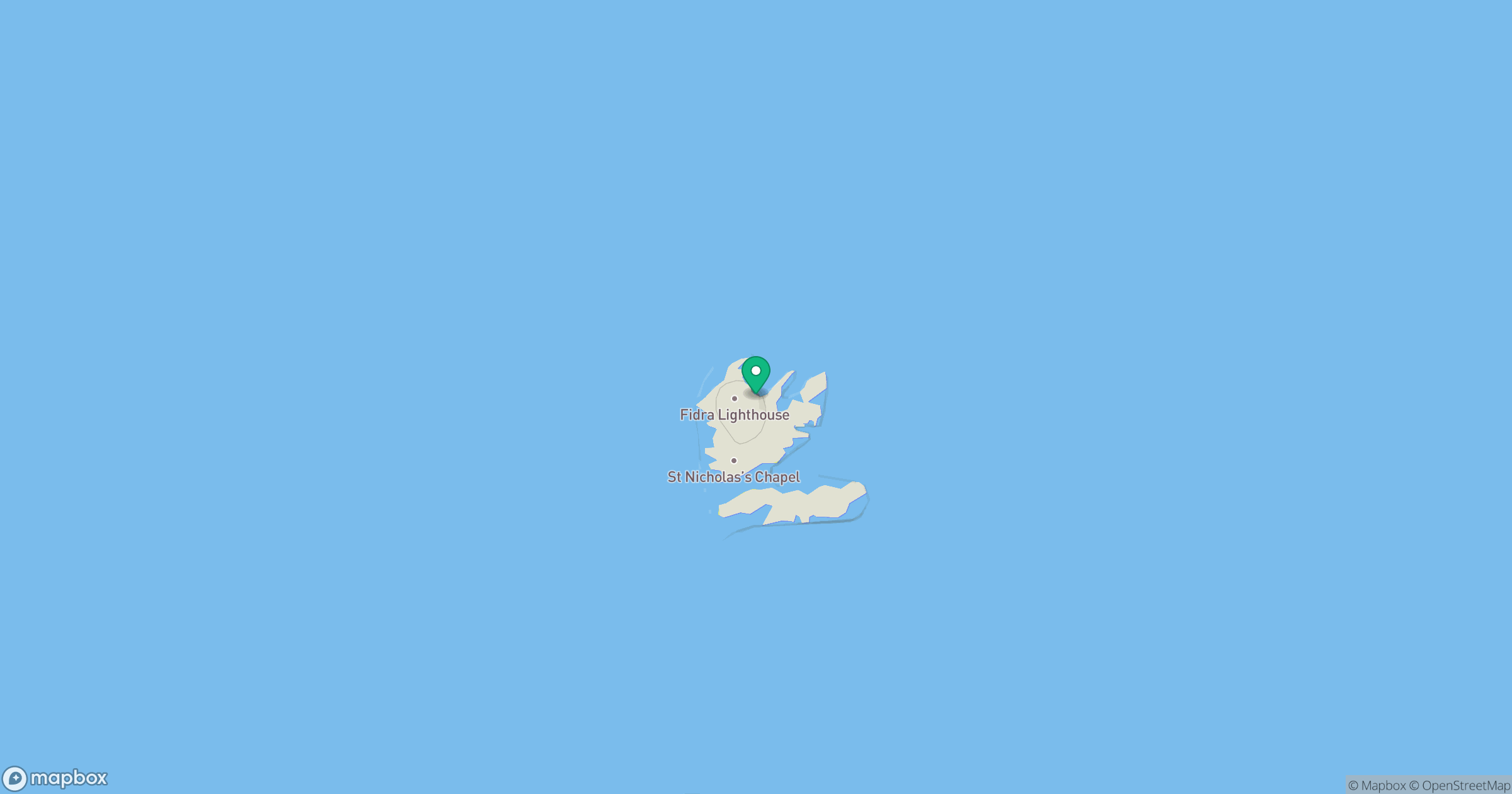
Grid reference: NT512869
View on OpenStreetMapOpens a map in a new tab, centred on the hill.
No comments yet. Be the first.