
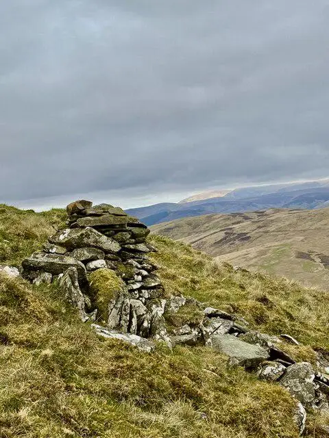
Mountbenger Law
Good walks are even better shared.
Overview
Mountbenger Law
Overview
Mountbenger Law, the modest but mighty Marilyn of the Southern Uplands, beckons outdoor enthusiasts to experience its rugged beauty. Standing at 572 meters, this peak, while not the tallest, offers unrivalled views and a pleasant hike.
Geology
The mountain is primarily composed of granite, with its rugged outcrops showcasing the geological history shaped over millennia. Glacial activity has left its mark, resulting in a fascinating landscape that captures the essence of Scotland’s geological wonders.
Routes
- Blackhope Burn Circuit:
A popular loop trail that starts from the picturesque Blackhope Burn. This route descends through a scenic valley and then climbs to the summit, providing a satisfying challenge for hikers. - Mountbenger Track:
For those leaning towards a more straightforward ascent, the Mountbenger Track beckons with a steady climb and gorgeous views, perfect for beginners.
Summit Features
The summit showcases a delightful stone cairn and a trig point that signifies the highest point. It’s a fantastic spot for a bit of reflection or an impromptu dance party – you’re on top of the world!
Terrain Type
The terrain is a delightful mix of grassy slopes and rocky outcrops, with some boggy stretches thrown in to keep hikers alert – it’s an adventure, after all.
Views
Once at the summit, you’ll be rewarded with sweeping views that include the rolling hills of the Borders and the distant Cheviots. The best conditions for visibility are during spring and autumn when the landscape is awash with colour.
Hazards
Vigilance is key as weather can be fickle, with swift changes in conditions. Trails can become wet and slippery, so sturdy footwear is highly recommended.
Access
Parking is available at a lay-by near the Blackhope Burn road (A713). Public transport is limited; a bus services Dalmellington, but you'll need to secure a taxi or lift to access the trailhead. Dalmellington, just 10 miles to the north, is your nearest town, offering facilities like cafés and shops.
History
The name 'Mountbenger' signifies its presence as a prominent hill, and the area is steeped in local history having been frequented by shepherds driving sheep to market in the past.
In short, Mountbenger Law may not be the highest, but with its stunning views, engaging routes, and rich history, it's definitely worth the hike. Happy adventuring!
Explore routes near Mountbenger Law
Public walks starting within 80 km of this hill. Nearby does not mean a route reaches the summit; check its map and access before setting out.
Cademuir Forest Pilots Trail
View route
Peebles to Neidpath Castle: Tweed Riverside Walk
View route
Selkirk Ettrick Water North Riverside Circuit
View route
Selkirk Haining Loch and Woodland Circuit
View route
Route planning notes
These notes describe possible approaches, not verified navigable routes or permission to cross land. Check current paths, local access rules and conditions before setting out.
Blackhope Burn Circuit
A popular loop trail starting from the Blackhope Burn, descending the scenic valley before climbing up to the summit.
Mountbenger Track
A more direct approach up the Mountbenger Track, offering a steady climb with rewarding views.
Make a day of it, together
Find someone to share the walk with, or organise a day out along a route you like.
Photo Gallery
View all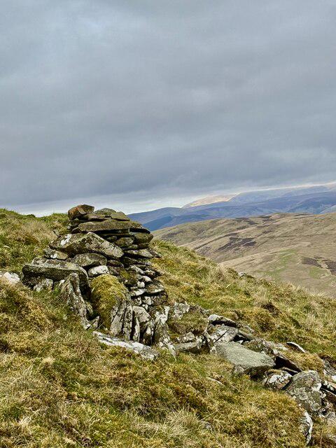 Photo could not load
NT3127 : Small Unmarked Cairn beneath the summit of Mountbenger Law
Iain Lees
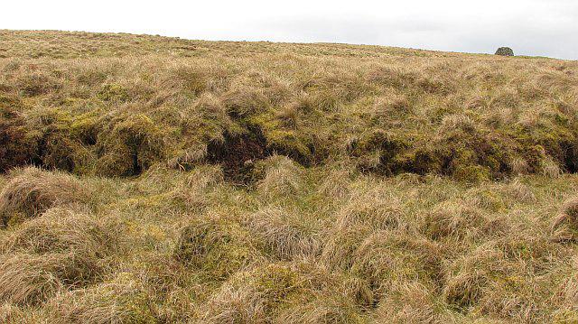 Photo could not load
NT3127 : Mountbenger Law
Richard Webb
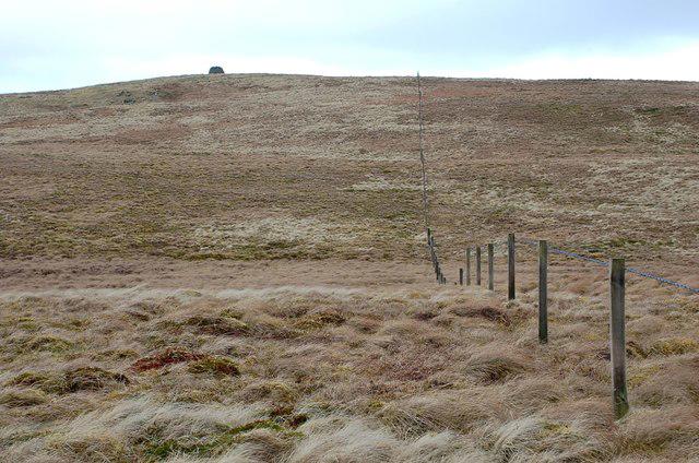 Photo could not load
NT3127 : Fence and cairn, Mountbenger Law
Jim Barton
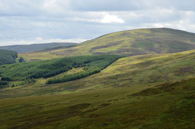 Photo could not load
NT3127 : Mountbenger Law from the north
Jim Barton
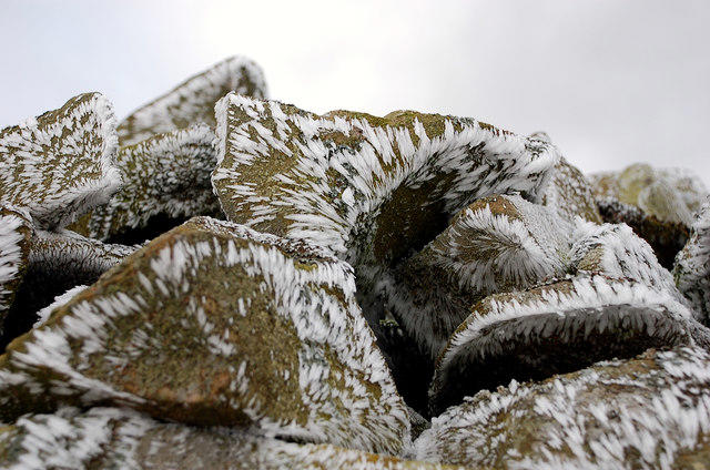 Photo could not load
NT3127 : Rimed cairn stones, Mountbenger Law
Jim Barton
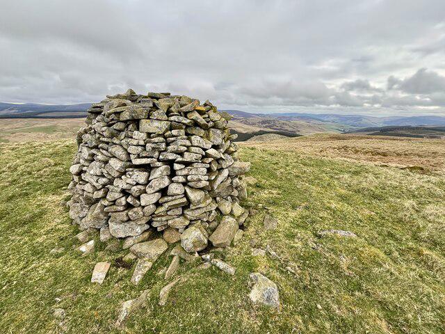 Photo could not load
NT3127 : Mountbenger Laws impressive Summit Cairn
Iain Lees
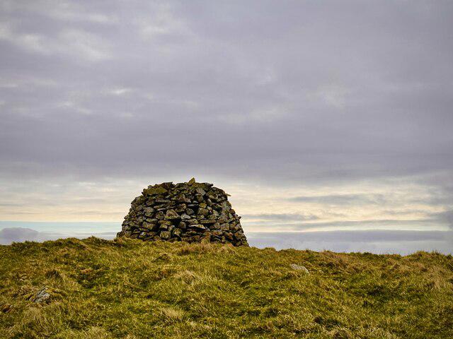 Photo could not load
NT3127 : The Well Built Cairn on Mountbenger Law
Iain Lees
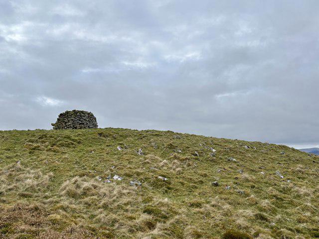 Photo could not load
NT3127 : The Summit and Cairn of Mountbenger Law
Iain Lees
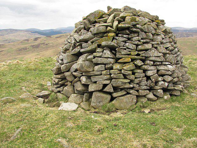 Photo could not load
NT3127 : Cairn, Mountbenger Law
Richard Webb
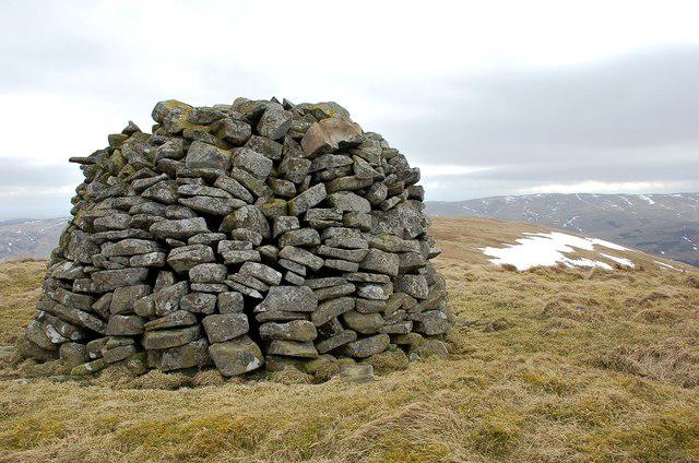
NT3127 : Summit cairn, Mountbenger Law
Jim Barton
Hill facts and local notes
Classifications
Elevation
544m
1,784 ft
Prominence
145m
Coordinates
55.5370, -3.0917
NT312275
OS Map
73
Explorer: 337
At the Summit
The summit features a stone cairn and a small trig point, which is an excellent spot for a quick selfie or to claim your triumph over the hill.
Terrain & Geology
Mountbenger Law is primarily composed of granite, which is characteristic of the Southern Uplands. The rocky outcrops at the summit are a testament to the area's geological history shaped by glacial activity.
Views & Scenery
From the summit, enjoy panoramic views of the surrounding hills, particularly the breathtaking hills of the Southern Uplands. Look out for the distant presence of the Cheviots and the rolling landscape of the Borders.
History & Heritage
Name Origin
The name 'Mountbenger' derives from the old Scottish term referring to 'beng' meaning a hill or mountain.
Historical Significance
Historically, the area has been a part of the local shepherding community, with paths once used for driving sheep to the markets.
Getting There & Facilities
Check current local access restrictions, parking rules and transport timetables before travelling. These notes do not confirm public access to the summit.
Parking
There is a small lay-by near the Blackhope Burn road (A713), which provides convenient parking for hikers.
Public Transport
The nearest bus service operates from the town of Dalmellington. You'll need to arrange a taxi or a car ride to reach the trailhead.
Nearby Facilities
In Dalmellington, you can find a local café, shops for snacks, and public toilets.
Safety Information
Known Hazards
- Be cautious of changing weather conditions, which can be unpredictable. Wet and slippery paths can pose a challenge, especially after rain.
General Safety Tips
- Check weather conditions before setting out
- Carry appropriate clothing and equipment
- Let someone know your planned route
- Take a map, compass, and GPS device
- Carry emergency supplies: food, water, first aid kit, torch
Hills
Some common questions about the hills answered
Are there group walks up Mountbenger Law?
Many walkers use Walkmates to join or organise walks with others. You can check for group walks around Mountbenger Law through the maps
Are there other walkers around Mountbenger Law?
Activity varies by location and time, but Walkmates lets you see whether others have shared walks or shown interest in this area. Find other people through the walking friends search walking friends for Mountbenger Law search or of course create your own walk for Mountbenger Law
Can I organise a walk to Mountbenger Law?
Yes. If there aren’t any walks listed already, you can create a walk and make it available for others to join.
If you're signed up to Walkmates, you can create a walk to Mountbenger Law.
How do I find a walk up this hill?
There are often multiple ways to walk this hill, depending on experience and route preference. Walkmates helps you explore walks and routes that others have shared.
Can I suggest a new route up Mountbenger Law?
Yes. You can suggest or create routes to share with others. Walkmates focuses on the social side of walking, so routes are used to help people organise walks and explore areas together, rather than as detailed navigation tools or route libraries.
Other uses really appreciate knowledgeable walkers sharing their routes. Share your favourite route to Mountbenger Law here
The is an error or something incorrect about this hill. How do I let you know?
We always strive to keep the information on Walkmates as accurate as possible. If you find an error, please let us know through the contact form and we'll aim to correct it as quickly as possible
Community Discussion
Comments
Location
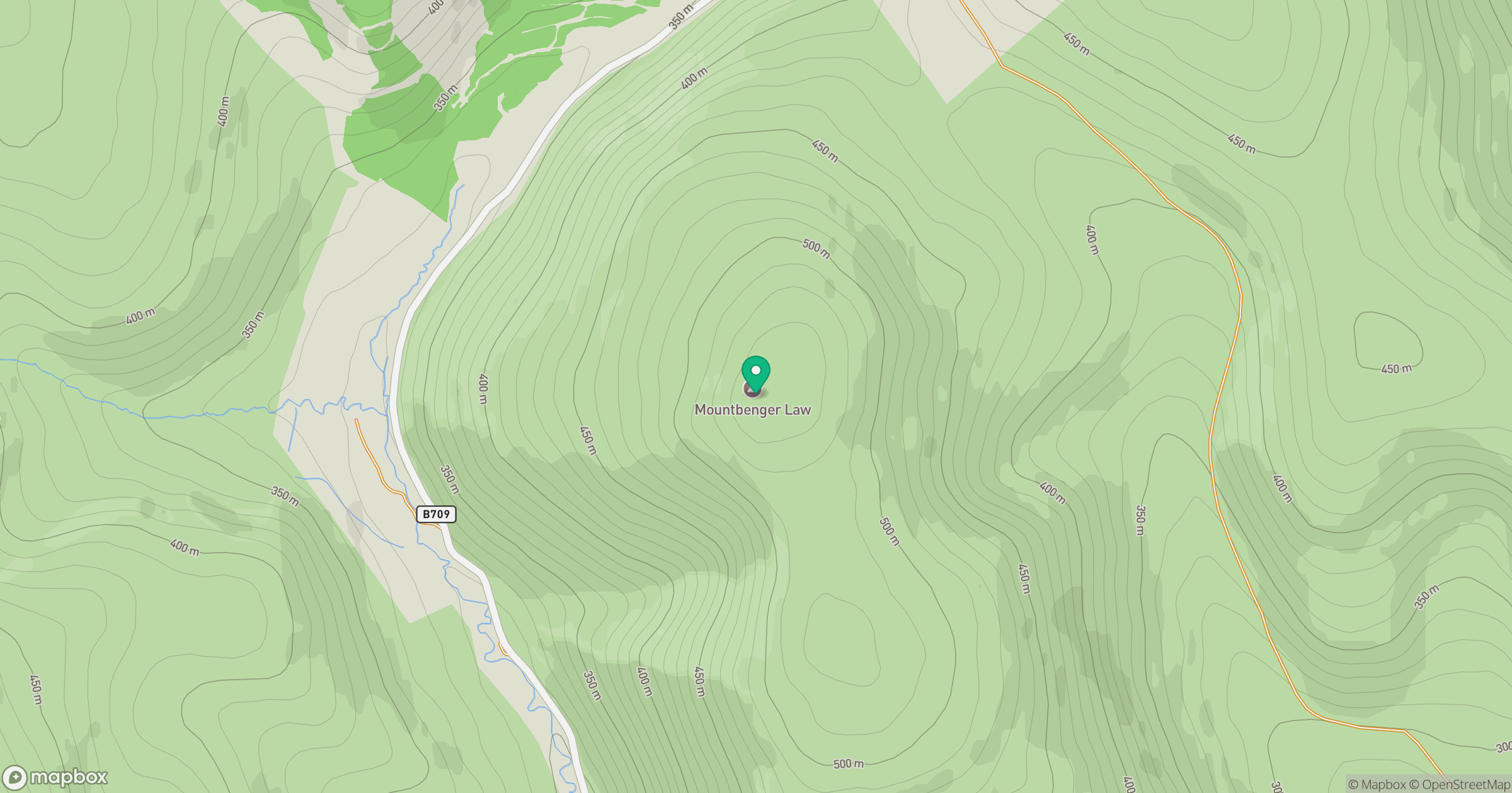
Grid reference: NT312275
View on OpenStreetMapOpens a map in a new tab, centred on the hill.
Hills within 30 km
Straight-line distance, not a walking route or confirmation of access.
No comments yet. Be the first.