

Eilean Tioram
Good walks are even better shared.
NG8310 : View across Camas Bay from Sgeir nan Gealag
Trevor Rickard Photo source
Overview
Eilean Tioram: The Dry Island
Nestled in the shimmering waters of the Sound of Sleat, Eilean Tioram is a delightful Marilyn that beckons hikers and nature lovers alike. Experience the beauty of the Scottish Highlands, where the mountains meet the sea!
Geology
Eilean Tioram showcases stunning granite and schist formations, evidence of the Earth's powerful geological forces at play. Strolling along its rugged paths, one may ponder if the rocks have tales to tell — if only they could speak!
Routes
Eilean Tioram Circular Walk
- Distance: 5.0 km
- Estimated Time: 2.5 hours
- Difficulty: Moderate
This charming circular route allows you to take in all the wonders of Eilean Tioram while circling its enchanting perimeter. Ensure to bring your sense of adventure and perhaps a snack for the journey!
Summit Features
At the summit, you’ll find a small cairn atop rocky outcrops that make for an excellent photo opportunity. The 360-degree views of the surrounding landscapes are nothing short of breathtaking.
Terrain Type
The terrain is primarily rocky and grassy, with some uneven surfaces that test your footing. A sturdy pair of boots is highly recommended; fashion can take a back seat here!
Views
From on high, you’ll catch glimpses of the magnificent Isle of Skye and the iconic peaks of the Cuillin range. On particularly sunny days, the views stretch for miles, promising the kind of experience that makes you forget about that pesky inbox for a while.
Best Seasons
Spring and autumn are favoured; they present vibrant colours and generally clearer skies. However, you might even find winter’s snowy blanket offers a magical touch!
Hazards
Watch your step! The terrain can be uneven and might surprise unsuspecting hikers. The alluring waters around the island can also be quite unpredictable, so exercise caution if you get close.
Nearby Summits
- Beinn na Caillich: Elevation 570 meters
- Sgurr na Coinnich: Elevation 893 meters
These summits offer great extension options for those looking to expand their hiking adventure in the Scottish Highlands.
Access
- Nearest Parking: A small, convenient car park is available off the Bracora village road, a short hop from the ferry terminal.
- Public Transport: Served by regular buses running from both Armadale and Broadford.
- Nearest Town: Just 5 km away lies Armadale with its quaint charm and local amenities.
Facilities
On the island, there are none—so come prepared! However, nearby Armadale boasts a café and shops for refreshments and other supplies.
History
The name 'Eilean Tioram' refers to 'dry island' in Gaelic, fitting for its drier conditions compared to the soggier Spots nearby. Historically pivotal, it was once a fortress for the Clan MacDonald, echoing tales of fierce battles and strategic importance throughout the ages.
Venture to Eilean Tioram not just to hike but to immerse yourself in stories old and new. Lace up your boots and let nature's charm reel you in!
Explore routes near Eilean Tioram
Walks starting near this hill. Open a route to check its map, distance and full itinerary.
Banavie to Glen Loy Aqueduct: Neptune’s Staircase Canal Towpath
View route
Ben Nevis via Mountain Path
View route
Glen Affric: Coire Loch Woodland Trail
View route
Beinn Eighe Lancaster Wreckage at Coire Mhic Fhearchair
View route
Route planning notes
These notes describe possible approaches. Check a route's map and access information when planning your walk.
Eilean Tioram Circular Walk
A scenic circular route that allows you to explore both the island and surrounding areas with stunning views of the Sound of Sleat.
Make a day of it, together
Find someone to share the walk with, or organise a day out along a route you like.
Photo Gallery
View all Photo could not load
NG8310 : View across Camas Bay from Sgeir nan Gealag
Trevor Rickard
 Photo could not load
NG8310 : Eilean Tioram
David Brown
 Photo could not load
NG8310 : Loch Hourn and Eilean Tioram at low tide
Andrew Hill
 Photo could not load
NG8310 : Eilean Tioram
Paul Biggin
 Photo could not load
NG8310 : Looking over the cliffs to Loch Hourn
C Michael Hogan
 Photo could not load
NG8310 : Eilean Tioram (Dry Island)
John Stewart
 Photo could not load
NG8310 : Looking down on Eilean Ràrsaidh from Torr Breac
David Medcalf
Hill facts and local notes
Classifications
Elevation
30m
98 ft
Prominence
30m
Coordinates
57.1322, -5.5763
NG836102
OS Map
33
Explorer: 413S
At the Summit
The summit consists of a rocky outcrop adorned with a modest cairn, offering a perfect vantage point for incredible views.
Terrain & Geology
Eilean Tioram is predominantly composed of granite and schist, providing a stunning contrast to the lush greenery of the surrounding area. The island's geology showcases the intricate forces of nature which have shaped the Scottish Highlands over millions of years.
Views & Scenery
From the summit, you can gaze upon the Isle of Skye, the distant peaks of the Cuillin range, and the breathtaking waters of the Sound of Sleat. On a clear day, the vistas will leave you speechless — or at least make you question why you forgot your camera.
History & Heritage
Name Origin
The name 'Eilean Tioram' translates from Gaelic as 'dry island', reflecting the relatively drier conditions of this island compared to its surroundings.
Historical Significance
Eilean Tioram has historical significance, once serving as a stronghold for the Clan MacDonald and a key strategic point during conflicts in the area.
Getting There & Facilities
Parking
A small car park is located at the edge of the village of Bracora, just a short walk from the ferry terminal.
Public Transport
Regular bus services run from both Armadale and Broadford, making it accessible for public transport users.
Nearby Facilities
There are no facilities on the island itself, but Armadale offers a café and small shops for refreshments and supplies.
Safety Information
Known Hazards
- Uneven terrain may pose a risk of tripping. The surrounding waters can be unpredictable, so take care when exploring near the edges.
General Safety Tips
- Check weather conditions before setting out
- Carry appropriate clothing and equipment
- Let someone know your planned route
- Take a map, compass, and GPS device
- Carry emergency supplies: food, water, first aid kit, torch
Hills
Some common questions about the hills answered
Are there group walks up Eilean Tioram?
Many walkers use Walkmates to join or organise walks with others. You can check for group walks around Eilean Tioram through the maps
Are there other walkers around Eilean Tioram?
Activity varies by location and time, but Walkmates lets you see whether others have shared walks or shown interest in this area. Find other people through the walking friends search walking friends for Eilean Tioram search or of course create your own walk for Eilean Tioram
Can I organise a walk to Eilean Tioram?
Yes. If there aren’t any walks listed already, you can create a walk and make it available for others to join.
If you're signed up to Walkmates, you can create a walk to Eilean Tioram.
How do I find a walk up this hill?
There are often multiple ways to walk this hill, depending on experience and route preference. Walkmates helps you explore walks and routes that others have shared.
Can I suggest a new route up Eilean Tioram?
Yes. You can suggest or create routes to share with others. Walkmates focuses on the social side of walking, so routes are used to help people organise walks and explore areas together, rather than as detailed navigation tools or route libraries.
Other uses really appreciate knowledgeable walkers sharing their routes. Share your favourite route to Eilean Tioram here
The is an error or something incorrect about this hill. How do I let you know?
We always strive to keep the information on Walkmates as accurate as possible. If you find an error, please let us know through the contact form and we'll aim to correct it as quickly as possible
Community Discussion
Comments
Location
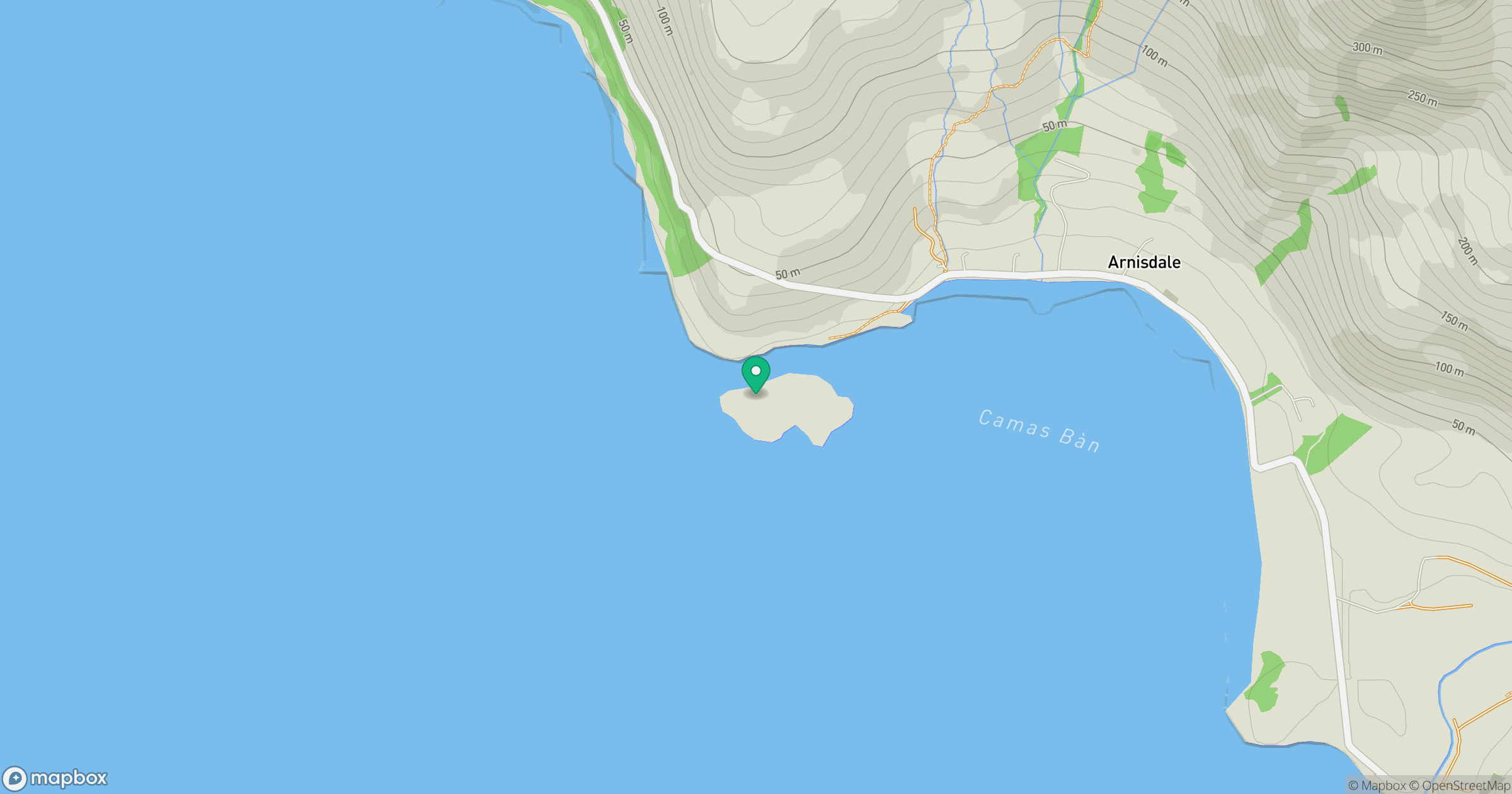
Grid reference: NG836102
View on OpenStreetMapOpens a map in a new tab, centred on the hill.
No comments yet. Be the first.