
Beinn a' Chapuill
Good walks are even better shared.
Overview
Beinn a' Chapuill
Overview
Beinn a' Chapuill, standing proudly at 600 meters, is not the highest mountain in the Scottish Highlands, but it has its own character that endeavours to charm even the most discerning of hikers. As a Marilyn, it holds the title of not just being a mountain, but a classic Scottish hill, making it a popular destination for those looking to enjoy the great outdoors.
Geology
The mountain's geology is primarily comprised of ancient gneiss and schist. This is not just a fancy way of saying rock, but a reminder that the area has seen significant geological history with volcanic activity and glacial sculpting playing a role in its current stature. The terrain tells tales of millennia, offering tired legs a moment to ponder geological time while enjoying the view.
Route Details
One of the most popular routes to ascend Beinn a' Chapuill begins at Innergie. The trek is about 8.5 km and typically takes around 3.5 hours, classified as moderate in difficulty. Don't forget your camera, as the sweeping views along the route are truly Instagram-worthy! The trail leads steadily upward with a mix of rocky patches and grassy knolls, ensuring a varied walking experience.
Summit Features
At the top, you will find a rocky outcrop adorned with a cairn. This is an excellent spot for a well-deserved break and offers a chance to admire the stunning panorama. Just don’t sit too long—mountain goats might take a liking to your packed lunch.
Terrain Type
Be prepared for a medley of terrains — rocky areas can impede progress, especially when wet. The grassy patches offer a gentler walk, but don’t let your guard down; nature can be slippery!
Views
The views from this summit are second to none. On a clear day, the Paps of Jura stand tall, while Loch a' Chroisg glimmers invitingly below. The peaks of the Arrochar Alps provide a dramatic backdrop, making it a photographer's paradise. Timing your visit in late spring to early autumn will yield the best visibility.
Hazards
As enchanting as the mountain may be, it is not without its risks. Sudden changes in weather can lead to treacherous conditions. Ensure you’re prepared for the unexpected, and take care around loose rocks—nobody wants an unexpected tumble!
Access
Parking is available close to the base of the mountain, near Innergie, with space for approximately ten vehicles. Public transport is limited to bus services from Oban to Inverary, necessitating a short taxi ride to Innergie. The closest town is the lovely Oban, a hub for services and amenities.
Facilities
While facilities around the mountain are scarce, Oban is only a short distance away and offers everything from curried haggis to excellent fish and chips. Make sure to stock up on supplies before heading into the wild!
History
The name 'Beinn a' Chapuill' means 'Hill of the Capuchin'. It’s a nod to the historical lore of the region and its significant cultural roots. As a cherished landmark, it has found its way into many local stories, solidifying its place in the hearts of those who reside nearby.
Enjoy your hike, and remember: the only bad weather is the weather you’re not prepared for!
Explore routes near Beinn a' Chapuill
Walks starting near this hill. Open a route to check its map, distance and full itinerary.
Loch Affric full circuit from River Affric
View route
Beinn Eighe Lancaster Wreckage at Coire Mhic Fhearchair
View route
Glen Affric: Coire Loch Woodland Trail
View route
Banavie to Glen Loy Aqueduct: Neptune’s Staircase Canal Towpath
View route
Route planning notes
These notes describe possible approaches. Check a route's map and access information when planning your walk.
From Innergie
This route begins at Innergie, offering a gentle ascent with stunning views along the way. Ideal for those who prefer a leisurely hike with plenty of photo opportunities.
Make a day of it, together
Find someone to share the walk with, or organise a day out along a route you like.
Hill facts and local notes
Classifications
Elevation
760m
2,493 ft
Prominence
259m
Coordinates
57.1732, -5.5829
NG835148
OS Map
33
Explorer: 413N 413S
At the Summit
The summit features a substantial rocky outcrop, with a small cairn that could have doubled as a resting spot for an errant sheep or two. On a clear day, it also offers a panorama of the surrounding peaks.
Terrain & Geology
The mountain is primarily composed of ancient gneiss and schist, contributing to its rugged appearance and excellent stability. Beinn a' Chapuill’s geology tells a story of volcanic history and glacial shaping.
Views & Scenery
From the summit, one can see the majestic Paps of Jura, the expansive Loch a' Chroisg, and the distant peaks of the Arrochar Alps.
History & Heritage
Name Origin
The name 'Beinn a' Chapuill' translates to 'Hill of the Capuchin' in Gaelic, likely referencing a historical figure or local legend associated with the area.
Historical Significance
This mountain has been a local landmark for generations, often featured in Scottish folklore and poetry, symbolising the rugged beauty of the Highlands.
Getting There & Facilities
Parking
There is ample parking at the base near Innergie, with space for approximately 10 vehicles. Arrive early during peak seasons to ensure a spot.
Public Transport
Public transport access is limited, but a bus service runs from Oban to Inverary, followed by a short taxi ride to Innergie.
Nearby Facilities
Facilities in the vicinity are minimal; however, Oban provides everything from cafés serving fresh seafood to public toilets.
Safety Information
Known Hazards
- Care is needed in adverse weather conditions as the terrain can become treacherous. Watch for sudden changes in weather, and be wary of loose rocks when navigating the summit.
General Safety Tips
- Check weather conditions before setting out
- Carry appropriate clothing and equipment
- Let someone know your planned route
- Take a map, compass, and GPS device
- Carry emergency supplies: food, water, first aid kit, torch
Hills
Some common questions about the hills answered
Are there group walks up Beinn a' Chapuill?
Many walkers use Walkmates to join or organise walks with others. You can check for group walks around Beinn a' Chapuill through the maps
Are there other walkers around Beinn a' Chapuill?
Activity varies by location and time, but Walkmates lets you see whether others have shared walks or shown interest in this area. Find other people through the walking friends search walking friends for Beinn a' Chapuill search or of course create your own walk for Beinn a' Chapuill
Can I organise a walk to Beinn a' Chapuill?
Yes. If there aren’t any walks listed already, you can create a walk and make it available for others to join.
If you're signed up to Walkmates, you can create a walk to Beinn a' Chapuill.
How do I find a walk up this hill?
There are often multiple ways to walk this hill, depending on experience and route preference. Walkmates helps you explore walks and routes that others have shared.
Can I suggest a new route up Beinn a' Chapuill?
Yes. You can suggest or create routes to share with others. Walkmates focuses on the social side of walking, so routes are used to help people organise walks and explore areas together, rather than as detailed navigation tools or route libraries.
Other uses really appreciate knowledgeable walkers sharing their routes. Share your favourite route to Beinn a' Chapuill here
The is an error or something incorrect about this hill. How do I let you know?
We always strive to keep the information on Walkmates as accurate as possible. If you find an error, please let us know through the contact form and we'll aim to correct it as quickly as possible
Community Discussion
Comments
Location
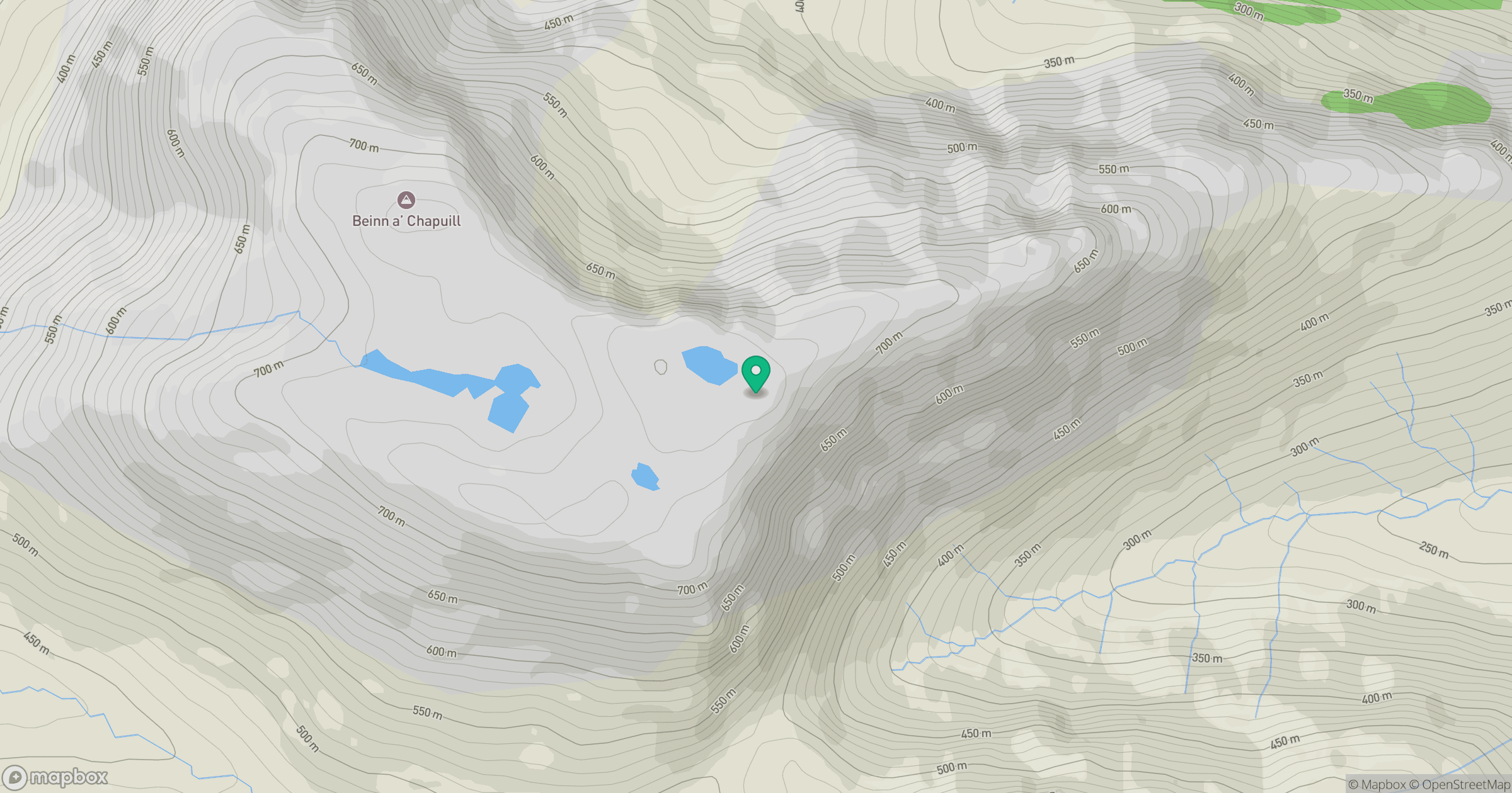
Grid reference: NG835148
View on OpenStreetMapOpens a map in a new tab, centred on the hill.
No comments yet. Be the first.