
Dunearn Hill
Good walks are even better shared.
Overview
Dunearn Hill
Dunearn Hill stands proudly at 315 metres, not quite a giant but no less charming. This Marilyn may not make the headlines like its taller counterparts, but it's a hidden gem perfect for a half-day excursion.
Geology
The hill is composed mainly of volcanic rock, featuring both basalt and andesite which dates from the early Carboniferous period. Such a geological feast gives any budding geologist plenty to ponder while enjoying the views.
Route and Access
The most popular way to reach the summit is via the Dunearn Hill Circular Route, a delightful walk of about 5.5 km that kicks off and finishes at a small car park near East Linton. Expect a moderate fitness level, with the walk taking approximately two hours to complete, assuming you’re not stopping every five minutes to take pictures (and who could blame you?).
The nearest parking is welcomingly close, with space for around 10 cars, but it does fill up quicker than a kettle in winter. If you’re using public transport, there are reliable bus services from Edinburgh, dropping you off conveniently nearby.
Summit Features
Reaching the summit, you’ll be greeted by a classic stone cairn—ideal for the obligatory selfie with your pals looking slightly puffed out behind you (it’s all in good fun).
Terrain
The terrain is mainly grassy with some rocky outcrops, ideal for those who prefer a walk that challenges without being too taxing. Just be cautious of the muddy patches, especially after a good rain (bring those gaiters).
Views
The views from Dunearn Hill won't leave you disappointed. On a clear day, the Firth of Forth glistens enticingly in the distance while the Berwick Law struts modestly further east. Spring and early autumn really are the best times to enjoy these vistas, with comfortable temperatures and stunning flora.
Hazards
As with many outdoor pursuits, it’s essential to tread carefully. Beware of the uneven terrain and the occasional sheep dropping—making your way to the hill is not without its hazards!
Nearby Summits
If you’re keen on ticking off more hills in the area, consider North Berwick Law or Traprain Law, both of which boast their unique features and views, ensuring your boots get plenty of adventure.
Facilities
After the hike, the village of East Linton beckons with its charming cafes and necessary public conveniences. Treat yourself to a well-deserved refreshment as you regale your hiking tales.
Conclusion
Dunearn Hill may be modest in stature but offers delightful hikes, captivating views, and a touch of history. Perfect for a day out where you can stretch your legs and enjoy the great outdoors without having to summit Everest!
Explore routes near Dunearn Hill
Walks starting near this hill. Open a route to check its map, distance and full itinerary.
To Absent Friends: Holyrood Park walk
View route
Loch Leven: Kinross Pier to RSPB Loch Leven Heritage Trail
View route
Artists’ walk in Craigmillar Castle Park (group meeting)
View route
East Calder: Almondell, Mandela Bridge and River Almond Circuit
View route
Route planning notes
These notes describe possible approaches. Check a route's map and access information when planning your walk.
Dunearn Hill Circular Route
A moderate circular hike that begins and ends at the car park near the village of East Linton.
Make a day of it, together
Find someone to share the walk with, or organise a day out along a route you like.
Hill facts and local notes
Classifications
Elevation
224m
734 ft
Prominence
99m
Coordinates
56.0732, -3.2681
NT211874
OS Map
66
Explorer: 367E
At the Summit
The summit features a large stone cairn, which serves as a perfect backdrop for a photo-op (keep your family disgruntled on the other side of the camera).
Terrain & Geology
Dunearn Hill is primarily composed of volcanic rock, featuring a mix of basalt and andesite that dates back to the early Carboniferous period. The surrounding landscape showcases glacial till, making it a fascinating area for those interested in geology.
Views & Scenery
From the summit, you can enjoy panoramic views of the Firth of Forth, the Berwick Law to the east, and the rolling hills of East Lothian. On a clear day, you might even spot the North Sea glittering in the distance.
History & Heritage
Name Origin
The name 'Dunearn' is believed to derive from the Gaelic 'Dun Eire', meaning 'fort of the land'.
Historical Significance
The hill is historically significant due to its proximity to ancient hill forts and archaeological sites, hinting at a rich history of human activity in the area.
Getting There & Facilities
Parking
There is a small car park located at the end of the minor road off the A1 near East Linton. It can accommodate around 10 cars.
Public Transport
Regular bus services run from Edinburgh to East Linton, making it easy to get to the area without a car.
Nearby Facilities
The nearby East Linton has a few cafes and shops, as well as public toilets in the village, perfect for a post-hike snack or beverage.
Safety Information
Known Hazards
- Uneven terrain may pose a risk, especially in wet conditions. Watch out for sheep droppings, which can appear like landmines on the trail.
General Safety Tips
- Check weather conditions before setting out
- Carry appropriate clothing and equipment
- Let someone know your planned route
- Take a map, compass, and GPS device
- Carry emergency supplies: food, water, first aid kit, torch
Hills
Some common questions about the hills answered
Are there group walks up Dunearn Hill?
Many walkers use Walkmates to join or organise walks with others. You can check for group walks around Dunearn Hill through the maps
Are there other walkers around Dunearn Hill?
Activity varies by location and time, but Walkmates lets you see whether others have shared walks or shown interest in this area. Find other people through the walking friends search walking friends for Dunearn Hill search or of course create your own walk for Dunearn Hill
Can I organise a walk to Dunearn Hill?
Yes. If there aren’t any walks listed already, you can create a walk and make it available for others to join.
If you're signed up to Walkmates, you can create a walk to Dunearn Hill.
How do I find a walk up this hill?
There are often multiple ways to walk this hill, depending on experience and route preference. Walkmates helps you explore walks and routes that others have shared.
Can I suggest a new route up Dunearn Hill?
Yes. You can suggest or create routes to share with others. Walkmates focuses on the social side of walking, so routes are used to help people organise walks and explore areas together, rather than as detailed navigation tools or route libraries.
Other uses really appreciate knowledgeable walkers sharing their routes. Share your favourite route to Dunearn Hill here
The is an error or something incorrect about this hill. How do I let you know?
We always strive to keep the information on Walkmates as accurate as possible. If you find an error, please let us know through the contact form and we'll aim to correct it as quickly as possible
Community Discussion
Comments
Location
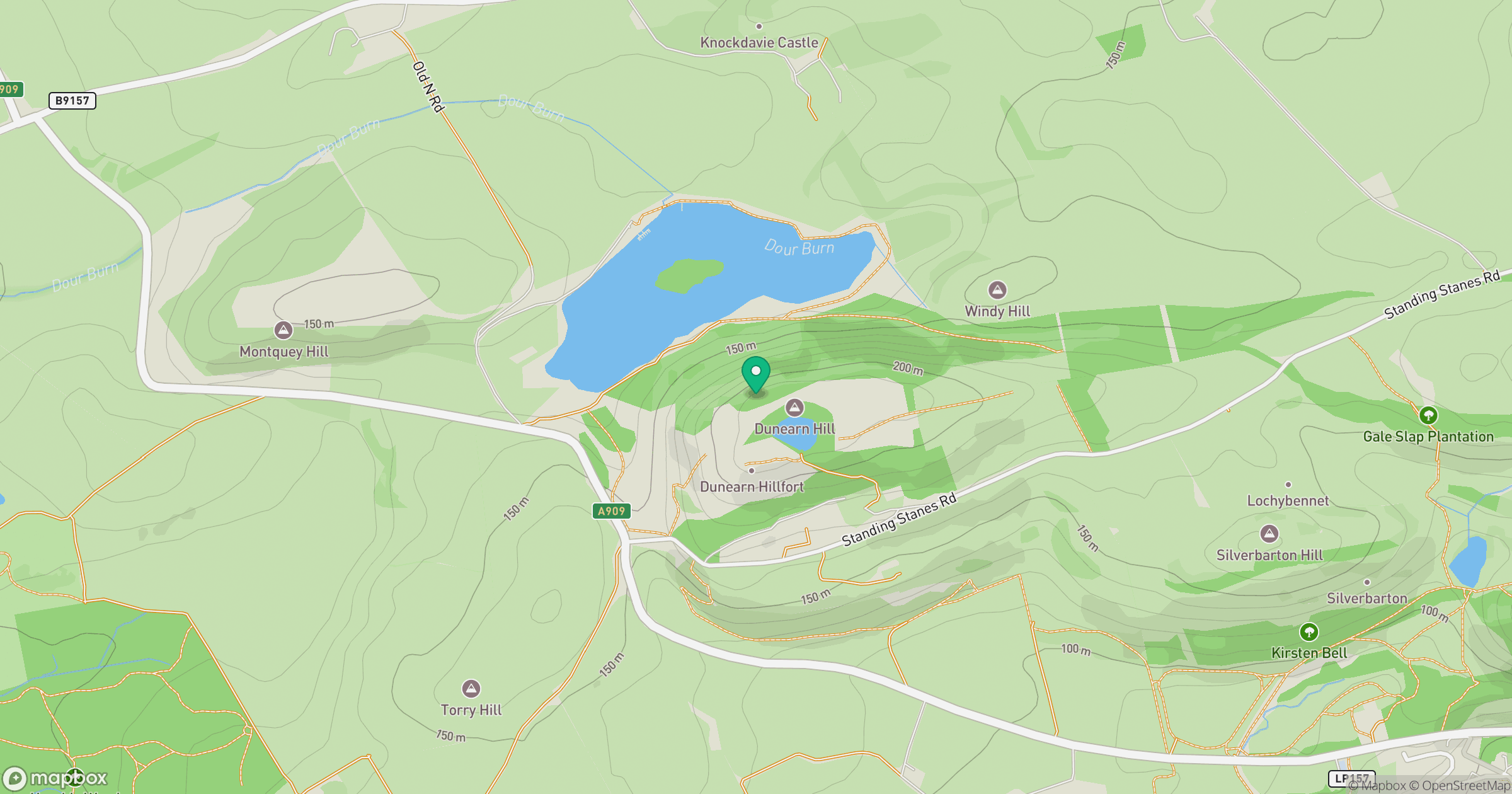
Grid reference: NT211874
View on OpenStreetMapOpens a map in a new tab, centred on the hill.

No comments yet. Be the first.