

Dunblane Roman Camps
Good walks are even better shared.
NN7700 : Covered reservoir, Dunblane
Richard Webb Photo source
Overview
Dunblane Roman Camps
Overview
Nestled in the heart of Central Scotland, the Dunblane Roman Camps offer hikers and history buffs alike a unique opportunity to step back in time. As you wander through the rugged landscape, you'll find the remnants of ancient Roman fortifications that tell tales of a long-gone era.
Geology
The area is primarily covered in sedimentary rocks, complemented by some volcanic intrusions—evidence of Scotland's varied geological past. A bit of rock formation trivia: Scotland has been shaped over millions of years by glacial activity that has left its mark in the form of valleys and hills.
Routes
Taking the Dunblane Roman Camps Trail is a splendid choice for families and novice hikers. This easy route spans about 3.5 km and generally takes around 1.5 hours to complete. Not only does it provide interesting educational insights along the way, but it also treats adventurers to some lovely views, so don’t forget your camera!
Summit Features
While there isn't a traditional summit to conquer, the earthworks that remain are significant. Stand on the banks of the fortified areas and imagine the soldiers who would’ve once looked out over this landscape. You can even strike a heroic pose, much to the confusion of any nearby wildlife!
Terrain Type
Expect a delightful blend of grassy knolls and gentle woodland paths. The soft grass is forgiving on the feet, but do watch for any uneven patches that might cause a trip – although that could lead to an amusing story for later!
Views
From the area, you can catch stunning views of Dunblane town and, on clear days, even the iconic Stirling Castle in the distance. Late spring and early autumn offer the most vibrant colours and best scenery.
Hazards
The main concern while exploring these historic grounds is the uneven terrain. Take care to watch your step; a little misplacement can lead to some unexpectedly entertaining moments!
Access
Getting there is an easy affair. Parking is available at the Dunblane Hotel Car Park, which is conveniently close to the trailhead. Public transport options include regular bus services from Stirling, as well as a train station nearby. If you’re wondering where to grab a slice of cake or some local fare after your hike, Dunblane has you covered!
Facilities
In Dunblane, you’ll find a delightful range of cafes and shops perfect for refueling after your excursion. Public toilets are available in the park, ensuring your day out is as comfortable as it is enjoyable.
Conclusion
Visiting Dunblane Roman Camps is not just a walk; it's a journey through time. So lace up those hiking boots, grab your sense of adventure, and immerse yourself in the fascinating history of Scotland!
Happy hiking!
Explore routes near Dunblane Roman Camps
Walks starting near this hill. Open a route to check its map, distance and full itinerary.
Bridge of Allan Strollers and Stragglers
View route
Strathallan Court Strollers and Stragglers
View route
Blair Drummond Circular
View route
King's Park and the Golf Course
View route
Route planning notes
These notes describe possible approaches. Check a route's map and access information when planning your walk.
Dunblane Roman Camps Trail
A leisurely route encompassing the remains of two Roman camps, providing a wonderful glimpse into history amidst stunning scenery.
Make a day of it, together
Find someone to share the walk with, or organise a day out along a route you like.
Photo Gallery
View all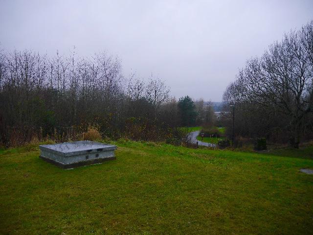 Photo could not load
NN7700 : Covered reservoir, Dunblane
Richard Webb
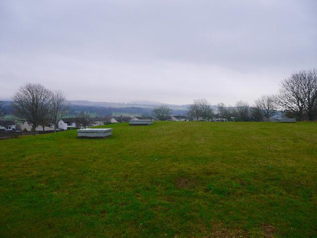 Photo could not load
NN7700 : Covered reservoir, Dunblane
Richard Webb
Hill facts and local notes
Classifications
Elevation
114m
374 ft
Prominence
36m
Coordinates
56.1822, -3.9751
NN775006
OS Map
57
Explorer: 366W
At the Summit
The site hosts earthworks and ramparts of the Roman fortifications, serving as a reminder of Scotland's ancient history.
Terrain & Geology
Primarily composed of sedimentary rocks with some volcanic intrusions typical of the area.
Views & Scenery
Panoramic views over the surrounding landscape, including the remnants of Dunblane town and the distant Stirling Castle on clear days.
History & Heritage
Name Origin
Dunblane derives from the Gaelic 'Dun Bhlathain', meaning 'the fort of Blàth', reflecting its historical significance as a stronghold.
Historical Significance
These Roman camps are an important archaeological site, providing insight into military strategies and life during the Roman occupation of Britain.
Getting There & Facilities
Parking
Dunblane Hotel Car Park, which is located just a short walk from the trailhead.
Public Transport
Regular bus services from Stirling and other surrounding areas. Dunblane train station is also within walking distance.
Nearby Facilities
There are cafes and shops in Dunblane, and public toilets are available at the park.
Safety Information
Known Hazards
- Uneven terrain might be encountered; watch your step!
General Safety Tips
- Check weather conditions before setting out
- Carry appropriate clothing and equipment
- Let someone know your planned route
- Take a map, compass, and GPS device
- Carry emergency supplies: food, water, first aid kit, torch
Hills
Some common questions about the hills answered
Are there group walks up Dunblane Roman Camps?
Many walkers use Walkmates to join or organise walks with others. You can check for group walks around Dunblane Roman Camps through the maps
Are there other walkers around Dunblane Roman Camps?
Activity varies by location and time, but Walkmates lets you see whether others have shared walks or shown interest in this area. Find other people through the walking friends search walking friends for Dunblane Roman Camps search or of course create your own walk for Dunblane Roman Camps
Can I organise a walk to Dunblane Roman Camps?
Yes. If there aren’t any walks listed already, you can create a walk and make it available for others to join.
If you're signed up to Walkmates, you can create a walk to Dunblane Roman Camps.
How do I find a walk up this hill?
There are often multiple ways to walk this hill, depending on experience and route preference. Walkmates helps you explore walks and routes that others have shared.
Can I suggest a new route up Dunblane Roman Camps?
Yes. You can suggest or create routes to share with others. Walkmates focuses on the social side of walking, so routes are used to help people organise walks and explore areas together, rather than as detailed navigation tools or route libraries.
Other uses really appreciate knowledgeable walkers sharing their routes. Share your favourite route to Dunblane Roman Camps here
The is an error or something incorrect about this hill. How do I let you know?
We always strive to keep the information on Walkmates as accurate as possible. If you find an error, please let us know through the contact form and we'll aim to correct it as quickly as possible
Community Discussion
Comments
Location
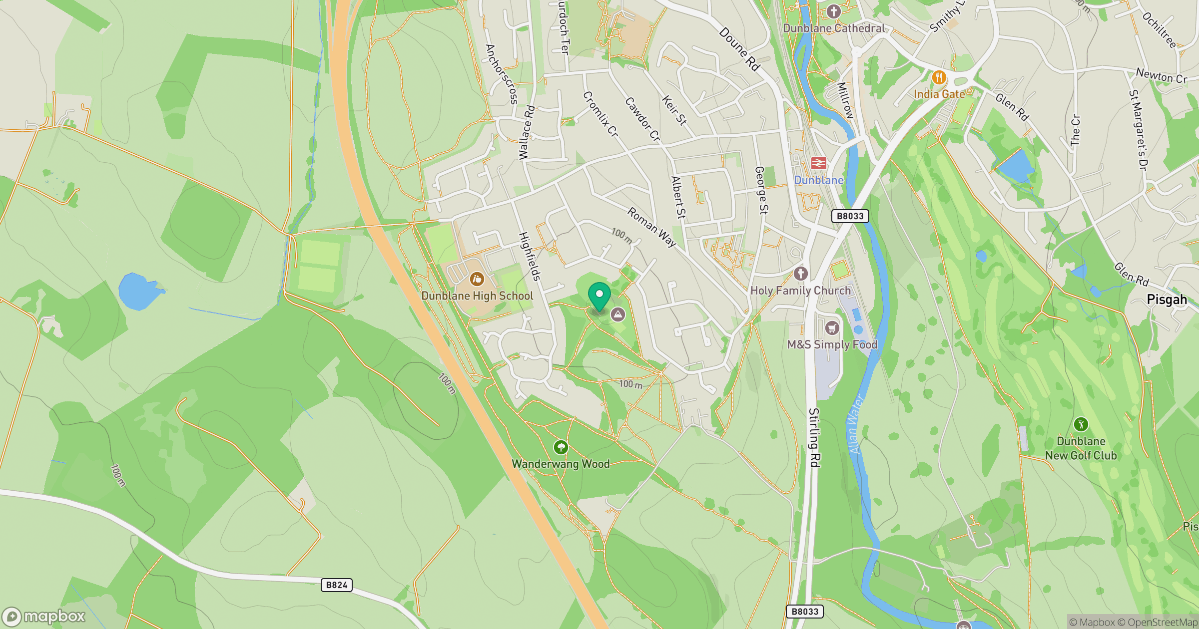
Grid reference: NN775006
View on OpenStreetMapOpens a map in a new tab, centred on the hill.


No comments yet. Be the first.