

Carleatheran
Good walks are even better shared.
NS6891 : Carleatheran trig point S3633 towards Earlsburn Reservoirs
Chris Wimbush Photo source
Explore routes near Carleatheran
Walks starting near this hill. Open a route to check its map, distance and full itinerary.
Kirkintilloch to Twechar Bridge: Forth and Clyde Canal Return
View route
Loch Lubnaig: West Shore Railway Path from Ben Ledi Car Park
View route
Falkirk Wheel: Bonnybridge and Doctor's Pend Canal Walk
View route
Loch Ard Forest: Sculpture Trail and Little Loch Ard
View route
Route planning notes
These notes describe possible approaches. Check a route's map and access information when planning your walk.
The Garbh Choire Route
A scenic route that starts from the A702 road, winding through heather and rocky paths with a gradual ascent to the summit.
Make a day of it, together
Find someone to share the walk with, or organise a day out along a route you like.
Photo Gallery
View all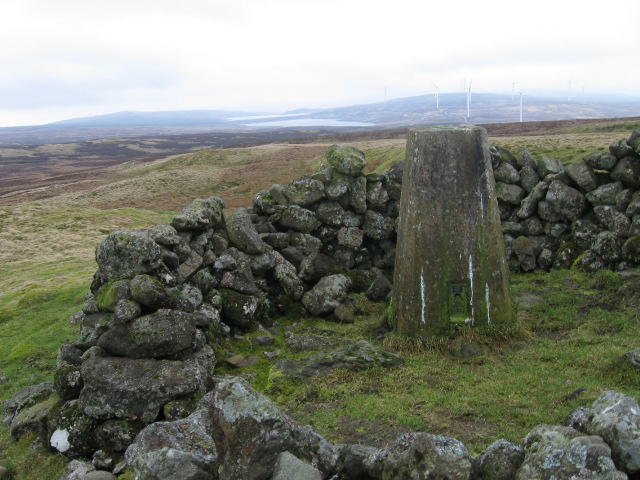 Photo could not load
NS6891 : Carleatheran trig point S3633 towards Earlsburn Reservoirs
Chris Wimbush
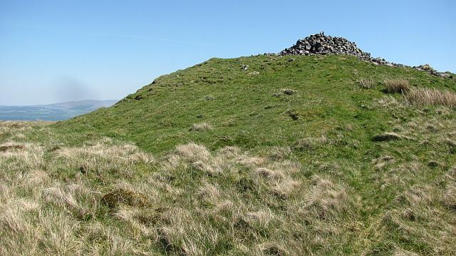 Photo could not load
NS6891 : Carleatheran summit
Richard Webb
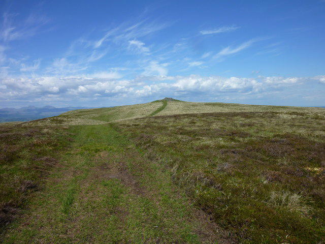 Photo could not load
NS6891 : Approaching Carleatheran from the South
I A Smellie
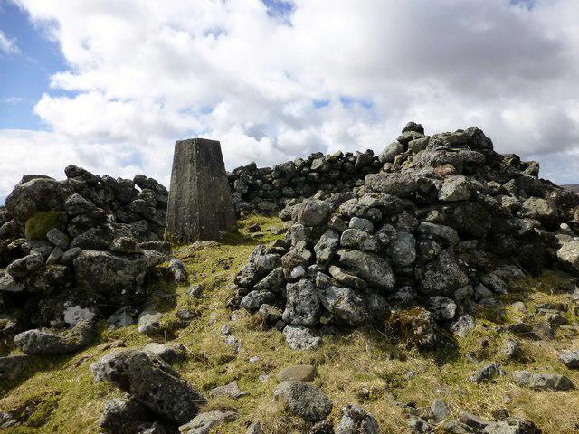 Photo could not load
NS6891 : Carleatheran Summit
Rude Health
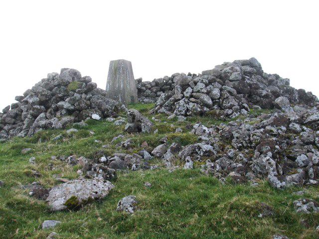 Photo could not load
NS6891 : Summit Carleatheran Hill
ronnie leask
Hill facts and local notes
Classifications
Elevation
485m
1,591 ft
Prominence
168m
Coordinates
56.1016, -4.1111
NS687918
OS Map
57
Explorer: 348
At the Summit
The summit features a small cairn and provides ample space for a picnic, provided you like the taste of fresh mountain air!
Terrain & Geology
Carleatheran is primarily composed of granite, with some schist and gneiss in the surrounding areas, making it a beautiful study in rugged, ancient Scottish geology.
Views & Scenery
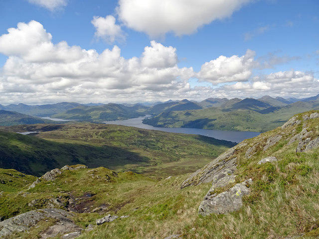
The breathtaking views include Ben Macdui, the second highest mountain in the UK, and the vast expanses of the Cairngorms.
History & Heritage
Name Origin
The name Carleatheran is derived from Scottish Gaelic, likely translating to 'The Place of the Stream'.
Historical Significance
Carleatheran is popular among local hikers and serves as a gateway to exploring the wider Cairngorms National Park, making it both a local favourite and a stepping stone for wider adventures.
Getting There & Facilities
Parking
There is a small parking area at the start of the A702, which can accommodate a few vehicles. Arrive early to snag a spot!
Public Transport
The nearest bus service runs from Edinburgh to Innerleithen. From there, it’s about a 7 km hike to the trailhead.
Nearby Facilities
Facilities are quite limited in the immediate area, but Peebles has a number of cafes and shops for refreshments. Be sure to bring plenty of water and snacks!
Safety Information
Known Hazards
- Watch out for sudden changes in weather, as conditions can shift from sunny to blustery without much warning. Also, uneven terrain can lead to slips and trips!
General Safety Tips
- Check weather conditions before setting out
- Carry appropriate clothing and equipment
- Let someone know your planned route
- Take a map, compass, and GPS device
- Carry emergency supplies: food, water, first aid kit, torch
Hills
Some common questions about the hills answered
Are there group walks up Carleatheran?
Many walkers use Walkmates to join or organise walks with others. You can check for group walks around Carleatheran through the maps
Are there other walkers around Carleatheran?
Activity varies by location and time, but Walkmates lets you see whether others have shared walks or shown interest in this area. Find other people through the walking friends search walking friends for Carleatheran search or of course create your own walk for Carleatheran
Can I organise a walk to Carleatheran?
Yes. If there aren’t any walks listed already, you can create a walk and make it available for others to join.
If you're signed up to Walkmates, you can create a walk to Carleatheran.
How do I find a walk up this hill?
There are often multiple ways to walk this hill, depending on experience and route preference. Walkmates helps you explore walks and routes that others have shared.
Can I suggest a new route up Carleatheran?
Yes. You can suggest or create routes to share with others. Walkmates focuses on the social side of walking, so routes are used to help people organise walks and explore areas together, rather than as detailed navigation tools or route libraries.
Other uses really appreciate knowledgeable walkers sharing their routes. Share your favourite route to Carleatheran here
The is an error or something incorrect about this hill. How do I let you know?
We always strive to keep the information on Walkmates as accurate as possible. If you find an error, please let us know through the contact form and we'll aim to correct it as quickly as possible
Community Discussion
Comments
Location
View the hill's mapped position and surrounding paths.
Grid reference: NS687918
View on OpenStreetMapOpens a map in a new tab, centred on the hill.


No comments yet. Be the first.