

Dun Corr-bhile
Good walks are even better shared.
Overview
Dun Corr-bhile: The Easy Climb That's Full of Surprises
Dun Corr-bhile is a hidden gem in the Scottish Highlands, standing at an impressive 400 meters. Although it's not the highest peak in the area, it offers breathtaking views and a satisfying climb for those looking for a taste of the outdoors without undertaking an expedition.
Geology
The region is rich in ancient rocks, primarily schist and gneiss, which are remnants of the Earth's geological past. This means expect some rocky terrain—keep an eye on where you place your feet; after all, it would be a shame to turn an ankle when there are glorious views to behold!
Access and Parking
Finding your way to Dun Corr-bhile is relatively straightforward, with a small parking area along the A84 road. It's free, but do arrive early, especially during spring and summer, as spaces fill up quicker than a squirrel in a nut factory! The nearest town is Crianlarich, about 2 km away, where you can stock up on your snacks and drinks.
Hiking Routes
The East Ridge Route offers a moderate ascent, popular among walkers and hikers. Completing the route usually takes around three hours, allowing plenty of time to soak in the scenery without feeling rushed.
Summit and Views
The summit features a charming stone cairn that makes for a perfect backdrop for photographs. And let’s not forget the views! Gaze northwards to admire the towering Ben More while southwards lies an intricate patchwork of glens and hills forming part of Scotland's wild beauty. Best viewed during spring and early autumn when the weather is a bit more reliable—and don't forget to pack that flask of tea!
Hazards
While not particularly treacherous, do ensure your wits about you as Highland weather can change in the blink of an eye. Keep an eye out for boggy patches on the trail; they may look inconspicuous but can lead to some unexpected splashdowns!
Conclusion
Dun Corr-bhile offers both challenge and delight, whether you seek an adrenaline-fueled adventure or a peaceful day out in nature. Pack your walking shoes, a camera, and perhaps a cheeky sandwich or two, and you're set for a wonderful day in the great outdoors!
Explore routes near Dun Corr-bhile
Public walks starting within 80 km of this hill. Nearby does not mean a route reaches the summit; check its map and access before setting out.
Beinn Ime from Succoth
View route
The Cobbler from Succoth Carpark
View route
Ben Lomond in the trossachs
View route
Glen Kin group walk
View route
Route planning notes
These notes describe possible approaches, not verified navigable routes or permission to cross land. Check current paths, local access rules and conditions before setting out.
East Ridge Route
This moderate route starts from the small parking area and follows the eastern ridge to the summit. It offers beautiful views along the way.
Make a day of it, together
Find someone to share the walk with, or organise a day out along a route you like.
Photo Gallery
View all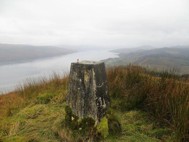 Photo could not load
NN1010 : Trig point on Dun Corr-Bhile 322m
John Ferguson
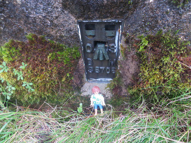 Photo could not load
NN1010 : Flush bracket on the trig point at Dun Corr- Bhile
John Ferguson
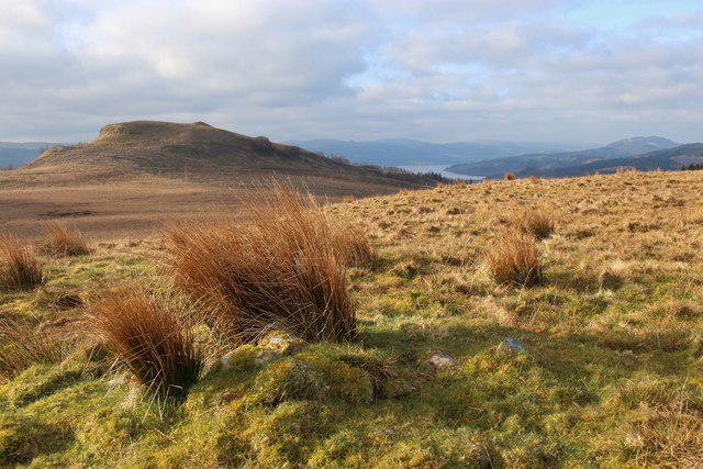 Photo could not load
NN1010 : Dùn Còrr-Bhile from Meall Rèidh
Alan Reid
Hill facts and local notes
Classifications
Elevation
322m
1,057 ft
Prominence
145m
Coordinates
56.2502, -5.0622
NN103106
OS Map
50 56
Explorer: OL37N 360S 363N
At the Summit
The summit of Dun Corr-bhile boasts a large stone cairn which is an iconic sight. There's also a wonderful panoramic view that would make anyone want to crack open a sandwich—or a slice of pie if you're feeling posh!
Terrain & Geology
Dun Corr-bhile is primarily composed of ancient metamorphic rocks, which provide a fascinating glimpse into the geological history of the Highlands. The area's schist and gneiss can sometimes make for a slippery ascent, but fear not, good shoes are your friend here!
Views & Scenery
From the summit, you can see the impressive Ben More to the north and the stunning landscapes of the surrounding glens.
History & Heritage
Name Origin
Dun Corr-bhile translates to 'fort of the round hill', hinting at its strategic vantage point in ancient times.
Historical Significance
This area was historically significant for ancient clans, providing strategic views across the Glen and serving as a lookout point.
Getting There & Facilities
Check current local access restrictions, parking rules and transport timetables before travelling. These notes do not confirm public access to the summit.
Parking
There is a small parking area by the A84 road approximately 2 km from the base of the mountain. Parking is free but space can be limited during peak seasons.
Public Transport
The nearest railway station is in Crianlarich, about 10 km away, with limited bus services connecting to nearby villages.
Nearby Facilities
You won't find much at the summit, but head to Crianlarich for cafes and shops. There are also public toilets available in the village.
Safety Information
Known Hazards
- Watch out for sudden weather changes; the Highlands have a habit of throwing a surprise shower or two at unsuspecting hikers!
- Beware of boggy ground in wet conditions, it can be deceptively deep!
General Safety Tips
- Check weather conditions before setting out
- Carry appropriate clothing and equipment
- Let someone know your planned route
- Take a map, compass, and GPS device
- Carry emergency supplies: food, water, first aid kit, torch
Hills
Some common questions about the hills answered
Are there group walks up Dun Corr-bhile?
Many walkers use Walkmates to join or organise walks with others. You can check for group walks around Dun Corr-bhile through the maps
Are there other walkers around Dun Corr-bhile?
Activity varies by location and time, but Walkmates lets you see whether others have shared walks or shown interest in this area. Find other people through the walking friends search walking friends for Dun Corr-bhile search or of course create your own walk for Dun Corr-bhile
Can I organise a walk to Dun Corr-bhile?
Yes. If there aren’t any walks listed already, you can create a walk and make it available for others to join.
If you're signed up to Walkmates, you can create a walk to Dun Corr-bhile.
How do I find a walk up this hill?
There are often multiple ways to walk this hill, depending on experience and route preference. Walkmates helps you explore walks and routes that others have shared.
Can I suggest a new route up Dun Corr-bhile?
Yes. You can suggest or create routes to share with others. Walkmates focuses on the social side of walking, so routes are used to help people organise walks and explore areas together, rather than as detailed navigation tools or route libraries.
Other uses really appreciate knowledgeable walkers sharing their routes. Share your favourite route to Dun Corr-bhile here
The is an error or something incorrect about this hill. How do I let you know?
We always strive to keep the information on Walkmates as accurate as possible. If you find an error, please let us know through the contact form and we'll aim to correct it as quickly as possible
Community Discussion
Comments
Location
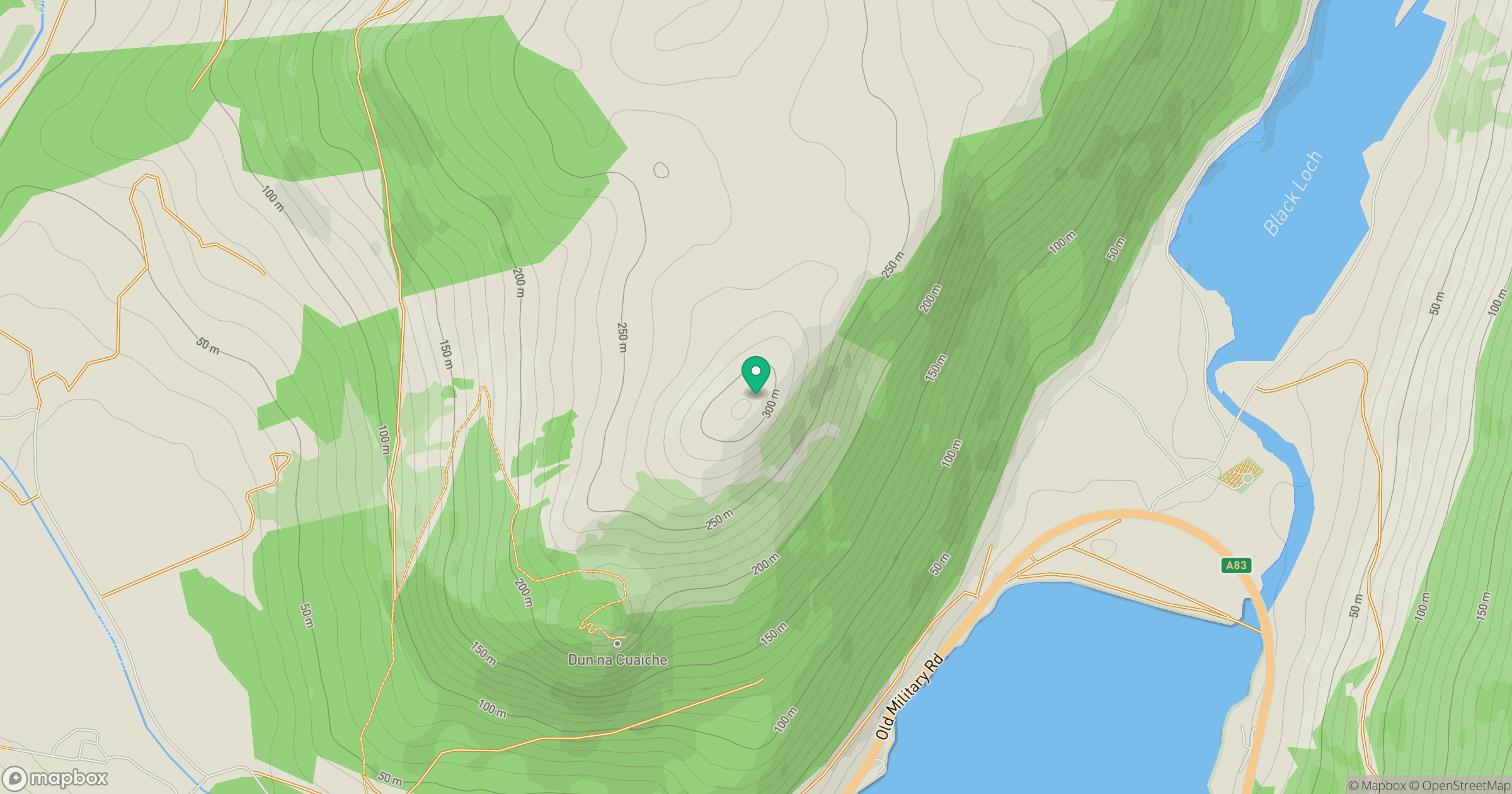
Grid reference: NN103106
View on OpenStreetMapOpens a map in a new tab, centred on the hill.
Hills within 30 km
Straight-line distance, not a walking route or confirmation of access.
Ben Cruachan
1,127m
Beinn Ghlas
420m
Beinn Ime
1,012m

The Cobbler [Ben Arthur]
887m
Beinn Narnain
927m
No comments yet. Be the first.