

Druim na h-Achlaise
Good walks are even better shared.
Overview
Druim na h-Achlaise
Nestled in the heart of the Scottish Highlands, Druim na h-Achlaise stands proudly at 585 meters, classified as a Marilyn due to its topographic prominence. The name translates intriguingly to 'ridge of the hollows,' referencing the interesting landscape that envelops the peak.
Geology
The mountain comprises granite, showcasing the classic Highland geology, with glacial striations etched on its surface as if a giant child had been scribbling doodles across it. Occasional patches of schist can also be spotted, adding a beautiful mix to the geological tapestry.
Routes
Glencoe Circuit
One of the most popular routes begins from the A82 road. The 5.5 km circuit is rated moderate and typically takes around 3.5 hours to navigate, offering stunning views as you scale towards the summit. This path takes you through varied terrains—from rocky outcrops to grassy patches, and you may even encounter a bog or two. Just keep an eye on your footing, or be prepared for soggy socks!
Summit Features
Upon reaching the summit, hikers are greeted by a modest cairn, a perfect spot to catch your breath and take a snap to boast about your adventure later on social media!
Terrain Type
Expect a lovely mix of rocky, grassy, and boggy areas. While the rocky paths offer solid footing, it’s advisable to remain vigilant, as the boggy patches can surprise even the most seasoned hikers.
Views
The vistas from the top are simply stunning! Notable peaks such as Buachaille Etive Mòr and the expansive Rannoch Moor paint a breathtaking picture that makes all the effort worthwhile. For the best views, consider hiking in Spring or Autumn when the skies are clearer, and the colours are more vibrant.
Hazards
As with any mountain, Druim na h-Achlaise comes with its own set of hazards. Sudden weather changes can occur, especially in the colder months. Always check forecasts before heading out, and be prepared for slippery rocks or wet grounds.
Nearby Summits
Not far from Druim na h-Achlaise are other magnificent peaks to conquer:
- Buachaille Etive Mòr (1022 m)
- Stob na Broige (1001 m)
Access
Parking is readily available at several laybys along the A82, and for those relying on public transport, there are regular bus services from Glasgow to Fort William. The nearest town, Ballachulish (just a 15-minute drive away), offers various facilities for refuelling after your hike! Expect plenty of cafes and even some shops where you can grab a bite.
In conclusion, Druim na h-Achlaise promises a delightful day out filled with breathtaking views, fascinating geology, and a chance to reconnect with nature. Whether you're a seasoned climber or just looking for a casual stroll in stunning surroundings, this mountain has something to offer everyone!
Explore routes near Druim na h-Achlaise
Public walks starting within 80 km of this hill. Nearby does not mean a route reaches the summit; check its map and access before setting out.
Loch Affric full circuit from River Affric
View route
Fort Augustus to Kytra Lock: Caledonian Canal Towpath
View route
Great Glen Way low route: Fort Augustus to Invermoriston Old Bridge
View route
Banavie to Glen Loy Aqueduct: Neptune’s Staircase Canal Towpath
View route
Route planning notes
These notes describe possible approaches, not verified navigable routes or permission to cross land. Check current paths, local access rules and conditions before setting out.
Glencoe Circuit
A well-trodden path starting from the A82 road, offering picturesque views of the surrounding landscape.
Make a day of it, together
Find someone to share the walk with, or organise a day out along a route you like.
Photo Gallery
View all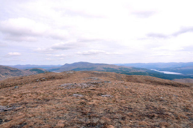 Photo could not load
NH1303 : Plateau of Druim na h-Achlaise
Steven Brown
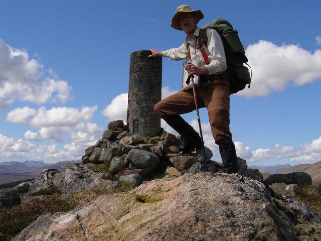 Photo could not load
NH1303 : Druim na h-Achlaise
Bart Horeman
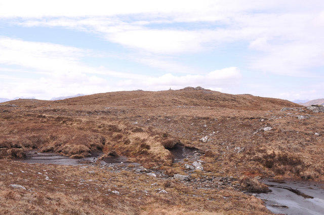 Photo could not load
NH1303 : Looking to the summit of Druim na h-Achlaise
Steven Brown
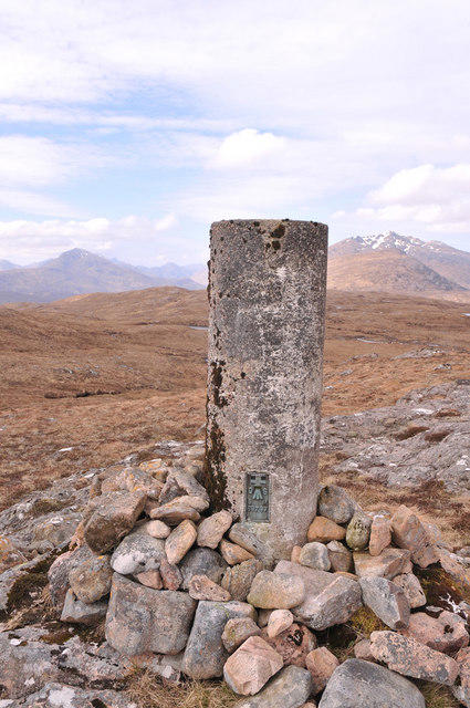 Photo could not load
NH1303 : Trig point on Druim na h-Achlaise
Steven Brown
Hill facts and local notes
Classifications
Elevation
540m
1,772 ft
Prominence
106m
Coordinates
57.0836, -5.0797
NH134033
OS Map
34
Explorer: 399 414S
At the Summit
The summit is adorned with a small cairn, providing a perfect selfie moment against the stunning backdrop of the Scottish Highlands.
Terrain & Geology
Druim na h-Achlaise is primarily composed of granite, featuring classic Scottish Highland geology that includes plentiful evidence of glacial activity, such as striations and rock formations that look like they’ve been smoothed out by the hand of a giant. You might spot some schist too, if you're lucky!
Views & Scenery
From the summit, you can admire the majestic peaks of the Buachaille Etive Mòr and the expansive expanse of Rannoch Moor, a sight that's guaranteed to make your heart sing.
History & Heritage
Name Origin
The name 'Druim na h-Achlaise' translates to 'ridge of the hollows' in Scottish Gaelic, aptly describing the landscape.
Historical Significance
This mountain holds cultural significance within Scottish Gaelic history, celebrated in local folklore and often a favourite among hikers and climbers.
Getting There & Facilities
Check current local access restrictions, parking rules and transport timetables before travelling. These notes do not confirm public access to the summit.
Parking
There are several laybys along the A82 road, just south of the mountain, suited for parking.
Public Transport
Regular bus services operate between Glasgow and Fort William, stopping at key points along the A82.
Nearby Facilities
In Ballachulish, you’ll find various facilities, including cafes, restaurants, and the essential toilet stops. Bring your own snacks—mountain climbing can be hungry work!
Safety Information
Known Hazards
- Potential for sudden weather changes, especially in winter. Watch for slippery rocks and be cautious in boggy areas.
General Safety Tips
- Check weather conditions before setting out
- Carry appropriate clothing and equipment
- Let someone know your planned route
- Take a map, compass, and GPS device
- Carry emergency supplies: food, water, first aid kit, torch
Hills
Some common questions about the hills answered
Are there group walks up Druim na h-Achlaise?
Many walkers use Walkmates to join or organise walks with others. You can check for group walks around Druim na h-Achlaise through the maps
Are there other walkers around Druim na h-Achlaise?
Activity varies by location and time, but Walkmates lets you see whether others have shared walks or shown interest in this area. Find other people through the walking friends search walking friends for Druim na h-Achlaise search or of course create your own walk for Druim na h-Achlaise
Can I organise a walk to Druim na h-Achlaise?
Yes. If there aren’t any walks listed already, you can create a walk and make it available for others to join.
If you're signed up to Walkmates, you can create a walk to Druim na h-Achlaise.
How do I find a walk up this hill?
There are often multiple ways to walk this hill, depending on experience and route preference. Walkmates helps you explore walks and routes that others have shared.
Can I suggest a new route up Druim na h-Achlaise?
Yes. You can suggest or create routes to share with others. Walkmates focuses on the social side of walking, so routes are used to help people organise walks and explore areas together, rather than as detailed navigation tools or route libraries.
Other uses really appreciate knowledgeable walkers sharing their routes. Share your favourite route to Druim na h-Achlaise here
The is an error or something incorrect about this hill. How do I let you know?
We always strive to keep the information on Walkmates as accurate as possible. If you find an error, please let us know through the contact form and we'll aim to correct it as quickly as possible
Community Discussion
Comments
Location
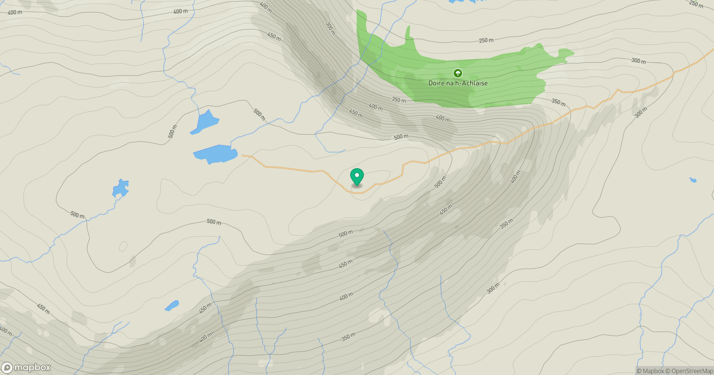
Grid reference: NH134033
View on OpenStreetMapOpens a map in a new tab, centred on the hill.
Hills within 30 km
Straight-line distance, not a walking route or confirmation of access.
Gleouraich
1,035m
Mam Sodhail
1,179m
Carn Eighe
1,183m
Sgurr a' Mhaoraich
1,027m
Sgurr Fhuaran
1,069m
No comments yet. Be the first.