

Cruachan Dearg
Good walks are even better shared.
Overview
Cruachan Dearg: A Guide to the Ruby of the Highlands
Introduction
Cruachan Dearg is a stunning Munro nestled in the Scottish Highlands, reaching an elevation of 1001 meters. Known affectionately as the 'Red Cruachan', it's famous for its breathtaking views and challenging yet rewarding hikes. If you're ready to lace up your boots, let’s take a deeper dive into what makes this mountain an essential trip for any outdoor enthusiast.
Geology
The mountain’s formidable presence is primarily due to its granitic gneiss composition. This type of rock is over two billion years old, making it a veritable time capsule of geological history. It’s hard not to feel a sense of awe at the thought of all the events that have shaped this rugged landscape.
Getting There
Parking
For your convenience, nearness matters! The best place to park is at the Cruachan Dam parking area (NM 5774 3340). From there, a well-marked path whisks you away into the stunning Scottish countryside.
Public Transport
If you fancy leaving the car at home, there’s regular bus service from Oban that stops not too far from the hiking start point. It’s a good way to soak in the scenery without needing to keep your eyes peeled on the road.
Nearby Town
The charming town of Oban is a stone's throw away and offers everything from cafés to fish and chips. After your hike, it’s worth pausing for a well-deserved treat.
Hiking Trails
The Cruachan Circuit
For the adventurous soul, the Cruachan Circuit is a solid choice. Clocking in at around 16 km, this route meanders around the mountain providing both a workout and remarkable views at every turn. Expect to dedicate around six hours to comfortably complete this loop, allowing plenty of time to take it all in.
Summit Features
As you approach the summit, you'll be greeted by a large cairn marking the pinnacle of your ascent. It's the perfect spot for a well-deserved rest... and maybe a cheeky snack. If you’re lucky enough to find the remnants of a trig point, take a moment to appreciate the history it represents.
Terrain
The terrain can be described as rocky with patches of grass dotting the landscape. Keep your wits about you; the rocks can be slippery, particularly after a good Scottish rain.
Views
Highlights
The views from Cruachan Dearg are downright magnificent. You'll see Loch Awe glimmering below and perhaps catch sight of Ben Cruachan looming majestically nearby. Just remember, your chosen route gives you the best vantage point, so plan accordingly!
Best Seasons
Visit in spring or early summer for best visibility. You’ll be enveloped in a tapestry of blooming heather that makes your hike feel even more special.
Hazards
Don't let the beauty fool you! The weather can change quicker than you can say 'Scottish drizzle'. Be sure to dress appropriately, watch for loose stones, and carry a map. Always keep your sense of humour handy—it's your best companion against tricky terrain!
Nearby Summits
If you fancy more than just Cruachan Dearg, nearby summits include:
- Ben Cruachan: Standing tall at 1126 meters, it's a great option for those looking to add an extra challenge.
- Meall Lighiche: At 844 meters, this peak provides a gentler alternative without skimping on the views.
Facilities
Everything you need is a short drive away in Oban, where delightful cafés and clean toilets await. Nothing beats a warm cup of tea after a day conquering the hills!
Conclusion
Cruachan Dearg is not just another hill to climb; it's an experience filled with stunning vistas, rich history, and perhaps a bit of banter with fellow hikers. As you conquer its heights, remember to appreciate the marvels of nature—and maybe take a selfie or two to brag about your epic adventure!
Get ready to lace up those boots and take on Cruachan Dearg. Happy hiking!
Explore routes near Cruachan Dearg
Public walks starting within 80 km of this hill. Nearby does not mean a route reaches the summit; check its map and access before setting out.
Crinan Canal: Bellanoch and Dunardry towpath return
View route
Ben Nevis via Mountain Path
View route
Banavie to Glen Loy Aqueduct: Neptune’s Staircase Canal Towpath
View route
West Highland Way: Tyndrum to Bridge of Orchy
View route
Route planning notes
These notes describe possible approaches, not verified navigable routes or permission to cross land. Check current paths, local access rules and conditions before setting out.
The Cruachan Circuit
A circular route that takes you around Cruachan Dearg, offering stunning views and a well-defined path.
Make a day of it, together
Find someone to share the walk with, or organise a day out along a route you like.
Photo Gallery
View all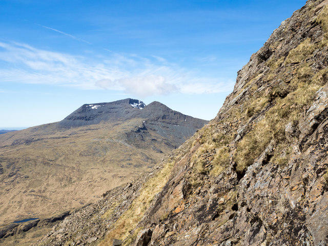 Photo could not load
NM5633 : Rocks of south face of Cruachan Dearg
Trevor Littlewood
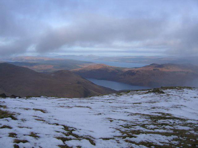 Photo could not load
NM5633 : Summit of Cruachan Dearg
Andrew Spenceley
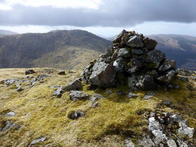 Photo could not load
NM5633 : Cruachan Dearg
Rude Health
Hill facts and local notes
Classifications
Elevation
704m
2,310 ft
Prominence
130m
Coordinates
56.4282, -5.9452
NM568332
OS Map
47 48
Explorer: 375E 375W
At the Summit
At the summit, you'll find a large cairn and, if you're lucky, the remnants of a trig point which points to its surveying past.
Terrain & Geology
The mountain is primarily composed of magnificent granitic gneiss, which gives it a rugged appearance and provides stability. The geology here dates back billions of years, offering a fascinating glimpse into the Earth's history.
Views & Scenery
From the summit, hikers are treated to expansive views over the nearby lochs and valleys, including Loch Awe and the surrounding peaks, with Ben Cruachan standing tall in the backdrop.
History & Heritage
Name Origin
The name 'Cruachan Dearg' translates to 'Red Cruachan,' possibly in reference to the red rock formations that can be observed in the area.
Historical Significance
The mountain has been a significant landmark for centuries, often serving as a navigational aid for local clans and adventurers alike.
Getting There & Facilities
Check current local access restrictions, parking rules and transport timetables before travelling. These notes do not confirm public access to the summit.
Parking
There is a convenient car park at the base of the Cruachan Dam, located at NM 5774 3340. Just a hop, skip, and jump away from your adventure!
Public Transport
Regular bus services operate from the nearby town of Oban to the Cruachan area, with stops close to the starting point.
Nearby Facilities
While there are no facilities directly on the mountain, you'll find cafes and toilets in Oban. Consider treating yourself to some fish and chips after your hiking exploits!
Safety Information
Known Hazards
- Watch out for loose rocks on steep sections and be aware of sudden changes in weather. The Scottish Highlands can be cheeky with its climate!
General Safety Tips
- Check weather conditions before setting out
- Carry appropriate clothing and equipment
- Let someone know your planned route
- Take a map, compass, and GPS device
- Carry emergency supplies: food, water, first aid kit, torch
Hills
Some common questions about the hills answered
Are there group walks up Cruachan Dearg?
Many walkers use Walkmates to join or organise walks with others. You can check for group walks around Cruachan Dearg through the maps
Are there other walkers around Cruachan Dearg?
Activity varies by location and time, but Walkmates lets you see whether others have shared walks or shown interest in this area. Find other people through the walking friends search walking friends for Cruachan Dearg search or of course create your own walk for Cruachan Dearg
Can I organise a walk to Cruachan Dearg?
Yes. If there aren’t any walks listed already, you can create a walk and make it available for others to join.
If you're signed up to Walkmates, you can create a walk to Cruachan Dearg.
How do I find a walk up this hill?
There are often multiple ways to walk this hill, depending on experience and route preference. Walkmates helps you explore walks and routes that others have shared.
Can I suggest a new route up Cruachan Dearg?
Yes. You can suggest or create routes to share with others. Walkmates focuses on the social side of walking, so routes are used to help people organise walks and explore areas together, rather than as detailed navigation tools or route libraries.
Other uses really appreciate knowledgeable walkers sharing their routes. Share your favourite route to Cruachan Dearg here
The is an error or something incorrect about this hill. How do I let you know?
We always strive to keep the information on Walkmates as accurate as possible. If you find an error, please let us know through the contact form and we'll aim to correct it as quickly as possible
Community Discussion
Comments
Location
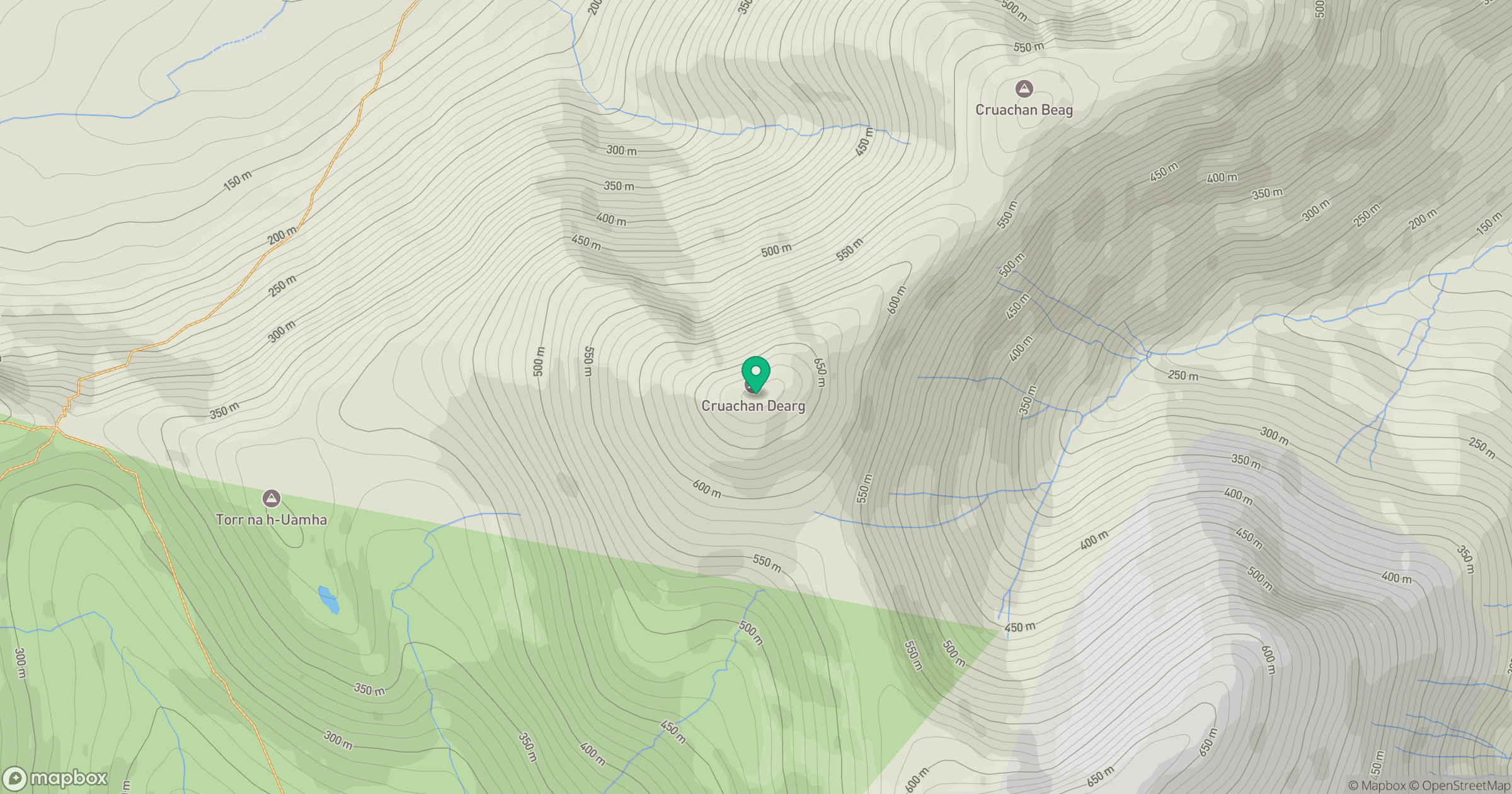
Grid reference: NM568332
View on OpenStreetMapOpens a map in a new tab, centred on the hill.
Hills within 30 km
Straight-line distance, not a walking route or confirmation of access.
Ben More
966m
Sgurr Dearg
741m
Beinn Mheadhoin
739m
Corra-bheinn
705m
Beinn a' Mheadhoin [Beinn a' Mheadhain]
602m
No comments yet. Be the first.