

Corra-bheinn
Good walks are even better shared.
NM5732 : Corra-bheinn Summit
Rude Health Photo source
Overview
Corra-bheinn: A Hiker's Delight
Introduction
Corra-bheinn rises majestically to 573 meters in the breathtaking Argyll and Bute region of the Scottish Highlands. This Marilyn may not be the highest peak in Scotland, but it rather prides itself on its stunning vistas and unique terrain that attracts hikers from all walks of life.
Geology
The peaks of Corra-bheinn are predominantly granite, shaped by the relentless forces of nature over millions of years. The impressive rock formations and occasional schist facets tell a tale of geological transitions that would excite any geology nerd!
Routes
One of the most enjoyable ways to ascend Corra-bheinn is via the Corra-bheinn Circuit, starting from Taynuilt. This circular route is 11 km long and typically takes around 4.5 hours to complete. With a mix of terrain and beautiful long-range views, it's perfect for most hikers looking for a moderate adventure.
Summit Features
Upon reaching the summit, you'll be greeted by a large cairn where fellow hikers typically gather for a brief chat or a photo opportunity. If you're keen on some summity discovery, look out for a humble trig point just a few steps away!
Terrain Type
Expect a combination of rocky outcrops and rolling grassy slopes. Be prepared for a bit of boggy ground, especially if the weather has been damp. Good hiking boots will serve you well here!
Views
The views from atop Corra-bheinn are awe-inspiring. On a clear day, gaze northward towards Ben Cruachan and south towards the lovely Loch Etive. It’s a sight that makes every step of the hike worthwhile. Ideally, visit in late spring or early autumn for the best visibility and a potential patch of blooming heather to add colour to the landscape!
Hazards
As with most highland hikes, pay attention to the weather. Scottish conditions can change quicker than you can say 'haggis', so be prepared for wind and rain, especially on the exposed sections.
Nearby Summits
You might want to extend your exploration further afield! Just a stone's throw away are Ben Cruachan (1126 m) and Meall nan Eun (835 m), both offering additional hiking opportunities with their own unique appeal.
Access
Taynuilt serves as your access point for Corra-bheinn. The village hall has a small parking area, and buses run regularly from nearby Oban, so leave the car at home if you prefer!
Facilities
Post-hike, Taynuilt has lovely cafes where you can indulge in some homemade scones and a warming cup of tea. Rest assured, public toilets are available at the village hall as well—a lifesaver after a long day outdoors!
History
The name Corra-bheinn fittingly translates to 'hill of the round top' in Gaelic. Given its rounded summit, it’s really a name that suits it to a tee! The hills around Taynuilt have been settled since the Iron Age, adding a sprinkle of historical magic to your hike.
With such rich geology, stunning views, and a touch of Scottish heritage, Corra-bheinn is a must-add to your hiking bucket list. Pack your bags (and perhaps a flask), and embark on this magnificent adventure!
Explore routes near Corra-bheinn
Walks starting near this hill. Open a route to check its map, distance and full itinerary.
Crinan Canal: Bellanoch and Dunardry towpath return
View route
Ben Nevis via Mountain Path
View route
Banavie to Glen Loy Aqueduct: Neptune’s Staircase Canal Towpath
View route
Glen Kin group walk
View route
Route planning notes
These notes describe possible approaches. Check a route's map and access information when planning your walk.
Corra-bheinn Circuit
A circular route starting from the village of Taynuilt, offering stunning views along the way and a pleasant ascent to the summit.
Make a day of it, together
Find someone to share the walk with, or organise a day out along a route you like.
Photo Gallery
View all Photo could not load
NM5732 : Corra-bheinn Summit
Rude Health
 Photo could not load
NM5732 : Trig point on Corra-bheinn
Colin Kinnear
 Photo could not load
NM5732 : Summit of Corra' Bheinn
Alistair Nixon
Hill facts and local notes
Classifications
Elevation
705m
2,312 ft
Prominence
317m
Coordinates
56.4193, -5.9363
NM573321
OS Map
48
Explorer: 375E 375W
At the Summit
The summit features a prominent cairn, which is a popular spot for photos. On a clear day, you'll also spot a small, discreet trig point just waiting to be discovered.
Terrain & Geology
Corra-bheinn is primarily composed of granite, with some areas of schist. The mountain showcases the geological history of the Scottish Highlands, allowing for fascinating rock formations and textures.
Views & Scenery
From the summit, you can enjoy views of Ben Cruachan to the north and the picturesque landscapes of Loch Etive to the south. Don't forget your camera!
History & Heritage
Name Origin
The name 'Corra-bheinn' derives from Gaelic meaning 'hill of the round top', a fitting description given its peak shape.
Historical Significance
Historically, this area has been a site of settlement since the Iron Age, offering a glimpse into Scotland's rich cultural tapestry.
Getting There & Facilities
Parking
There is a small parking area at the Taynuilt village hall. Please park considerately to avoid blocking access.
Public Transport
Regular buses run from Oban to Taynuilt, making it accessible for those relying on public transport.
Nearby Facilities
Taynuilt offers several cafes and a public toilet at the village hall. A great spot to grab a scone post-hike!
Safety Information
Known Hazards
- The usual Scottish hazards of changeable weather, including sudden rain and strong winds. Take care on rocky sections and in low visibility.
General Safety Tips
- Check weather conditions before setting out
- Carry appropriate clothing and equipment
- Let someone know your planned route
- Take a map, compass, and GPS device
- Carry emergency supplies: food, water, first aid kit, torch
Hills
Some common questions about the hills answered
Are there group walks up Corra-bheinn?
Many walkers use Walkmates to join or organise walks with others. You can check for group walks around Corra-bheinn through the maps
Are there other walkers around Corra-bheinn?
Activity varies by location and time, but Walkmates lets you see whether others have shared walks or shown interest in this area. Find other people through the walking friends search walking friends for Corra-bheinn search or of course create your own walk for Corra-bheinn
Can I organise a walk to Corra-bheinn?
Yes. If there aren’t any walks listed already, you can create a walk and make it available for others to join.
If you're signed up to Walkmates, you can create a walk to Corra-bheinn.
How do I find a walk up this hill?
There are often multiple ways to walk this hill, depending on experience and route preference. Walkmates helps you explore walks and routes that others have shared.
Can I suggest a new route up Corra-bheinn?
Yes. You can suggest or create routes to share with others. Walkmates focuses on the social side of walking, so routes are used to help people organise walks and explore areas together, rather than as detailed navigation tools or route libraries.
Other uses really appreciate knowledgeable walkers sharing their routes. Share your favourite route to Corra-bheinn here
The is an error or something incorrect about this hill. How do I let you know?
We always strive to keep the information on Walkmates as accurate as possible. If you find an error, please let us know through the contact form and we'll aim to correct it as quickly as possible
Community Discussion
Comments
Location
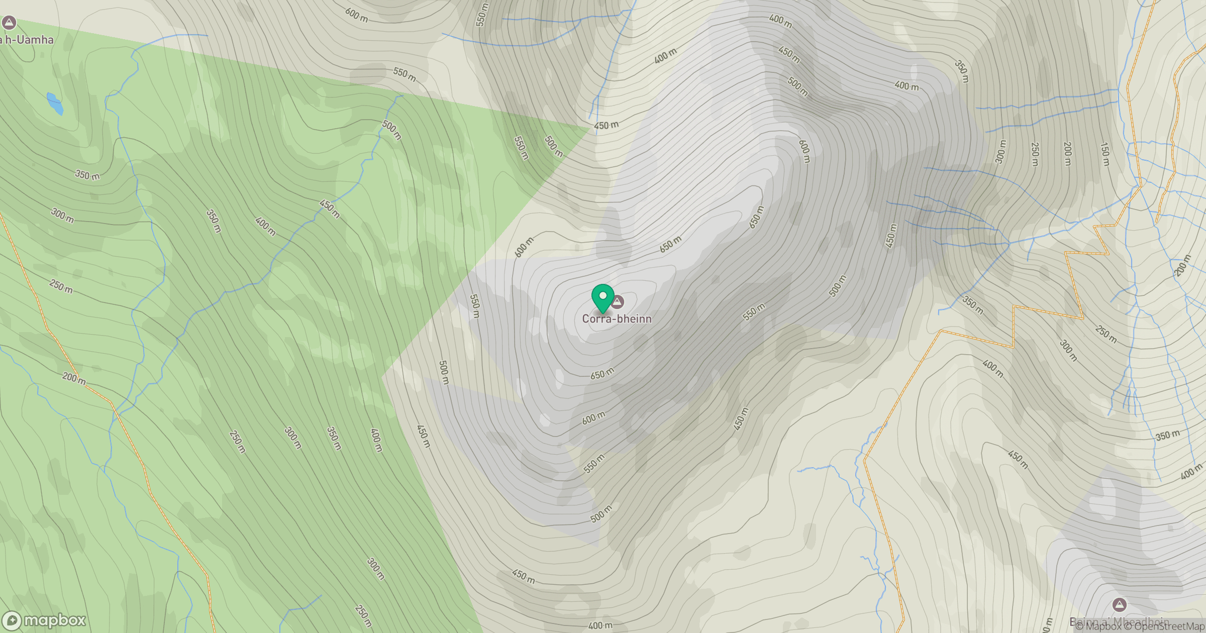
Grid reference: NM573321
View on OpenStreetMapOpens a map in a new tab, centred on the hill.
No comments yet. Be the first.