

Cruach Torr an Lochain
Good walks are even better shared.
Overview
Cruach Torr an Lochain: A Hiker's Delight
Nestled in the heart of the Scottish Highlands, Cruach Torr an Lochain offers both challenge and reward for avid hikers seeking its majestic summit. Standing at a respectable 737 meters, this Marilyn is a popular choice for those looking to explore the beauty of Argyll.
Geology
The mountain's geology is primarily made up of granite, formed through ancient volcanic activity. The landscape is a testament to nature's artistry, complete with rocky outcrops and dramatic slopes. As you ascend, keep an eye out for the stunning forms the rock takes, shaped by millennia of glacial activity.
Routes
The route from the A83 is well-trodden and easy to follow. Starting from a convenient layby, you’ll find the initial stages quite gentle, providing a great opportunity to soak in the scenery. As you climb, the path steepens, adding a delightful challenge that culminates at the summit cairn. Remember, the best views are often at the top, so keep pushing onward!
Summit Features
Upon reaching the summit, you'll find a sturdy cairn, a perfect spot for resting your weary legs and admiring the breathtaking views. The vistas stretch far and wide, giving you a feeling of conquering both mountain and sky.
Access and Parking
The nearest parking is at a layby along the A83, providing easy access to the mountain’s base. Public transport is limited, but a taxi from Inveraray can get you closer if you prefer not to walk the extra distance.
Facilities
Inveraray, just a stone's throw away, boasts all the amenities a hiker could wish for. From hearty meals to refreshing drinks, you can restore your energy before or after your adventure.
History
The name 'Cruach Torr an Lochain' tells a story of its own, with historical roots tied to the land and its ancient clans. This rich history adds a layer of depth to your hike that enhances the overall experience.
Conclusion
Cruach Torr an Lochain is not just another peak; it’s an invitation to immerse yourself in the beauty and heritage of the Scottish Highlands. Whether you're an experienced climber or a casual walker, this mountain promises an unforgettable outing amidst its scenic splendour.
So lace up those boots, pack a sandwich, and don’t forget the camera!
Happy hiking!
Explore routes near Cruach Torr an Lochain
Public walks starting within 80 km of this hill. Nearby does not mean a route reaches the summit; check its map and access before setting out.
Crinan Canal: Bellanoch and Dunardry towpath return
View route
Ben Nevis via Mountain Path
View route
Banavie to Glen Loy Aqueduct: Neptune’s Staircase Canal Towpath
View route
West Highland Way: Tyndrum to Bridge of Orchy
View route
Route planning notes
These notes describe possible approaches, not verified navigable routes or permission to cross land. Check current paths, local access rules and conditions before setting out.
From the A83 Road
This straightforward route begins at the A83 road, leading you through scenic moorland before ascending the steep slopes of Cruach Torr an Lochain.
Make a day of it, together
Find someone to share the walk with, or organise a day out along a route you like.
Photo Gallery
View all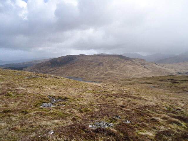 Photo could not load
NM5640 : The eastern slopes of Cruach Torr an Lochain
Michael Earnshaw
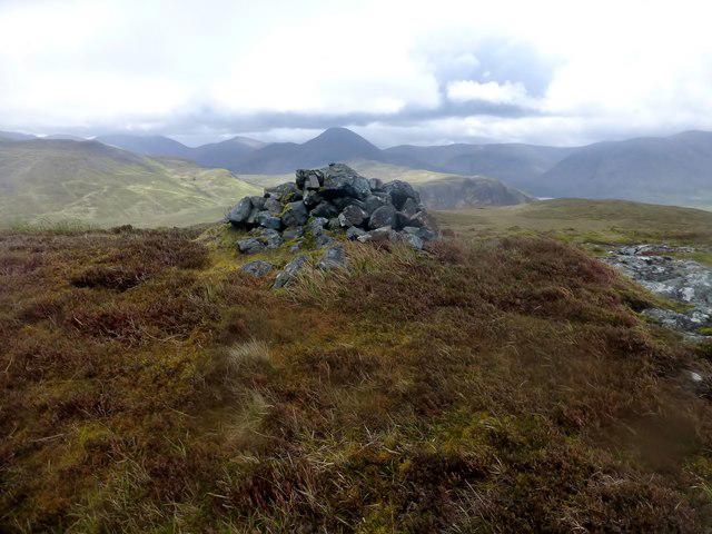 Photo could not load
NM5640 : Cruach Torr an Lochain
Rude Health
Hill facts and local notes
Classifications
Elevation
348m
1,141 ft
Prominence
149m
Coordinates
56.4914, -5.9588
NM564402
OS Map
47 48
Explorer: 374E 375E 375W
At the Summit
The summit features a prominent cairn, a veritable pile of stones marking the apex of your ascent. It provides an excellent spot for taking in panoramic views and congratulating yourself on the climb.
Terrain & Geology
The mountain is primarily composed of fine-grained granite, which offers a rugged landscape adorned with occasional scree slopes. The area's geology reveals a history of volcanic activity, further enhanced by glacial sculpting during the last Ice Age, resulting in a dramatic topography.
Views & Scenery
From the summit, you can enjoy splendid views of Loch Fyne, the surrounding hills, and even distant islands if the weather plays nice. On a clear day, you might be able to spot the shimmering waters of the Firth of Clyde.
History & Heritage
Name Origin
The name 'Cruach Torr an Lochain' translates to 'the hill of the mound of the little lake', referring to a nearby small loch.
Historical Significance
Culturally, the mountain holds importance in local folklore, with legends of ancient clans and their warriors echoing through the valleys.
Getting There & Facilities
Check current local access restrictions, parking rules and transport timetables before travelling. These notes do not confirm public access to the summit.
Parking
The nearest parking is available at a layby along the A83 road, approximately 2 km from the trailhead. There's enough space for several vehicles but arrive early during peak seasons to secure a spot.
Public Transport
Public transport options are limited; the nearest bus stop is located in the village of Inveraray, from where a taxi can be arranged to the trailhead.
Nearby Facilities
Inveraray has several facilities, including cafes, restaurants, and public toilets, making it a handy pit-stop either pre- or post-hike.
Safety Information
Known Hazards
- Be mindful of changing weather conditions, as they can shift from glorious sunshine to dense fog in a matter of moments. Additionally, the rocky terrain may present slippery conditions, particularly in wet weather.
General Safety Tips
- Check weather conditions before setting out
- Carry appropriate clothing and equipment
- Let someone know your planned route
- Take a map, compass, and GPS device
- Carry emergency supplies: food, water, first aid kit, torch
Hills
Some common questions about the hills answered
Are there group walks up Cruach Torr an Lochain?
Many walkers use Walkmates to join or organise walks with others. You can check for group walks around Cruach Torr an Lochain through the maps
Are there other walkers around Cruach Torr an Lochain?
Activity varies by location and time, but Walkmates lets you see whether others have shared walks or shown interest in this area. Find other people through the walking friends search walking friends for Cruach Torr an Lochain search or of course create your own walk for Cruach Torr an Lochain
Can I organise a walk to Cruach Torr an Lochain?
Yes. If there aren’t any walks listed already, you can create a walk and make it available for others to join.
If you're signed up to Walkmates, you can create a walk to Cruach Torr an Lochain.
How do I find a walk up this hill?
There are often multiple ways to walk this hill, depending on experience and route preference. Walkmates helps you explore walks and routes that others have shared.
Can I suggest a new route up Cruach Torr an Lochain?
Yes. You can suggest or create routes to share with others. Walkmates focuses on the social side of walking, so routes are used to help people organise walks and explore areas together, rather than as detailed navigation tools or route libraries.
Other uses really appreciate knowledgeable walkers sharing their routes. Share your favourite route to Cruach Torr an Lochain here
The is an error or something incorrect about this hill. How do I let you know?
We always strive to keep the information on Walkmates as accurate as possible. If you find an error, please let us know through the contact form and we'll aim to correct it as quickly as possible
Community Discussion
Comments
Location
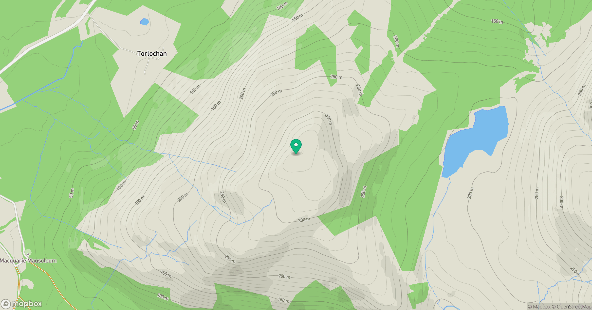
Grid reference: NM564402
View on OpenStreetMapOpens a map in a new tab, centred on the hill.
Hills within 30 km
Straight-line distance, not a walking route or confirmation of access.
No comments yet. Be the first.