

Cruach Ionnastail
Good walks are even better shared.
Overview
Cruach Ionnastail
Nestled within the majestic expanse of the Scottish Highlands, Cruach Ionnastail rises to an admirable height of 601 meters, classifying it as a Marilyn. Whether you’re a seasoned trekker or just someone who enjoys a good leg stretch, the journey to its summit is a rewarding experience.
Geology
Cruach Ionnastail’s rugged beauty is primarily attributed to schist formations, shaped through geological processes over the millennia. Its rocky outcrops create a dramatic landscape, perfect for those Instagram moments!
Routes
The most popular route starts from the A82 road, making it accessible to many adventurers. Spanning approximately 6.5 km, this moderately challenging trail takes about 2.5 hours to conquer. As you follow the well-marked path, you’ll find that your efforts are rewarded with breathtaking sights and a moderate workout.
Summit Features
Upon reaching the summit, don’t expect much—just a charm-filled, rocky outcrop with no formal markers. Fellow hikers often leave small stones piled high—like a mini rock family—adding a personal touch to your summit tick-off.
Terrain Type
The terrain varies between rocky outcrops and grassy patches with the occasional boggy section. It’s a landscape that demands respect and an eye for your footing, especially after some Scottish rain!
Views
Once you’ve caught your breath, make sure to take in the stunning views over Loch Awe and the distant peaks. Ben Cruachan looms majestically, and if you're lucky, you'll witness a sunset that seems to set the hills ablaze!
Hazards
As beautiful as it is, Cruach Ionnastail has its quirks. Loose stones may give your ankles a workout, and boggy patches can make you rethink every step. Keep an eye on the weather—sunshine may turn to showers faster than you can say 'pack a waterproof'.
Nearby Summits
Close to Cruach Ionnastail are notable peaks including Ben Cruachan (1126 meters) and Meall Tairneachan (628 meters), both of which offer further exploration for dedicated hikers.
Access
Parking can be found along the A82, though it’s best to arrive early during busy weekends. The nearest town, Dalmally, has basic amenities for your last-minute needs, while public transport from Glasgow makes the area more accessible.
Facilities
Although amenities are sparse in the immediate area, Dalmally offers a small shop and a café to fuel up before or after your adventure.
History
The name Cruach Ionnastail has a rich linguistic heritage, drawing on Gaelic to reflect local culture and salmon lore that ties deeply to the area’s natural beauty.
In conclusion, whether you’re in it for the views, the challenge, or simply the bragging rights, Cruach Ionnastail is sure to offer a memorable day in the Highlands. Pack wisely, keep your camera handy, and enjoy every step of this stunning Scottish adventure.
Explore routes near Cruach Ionnastail
Public walks starting within 80 km of this hill. Nearby does not mean a route reaches the summit; check its map and access before setting out.
Crinan Canal: Bellanoch and Dunardry towpath return
View route
Glen Kin group walk
View route
Bishop’s Glen group walk
View route
West Bay walk and talk
View route
Route planning notes
These notes describe possible approaches, not verified navigable routes or permission to cross land. Check current paths, local access rules and conditions before setting out.
From the A82 road
A well-trodden path leading up from the roadside, providing a steady ascent with occasional views of the surrounding valleys.
Make a day of it, together
Find someone to share the walk with, or organise a day out along a route you like.
Photo Gallery
View all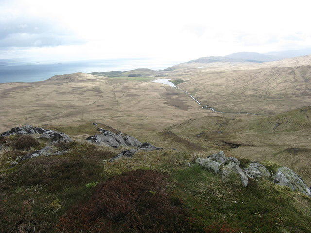 Photo could not load
NR6491 : Summit of Cruach Ionnastail
Andrew Spenceley
Hill facts and local notes
Classifications
Elevation
295m
968 ft
Prominence
104m
Coordinates
56.0607, -5.7803
NR647917
OS Map
55 61
Explorer: 355N
At the Summit
The summit is adorned with a small rocky outcrop but lacks any formal cairn or trig point. Hikers often leave small stones as markers, creating a charming site for summit selfies.
Terrain & Geology
Cruach Ionnastail is primarily composed of schist, giving it a rugged appearance that is typical of the Scottish Highlands. The mountain's geology has been shaped over millennia by glacial activity, leaving behind a striking landscape.
Views & Scenery
From the summit, enjoy panoramic views over Loch Awe and the surrounding peaks of the Highlands, including Ben Cruachan and the distant Argyll hills.
History & Heritage
Name Origin
The name 'Ionnastail' is derived from Gaelic, with 'Cruach' meaning 'stack' or 'hill' and 'Ionnastail' referring to 'the hill of the place of the salmon,' likely linking the area to local wildlife.
Historical Significance
The mountain is noted for its remoteness and beauty, offering a retreat into nature that has drawn outdoors enthusiasts for generations.
Getting There & Facilities
Check current local access restrictions, parking rules and transport timetables before travelling. These notes do not confirm public access to the summit.
Parking
Parking is available along the A82, near the start of the route. Parking spaces can fill up quickly during weekends.
Public Transport
The nearest bus service runs between Glasgow and Fort William, stopping at various points along the A82.
Nearby Facilities
Facilities are sparse in the immediate vicinity; however, Dalmally has a small shop and a café. Be sure to stock up before heading out.
Safety Information
Known Hazards
- Be mindful of loose stones and boggy ground, especially after rainfall. As always, the weather can be unpredictable, so carry appropriate gear.
General Safety Tips
- Check weather conditions before setting out
- Carry appropriate clothing and equipment
- Let someone know your planned route
- Take a map, compass, and GPS device
- Carry emergency supplies: food, water, first aid kit, torch
Hills
Some common questions about the hills answered
Are there group walks up Cruach Ionnastail?
Many walkers use Walkmates to join or organise walks with others. You can check for group walks around Cruach Ionnastail through the maps
Are there other walkers around Cruach Ionnastail?
Activity varies by location and time, but Walkmates lets you see whether others have shared walks or shown interest in this area. Find other people through the walking friends search walking friends for Cruach Ionnastail search or of course create your own walk for Cruach Ionnastail
Can I organise a walk to Cruach Ionnastail?
Yes. If there aren’t any walks listed already, you can create a walk and make it available for others to join.
If you're signed up to Walkmates, you can create a walk to Cruach Ionnastail.
How do I find a walk up this hill?
There are often multiple ways to walk this hill, depending on experience and route preference. Walkmates helps you explore walks and routes that others have shared.
Can I suggest a new route up Cruach Ionnastail?
Yes. You can suggest or create routes to share with others. Walkmates focuses on the social side of walking, so routes are used to help people organise walks and explore areas together, rather than as detailed navigation tools or route libraries.
Other uses really appreciate knowledgeable walkers sharing their routes. Share your favourite route to Cruach Ionnastail here
The is an error or something incorrect about this hill. How do I let you know?
We always strive to keep the information on Walkmates as accurate as possible. If you find an error, please let us know through the contact form and we'll aim to correct it as quickly as possible
Community Discussion
Comments
Location
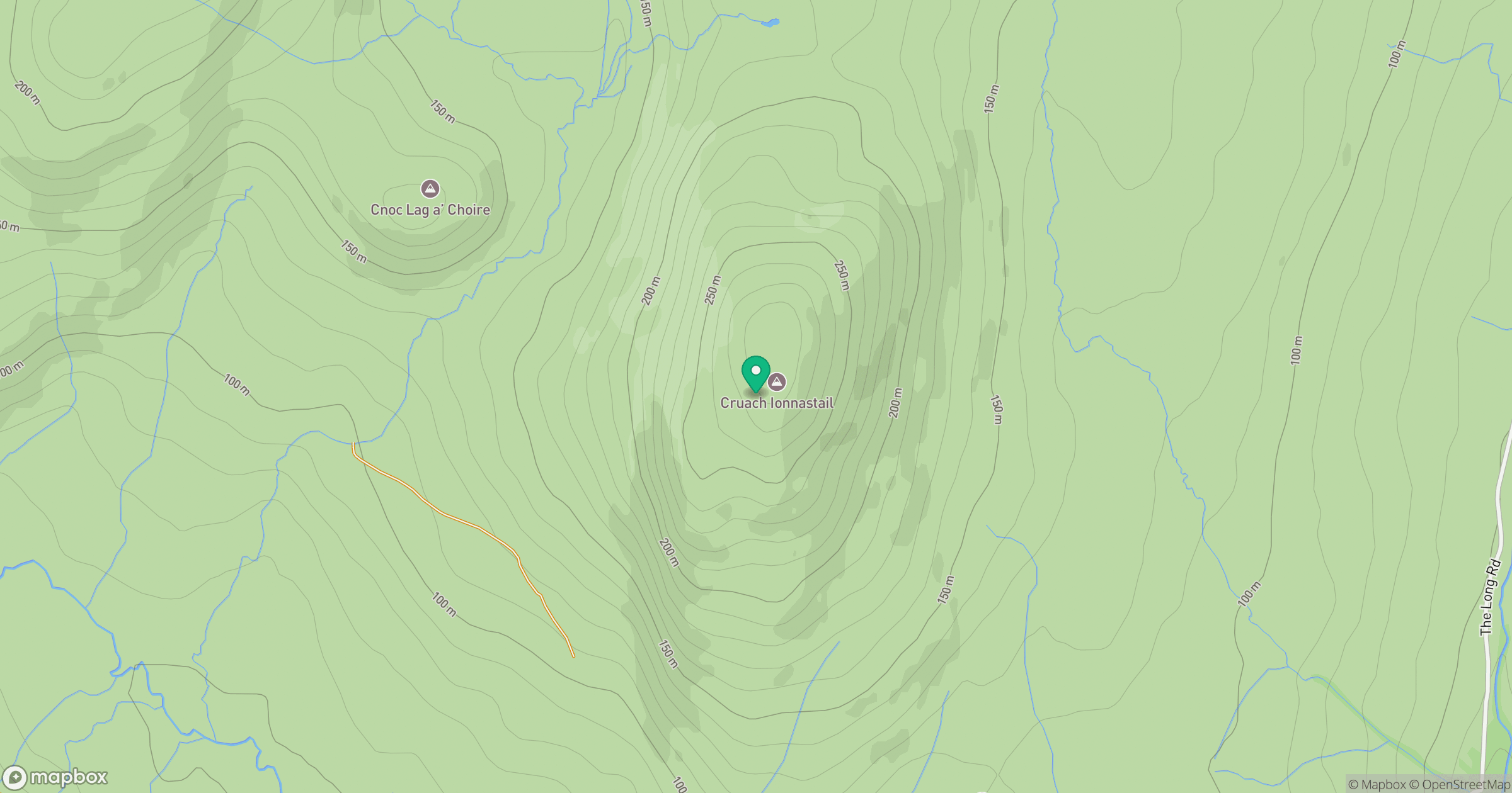
Grid reference: NR647917
View on OpenStreetMapOpens a map in a new tab, centred on the hill.
Hills within 30 km
Straight-line distance, not a walking route or confirmation of access.
Beinn an Oir
785m
Cruach an Uillt Fearna
339m
Cruach na Seilcheig
304m
Beinn Sgaillinish
194m
Beinn Bhreac
468m
No comments yet. Be the first.