
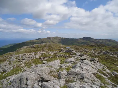
Rainberg Mor
Good walks are even better shared.
Overview
Rainberg Mor
Nestled in the heart of the Southern Uplands, Rainberg Mor stands proud at 480 meters above sea level. It may not be the highest peak in Scotland, but it certainly packs a punch with its splendid views and rich tapestry of flora and fauna.
Geology
The mountain is primarily composed of volcanic rock, particularly andesite, shaped through millions of years of geological processes. The contrasting sedimentary layers are visible as you ascend, making it a geologist's delight. Keep an eye out for quirky rock formations that could fuel your imagination!
Access
Getting to Rainberg Mor is relatively straightforward. The nearest parking can be found at Upper Donside, where you can safely leave your vehicle. A short jaunt leads you to the trailhead, making it accessible for families as well.
Public transport options are somewhat limited, with infrequent bus services from Moffat, but nothing a bit of pre-planning can't fix. The charming town of Moffat, just a 10 km drive away, is your gateway to supplies and a hearty meal!
The Route
The Circular Route from Upper Donside is a scenic trek that showcases the best this beautiful area has to offer. It’s about 8.5 km long and should take around 3.5 hours to complete. Expect a moderate challenge, with some boggy sections that demand a bit of agility—mind those wellington boots!
Summit Features
When you reach the summit, you’ll find a modest cairn, a true sign of your achievement. The views from the top span across the Southern Uplands, providing a perfect backdrop for your happies snaps.
Views
On a clear day, not only do you have panoramic vistas of the surrounding hills, but you might just spot the Isle of Arran in the distance, waving hello!
Hazards
As with any outdoor adventure in these stunning but unpredictable lands, be aware of rapidly changing weather conditions. The terrain can be slippery after rain, and you may well encounter some boggy bits that are surprisingly adept at holding onto your boots.
Nearby Summits
If you’re feeling adventurous after conquering Rainberg Mor, consider checking out nearby Black Hill or even the more challenging Skiddaw. Both are fantastic hikes in their own right.
Conclusion
In summary, Rainberg Mor may not boast the height of its taller neighbours, but its charm lies in the views, the geology, and the stories that surround it. Pack your hiking boots, a hearty lunch, and don’t forget your sense of adventure!
Explore routes near Rainberg Mor
Public walks starting within 80 km of this hill. Nearby does not mean a route reaches the summit; check its map and access before setting out.
Crinan Canal: Bellanoch and Dunardry towpath return
View route
Glen Kin group walk
View route
Bishop’s Glen group walk
View route
West Bay walk and talk
View route
Route planning notes
These notes describe possible approaches, not verified navigable routes or permission to cross land. Check current paths, local access rules and conditions before setting out.
The Circular Route from Upper Donside
This delightful loop trail offers a mix of open moorland and woodland, culminating in stunning views from the summit. A beautifully scenic way to get your steps in!
Make a day of it, together
Find someone to share the walk with, or organise a day out along a route you like.
Photo Gallery
View all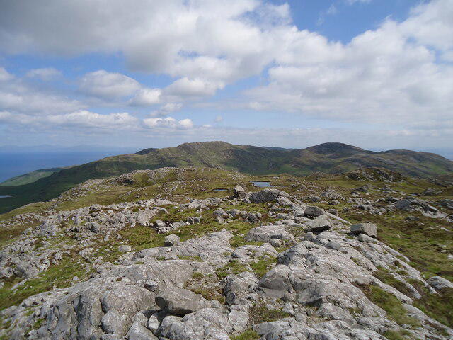 Photo could not load
NR5787 : The summit of Rainberg Mor, 459m
Michael Earnshaw
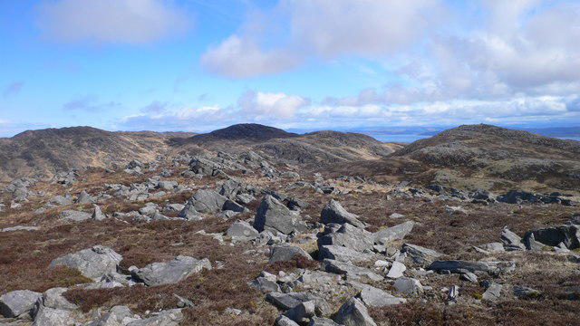 Photo could not load
NR5787 : Top to the south-east of Rainberg Mor summit
Peter Edwards
Hill facts and local notes
Classifications
Elevation
459m
1,506 ft
Prominence
118m
Coordinates
56.0179, -5.8960
NR572874
OS Map
61
Explorer: 355N
At the Summit
At the summit, there is a modest stone cairn that serves as a navigational aid. The surrounding area is grassy with scattered rocks; perfect for a picnic if you fancy a munch at the top!
Terrain & Geology
The dominant geology is volcanic rock, predominantly andesite, with patches of sedimentary deposits forming interesting contrasts. The area was shaped by volcanic activity and glacial erosion, providing fascinating rock formations and great photo opportunities.
Views & Scenery
From the top, you can marvel at the rolling hills of the Southern Uplands, spot the shimmering waters of nearby lochs, and, on a clear day, see as far as the Isle of Arran.
History & Heritage
Name Origin
The name 'Rainberg' suggests it's derived from the Gaelic 'Rain' meaning 'hill', and 'berg' reflects the higher ground, giving it a simple yet significant meaning: hill of the higher ground.
Historical Significance
Historically, this area has been a crossroads for local communities, with old tracks likely used by drovers moving livestock between pastures.
Getting There & Facilities
Check current local access restrictions, parking rules and transport timetables before travelling. These notes do not confirm public access to the summit.
Parking
There is a small parking area at Upper Donside, which can accommodate several cars; it's free of charge and only a short walk to the trailhead.
Public Transport
The nearest bus service runs from the town of Moffat to Upper Donside, but it’s advisable to check the schedules as they can be infrequent.
Nearby Facilities
There are no facilities directly on the mountain, but Moffat has several cafés, restaurants, and public toilets—perfect for a hearty meal before or after your adventure!
Safety Information
Known Hazards
- Beware of sudden weather changes, typical of the Scottish uplands, and muddy paths during rainy periods. Take care, as the bogs may have more 'suction power' than you bargain for!
General Safety Tips
- Check weather conditions before setting out
- Carry appropriate clothing and equipment
- Let someone know your planned route
- Take a map, compass, and GPS device
- Carry emergency supplies: food, water, first aid kit, torch
Hills
Some common questions about the hills answered
Are there group walks up Rainberg Mor?
Many walkers use Walkmates to join or organise walks with others. You can check for group walks around Rainberg Mor through the maps
Are there other walkers around Rainberg Mor?
Activity varies by location and time, but Walkmates lets you see whether others have shared walks or shown interest in this area. Find other people through the walking friends search walking friends for Rainberg Mor search or of course create your own walk for Rainberg Mor
Can I organise a walk to Rainberg Mor?
Yes. If there aren’t any walks listed already, you can create a walk and make it available for others to join.
If you're signed up to Walkmates, you can create a walk to Rainberg Mor.
How do I find a walk up this hill?
There are often multiple ways to walk this hill, depending on experience and route preference. Walkmates helps you explore walks and routes that others have shared.
Can I suggest a new route up Rainberg Mor?
Yes. You can suggest or create routes to share with others. Walkmates focuses on the social side of walking, so routes are used to help people organise walks and explore areas together, rather than as detailed navigation tools or route libraries.
Other uses really appreciate knowledgeable walkers sharing their routes. Share your favourite route to Rainberg Mor here
The is an error or something incorrect about this hill. How do I let you know?
We always strive to keep the information on Walkmates as accurate as possible. If you find an error, please let us know through the contact form and we'll aim to correct it as quickly as possible
Community Discussion
Comments
Location
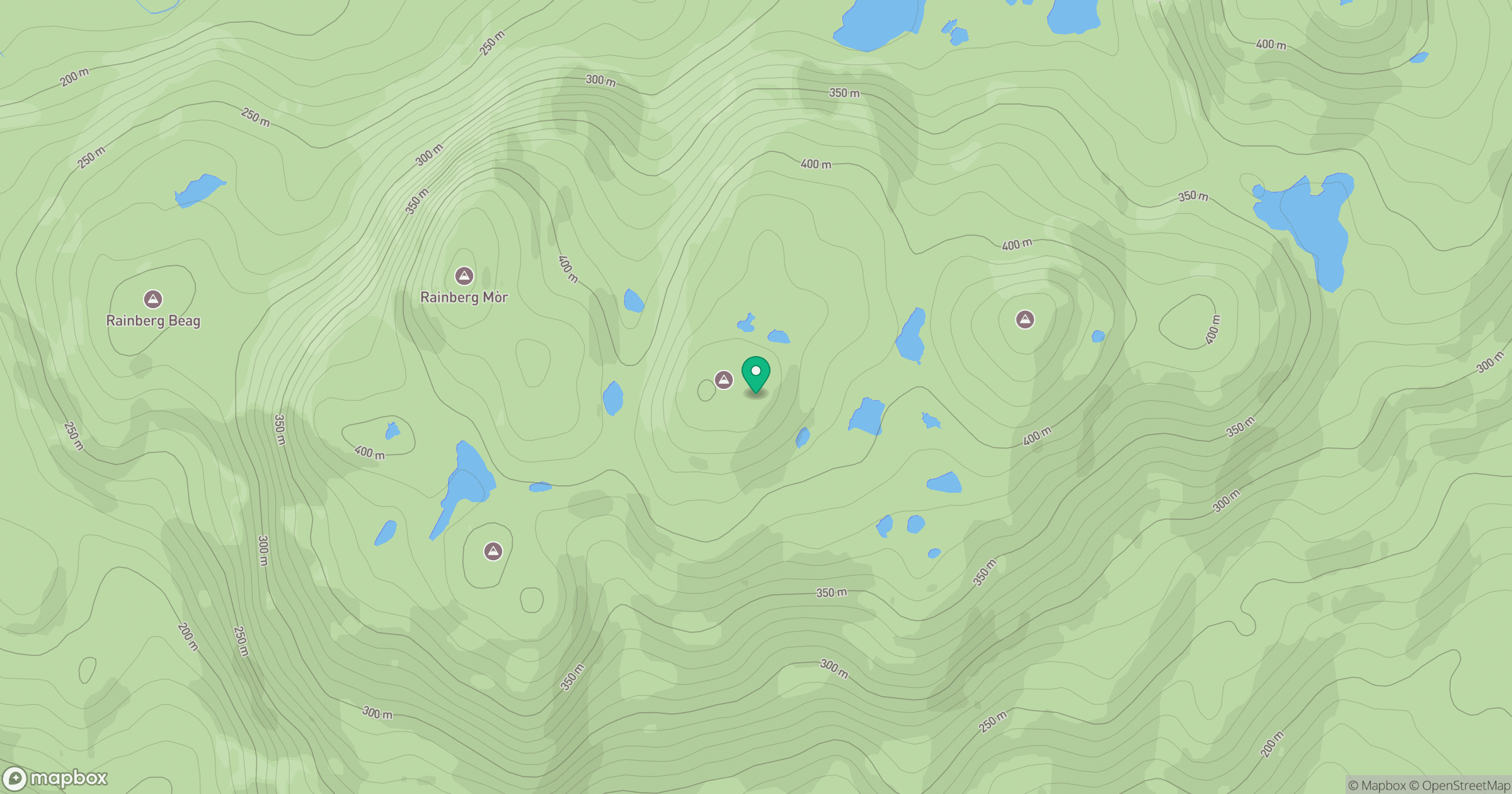
Grid reference: NR572874
View on OpenStreetMapOpens a map in a new tab, centred on the hill.
Hills within 30 km
Straight-line distance, not a walking route or confirmation of access.
No comments yet. Be the first.