
Beinn Sgaillinish
Good walks are even better shared.
Overview
Overview
Beinn Sgaillinish is a hidden gem nestled in the heart of the Scottish Highlands. At an elevation of 840 meters, it may not be the tallest in the region, but it certainly commands respect with its rugged features and breathtaking views.
Geology
The rocky formations here are primarily ancient schist, shaped by millennia of glacial activity and erosion. As you make your ascent, keep an eye out for peculiar rock formations that tell the story of the earth's dynamic processes.
Routes
Starting from Inverawe, the routes are diverse and suitable for a range of hiking abilities. The Walker’s Route is a firm favourite, offering a moderately challenging trek through picturesque scenery. If you're feeling a bit more adventurous, the Western Approach involves a delightful scramble near the summit, perfect for those who thrive on a bit of challenge. Remember, every step is a step closer to that sweet summit hug—a well-earned reward!
Terrain
Expect rocky and grassy terrain, with some boggy patches if the heavens have opened. Waterproof boots are a must; remember, the Highlands can be a bit shy and might choose to shower you unexpectedly.
Views
Once at the summit, bask in the views of Ben Cruachan and Loch Awe, especially stunning during a crisp clear day. Spring and summer are the best seasons for grabbing the most casual and scenic photos.
Hazards
While hiking is generally a safe venture, do be wary of loose rocks and changeable weather! The Highlands are notorious for being temperamental, so always check the forecast before you set out.
Access
Inverawe Forest Park is your go-to for parking, with public transport links from Oban. If you’ve time, a quick visit to Taynuilt is advised to stock up on supplies before heading into the wild.
Facilities
After your adventure, enjoy a treat or two in Taynuilt's cafes. Nothing like a warm cuppa to discuss the day’s exploits!
Conclusion
Beinn Sgaillinish is not just a climb but an invitation to engage with nature in one of its purest forms. Bring your sense of adventure and a snack or two, and you'll create memories to last a lifetime.
Explore routes near Beinn Sgaillinish
Public walks starting within 80 km of this hill. Nearby does not mean a route reaches the summit; check its map and access before setting out.
Crinan Canal: Bellanoch and Dunardry towpath return
View route
Glen Kin group walk
View route
Bishop’s Glen group walk
View route
West Bay walk and talk
View route
Route planning notes
These notes describe possible approaches, not verified navigable routes or permission to cross land. Check current paths, local access rules and conditions before setting out.
Walker’s Route from Inverawe
A scenic route starting from Inverawe, leading you through beautiful woodland and into the open moorland towards the summit.
Western Approach
This more challenging route takes you from the western side and involves some scrambling near the summit, ideal for the adventurous.
Make a day of it, together
Find someone to share the walk with, or organise a day out along a route you like.
Hill facts and local notes
Classifications
Elevation
194m
636 ft
Prominence
120m
Coordinates
55.9947, -5.8199
NR618845
OS Map
61
Explorer: 355N
At the Summit
The summit features a substantial cairn alongside a trig point, providing a perfect spot for a well-deserved snack and photo opportunities.
Terrain & Geology
Beinn Sgaillinish is primarily composed of ancient schist, giving it a rugged look. The mountain's long history of erosion has produced striking cliffs and crags, perfect for those who appreciate the raw power of nature.
Views & Scenery
From the summit, you can behold stunning views of the surrounding peaks including Ben Cruachan to the northeast and the vast Loch Awe nestled in the distance.
History & Heritage
Name Origin
The name 'Beinn Sgaillinish' derives from the Gaelic for 'the mountain of the mountain side', hinting at its quintessential Highland charm.
Historical Significance
The mountain is popular with climbers and hikers looking to experience the rugged beauty of the Scottish Highlands, part of the munro bagging community.
Getting There & Facilities
Check current local access restrictions, parking rules and transport timetables before travelling. These notes do not confirm public access to the summit.
Parking
Inverawe Forest Park offers ample parking with signs directing you to suitable start points for various hiking routes.
Public Transport
Buses from Oban stop at the Inverawe area, but check timings in advance as they may be infrequent.
Nearby Facilities
Amenities include public toilets at Inverawe Forest Park and several cafes in Taynuilt for a post-hike refreshment.
Safety Information
Known Hazards
- Loose rocks on steeper sections can pose a risk, especially when wet. Be mindful of sudden weather changes typical in the Highlands.
General Safety Tips
- Check weather conditions before setting out
- Carry appropriate clothing and equipment
- Let someone know your planned route
- Take a map, compass, and GPS device
- Carry emergency supplies: food, water, first aid kit, torch
Hills
Some common questions about the hills answered
Are there group walks up Beinn Sgaillinish?
Many walkers use Walkmates to join or organise walks with others. You can check for group walks around Beinn Sgaillinish through the maps
Are there other walkers around Beinn Sgaillinish?
Activity varies by location and time, but Walkmates lets you see whether others have shared walks or shown interest in this area. Find other people through the walking friends search walking friends for Beinn Sgaillinish search or of course create your own walk for Beinn Sgaillinish
Can I organise a walk to Beinn Sgaillinish?
Yes. If there aren’t any walks listed already, you can create a walk and make it available for others to join.
If you're signed up to Walkmates, you can create a walk to Beinn Sgaillinish.
How do I find a walk up this hill?
There are often multiple ways to walk this hill, depending on experience and route preference. Walkmates helps you explore walks and routes that others have shared.
Can I suggest a new route up Beinn Sgaillinish?
Yes. You can suggest or create routes to share with others. Walkmates focuses on the social side of walking, so routes are used to help people organise walks and explore areas together, rather than as detailed navigation tools or route libraries.
Other uses really appreciate knowledgeable walkers sharing their routes. Share your favourite route to Beinn Sgaillinish here
The is an error or something incorrect about this hill. How do I let you know?
We always strive to keep the information on Walkmates as accurate as possible. If you find an error, please let us know through the contact form and we'll aim to correct it as quickly as possible
Community Discussion
Comments
Location
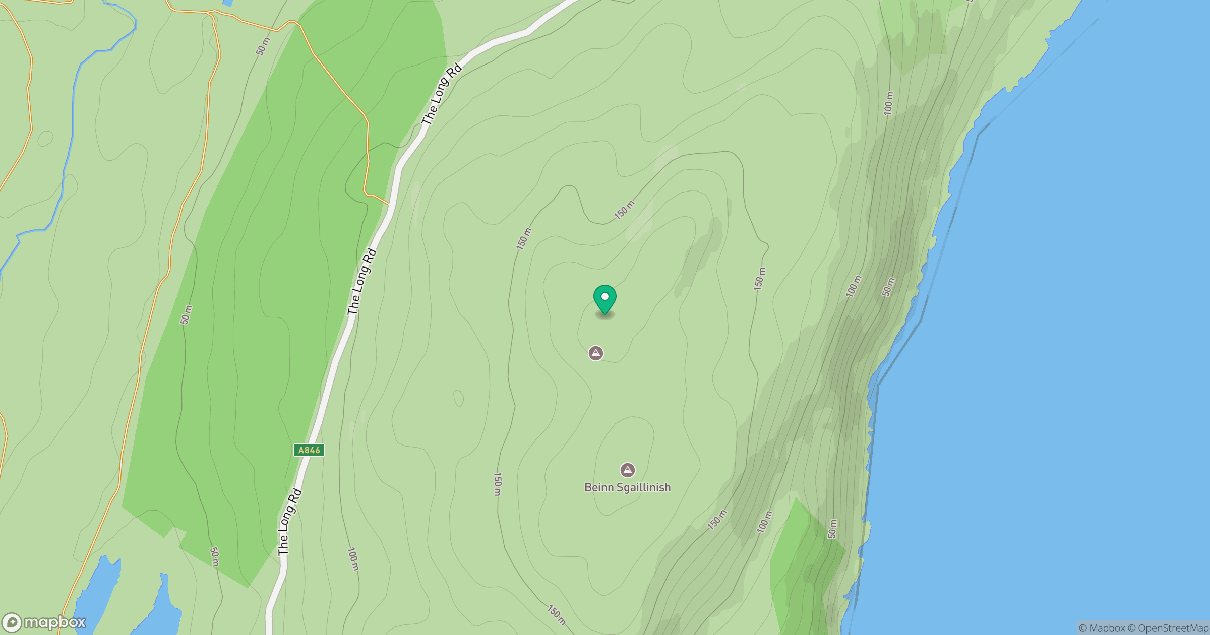
Grid reference: NR618845
View on OpenStreetMapOpens a map in a new tab, centred on the hill.
Hills within 30 km
Straight-line distance, not a walking route or confirmation of access.
No comments yet. Be the first.