

Cruach an Uillt Fearna
Good walks are even better shared.
Overview
Cruach an Uillt Fearna
Nestled within the stunning Scottish Highlands, Cruach an Uillt Fearna rises at an elevation of 400 meters, standing as a modest yet fulfilling challenge for hikers looking to explore the scenic landscapes of the region.
Geology
The mountain is primarily made of granite and quartzite, showcasing a tapestry of geological history. As you traverse its slopes, keep your eyes peeled for glacial features that tell stories of the Ice Age. You'll find yourself walking on nature's very own battlefields between time and weather.
Route Information
The most popular route begins at the charming hamlet of Achagour. This trek is approximately 8 kilometers round trip and takes about 3.5 hours to complete. The trail meanders through picturesque heather moorland, ascending gently before the glorious challenge of steeper terrain. It's a moderate hike that will make you feel accomplished without leaving you gasping for breath like you've just run a marathon.
Summit Features
Arriving at the summit, you'll be greeted by a sturdy cairn. It’s the perfect backdrop for that illustrious Instagram shot where you can pretend to look contemplative while really just trying to catch your breath. The views from this vantage point are nothing short of spectacular.
Terrain Type
The terrain is primarily grassy, accented by rocky outcrops. Be aware that sections can be boggy, especially after rainfall, so sturdy boots are recommended unless you want to take a surprise dip in the mud.
Views
From the summit, you will gain breathtaking panoramic views of Loch Awe and the surrounding hills. On clear days, the impressive Ben Cruachan and other peaks in Argyll make for stunning photographs, proving to your friends back home that yes, the Scottish countryside is real and utterly enchanting.
Hazards
While hiking, be aware that the weather in the Highlands can change faster than a cat in a room full of rocking chairs. Prepare for rain, even if the forecast is sunny. It's always better to be over-prepared than to find yourself squelching back to your car in soggy socks.
Nearby Summits
For those looking to extend their adventure, nearby summits like Ben Cruachan (1,126 meters) and Meall nan Searr (676 meters) offer additional hiking opportunities, ensuring that you’ll never get bored of the breathtaking Highland scenery.
Access
Parking is available at Achagour, just a few spaces off the road, making it convenient for hikers. Public transportation options are slim, with the nearest bus stopping in Dalmally, requiring a short taxi ride to the starting point. Dalmally is also your best bet for pre-hike snacks or a comforting cup of tea.
Facilities
While Achagour itself has no facilities, the nearby town of Dalmally has cafes and toilets for hikers needing to refuel or refresh.
History
The name 'Cruach an Uillt Fearna' speaks to the fern-covered streams that weave through the area. Historically, the mountain has been steeped in cultural significance with connections to local folklore and the tales of ancient clans that once roamed these lands.
Whether you're a seasoned hiker or just fancy a stroll, Cruach an Uillt Fearna offers a delightful escape into the wild beauty of the Scottish Highlands. So pack your things, grab your walking stick, and get ready to make some memories that will last a lifetime.
Happy hiking!
Explore routes near Cruach an Uillt Fearna
Public walks starting within 80 km of this hill. Nearby does not mean a route reaches the summit; check its map and access before setting out.
Crinan Canal: Bellanoch and Dunardry towpath return
View route
Glen Kin group walk
View route
Bishop’s Glen group walk
View route
West Bay walk and talk
View route
Route planning notes
These notes describe possible approaches, not verified navigable routes or permission to cross land. Check current paths, local access rules and conditions before setting out.
Start at Achagour
A scenic route starts from the small hamlet of Achagour, gently ascending through heather moorland before tackling the steeper slopes.
Make a day of it, together
Find someone to share the walk with, or organise a day out along a route you like.
Photo Gallery
View all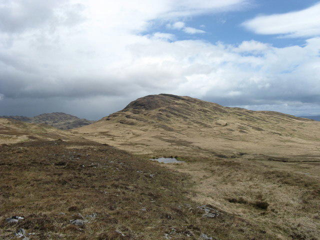 Photo could not load
NR6190 : Upper Glen Grundale
Andrew Spenceley
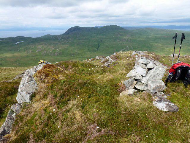 Photo could not load
NR6290 : Cruach an Uillt Fearna
Rude Health
Hill facts and local notes
Classifications
Elevation
339m
1,112 ft
Prominence
111m
Coordinates
56.0512, -5.8224
NR620908
OS Map
61
Explorer: 355N
At the Summit
The summit is marked by a prominent cairn that offers a welcome sight for tired legs and a perfect photo opportunity.
Terrain & Geology
The mountain is primarily composed of granite and quartzite, forming characteristic rugged outcrops that embody the ancient geological history of the Highlands.
Views & Scenery
Panoramic views of Loch Awe and the surrounding hills, with distant sightings of Ben Cruachan and the peaks of the Argyll region.
History & Heritage
Name Origin
Cruach an Uillt Fearna translates to 'the hill of the fern brook', highlighting the natural flora and streams in the area.
Historical Significance
The mountain holds local historic value, often featuring in folklore and the stories of early Scottish clans.
Getting There & Facilities
Check current local access restrictions, parking rules and transport timetables before travelling. These notes do not confirm public access to the summit.
Parking
Parking is available at Achagour, a small roadside area suitable for a few cars.
Public Transport
Public transport is limited; nearest service is a bus to Dalmally, followed by a short taxi ride to Achagour.
Nearby Facilities
While there are no facilities directly at Achagour, Dalmally has cafes and toilets for pre- or post-hike refreshments.
Safety Information
Known Hazards
- Potential for sudden weather changes common in the Highlands; be prepared for rain even in the sunshine.
General Safety Tips
- Check weather conditions before setting out
- Carry appropriate clothing and equipment
- Let someone know your planned route
- Take a map, compass, and GPS device
- Carry emergency supplies: food, water, first aid kit, torch
Hills
Some common questions about the hills answered
Are there group walks up Cruach an Uillt Fearna?
Many walkers use Walkmates to join or organise walks with others. You can check for group walks around Cruach an Uillt Fearna through the maps
Are there other walkers around Cruach an Uillt Fearna?
Activity varies by location and time, but Walkmates lets you see whether others have shared walks or shown interest in this area. Find other people through the walking friends search walking friends for Cruach an Uillt Fearna search or of course create your own walk for Cruach an Uillt Fearna
Can I organise a walk to Cruach an Uillt Fearna?
Yes. If there aren’t any walks listed already, you can create a walk and make it available for others to join.
If you're signed up to Walkmates, you can create a walk to Cruach an Uillt Fearna.
How do I find a walk up this hill?
There are often multiple ways to walk this hill, depending on experience and route preference. Walkmates helps you explore walks and routes that others have shared.
Can I suggest a new route up Cruach an Uillt Fearna?
Yes. You can suggest or create routes to share with others. Walkmates focuses on the social side of walking, so routes are used to help people organise walks and explore areas together, rather than as detailed navigation tools or route libraries.
Other uses really appreciate knowledgeable walkers sharing their routes. Share your favourite route to Cruach an Uillt Fearna here
The is an error or something incorrect about this hill. How do I let you know?
We always strive to keep the information on Walkmates as accurate as possible. If you find an error, please let us know through the contact form and we'll aim to correct it as quickly as possible
Community Discussion
Comments
Location
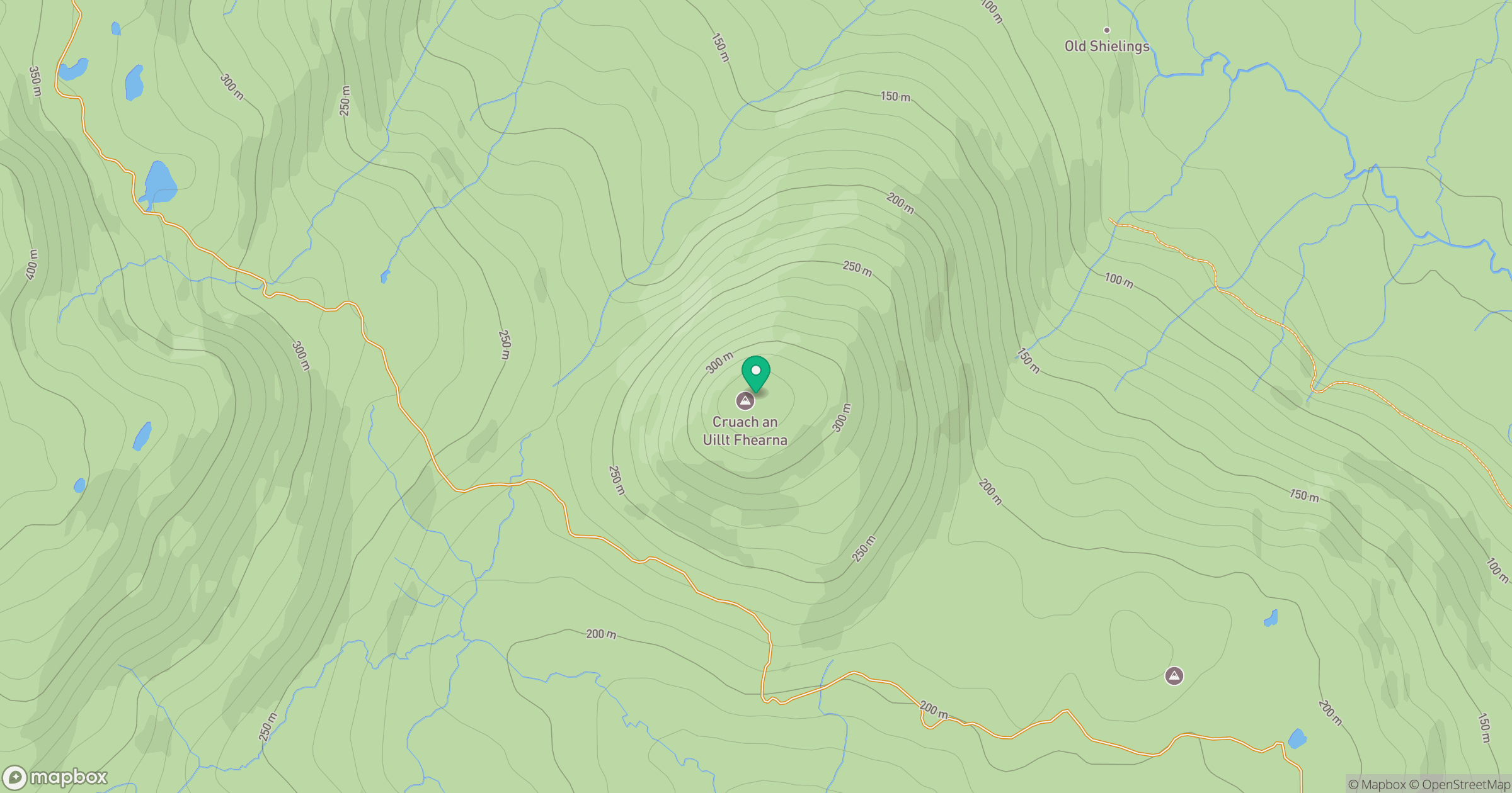
Grid reference: NR620908
View on OpenStreetMapOpens a map in a new tab, centred on the hill.
Hills within 30 km
Straight-line distance, not a walking route or confirmation of access.
No comments yet. Be the first.