
Cruach Bhuidhe
Good walks are even better shared.
Overview
Cruach Bhuidhe: A Munro of Distinction
Nestled in the heart of the Scottish Highlands, Cruach Bhuidhe stands proudly at an elevation of 926 meters, beckoning hikers and outdoor enthusiasts alike to explore its scenic paths and breathtaking summits.
Geology
The mountains of the Highlands are storied, and Cruach Bhuidhe is no different. Its rocky crags and rounded slopes are primarily composed of metamorphic rock formed under immense pressure. Glacial activity has sculpted the terrain, leaving behind an impressive landscape ripe for exploration. Who knew geology could be both fascinating and beautiful?
Routes
Two popular routes to reach the summit are from Inveruglas and the Clutha River Trail. The Inveruglas route is approximately 10 km, taking an average of 4 hours to navigate through picturesque woodlands to the steeper terrain of the hill. Alternatively, the Clutha River Trail stretches a tad longer at 11.5 km and is slightly more scenic, combining riverside beauty with the tranquillity of the Loch Awe.
Summit Features
As you approach the top, you'll find a small stone cairn marking the summit. Don't forget your camera; the panoramic views from here are a treat! You'll see Ben Lomond rising majestically, Loch Awe sprawling like a glistening jewel, and further afield, the Southern Highlands laughing in the distance.
Terrain Type
Hikers will encounter rocky paths interspersed with grassy slopes that can turn into bogs quickly after rain. Sturdy footwear is a must; it's not always buttercups and daisies up here!
Views
The highlights from the summit are surely not to be missed; on clear days, the vistas become nothing short of stunning. Spring and early autumn offer the best opportunities for breathtaking views, with the heather colourfully blooming and visibility great. Just avoid the occasional Scottish fog—it’ll cover you quicker than a Scotsman can down a pint!
Hazards
While the thrill of summiting is incomparable, keep your wits about you! Be mindful of steep drops near the summit, unpredictable weather patterns, and steer clear of boggy patches after rain. Safety first, always!
Nearby Summits
If you’ve got the legs for it, consider adding nearby summits like Ben Lomond and Meall na Dunaiche to your itinerary. They promise more of the stunning views and, of course, more chances for those all-important Instagram moments.
Access
Accessing Cruach Bhuidhe is user-friendly, with ample parking at the Inveruglas car park making it a breeze to get started. The local public transport links, from Glasgow to Tarbet, are reliable if you prefer not to drive. Plus, Balloch, just a 12-mile jaunt away, is your go-to hive for pre-hike logistics.
Facilities
Ensure you stock up at the cafes in Balloch before you set off. Nature calls, and a well-timed coffee break can do wonders for your morale!
History
As you hike, take a moment to appreciate the mountain's significance; 'Cruach Bhuidhe', meaning 'yellow hill' in Gaelic, reflects the breathtaking natural beauty found among the heather blooms here.
Set your sights on Cruach Bhuidhe for a delightful blend of adventure, stunning views, and an intriguing Scottish legacy. Now, lace up those boots and get out there—nature is calling!
Happy hiking!
Explore routes near Cruach Bhuidhe
Public walks starting within 80 km of this hill. Nearby does not mean a route reaches the summit; check its map and access before setting out.
Glen Kin group walk
View route
Bishop’s Glen group walk
View route
West Bay walk and talk
View route
West Bay walk and talk
View route
Route planning notes
These notes describe possible approaches, not verified navigable routes or permission to cross land. Check current paths, local access rules and conditions before setting out.
Inveruglas
A popular starting point from the shores of Loch Lomond, this route takes you through scenic woodland before approaching the steeper slopes of Cruach Bhuidhe.
Clutha River Trail
An alternative approach that combines stunning riverside paths with views over Loch Awe, before summiting Cruach Bhuidhe.
Make a day of it, together
Find someone to share the walk with, or organise a day out along a route you like.
Hill facts and local notes
Classifications
Elevation
568m
1,865 ft
Prominence
149m
Coordinates
56.1082, -5.0164
NS125947
OS Map
56
Explorer: OL37N 363N
At the Summit
The summit boasts a small stone cairn and is renowned for its panoramic views of the surrounding Highlands, making for a perfect photo opportunity.
Terrain & Geology
Primarily composed of metamorphic rocks with a significantly glacially influenced landscape, offering a fascinating study of geological processes in the area.
Views & Scenery
On a clear day, you can enjoy breathtaking views of the surrounding mountains including Ben Lomond, Loch Awe, and even out toward the distant peaks of the Southern Highlands.
History & Heritage
Name Origin
The name 'Cruach Bhuidhe' translates to 'yellow hill' in Gaelic, likely referencing the heathers that bloom on the slopes.
Historical Significance
Cruach Bhuidhe is a beloved destination among hikers and attracts considerable attention for its natural beauty and biodiversity.
Getting There & Facilities
Check current local access restrictions, parking rules and transport timetables before travelling. These notes do not confirm public access to the summit.
Parking
There is ample parking available at the Inveruglas car park, which provides convenient access to the trails starting point.
Public Transport
Regular buses run from Glasgow to the nearby village of Tarbet, followed by a short taxi ride to the car park.
Nearby Facilities
Balloch offers various facilities including cafes, shops, and public toilets to prepare for your hike.
Safety Information
Known Hazards
- Be cautious of steep drops near the summit, changing weather conditions, and avoid walking on boggy paths when wet.
General Safety Tips
- Check weather conditions before setting out
- Carry appropriate clothing and equipment
- Let someone know your planned route
- Take a map, compass, and GPS device
- Carry emergency supplies: food, water, first aid kit, torch
Hills
Some common questions about the hills answered
Are there group walks up Cruach Bhuidhe?
Many walkers use Walkmates to join or organise walks with others. You can check for group walks around Cruach Bhuidhe through the maps
Are there other walkers around Cruach Bhuidhe?
Activity varies by location and time, but Walkmates lets you see whether others have shared walks or shown interest in this area. Find other people through the walking friends search walking friends for Cruach Bhuidhe search or of course create your own walk for Cruach Bhuidhe
Can I organise a walk to Cruach Bhuidhe?
Yes. If there aren’t any walks listed already, you can create a walk and make it available for others to join.
If you're signed up to Walkmates, you can create a walk to Cruach Bhuidhe.
How do I find a walk up this hill?
There are often multiple ways to walk this hill, depending on experience and route preference. Walkmates helps you explore walks and routes that others have shared.
Can I suggest a new route up Cruach Bhuidhe?
Yes. You can suggest or create routes to share with others. Walkmates focuses on the social side of walking, so routes are used to help people organise walks and explore areas together, rather than as detailed navigation tools or route libraries.
Other uses really appreciate knowledgeable walkers sharing their routes. Share your favourite route to Cruach Bhuidhe here
The is an error or something incorrect about this hill. How do I let you know?
We always strive to keep the information on Walkmates as accurate as possible. If you find an error, please let us know through the contact form and we'll aim to correct it as quickly as possible
Community Discussion
Comments
Location
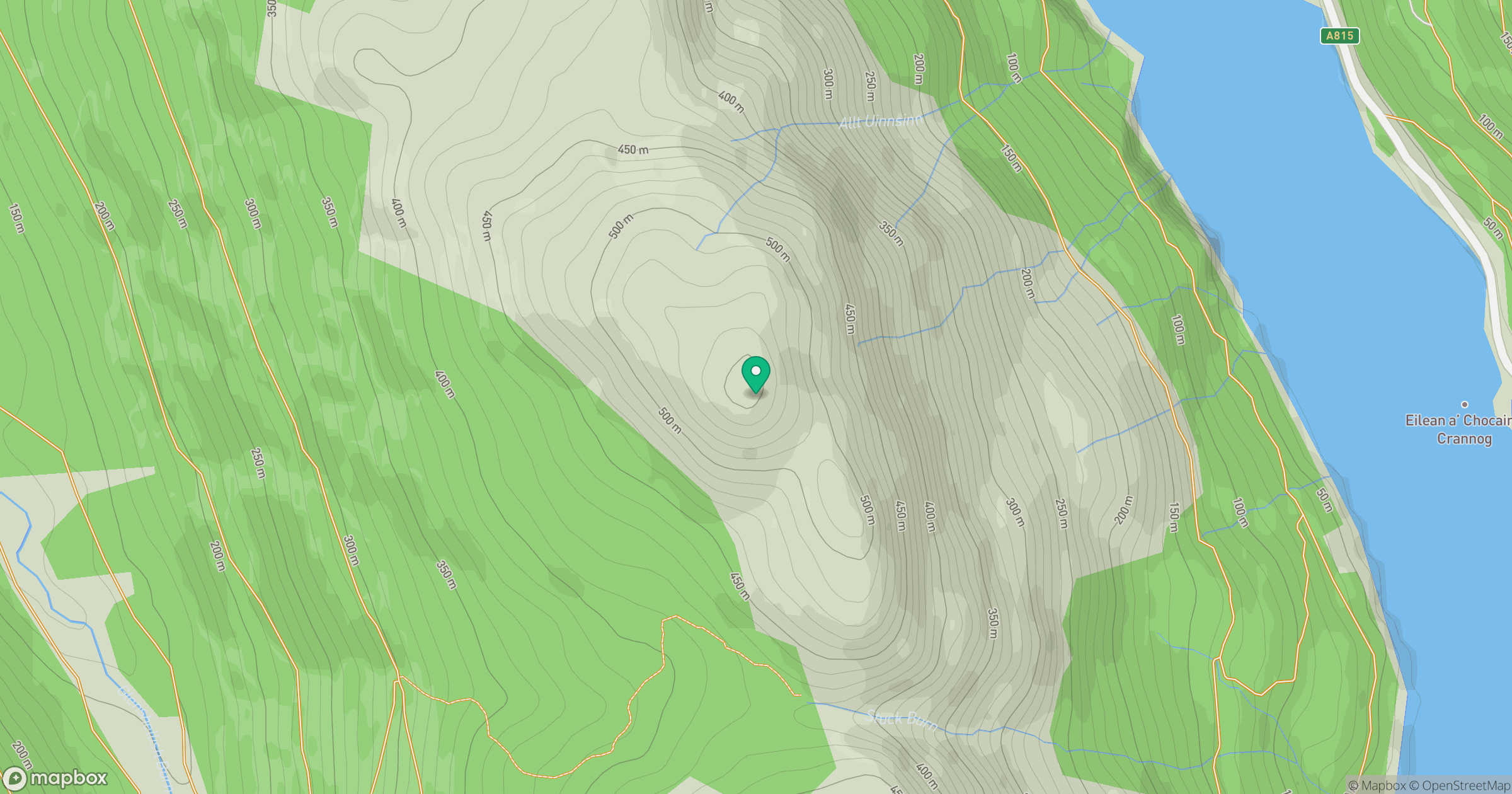
Grid reference: NS125947
View on OpenStreetMapOpens a map in a new tab, centred on the hill.
Hills within 30 km
Straight-line distance, not a walking route or confirmation of access.

No comments yet. Be the first.