

Clach Bheinn
Good walks are even better shared.
Overview
Clach Bheinn: A Hiking Gem of the Scottish Highlands
Clach Bheinn, standing proudly at 829 metres, is a must-visit for any hiker—no ifs, ands, or buts about it! This Munro offers both challenge and beauty, with its dramatic granite landscapes that have weathered the test of time.
Geology
As you ascend, take a moment to appreciate the geology around you. The granite of Clach Bheinn gives way to boulders and crags, while the ancient Lewisian gneiss of the surrounding areas provides a glimpse into the Earth’s early history. You might even feel like a geologist yourself, armed with nothing but curiosity and a pair of sturdy boots!
Routes
The recommended route begins at Inverkaillie Farm, progressing through lush scenery before striding upwards towards the summit. Clocking in at about 10 km, the hike will take approximately five hours, depending on your pace (and how often you stop for selfies, of course).
Summit Features
On reaching the summit, you’ll be greeted by a traditional stone cairn, perfect for posing with your hiking buddies or for an epic solo shot. The panoramic views are worth every step of the climb—grab a biscuit, sit back, and soak it all in!
Terrain
The terrain varies between rocky scrambles and grassy expanses, with the ever-present risk of the odd boggy spot. Stick to the path to avoid getting your boots soaked!
Views
From the summit, you’ll behold the sparkling Loch Allt a' Chaoil and distant peaks, including the iconic Ben Nevis. The view is best enjoyed at dawn or dusk when the golden light bathes the landscape.
Hazards
Bear in mind that weather in the Highlands can change quicker than a chameleon on a rainbow. Sudden showers can make paths slippery, so tread carefully!
Access
Finding your way to Clach Bheinn is straightforward. There is convenient parking at Inverkaillie Farm, and if public transport is more your style, take a bus from Fort William to Ballachulish—a nearby village.
Facilities
Before beginning your adventure, swing by a local café in Ballachulish. A good cup of coffee can be the fuel that fires you up the mountain!
History
The name Clach Bheinn, which means 'Stone of the Hill', reflects its rugged silhouette against the skyline. The mountain is steeped in local folklore and serves as a prominent landmark in the Highland landscape.
In conclusion, Clach Bheinn is not just a mountain; it’s an experience. So pack your rucksack, get your gear together, and set out for a memorable day in the Scottish Highlands.
For more information or tips, always check local guides or maps—because who needs an extra adventure via wrong turns?
Explore routes near Clach Bheinn
Public walks starting within 80 km of this hill. Nearby does not mean a route reaches the summit; check its map and access before setting out.
Glen Kin group walk
View route
Bishop’s Glen group walk
View route
West Bay walk and talk
View route
West Bay walk and talk
View route
Route planning notes
These notes describe possible approaches, not verified navigable routes or permission to cross land. Check current paths, local access rules and conditions before setting out.
Inverkaillie Route
A popular route starting from Inverkaillie Farm. The path meanders through scenic landscapes before tackling the final ascent to the summit.
Make a day of it, together
Find someone to share the walk with, or organise a day out along a route you like.
Photo Gallery
View all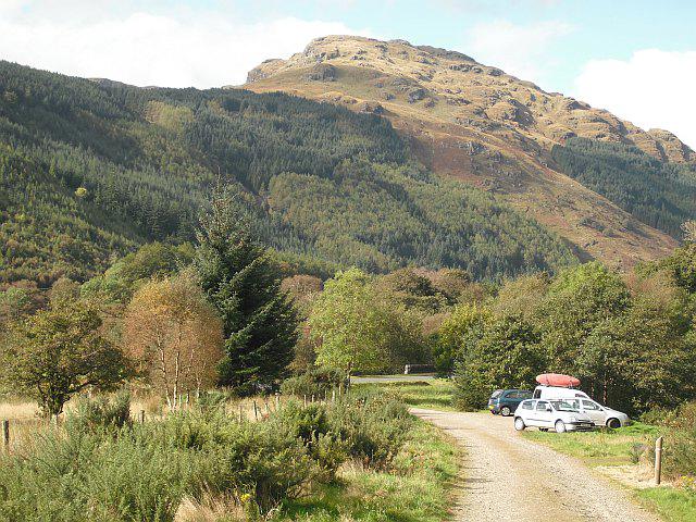 Photo could not load
NS1288 : Clach Bheinn
Richard Webb
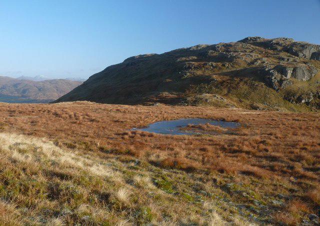 Photo could not load
NS1288 : Clach Bheinn
Alan Reid
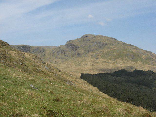 Photo could not load
NS1288 : Clach Bheinn
Richard Webb
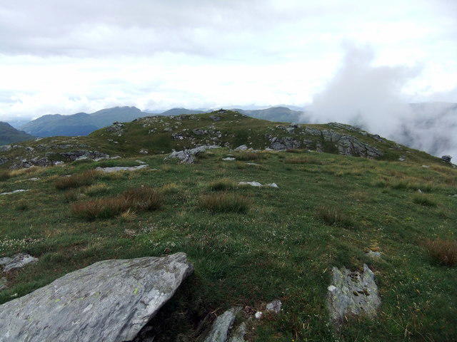 Photo could not load
NS1288 : Clach Bheinn
David Brown
Hill facts and local notes
Classifications
Elevation
643m
2,110 ft
Prominence
128m
Coordinates
56.0539, -5.0106
NS126886
OS Map
56
Explorer: OL37S 363S
At the Summit
The summit is marked by a sizeable stone cairn, offering a great spot for a snack break and a perfect photo opportunity!
Terrain & Geology
Clach Bheinn is predominantly composed of granite, which has weathered to form distinctive boulders and crags. The surrounding area features ancient Lewisian gneiss, among the oldest rocks in the UK.
Views & Scenery
Spectacular views of Loch Allt a' Chaoil and the surrounding peaks including Ben Nevis in the distance.
History & Heritage
Name Origin
Clach Bheinn translates to 'Stone of the Hill' in Gaelic, reflecting the rocky character of the mountain.
Historical Significance
The mountain is part of the ancient landscape steeped in local folklore, wherein it has been an iconic viewpoint for centuries.
Getting There & Facilities
Check current local access restrictions, parking rules and transport timetables before travelling. These notes do not confirm public access to the summit.
Parking
Ample parking is available at Inverkaillie Farm, just off the road leading to Clach Bheinn.
Public Transport
Bus services run from Fort William to the nearby village of Ballachulish; the closest stop is approximately 5 km from the route start.
Nearby Facilities
There are local cafes in Ballachulish for pre-hike refreshments and public toilets are available in the village.
Safety Information
Known Hazards
- Be wary of sudden weather changes; the Highlands can be as unpredictable as a cat on a hot tin roof. Rocky paths may be slippery, especially after rain.
General Safety Tips
- Check weather conditions before setting out
- Carry appropriate clothing and equipment
- Let someone know your planned route
- Take a map, compass, and GPS device
- Carry emergency supplies: food, water, first aid kit, torch
Hills
Some common questions about the hills answered
Are there group walks up Clach Bheinn?
Many walkers use Walkmates to join or organise walks with others. You can check for group walks around Clach Bheinn through the maps
Are there other walkers around Clach Bheinn?
Activity varies by location and time, but Walkmates lets you see whether others have shared walks or shown interest in this area. Find other people through the walking friends search walking friends for Clach Bheinn search or of course create your own walk for Clach Bheinn
Can I organise a walk to Clach Bheinn?
Yes. If there aren’t any walks listed already, you can create a walk and make it available for others to join.
If you're signed up to Walkmates, you can create a walk to Clach Bheinn.
How do I find a walk up this hill?
There are often multiple ways to walk this hill, depending on experience and route preference. Walkmates helps you explore walks and routes that others have shared.
Can I suggest a new route up Clach Bheinn?
Yes. You can suggest or create routes to share with others. Walkmates focuses on the social side of walking, so routes are used to help people organise walks and explore areas together, rather than as detailed navigation tools or route libraries.
Other uses really appreciate knowledgeable walkers sharing their routes. Share your favourite route to Clach Bheinn here
The is an error or something incorrect about this hill. How do I let you know?
We always strive to keep the information on Walkmates as accurate as possible. If you find an error, please let us know through the contact form and we'll aim to correct it as quickly as possible
Community Discussion
Comments
Location
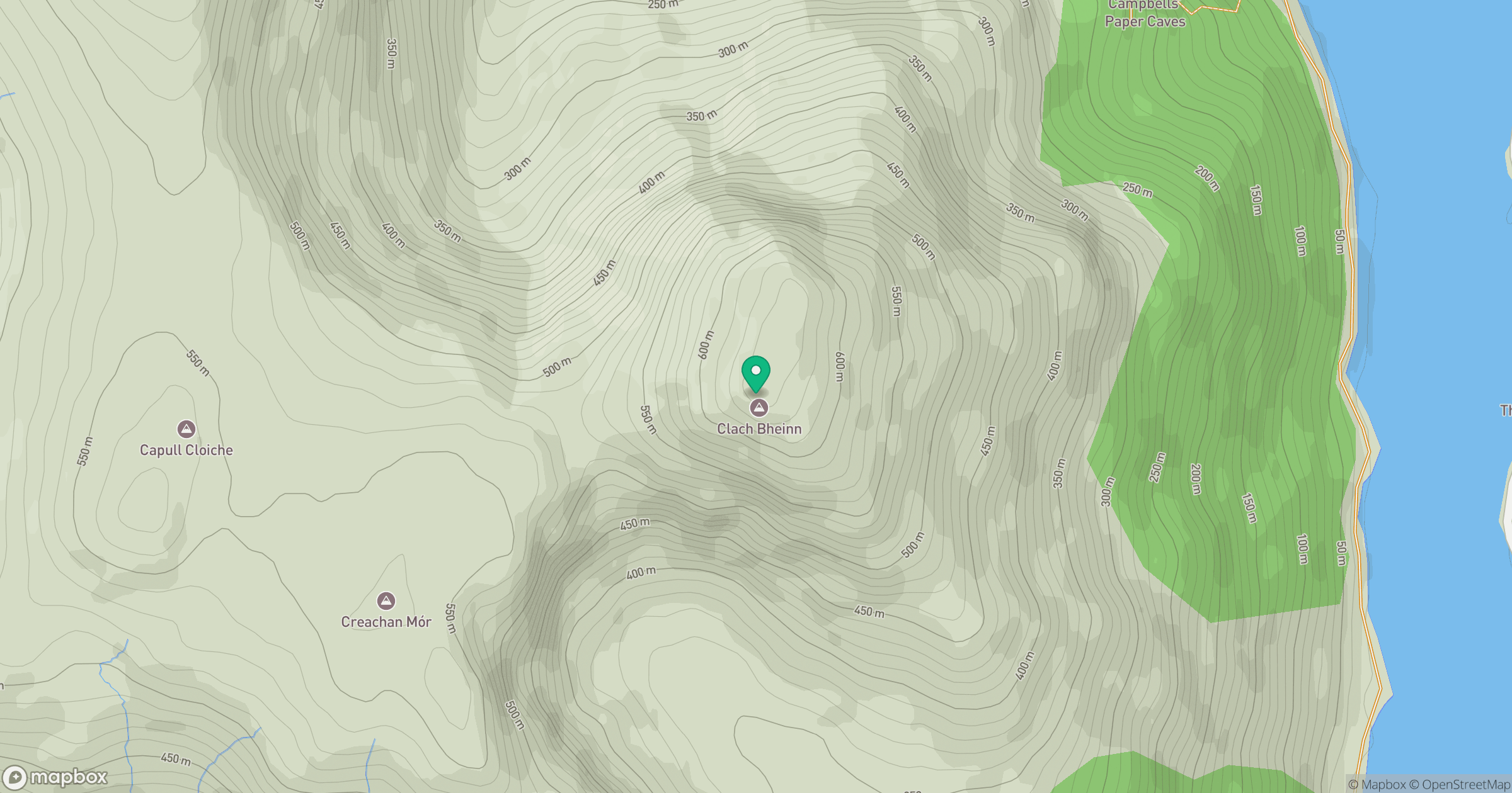
Grid reference: NS126886
View on OpenStreetMapOpens a map in a new tab, centred on the hill.
Hills within 30 km
Straight-line distance, not a walking route or confirmation of access.

No comments yet. Be the first.