
Creag a' Mhadaidh
Good walks are even better shared.
Overview
Creag a' Mhadaidh
Creag a' Mhadaidh, rising to a respectable 802 meters, is a Marilyn nestled in the heart of the Scottish Highlands, offering rugged beauty and striking views that make it a must-visit for adventurers and hillwalkers alike.
Geology
The mountain's geology is primarily mid-Devonian sandstone, interspersed with impressive granite outcrops that provide both a challenge and a feast for the eyes. The varied terrain gives insight into the powerful forces that shaped this breathtaking landscape.
Routes
While there are several routes to the summit, two popular options are:
- From Glencoe Village: A moderate trek that spans about 8 km round trip, this route is ideal for those looking to enjoy the scenic beauty of Glencoe while making their way to the summit.
- The Ridge Approach: For the more adventurous, this challenging route offers a narrow ridge that promises not only excitement but also some of the best views in the region.
Summit Features
Upon reaching the summit, hikers are greeted by a large cairn which serves as both a marker and an ideal spot for a picnic. But remember, no eating too close to the edge!
Terrain Type
Expect a mix of rocky pathways and grassy stretches, with the occasional surprise bog that can catch the unwary. Good sturdy footwear is essential unless you're keen on squelching through the mud.
Views
From the summit, the views are nothing short of spectacular. Glencoe Valley stretches out below, with iconic peaks like Buachaille Etive Mòr dominating the skyline. If you time your visit right, the sun setting over Loch Leven is simply unforgettable.
Hazards
Be aware that the weather can be fickle in the Highlands. Sudden downpours or winds can make navigation tricky. Steep slopes and slippery rocks demand caution from all climbers.
Nearby Summits
Don’t miss the chance to explore nearby heights such as Buachaille Etive Mòr and Meall nan T Arm, each offering their own unique challenges and rewards.
Access
Reaching Creag a' Mhadaidh is manageable, with parking available at the Glencoe Visitor Centre. For those relying on public transport, local buses link major towns like Fort William and Oban.
Facilities
The Glencoe Visitor Centre is a handy pit stop for a caffeine boost, as well as clean facilities before or after your hike.
History
The name Creag a' Mhadaidh, meaning 'the crag of the wolf', pays homage to the rich wildlife that once roamed the area. Historically, this mountain has stood watch over significant events in Scottish history, making it not just a walk but a journey through time.
Visit Creag a' Mhadaidh for a memorable hike where spectacular views await, history whispers in the wind, and laughter is bound to accompany you along the way.
Explore routes near Creag a' Mhadaidh
Public walks starting within 80 km of this hill. Nearby does not mean a route reaches the summit; check its map and access before setting out.
Aberfeldy: Glassie Woodland and River Tay Circular
View route
Kenmore: Drummond Hill Black Rock Trail above Loch Tay
View route
Glen Banvie Trail with the Bruar viewpoint
View route
Crieff: Lady Mary's Walk and the River Earn
View route
Route planning notes
These notes describe possible approaches, not verified navigable routes or permission to cross land. Check current paths, local access rules and conditions before setting out.
From Glencoe Village
A scenic ascent from Glencoe Village that provides a gradual rise with stunning views along the way.
The Ridge Approach
This route follows a narrow ridge, demanding concentration but rewarding with dramatic vistas.
Make a day of it, together
Find someone to share the walk with, or organise a day out along a route you like.
Hill facts and local notes
Classifications
Elevation
530m
1,739 ft
Prominence
105m
Coordinates
56.5846, -3.7652
NN916450
OS Map
52
Explorer: 379W
At the Summit
The summit is marked by a sizable cairn, providing an excellent photo opportunity and a spot to catch your breath.
Terrain & Geology
Predominantly composed of mid-Devonian sandstone, with some striking granite outcrops adding to its rugged charm.
Views & Scenery
A panoramic view of Glencoe Valley, the surrounding peaks including Buachaille Etive Mòr, and, on a clear day, Loch Leven.
History & Heritage
Name Origin
Creag a' Mhadaidh translates to 'the crag of the wolf', reflecting the area's natural wildlife heritage.
Historical Significance
Historically significant for its role in the defense against raiders and as a vantage point during various clan conflicts.
Getting There & Facilities
Check current local access restrictions, parking rules and transport timetables before travelling. These notes do not confirm public access to the summit.
Parking
Parking is available at the Glencoe Visitor Centre, just a short walk from the trailhead.
Public Transport
The area is accessible via local buses from nearby towns, including Fort William and Oban.
Nearby Facilities
The Glencoe Visitor Centre offers visitor information, a café, and toilet facilities.
Safety Information
Known Hazards
- Beware of sudden changes in weather conditions, steep slopes, and the occasional slippery rock.
General Safety Tips
- Check weather conditions before setting out
- Carry appropriate clothing and equipment
- Let someone know your planned route
- Take a map, compass, and GPS device
- Carry emergency supplies: food, water, first aid kit, torch
Hills
Some common questions about the hills answered
Are there group walks up Creag a' Mhadaidh?
Many walkers use Walkmates to join or organise walks with others. You can check for group walks around Creag a' Mhadaidh through the maps
Are there other walkers around Creag a' Mhadaidh?
Activity varies by location and time, but Walkmates lets you see whether others have shared walks or shown interest in this area. Find other people through the walking friends search walking friends for Creag a' Mhadaidh search or of course create your own walk for Creag a' Mhadaidh
Can I organise a walk to Creag a' Mhadaidh?
Yes. If there aren’t any walks listed already, you can create a walk and make it available for others to join.
If you're signed up to Walkmates, you can create a walk to Creag a' Mhadaidh.
How do I find a walk up this hill?
There are often multiple ways to walk this hill, depending on experience and route preference. Walkmates helps you explore walks and routes that others have shared.
Can I suggest a new route up Creag a' Mhadaidh?
Yes. You can suggest or create routes to share with others. Walkmates focuses on the social side of walking, so routes are used to help people organise walks and explore areas together, rather than as detailed navigation tools or route libraries.
Other uses really appreciate knowledgeable walkers sharing their routes. Share your favourite route to Creag a' Mhadaidh here
The is an error or something incorrect about this hill. How do I let you know?
We always strive to keep the information on Walkmates as accurate as possible. If you find an error, please let us know through the contact form and we'll aim to correct it as quickly as possible
Community Discussion
Comments
Location
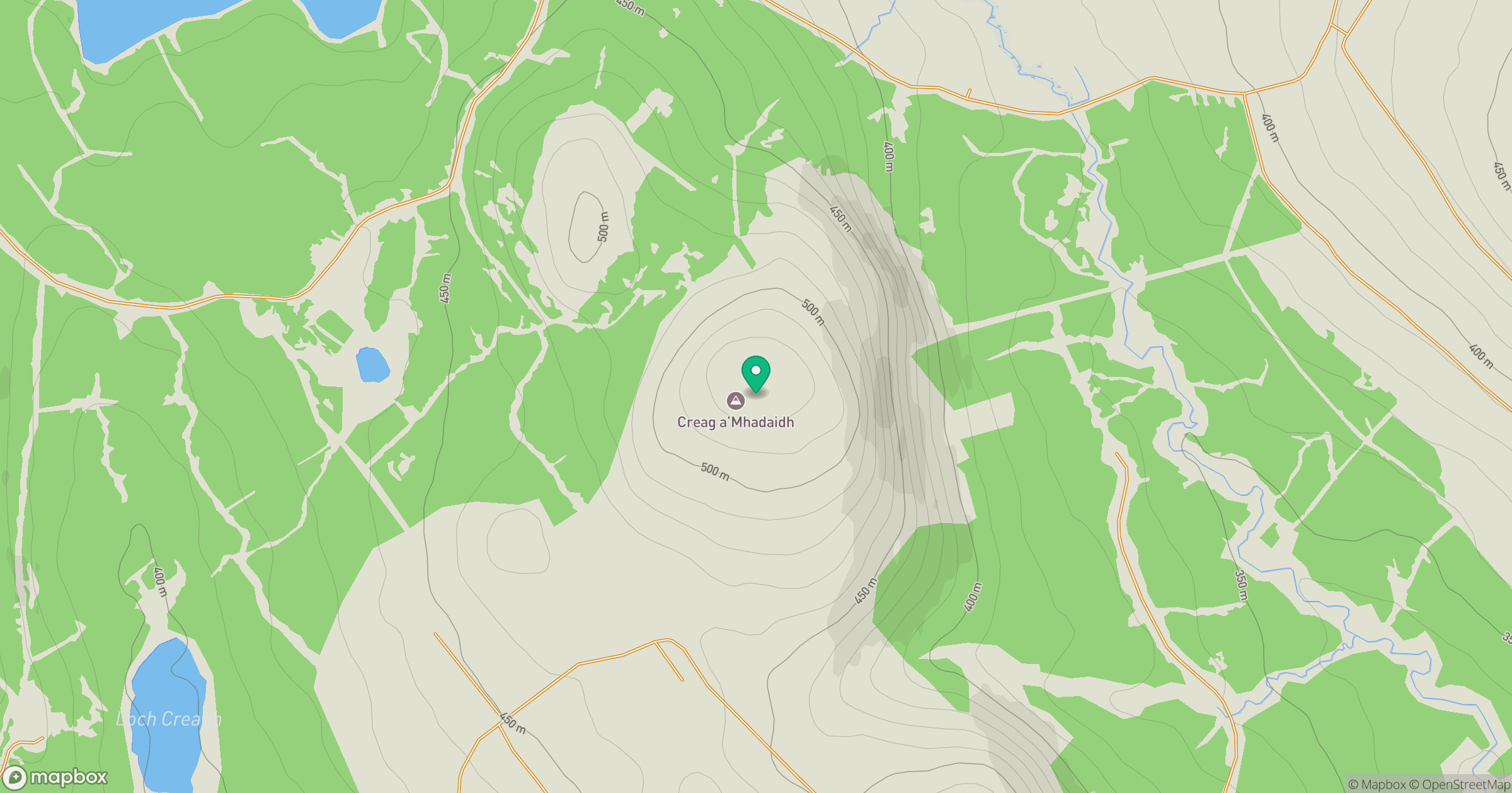
Grid reference: NN916450
View on OpenStreetMapOpens a map in a new tab, centred on the hill.
Hills within 30 km
Straight-line distance, not a walking route or confirmation of access.
Beinn a' Ghlo - Carn Liath
976m
Beinn a' Ghlo - Braigh Coire Chruinn-bhalgain
1,070m
Beinn a' Ghlo - Carn nan Gabhar
1,122m
Schiehallion
1,083m
An Stuc
1,117m
No comments yet. Be the first.