
Craig a Barns
Good walks are even better shared.
Overview
Craig a Barns
Overview
Craig a Barns is a charming Marilyn located in the picturesque Scottish Highlands, standing proudly at an elevation of 608 meters. It offers a delightful blend of relative accessibility and stunning views, making it a popular choice for hikers of all skill levels.
Geology
The mountain is primarily composed of Old Red Sandstone, which is not only fascinating to explore but also showcases the dynamic geological history of the region. The unique rock formations found here are a testament to the earth's natural artistry.
Routes
The most popular route begins at the Abbey Craig car park. This scenic path meanders through lush forestry and gently slopes upwards towards the summit. Expect to cover about 4.5 km in approximately 2 hours. While it’s classified as moderate in difficulty, you'll want to keep an eye out for the odd boggy patch that may try to swallow your shoe!
Summit Features
At the top, adventurers will find a substantial stone cairn, a great spot for that victory selfie. The 360-degree views from the top of Craig a Barns are simply magnificent, providing a visual feast of the Trossachs and the Wallace Monument. Don’t forget your binoculars for the distant Southern Highlands!
Terrain Type
Hikers will encounter a mixed terrain: grassy slopes that cushion your step, rocky outcrops that test your stability, and occasionally, boggy areas that will keep you on your toes (or stuck in them).
Views
Highlights
There's nothing quite like the view from the summit! Notable sights include the Trossachs, Wallace Monument, and the majesty of the distant peaks. On a clear day, you might even spot birds planning their next moves - they take flight to avoid anyone’s flailing hiking poles!
Best Seasons
The best time to bask in these views is during spring and autumn. The spring flowers add a dash of colour, while autumn's vibrant foliage complements the stunning vistas beautifully.
Hazards
As is typical in the Highlands, weather conditions can change in the blink of an eye. Be prepared for potential rain and stronger winds. Additionally, the terrain can be slippery, especially when wet, so tread carefully and hold onto your hats (and possibly your sandwiches).
Nearby Summits
Just a short distance away lies the impressive Ben Ledi, standing tall at 878 meters. For those who want a more vigorous challenge, Ben Ledi is well worth the extra effort!
Access
Nearest Parking
The Abbey Craig car park provides free parking and is a perfect starting point for your adventure.
Public Transport
The area is accessible by bus from Stirling, which offers a convenient option for those reliant on public transport.
Nearest Town
The charming village of Doune is the closest, providing a quaint atmosphere and essential amenities before your hike.
Facilities
Amenities are limited on the mountain, but before setting off, you can find lovely cafes and public toilets in Doune. Refuel with coffee and cake before taking on Craig a Barns!
History
Name Meaning
The name Craig a Barns offers insight into the local heritage, suggesting 'rocky hill of the barn’—a nod to the regional landscape.
Significance
The mountain holds cultural significance, tied closely to the local clans and providing historical viewpoints during notable events like the Jacobite risings.
So lace up those boots, grab your walking stick, and set off to explore the enchanting Craig a Barns. It’s a hike that promises a fantastic day out and, of course, a perfect excuse for that well-deserved slice of cake afterwards!
Explore routes near Craig a Barns
Public walks starting within 80 km of this hill. Nearby does not mean a route reaches the summit; check its map and access before setting out.
Aberfeldy: Glassie Woodland and River Tay Circular
View route
Unled club outing: Glenesk (coach departure)
View route
Unled club outing: Xmas Walk - Bankfoot - Dunkeld (coach departure)
View route
Unled club outing: Angus coastal walk (coach departure)
View route
Route planning notes
These notes describe possible approaches, not verified navigable routes or permission to cross land. Check current paths, local access rules and conditions before setting out.
Abbey Craig Route
A picturesque path starting at the scenic Abbey Craig car park, offering gentle slopes that wind through forestry before ascending to the summit.
Make a day of it, together
Find someone to share the walk with, or organise a day out along a route you like.
Hill facts and local notes
Classifications
Elevation
360m
1,181 ft
Prominence
142m
Coordinates
56.5848, -3.6053
NO015448
OS Map
52 53
Explorer: 379E
At the Summit
The summit boasts a large stone cairn and 360-degree panoramic views, allowing you to take in the splendour of the surrounding landscapes.
Terrain & Geology
The summit consists predominantly of Old Red Sandstone, featuring striking rock formations that reveal the geological history of the area.
Views & Scenery
From the summit, hikers can savour breathtaking views of the Trossachs, the Wallace Monument, and the distant peaks of the Southern Highlands.
History & Heritage
Name Origin
The name 'Craig a Barns' is thought to derive from the Scots Gaelic meaning 'rocky hill of the barn', reflecting its rugged terrain.
Historical Significance
The site is rich in history, closely associated with the local Clans and notable for its viewpoint during the Jacobite risings.
Getting There & Facilities
Check current local access restrictions, parking rules and transport timetables before travelling. These notes do not confirm public access to the summit.
Parking
The nearest parking is at Abbey Craig car park, which provides ample space and is free of charge.
Public Transport
Regular bus services run from Stirling with a short walk to the car park, making it accessible for public transport users.
Nearby Facilities
While amenities directly on the mountain are sparse, visitors can find cafes and public toilets in Doune before setting off on their hike.
Safety Information
Known Hazards
- Be wary of sudden weather changes; conditions can change quickly in the Highlands. Also, watch for slippery rocks and hidden bogs.
General Safety Tips
- Check weather conditions before setting out
- Carry appropriate clothing and equipment
- Let someone know your planned route
- Take a map, compass, and GPS device
- Carry emergency supplies: food, water, first aid kit, torch
Hills
Some common questions about the hills answered
Are there group walks up Craig a Barns?
Many walkers use Walkmates to join or organise walks with others. You can check for group walks around Craig a Barns through the maps
Are there other walkers around Craig a Barns?
Activity varies by location and time, but Walkmates lets you see whether others have shared walks or shown interest in this area. Find other people through the walking friends search walking friends for Craig a Barns search or of course create your own walk for Craig a Barns
Can I organise a walk to Craig a Barns?
Yes. If there aren’t any walks listed already, you can create a walk and make it available for others to join.
If you're signed up to Walkmates, you can create a walk to Craig a Barns.
How do I find a walk up this hill?
There are often multiple ways to walk this hill, depending on experience and route preference. Walkmates helps you explore walks and routes that others have shared.
Can I suggest a new route up Craig a Barns?
Yes. You can suggest or create routes to share with others. Walkmates focuses on the social side of walking, so routes are used to help people organise walks and explore areas together, rather than as detailed navigation tools or route libraries.
Other uses really appreciate knowledgeable walkers sharing their routes. Share your favourite route to Craig a Barns here
The is an error or something incorrect about this hill. How do I let you know?
We always strive to keep the information on Walkmates as accurate as possible. If you find an error, please let us know through the contact form and we'll aim to correct it as quickly as possible
Community Discussion
Comments
Location
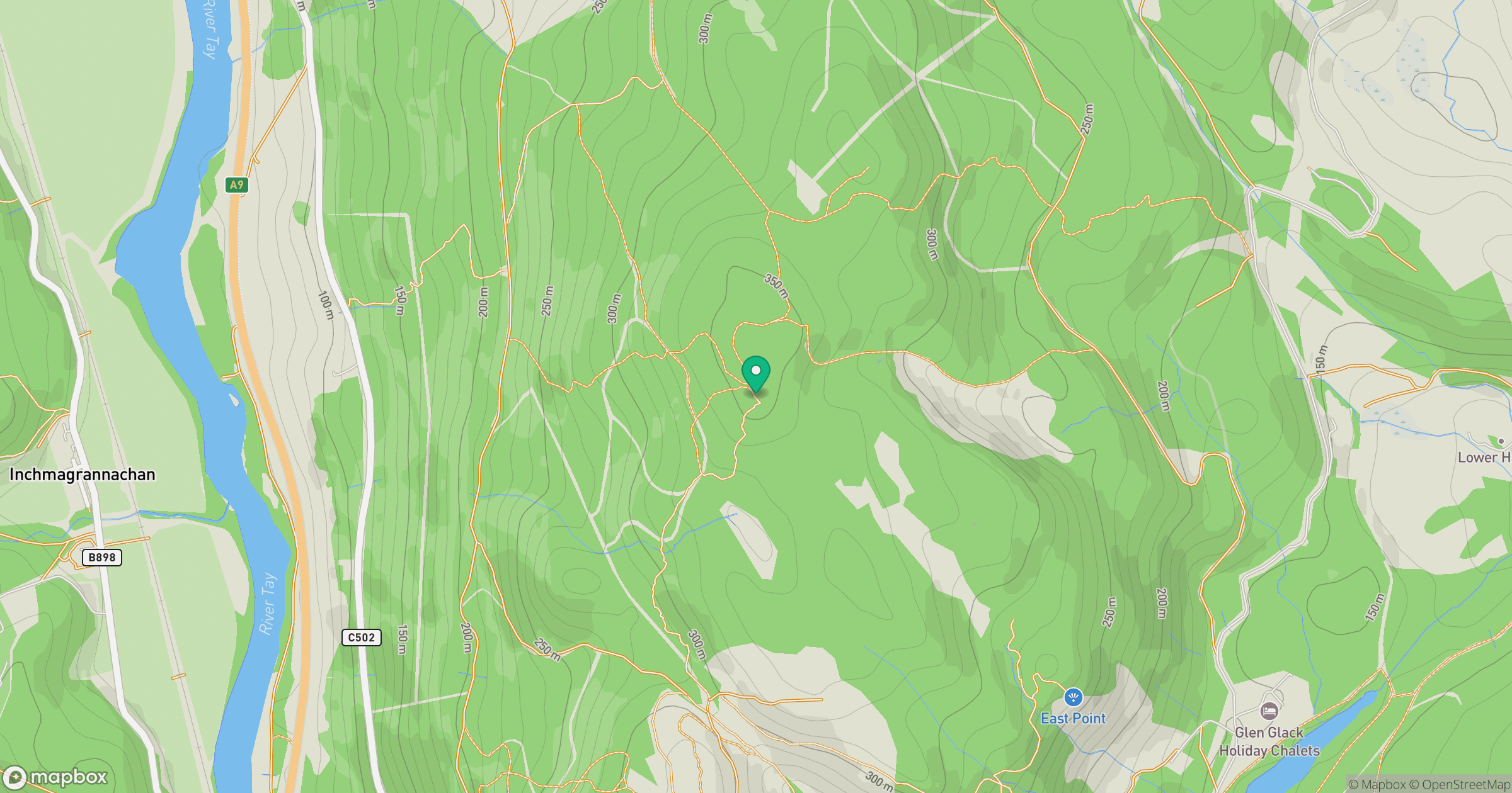
Grid reference: NO015448
View on OpenStreetMapOpens a map in a new tab, centred on the hill.
Hills within 30 km
Straight-line distance, not a walking route or confirmation of access.
Beinn a' Ghlo - Carn Liath
976m
Beinn a' Ghlo - Carn nan Gabhar
1,122m
Beinn a' Ghlo - Braigh Coire Chruinn-bhalgain
1,070m
Deuchary Hill
511m
Birnam Hill - King's Seat
404m
No comments yet. Be the first.